Pertusaria dispar J. Steiner
Österr. bot. Z., 67: 279, 1918.
Synonyms:
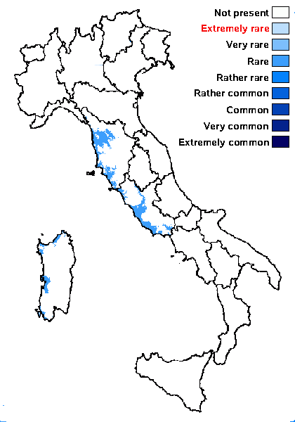
Distribution: C - Tosc (Craighero 2010), Laz (Craighero 2010), Sar (Craighero 2010).
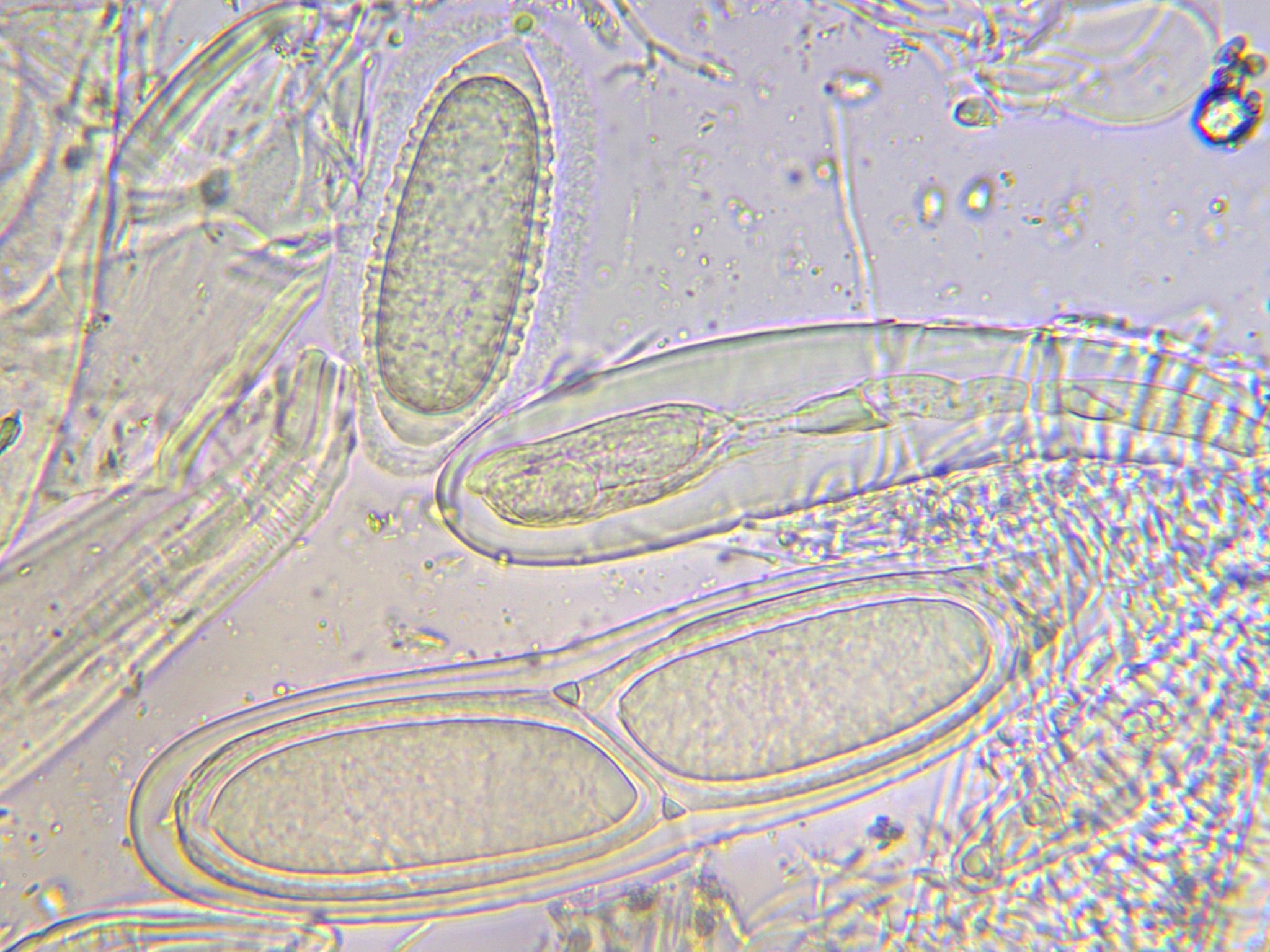
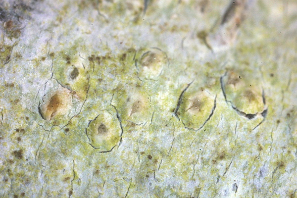
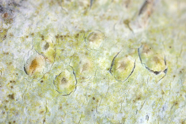
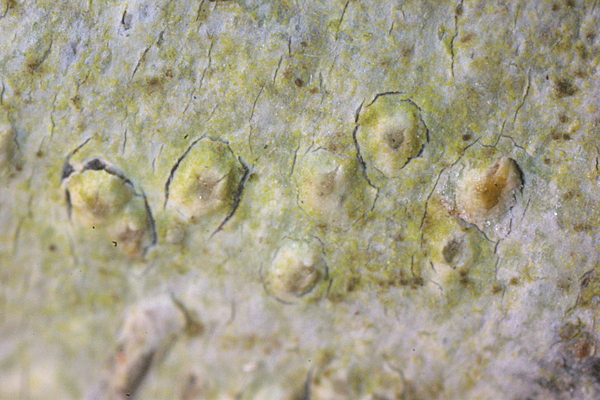
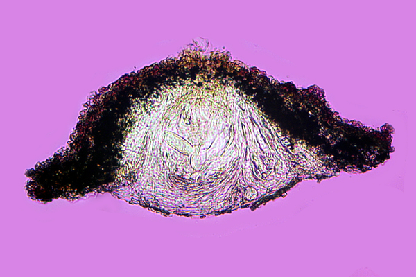
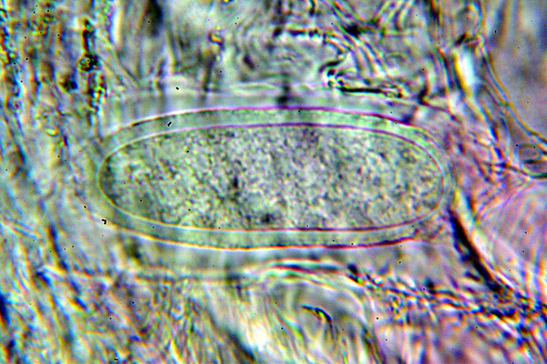
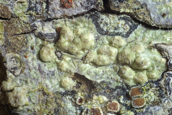
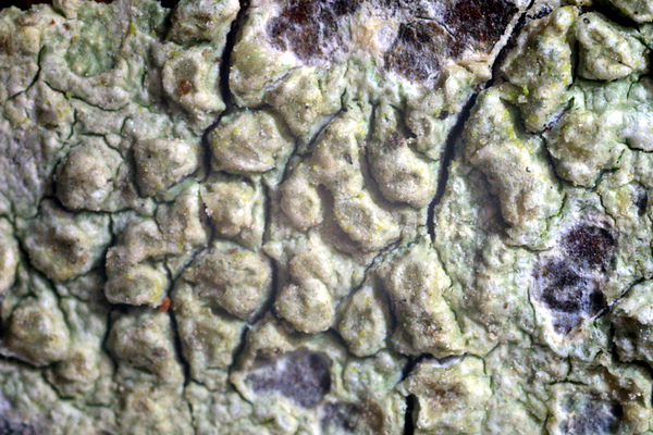
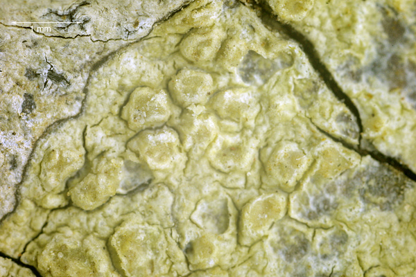
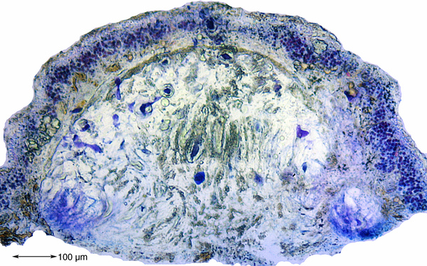
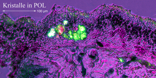
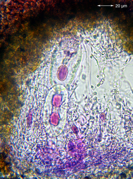
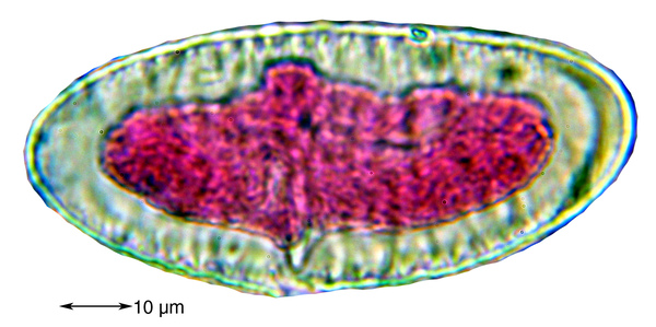
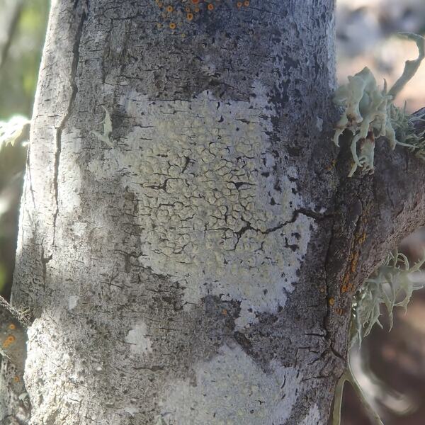
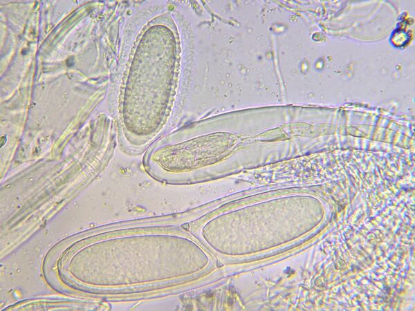
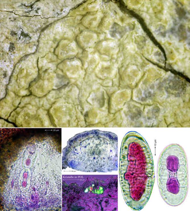
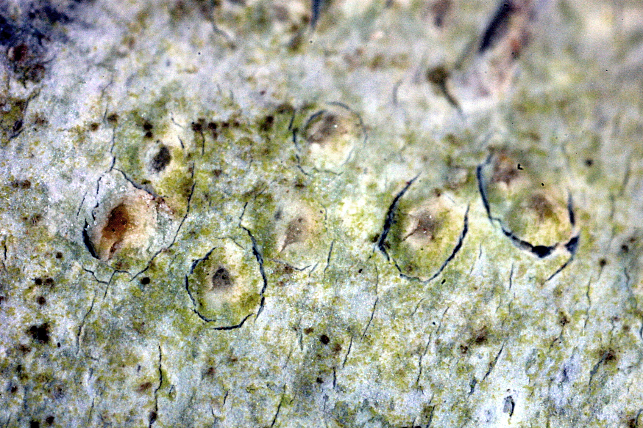
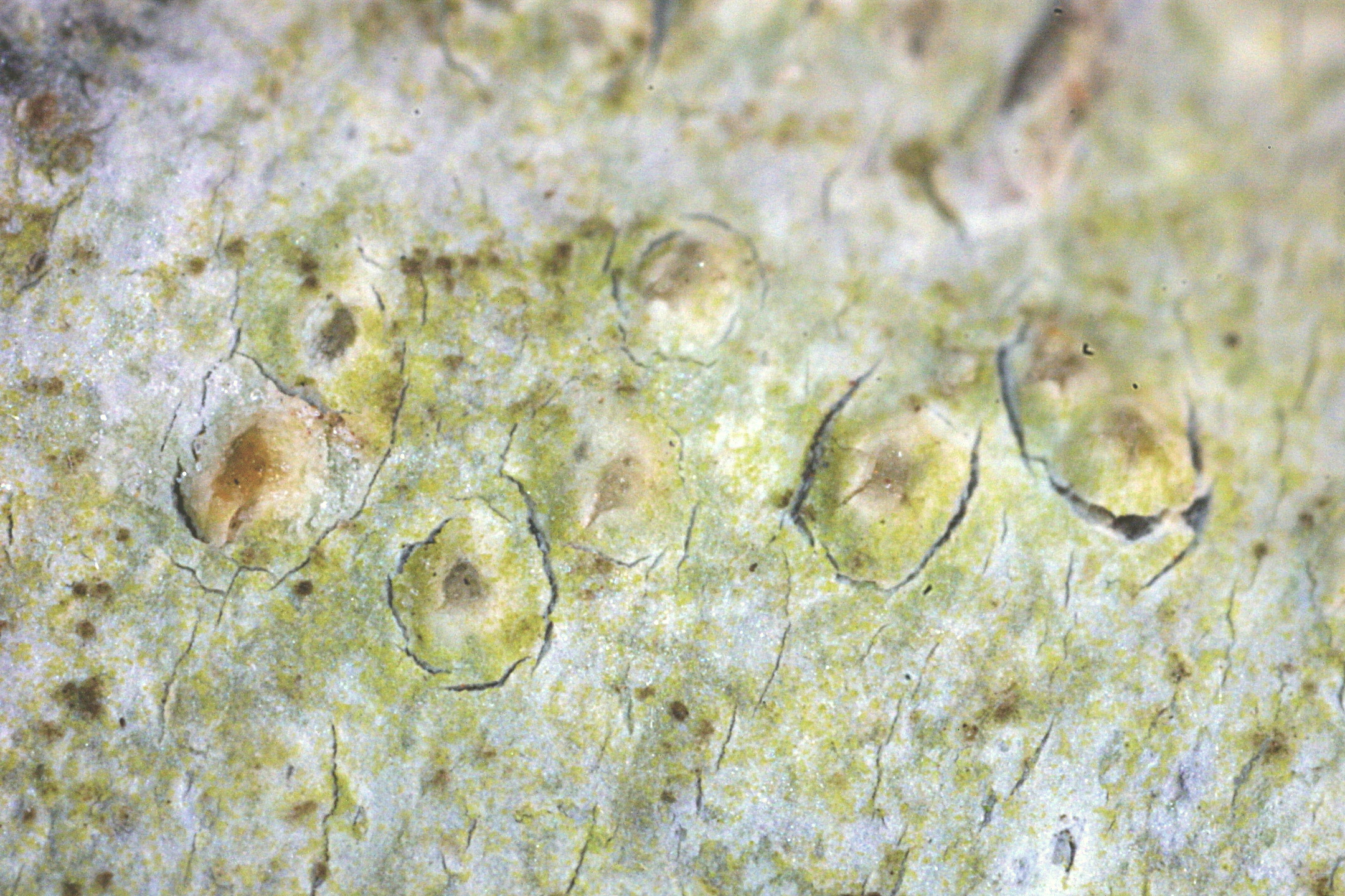
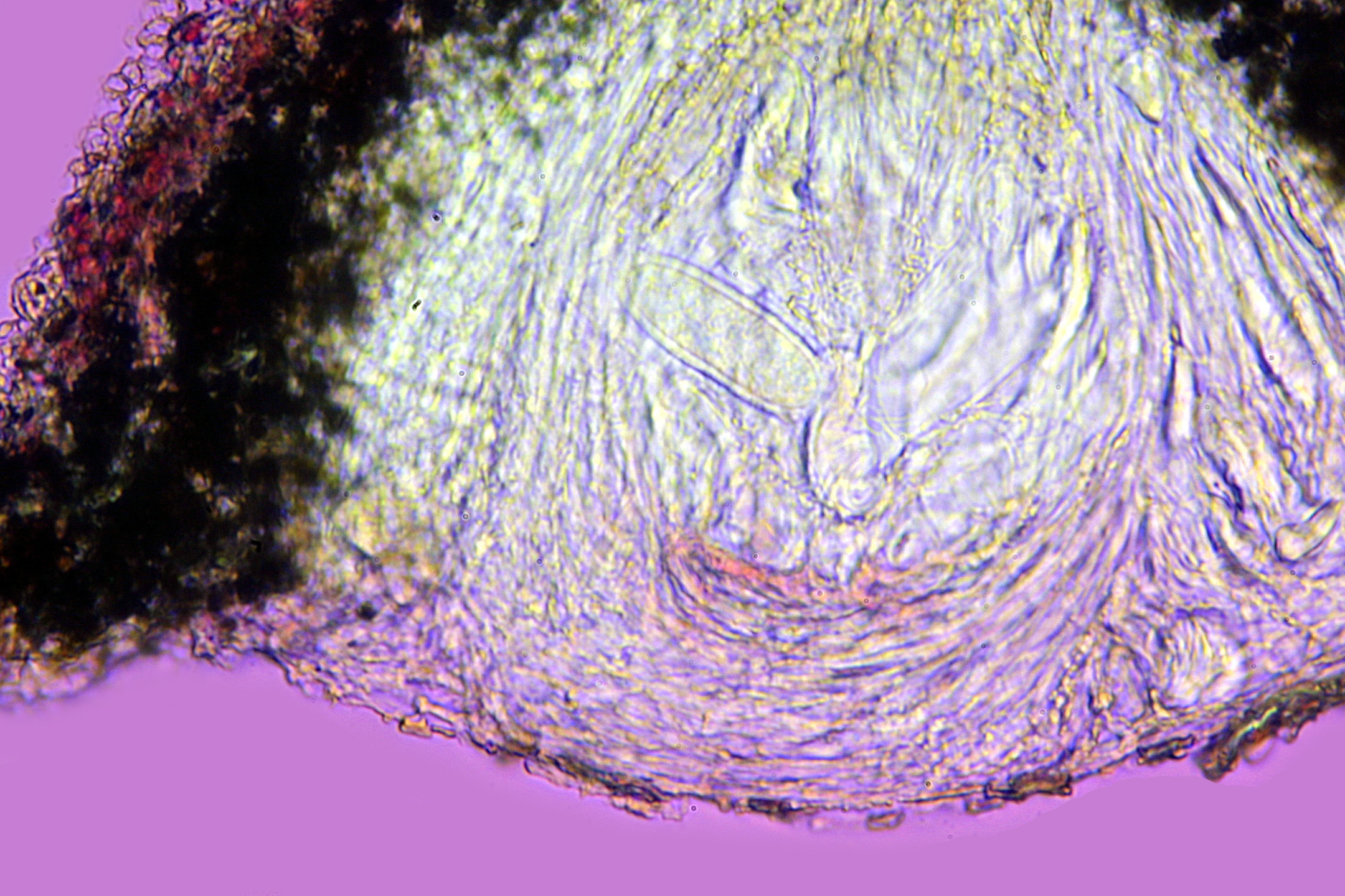
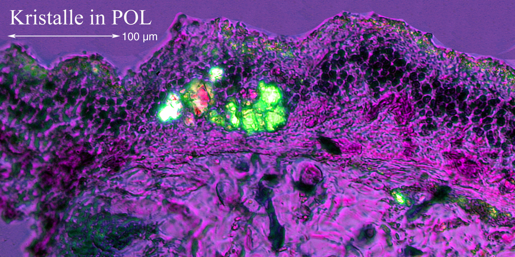
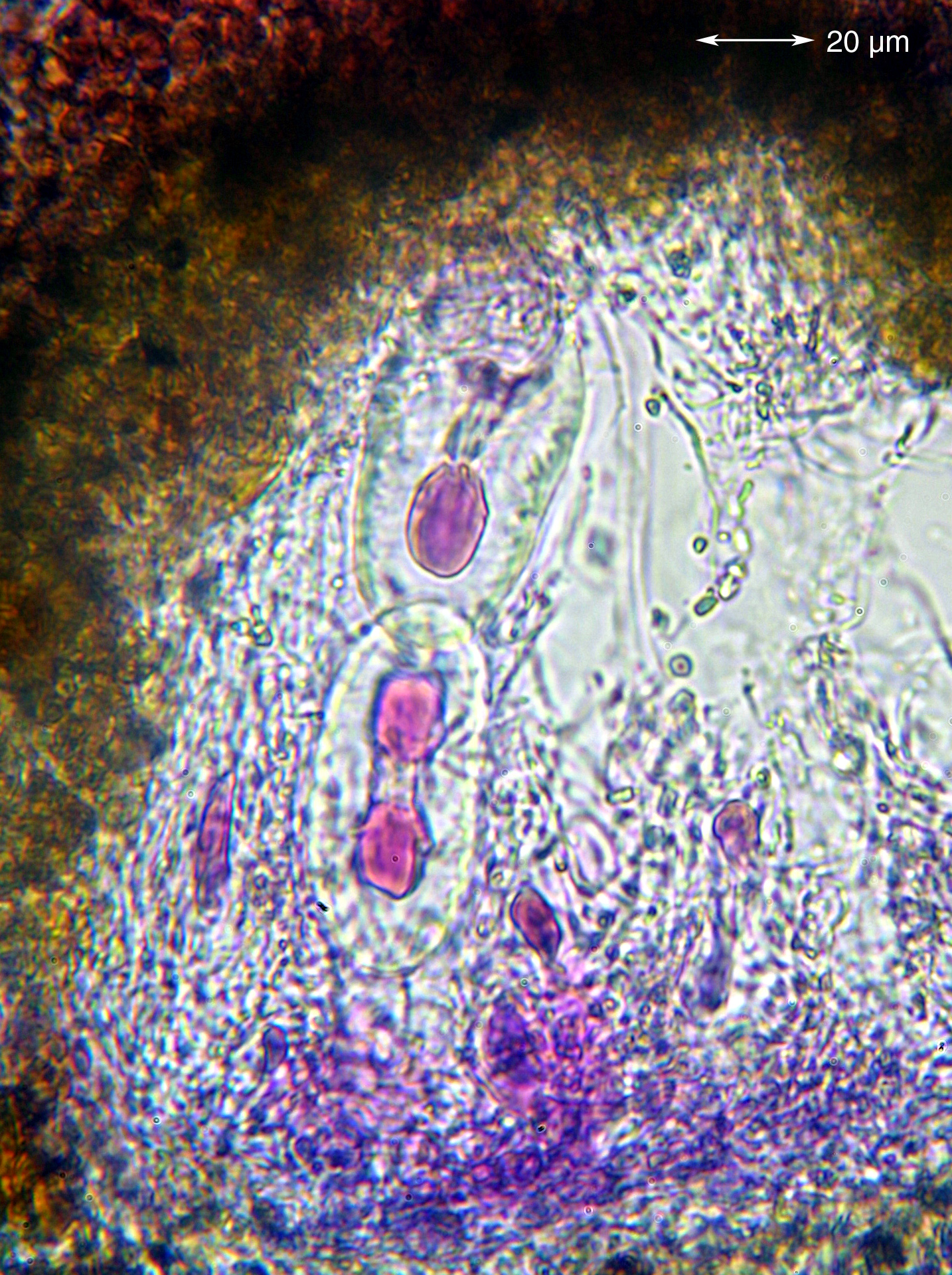
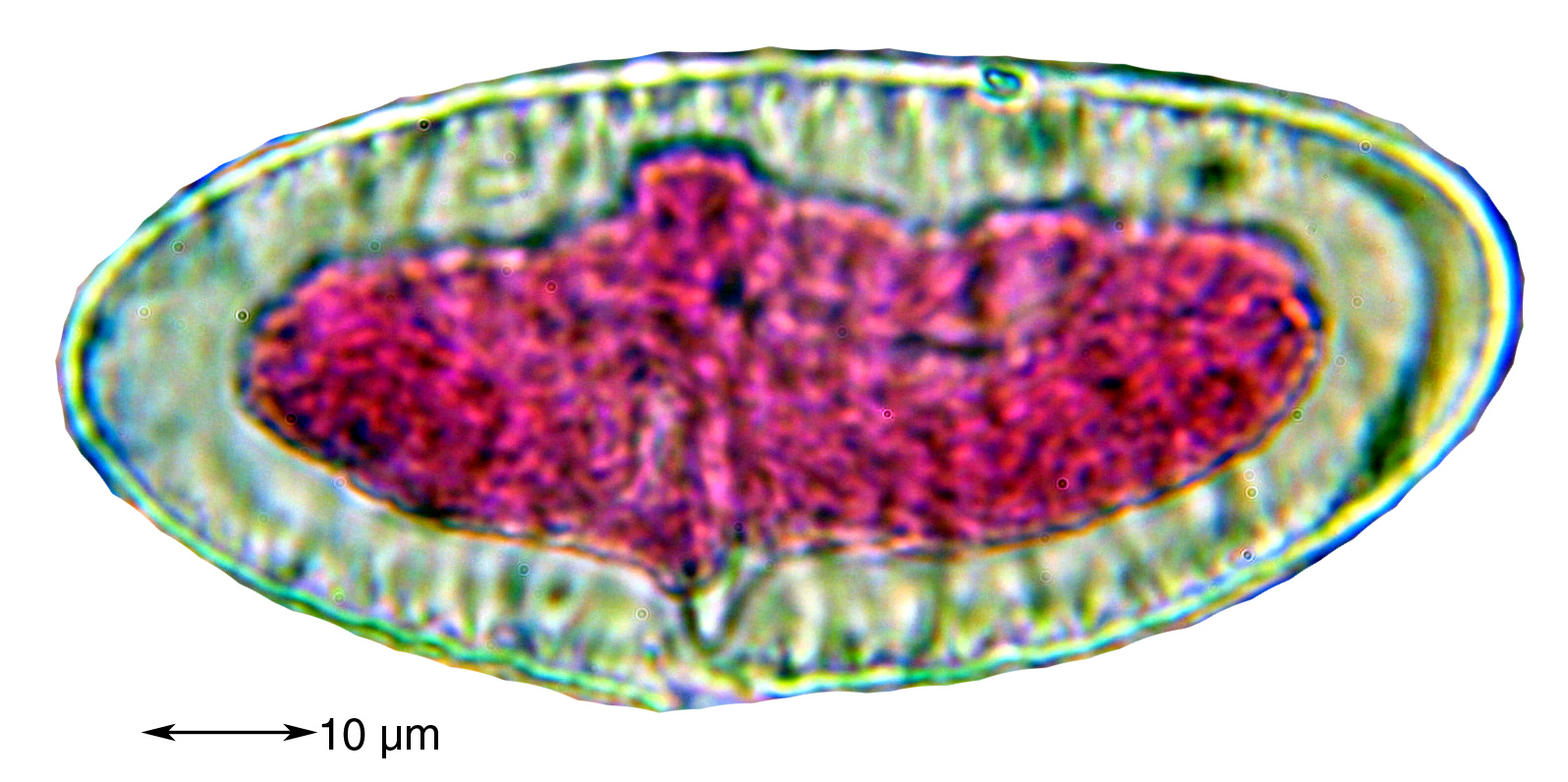
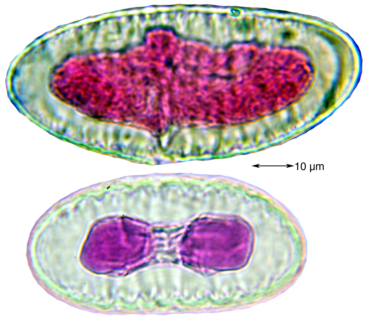
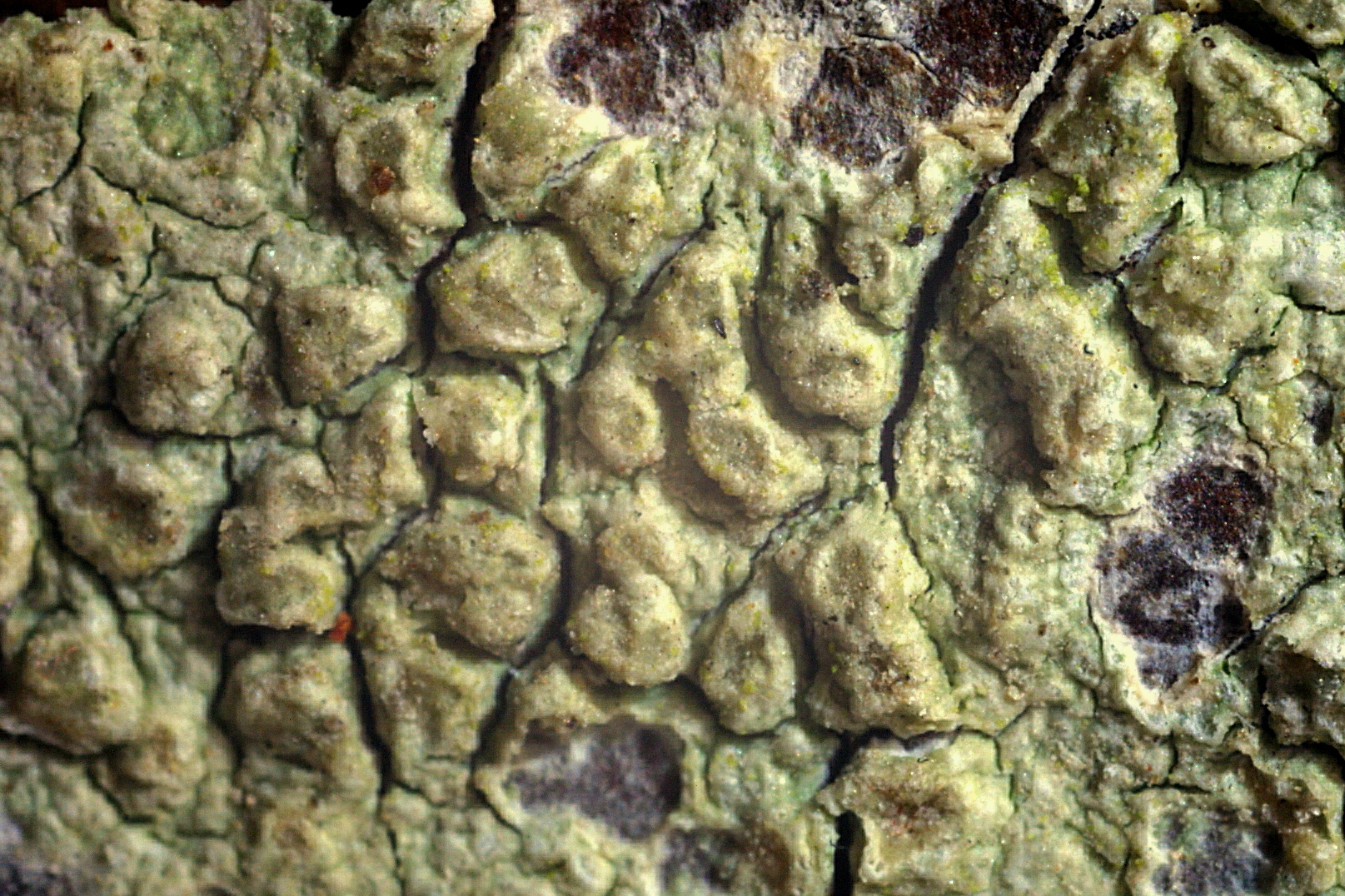
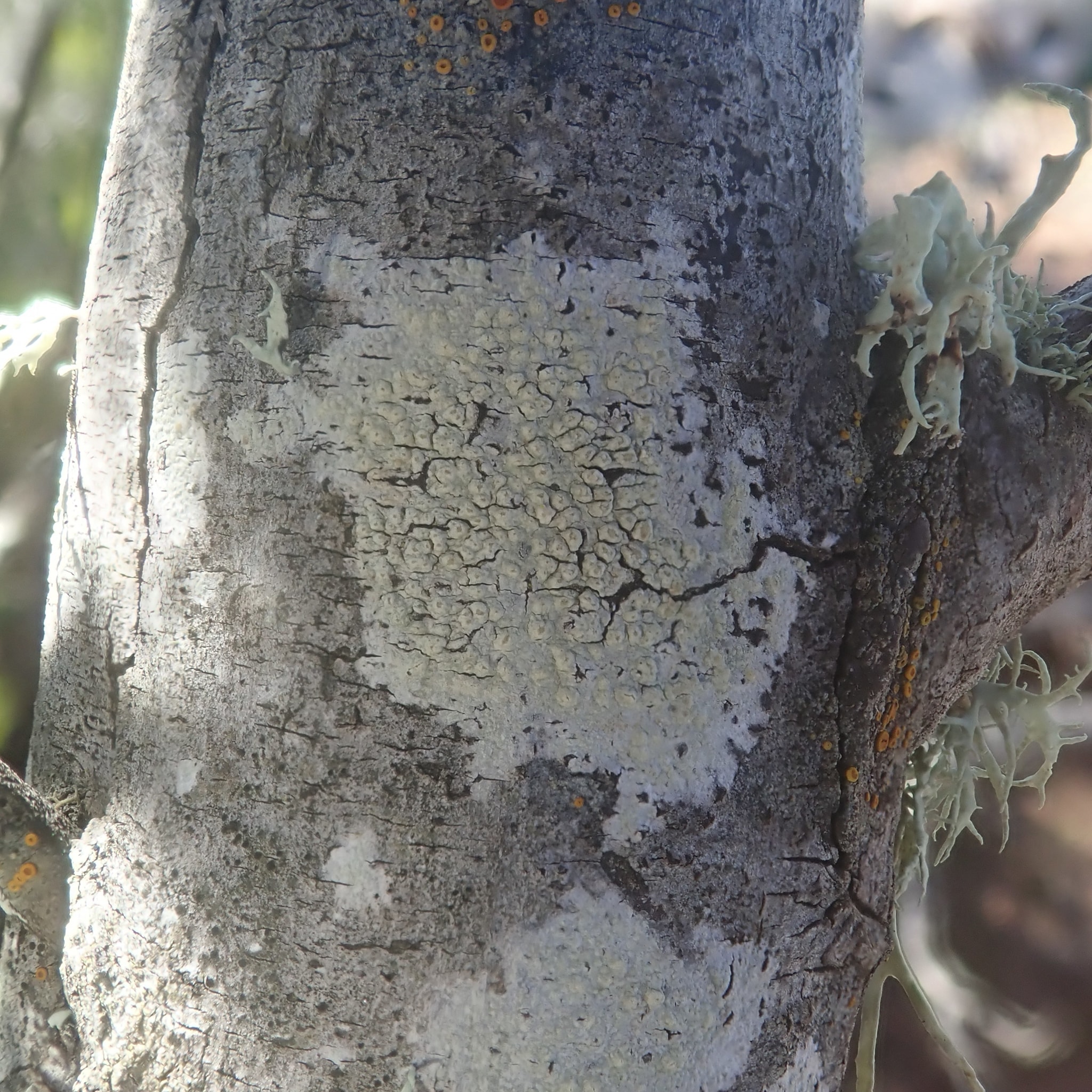
Description: Thallus crustose, episubstratic, more or less smooth, cracked to verrucose, whitish to yellowish. Apothecia perithecioid, immersed in rounded to irregular, flattened thalline warts, 1-3(-4) per wart, with a punctiform to slightly expanded, 0.1-0.3 mm wide, pale brown disc. Epithecium yellowish, K- or K+ yellow, C- or C+ pink; hymenium and hypothecium colourless. Asci 2-spored, broadly cylindrical, the apex with a broad ocular chamber, the outer sheath K/I+ blue, otherwise K/I-, with an inner extensible layer, Pertusaria-type. Ascospores 1-celled, hyaline, narrowly ellipsoid, 80-110 x 28-50 µm, double-walled, the wall transversally striated, strongly foveolate in the interface between the 2 walls, the inner wall warted. Photobiont chlorococcoid. Spot tests: thallus K+ pale yellow, C+ and KC+ orange (reaction intense in yellowish thalli, less intense in whitish ones), P-, UV+ orange. Chemistry: arthothelin, 6-O-methylarthothelin, granulosin, traces of gyrophoric acid. Note: this species, described from Portugal and previously known only from the Iberian Peninsula, grows on Juniperus in coastal situations, and is characterised by the presence of artothelin, 6-O-methylarthothelin, granulosin and traces of gyrophoric acid; it probably has a strictly Tyrrhenian distribution in Italy.
Growth form: Crustose
Substrata: bark
Photobiont: green algae other than Trentepohlia
Reproductive strategy: mainly sexual
Most common in areas with a humid-warm climate (e.g. most of Tyrrenian Italy)
Commonnes-rarity: (info)
Alpine belt: absent
Subalpine belt: absent
Oromediterranean belt: absent
Montane belt: absent
Submediterranean belt: absent
Padanian area: absent
Humid submediterranean belt: absent
Humid mediterranean belt: rare
Dry mediterranean belt: absent
Predictive model
Herbarium samples


Felix Schumm – CC BY-SA 4.0
Image from: F. Schumm (2008) - Flechten Madeiras, der Kanaren und Azoren. Beck, OHG - ISBN: 978-3-00-023700-3

Felix Schumm - CC BY-SA 4.0
[11200], Portugal, Azoren, Sao Miguel, SE-Ufer des Lagoa Azul, 37°51.307' N, 25°47.060' W, 280 m, an Laubbaumrinden. Leg. et det. F. Schumm, 06.06.2003
Felix Schumm - CC BY-SA 4.0
[11200], Portugal, Azoren, Sao Miguel, SE-Ufer des Lagoa Azul, 37°51.307' N, 25°47.060' W, 280 m, an Laubbaumrinden. Leg. et det. F. Schumm, 06.06.2003
Felix Schumm - CC BY-SA 4.0
[11200], Portugal, Azoren, Sao Miguel, SE-Ufer des Lagoa Azul, 37°51.307' N, 25°47.060' W, 280 m, an Laubbaumrinden. Leg. et det. F. Schumm, 06.06.2003
Felix Schumm - CC BY-SA 4.0
[11200], Portugal, Azoren, Sao Miguel, SE-Ufer des Lagoa Azul, 37°51.307' N, 25°47.060' W, 280 m, an Laubbaumrinden. Leg. et det. F. Schumm, 06.06.2003
Felix Schumm - CC BY-SA 4.0
[11200], Portugal, Azoren, Sao Miguel, SE-Ufer des Lagoa Azul, 37°51.307' N, 25°47.060' W, 280 m, an Laubbaumrinden. Leg. et det. F. Schumm, 06.06.2003

Felix Schumm - CC BY-SA 4.0
[11200], Portugal, Azoren, Sao Miguel, SE-Ufer des Lagoa Azul, 37°51.307' N, 25°47.060' W, 280 m, an Laubbaumrinden. Leg. et det. F. Schumm, 06.06.2003
Felix Schumm - CC BY-SA 4.0
[11200], Portugal, Azoren, Sao Miguel, SE-Ufer des Lagoa Azul, 37°51.307' N, 25°47.060' W, 280 m, an Laubbaumrinden. Leg. et det. F. Schumm, 06.06.2003
Felix Schumm - CC BY-SA 4.0
[11226], Portugal, Azoren, Sao Miguel, an Straßenbäumen zwischen Mosteiros und Bretanha, 37°52.912' N, 25°48.512' W, 260 m. Leg. et det. F. Schumm, 06.06.2003, conf. H. Sipman 2007.
Felix Schumm - CC BY-SA 4.0
[11226], Portugal, Azoren, Sao Miguel, an Straßenbäumen zwischen Mosteiros und Bretanha, 37°52.912' N, 25°48.512' W, 260 m. Leg. et det. F. Schumm, 06.06.2003, conf. H. Sipman 2007.
Felix Schumm - CC BY-SA 4.0
[11226], Portugal, Azoren, Sao Miguel, an Straßenbäumen zwischen Mosteiros und Bretanha, 37°52.912' N, 25°48.512' W, 260 m. Leg. et det. F. Schumm, 06.06.2003, conf. H. Sipman 2007.
Felix Schumm - CC BY-SA 4.0
[11226], Portugal, Azoren, Sao Miguel, an Straßenbäumen zwischen Mosteiros und Bretanha, 37°52.912' N, 25°48.512' W, 260 m. Leg. et det. F. Schumm, 06.06.2003, conf. H. Sipman 2007.
Felix Schumm - CC BY-SA 4.0
[11226], Portugal, Azoren, Sao Miguel, an Straßenbäumen zwischen Mosteiros und Bretanha, 37°52.912' N, 25°48.512' W, 260 m. Leg. et det. F. Schumm, 06.06.2003, conf. H. Sipman 2007.
Felix Schumm - CC BY-SA 4.0
[11226], Portugal, Azoren, Sao Miguel, an Straßenbäumen zwischen Mosteiros und Bretanha, 37°52.912' N, 25°48.512' W, 260 m. Leg. et det. F. Schumm, 06.06.2003, conf. H. Sipman 2007.
Felix Schumm - CC BY-SA 4.0
[11226], Portugal, Azoren, Sao Miguel, an Straßenbäumen zwischen Mosteiros und Bretanha, 37°52.912' N, 25°48.512' W, 260 m. Leg. et det. F. Schumm, 06.06.2003, conf. H. Sipman 2007.

Felix Schumm - CC BY-SA 4.0
[11226], Portugal, Azoren, Sao Miguel, an Straßenbäumen zwischen Mosteiros und Bretanha, 37°52.912' N, 25°48.512' W, 260 m. Leg. et det. F. Schumm, 06.06.2003, conf. H. Sipman 2007.

Felix Schumm - CC BY-SA 4.0
[11226], Portugal, Azoren, Sao Miguel, an Straßenbäumen zwischen Mosteiros und Bretanha, 37°52.912' N, 25°48.512' W, 260 m. Leg. et det. F. Schumm, 06.06.2003, conf. H. Sipman 2007.
Manuel Gil
Spain, Canary Islands, Lanzarote
Manuel Gil
Spain, Canary Islands, Lanzarote
Growth form: Crustose
Substrata: bark
Photobiont: green algae other than Trentepohlia
Reproductive strategy: mainly sexual
Most common in areas with a humid-warm climate (e.g. most of Tyrrenian Italy)
Commonnes-rarity: (info)
Alpine belt: absent
Subalpine belt: absent
Oromediterranean belt: absent
Montane belt: absent
Submediterranean belt: absent
Padanian area: absent
Humid submediterranean belt: absent
Humid mediterranean belt: rare
Dry mediterranean belt: absent
Predictive model
| Herbarium samples |
Felix Schumm – CC BY-SA 4.0
Image from: F. Schumm (2008) - Flechten Madeiras, der Kanaren und Azoren. Beck, OHG - ISBN: 978-3-00-023700-3
Felix Schumm - CC BY-SA 4.0
[11200], Portugal, Azoren, Sao Miguel, SE-Ufer des Lagoa Azul, 37°51.307' N, 25°47.060' W, 280 m, an Laubbaumrinden. Leg. et det. F. Schumm, 06.06.2003
Felix Schumm - CC BY-SA 4.0
[11200], Portugal, Azoren, Sao Miguel, SE-Ufer des Lagoa Azul, 37°51.307' N, 25°47.060' W, 280 m, an Laubbaumrinden. Leg. et det. F. Schumm, 06.06.2003

Felix Schumm - CC BY-SA 4.0
[11200], Portugal, Azoren, Sao Miguel, SE-Ufer des Lagoa Azul, 37°51.307' N, 25°47.060' W, 280 m, an Laubbaumrinden. Leg. et det. F. Schumm, 06.06.2003

Felix Schumm - CC BY-SA 4.0
[11200], Portugal, Azoren, Sao Miguel, SE-Ufer des Lagoa Azul, 37°51.307' N, 25°47.060' W, 280 m, an Laubbaumrinden. Leg. et det. F. Schumm, 06.06.2003

Felix Schumm - CC BY-SA 4.0
[11200], Portugal, Azoren, Sao Miguel, SE-Ufer des Lagoa Azul, 37°51.307' N, 25°47.060' W, 280 m, an Laubbaumrinden. Leg. et det. F. Schumm, 06.06.2003
Felix Schumm - CC BY-SA 4.0
[11200], Portugal, Azoren, Sao Miguel, SE-Ufer des Lagoa Azul, 37°51.307' N, 25°47.060' W, 280 m, an Laubbaumrinden. Leg. et det. F. Schumm, 06.06.2003

Felix Schumm - CC BY-SA 4.0
[11200], Portugal, Azoren, Sao Miguel, SE-Ufer des Lagoa Azul, 37°51.307' N, 25°47.060' W, 280 m, an Laubbaumrinden. Leg. et det. F. Schumm, 06.06.2003

Felix Schumm - CC BY-SA 4.0
[11226], Portugal, Azoren, Sao Miguel, an Straßenbäumen zwischen Mosteiros und Bretanha, 37°52.912' N, 25°48.512' W, 260 m. Leg. et det. F. Schumm, 06.06.2003, conf. H. Sipman 2007.

Felix Schumm - CC BY-SA 4.0
[11226], Portugal, Azoren, Sao Miguel, an Straßenbäumen zwischen Mosteiros und Bretanha, 37°52.912' N, 25°48.512' W, 260 m. Leg. et det. F. Schumm, 06.06.2003, conf. H. Sipman 2007.

Felix Schumm - CC BY-SA 4.0
[11226], Portugal, Azoren, Sao Miguel, an Straßenbäumen zwischen Mosteiros und Bretanha, 37°52.912' N, 25°48.512' W, 260 m. Leg. et det. F. Schumm, 06.06.2003, conf. H. Sipman 2007.

Felix Schumm - CC BY-SA 4.0
[11226], Portugal, Azoren, Sao Miguel, an Straßenbäumen zwischen Mosteiros und Bretanha, 37°52.912' N, 25°48.512' W, 260 m. Leg. et det. F. Schumm, 06.06.2003, conf. H. Sipman 2007.
Felix Schumm - CC BY-SA 4.0
[11226], Portugal, Azoren, Sao Miguel, an Straßenbäumen zwischen Mosteiros und Bretanha, 37°52.912' N, 25°48.512' W, 260 m. Leg. et det. F. Schumm, 06.06.2003, conf. H. Sipman 2007.
Felix Schumm - CC BY-SA 4.0
[11226], Portugal, Azoren, Sao Miguel, an Straßenbäumen zwischen Mosteiros und Bretanha, 37°52.912' N, 25°48.512' W, 260 m. Leg. et det. F. Schumm, 06.06.2003, conf. H. Sipman 2007.
Felix Schumm - CC BY-SA 4.0
[11226], Portugal, Azoren, Sao Miguel, an Straßenbäumen zwischen Mosteiros und Bretanha, 37°52.912' N, 25°48.512' W, 260 m. Leg. et det. F. Schumm, 06.06.2003, conf. H. Sipman 2007.
Felix Schumm - CC BY-SA 4.0
[11226], Portugal, Azoren, Sao Miguel, an Straßenbäumen zwischen Mosteiros und Bretanha, 37°52.912' N, 25°48.512' W, 260 m. Leg. et det. F. Schumm, 06.06.2003, conf. H. Sipman 2007.
Felix Schumm - CC BY-SA 4.0
[11226], Portugal, Azoren, Sao Miguel, an Straßenbäumen zwischen Mosteiros und Bretanha, 37°52.912' N, 25°48.512' W, 260 m. Leg. et det. F. Schumm, 06.06.2003, conf. H. Sipman 2007.
Manuel Gil
Spain, Canary Islands, Lanzarote