Stenocybe pullatula (Ach.) Stein
in Cohn, Krypt- Fl. von Schlesien, 2, 2: 298, 1879. Basionym: Calicium pullatulum Ach. - K. Vetensk.-Akad. Nya Handl.: 121, 1816.
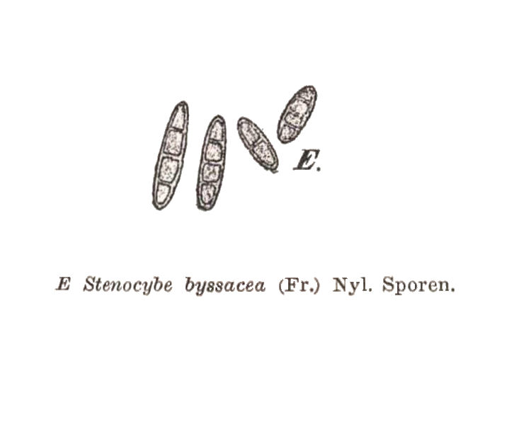
Synonyms: Calicium byssaceum Fr.; Stenocybe byssacea (Fr.) Körb.
Distribution: N - Frl (Puntillo & Puntillo 2009), TAA (Nascimbene & al. 2007b, Puntillo & Puntillo 2009), Lomb (Puntillo & Puntillo 2009), Piem (Isocrono & al. 2004, Puntillo & Puntillo 2009). C - Tosc (Puntillo & Puntillo 2009).
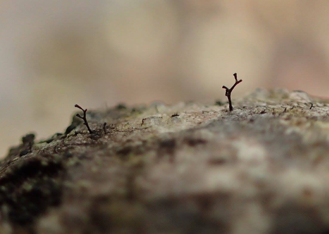
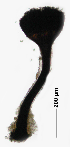
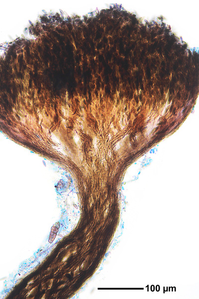
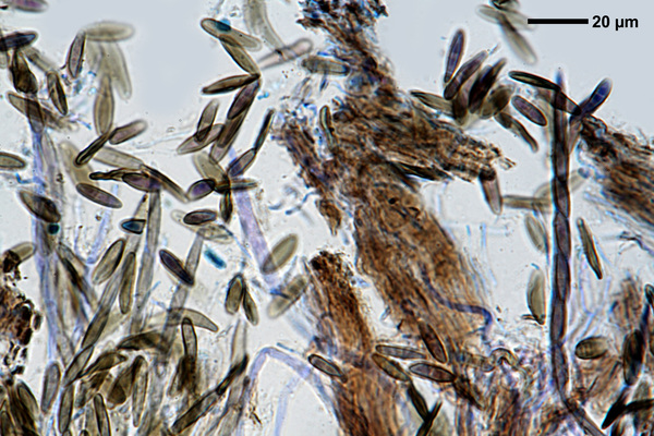
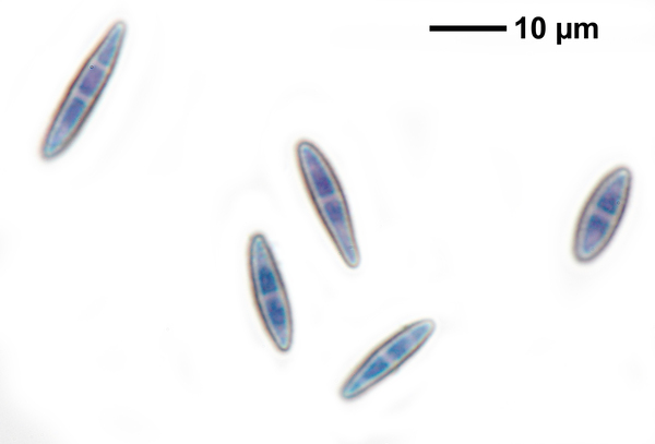
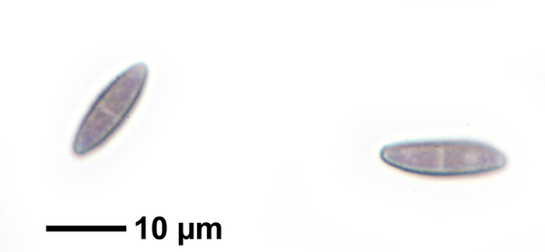
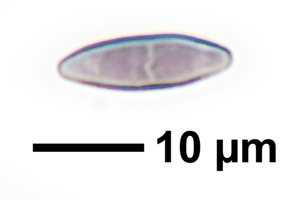
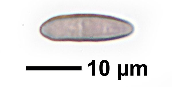
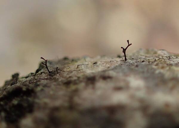
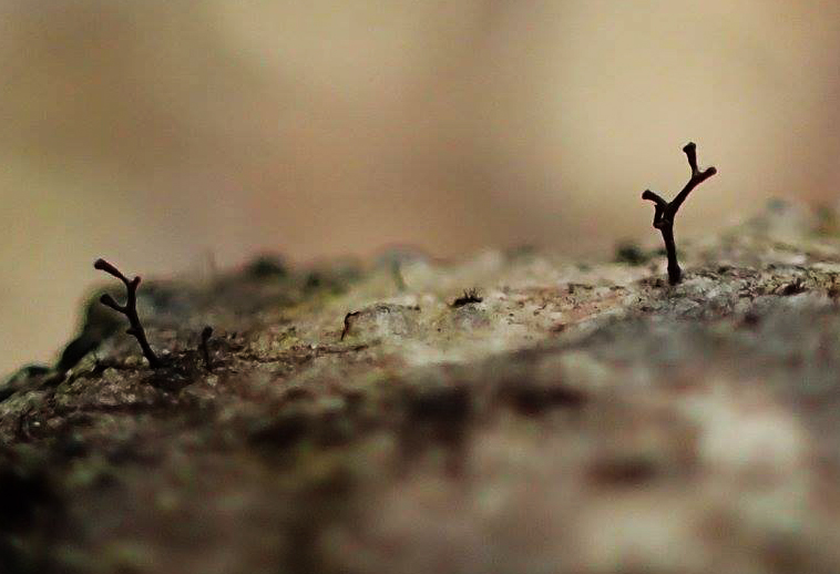
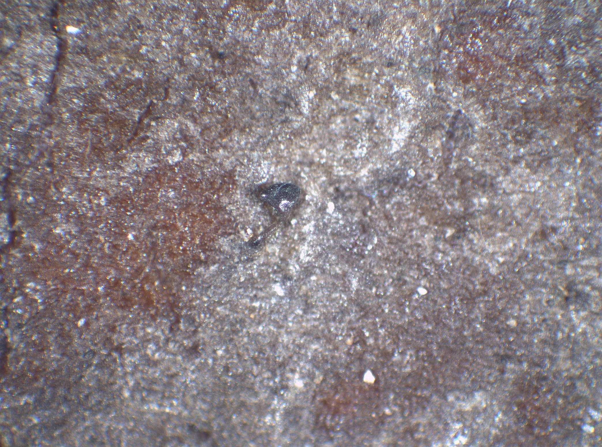
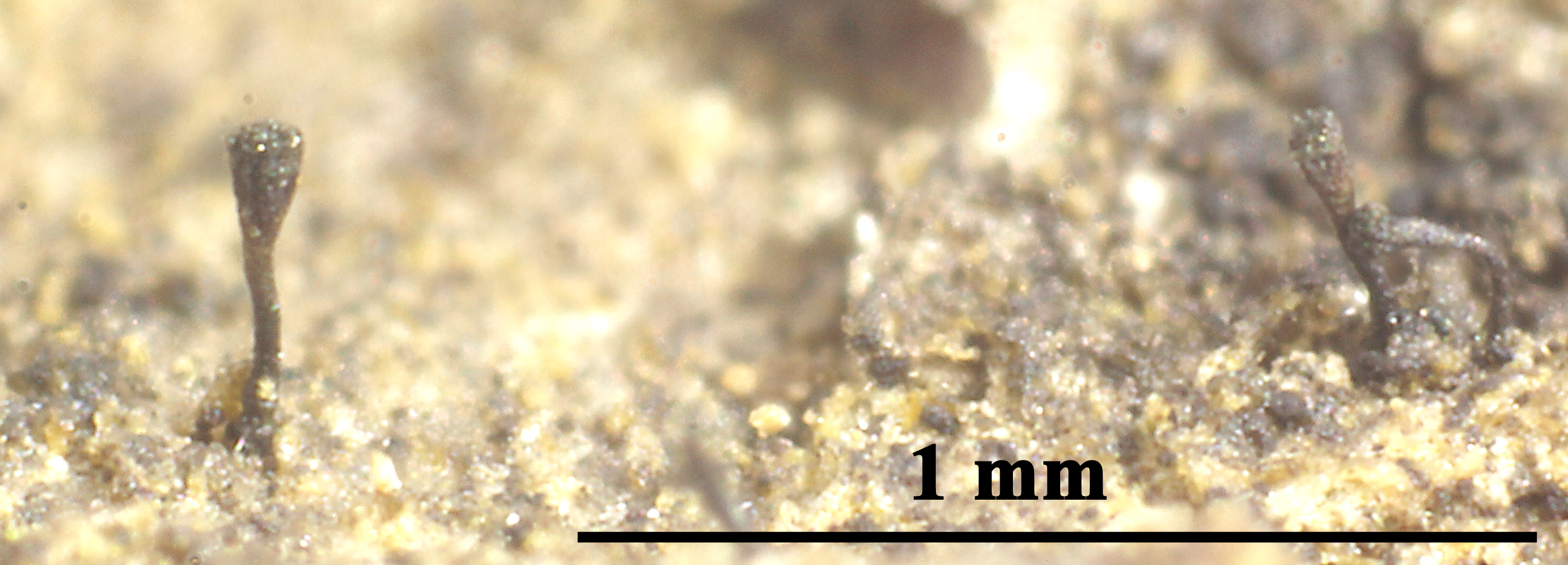
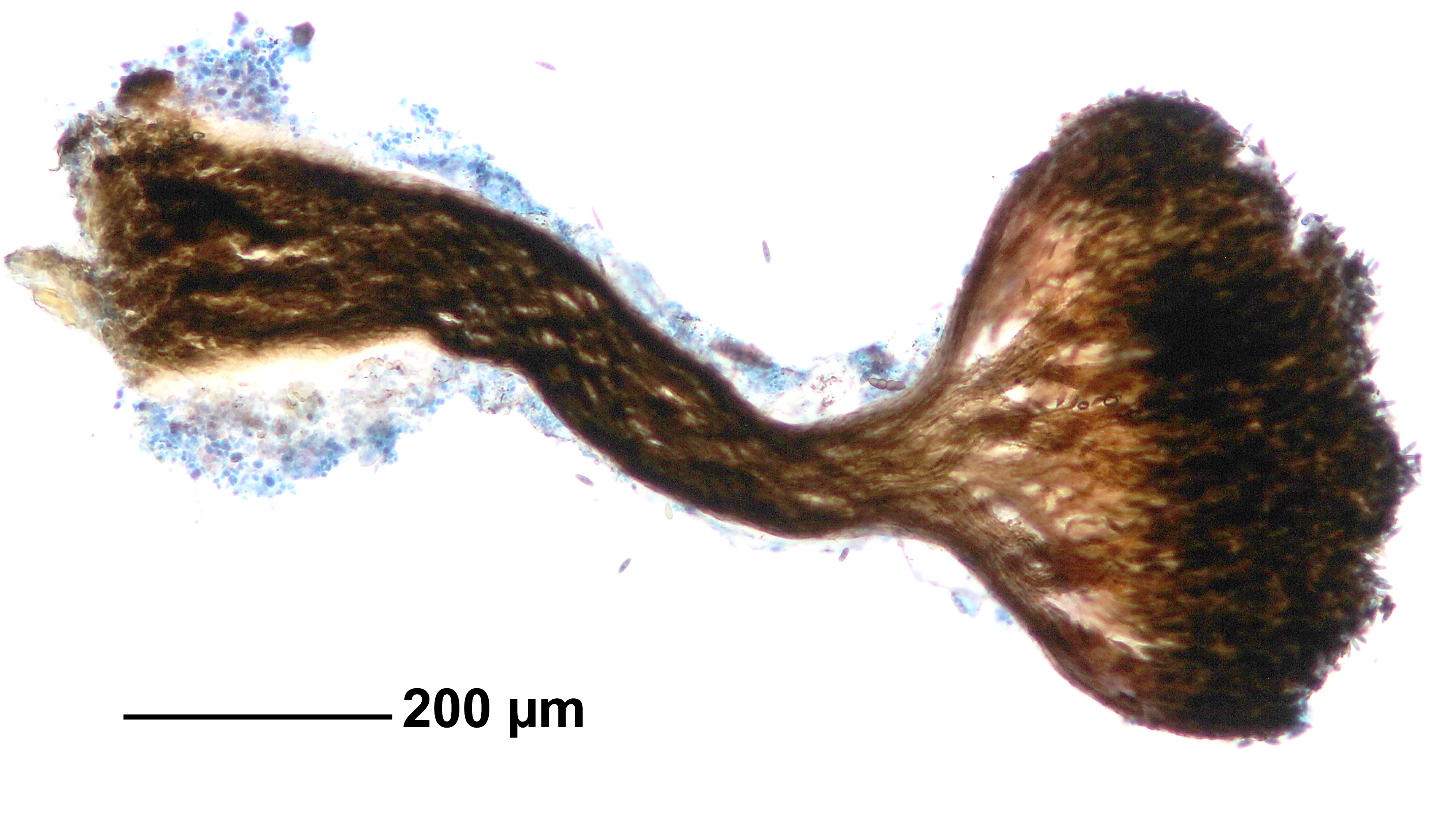
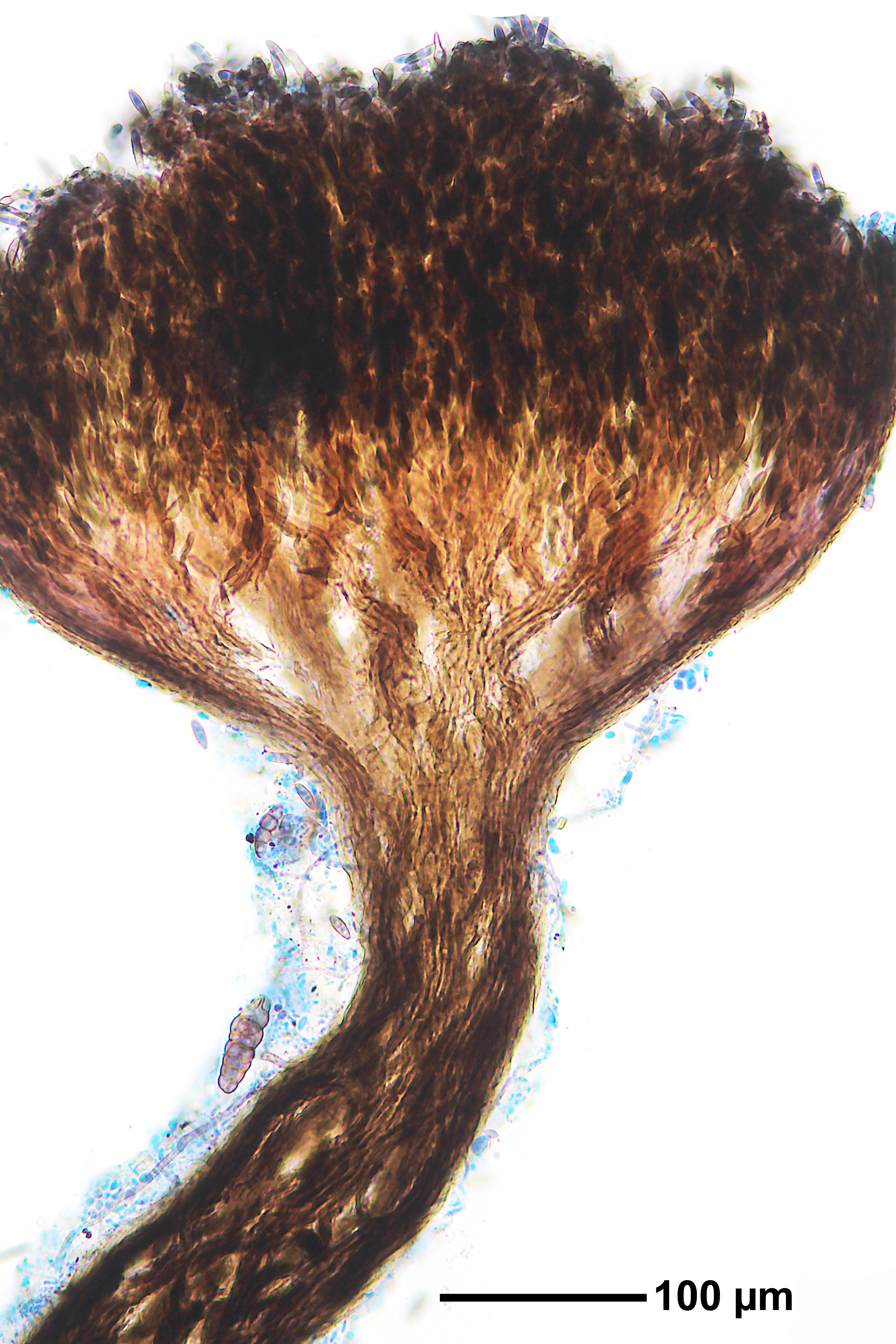
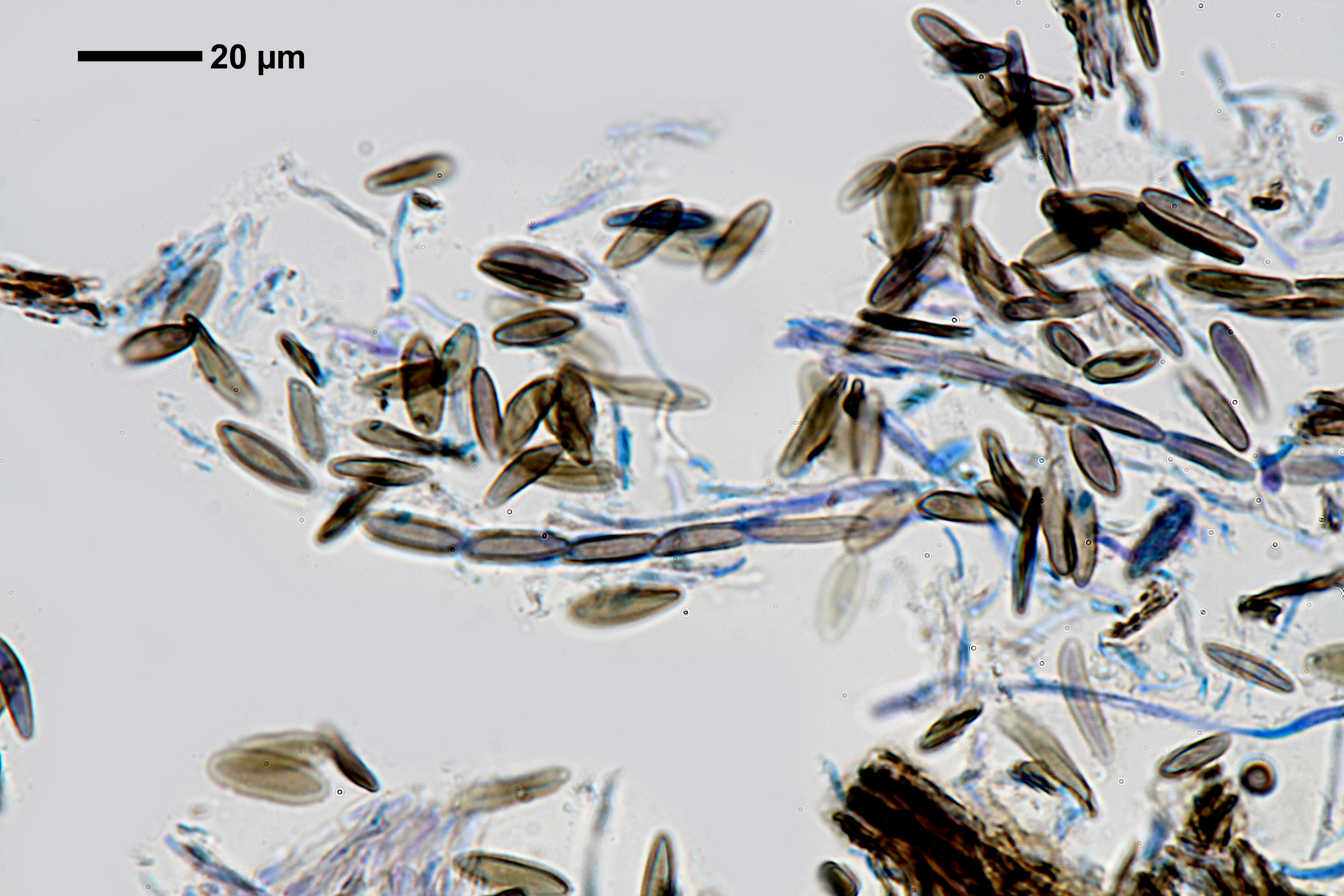
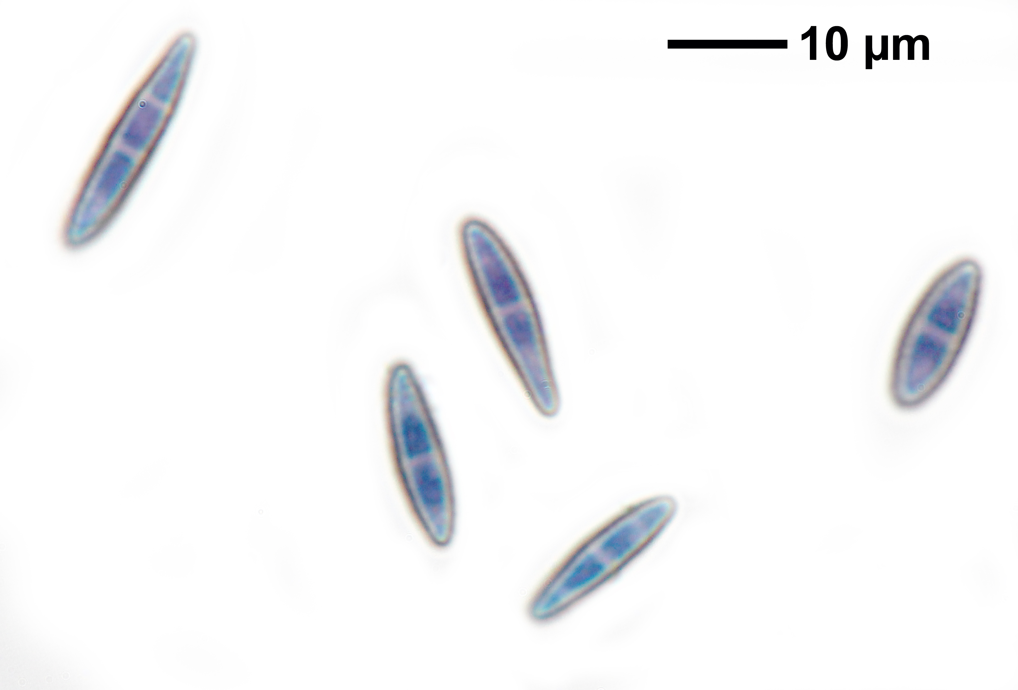
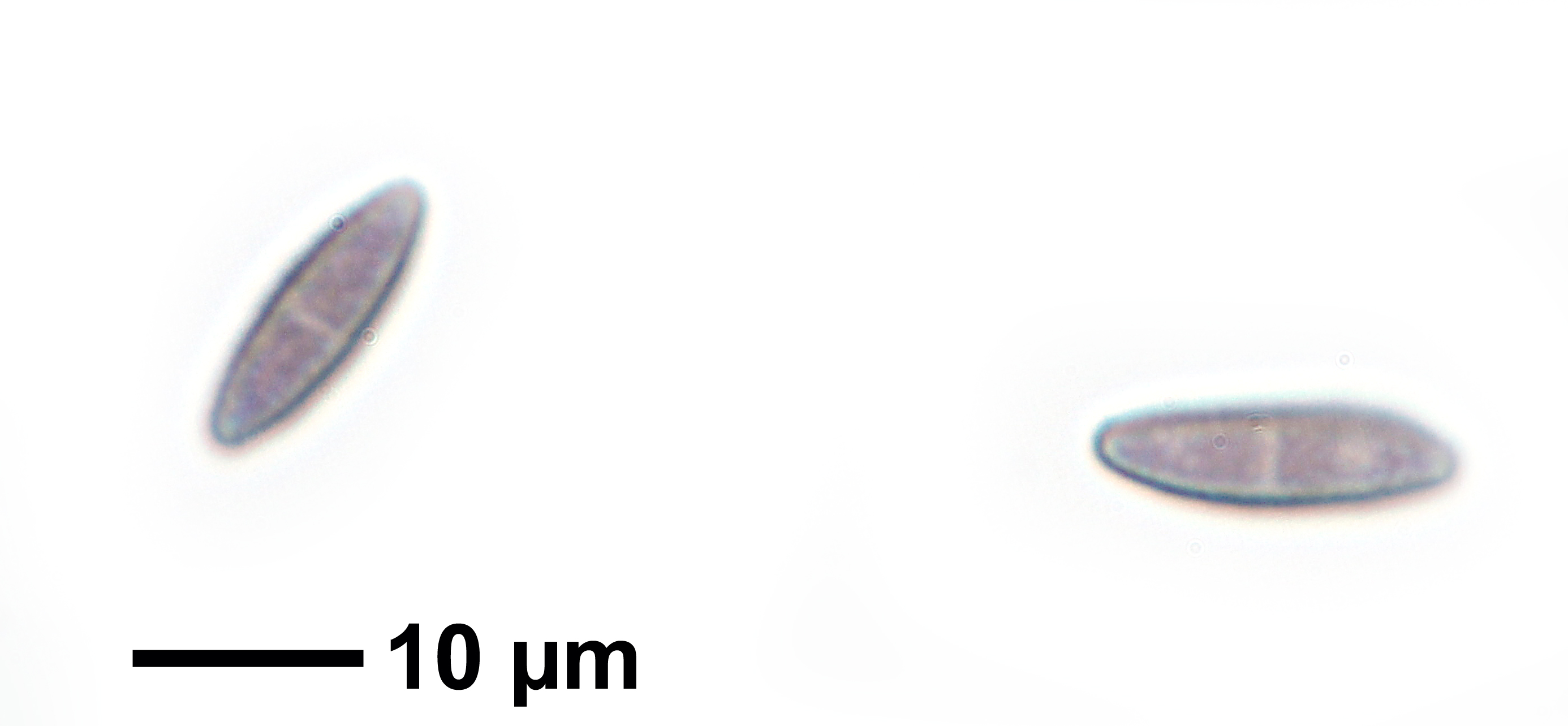
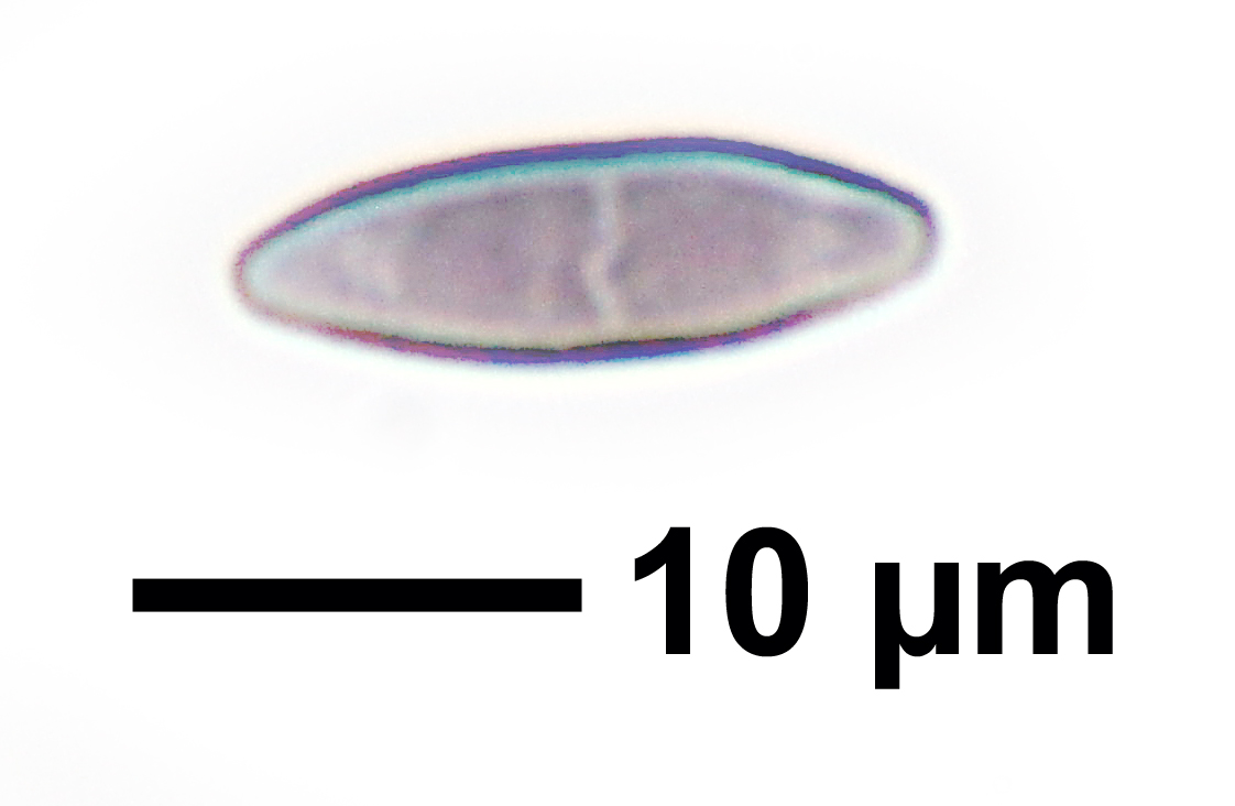
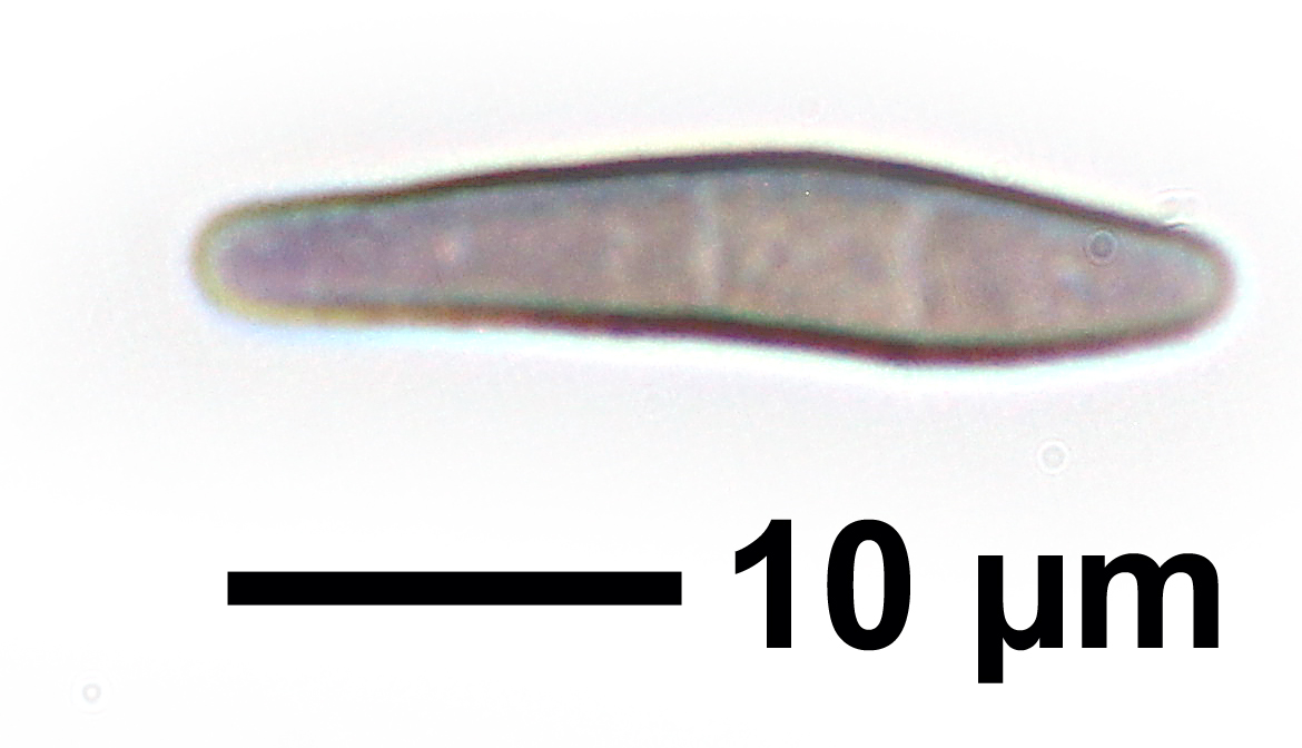
Description: Thallus not evident, not lichenized. Apothecia stalked, pin-like, 0.3-0.8 mm high, black. Stalk slender, simple or quite often branched and bearing 2-5 capitula, of dark brown, periclinally arranged hyphae, surrounded by a gelatinous coat. Capitulum lenticular to elongate, with a slightly constricted margin, 0.1-0.15 mm across. Epithecium dark brown, thin, of interwoven sclerotized hyphae; exciple well-developed, consisting of 4-7 layers of dark brown, periclinally arranged hyphae; paraphyses absent. Asci 8-spored, cylindrical, formed singly from ascogenous hyphae with croziers, uniformly thickened at apex, with a single functional wall layer, persisting until the spores are ejected (mazaedium absent), with uniseriately arranged spores. Ascospores 1-3 septate, the septa poorly pigmented (3 septa well-visible only in fully mature ascospores), narrowly ellipsoid, pale to medium grey-brown, 10-16(-20) x 4-5(-6) µm, with a minutely warted wall. Photobiont absent. Spot tests: K-, C-, KC-, P-. Chemistry: without lichen substances.Note: saprobic or parasitic on branches of Alnus, on decaying branches and trunks, especially along streams and lakes, usually associated with algal colonies. Widespread throughout the Alps and the Northern Apennines, but rarely collected.
Growth form: Fungus
Substrata: bark
Reproductive strategy: mainly sexual
Commonnes-rarity: (info)
Alpine belt: absent
Subalpine belt: absent
Oromediterranean belt: absent
Montane belt: very rare
Submediterranean belt: extremely rare
Padanian area: absent
Humid submediterranean belt: absent
Humid mediterranean belt: absent
Dry mediterranean belt: absent
Predictive model
Herbarium samples


Curtis Randall Björk CC BY-SA 4.0
Sugarbowl-Grizzly Den Provincial Park, British Columbia, Canada September 2017
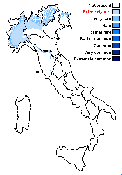
P.L. Nimis; Owner: Department of Life Sciences, University of Trieste
Herbarium: TSB (25880)
2003/03/20
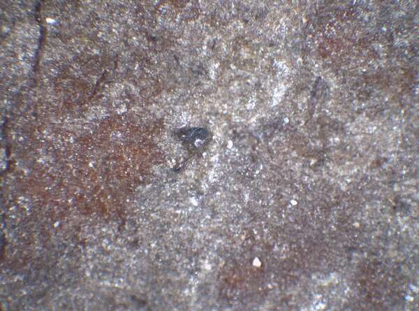
Felix Schumm – CC BY-SA 4.0
[14967], Germany, Baden-Württemberg, Kreis Göppingen, südöstlich der Zachersmühle im Herrenbachtal, 48,74408° N, 9,62049° E, 359 m, auf Erle am Bach. TK 7223. Leg. F. Schumm 24.07.2009, det. F. Schumm 2009
Felix Schumm – CC BY-SA 4.0
[14967], Germany, Baden-Württemberg, Kreis Göppingen, südöstlich der Zachersmühle im Herrenbachtal, 48,74408° N, 9,62049° E, 359 m, auf Erle am Bach. TK 7223. Leg. F. Schumm 24.07.2009, det. F. Schumm 2009

Felix Schumm – CC BY-SA 4.0
[14967], Germany, Baden-Württemberg, Kreis Göppingen, südöstlich der Zachersmühle im Herrenbachtal, 48,74408° N, 9,62049° E, 359 m, auf Erle am Bach. TK 7223. Leg. F. Schumm 24.07.2009, det. F. Schumm 2009
Felix Schumm – CC BY-SA 4.0
[14967], Germany, Baden-Württemberg, Kreis Göppingen, südöstlich der Zachersmühle im Herrenbachtal, 48,74408° N, 9,62049° E, 359 m, auf Erle am Bach. TK 7223. Leg. F. Schumm 24.07.2009, det. F. Schumm 2009
Felix Schumm – CC BY-SA 4.0
[14967], Germany, Baden-Württemberg, Kreis Göppingen, südöstlich der Zachersmühle im Herrenbachtal, 48,74408° N, 9,62049° E, 359 m, auf Erle am Bach. TK 7223. Leg. F. Schumm 24.07.2009, det. F. Schumm 2009

Felix Schumm – CC BY-SA 4.0
[14967], Germany, Baden-Württemberg, Kreis Göppingen, südöstlich der Zachersmühle im Herrenbachtal, 48,74408° N, 9,62049° E, 359 m, auf Erle am Bach. TK 7223. Leg. F. Schumm 24.07.2009, det. F. Schumm 2009
Felix Schumm – CC BY-SA 4.0
[14967], Germany, Baden-Württemberg, Kreis Göppingen, südöstlich der Zachersmühle im Herrenbachtal, 48,74408° N, 9,62049° E, 359 m, auf Erle am Bach. TK 7223. Leg. F. Schumm 24.07.2009, det. F. Schumm 2009
Felix Schumm – CC BY-SA 4.0
[14967], Germany, Baden-Württemberg, Kreis Göppingen, südöstlich der Zachersmühle im Herrenbachtal, 48,74408° N, 9,62049° E, 359 m, auf Erle am Bach. TK 7223. Leg. F. Schumm 24.07.2009, det. F. Schumm 2009
Felix Schumm – CC BY-SA 4.0
[14967], Germany, Baden-Württemberg, Kreis Göppingen, südöstlich der Zachersmühle im Herrenbachtal, 48,74408° N, 9,62049° E, 359 m, auf Erle am Bach. TK 7223. Leg. F. Schumm 24.07.2009, det. F. Schumm 2009

Felix Schumm – CC BY-SA 4.0
[14967], Germany, Baden-Württemberg, Kreis Göppingen, südöstlich der Zachersmühle im Herrenbachtal, 48,74408° N, 9,62049° E, 359 m, auf Erle am Bach. TK 7223. Leg. F. Schumm 24.07.2009, det. F. Schumm 2009
Felix Schumm – CC BY-SA 4.0
[14967], Germany, Baden-Württemberg, Kreis Göppingen, südöstlich der Zachersmühle im Herrenbachtal, 48,74408° N, 9,62049° E, 359 m, auf Erle am Bach. TK 7223. Leg. F. Schumm 24.07.2009, det. F. Schumm 2009

Zahlbruckner A. 1926. Lichenes (Flechten). In: Engler A. (ed.): Die natürlichen Pflanzenfamilien. 2nd ed., vol 8, W. Engelmann, Leipzig, 270 pp.
Curtis Randall Björk, - CC BY-SA 4.0
Sugarbowl-Grizzly Den Provincial Park, British Columbia, Canada
September 2017
Growth form: Fungus
Substrata: bark
Reproductive strategy: mainly sexual
Commonnes-rarity: (info)
Alpine belt: absent
Subalpine belt: absent
Oromediterranean belt: absent
Montane belt: very rare
Submediterranean belt: extremely rare
Padanian area: absent
Humid submediterranean belt: absent
Humid mediterranean belt: absent
Dry mediterranean belt: absent
Predictive model
| Herbarium samples |
Curtis Randall Björk CC BY-SA 4.0
Sugarbowl-Grizzly Den Provincial Park, British Columbia, Canada September 2017
P.L. Nimis; Owner: Department of Life Sciences, University of Trieste
Herbarium: TSB (25880)
2003/03/20
Felix Schumm – CC BY-SA 4.0
[14967], Germany, Baden-Württemberg, Kreis Göppingen, südöstlich der Zachersmühle im Herrenbachtal, 48,74408° N, 9,62049° E, 359 m, auf Erle am Bach. TK 7223. Leg. F. Schumm 24.07.2009, det. F. Schumm 2009

Felix Schumm – CC BY-SA 4.0
[14967], Germany, Baden-Württemberg, Kreis Göppingen, südöstlich der Zachersmühle im Herrenbachtal, 48,74408° N, 9,62049° E, 359 m, auf Erle am Bach. TK 7223. Leg. F. Schumm 24.07.2009, det. F. Schumm 2009
Felix Schumm – CC BY-SA 4.0
[14967], Germany, Baden-Württemberg, Kreis Göppingen, südöstlich der Zachersmühle im Herrenbachtal, 48,74408° N, 9,62049° E, 359 m, auf Erle am Bach. TK 7223. Leg. F. Schumm 24.07.2009, det. F. Schumm 2009
Felix Schumm – CC BY-SA 4.0
[14967], Germany, Baden-Württemberg, Kreis Göppingen, südöstlich der Zachersmühle im Herrenbachtal, 48,74408° N, 9,62049° E, 359 m, auf Erle am Bach. TK 7223. Leg. F. Schumm 24.07.2009, det. F. Schumm 2009

Felix Schumm – CC BY-SA 4.0
[14967], Germany, Baden-Württemberg, Kreis Göppingen, südöstlich der Zachersmühle im Herrenbachtal, 48,74408° N, 9,62049° E, 359 m, auf Erle am Bach. TK 7223. Leg. F. Schumm 24.07.2009, det. F. Schumm 2009
Felix Schumm – CC BY-SA 4.0
[14967], Germany, Baden-Württemberg, Kreis Göppingen, südöstlich der Zachersmühle im Herrenbachtal, 48,74408° N, 9,62049° E, 359 m, auf Erle am Bach. TK 7223. Leg. F. Schumm 24.07.2009, det. F. Schumm 2009
Felix Schumm – CC BY-SA 4.0
[14967], Germany, Baden-Württemberg, Kreis Göppingen, südöstlich der Zachersmühle im Herrenbachtal, 48,74408° N, 9,62049° E, 359 m, auf Erle am Bach. TK 7223. Leg. F. Schumm 24.07.2009, det. F. Schumm 2009
Felix Schumm – CC BY-SA 4.0
[14967], Germany, Baden-Württemberg, Kreis Göppingen, südöstlich der Zachersmühle im Herrenbachtal, 48,74408° N, 9,62049° E, 359 m, auf Erle am Bach. TK 7223. Leg. F. Schumm 24.07.2009, det. F. Schumm 2009
Felix Schumm – CC BY-SA 4.0
[14967], Germany, Baden-Württemberg, Kreis Göppingen, südöstlich der Zachersmühle im Herrenbachtal, 48,74408° N, 9,62049° E, 359 m, auf Erle am Bach. TK 7223. Leg. F. Schumm 24.07.2009, det. F. Schumm 2009
Felix Schumm – CC BY-SA 4.0
[14967], Germany, Baden-Württemberg, Kreis Göppingen, südöstlich der Zachersmühle im Herrenbachtal, 48,74408° N, 9,62049° E, 359 m, auf Erle am Bach. TK 7223. Leg. F. Schumm 24.07.2009, det. F. Schumm 2009

Felix Schumm – CC BY-SA 4.0
[14967], Germany, Baden-Württemberg, Kreis Göppingen, südöstlich der Zachersmühle im Herrenbachtal, 48,74408° N, 9,62049° E, 359 m, auf Erle am Bach. TK 7223. Leg. F. Schumm 24.07.2009, det. F. Schumm 2009
Zahlbruckner A. 1926. Lichenes (Flechten). In: Engler A. (ed.): Die natürlichen Pflanzenfamilien. 2nd ed., vol 8, W. Engelmann, Leipzig, 270 pp.