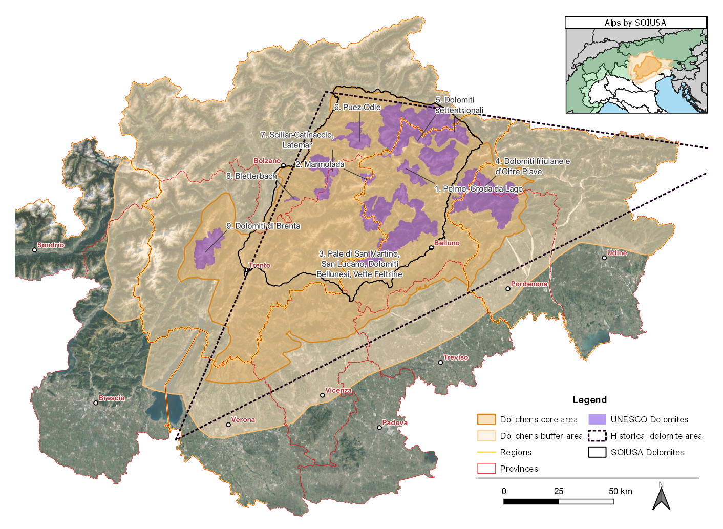
The Dolomites area

Nowadays, the most common geographical definition for the Dolomite Region is provided by the Partition of the Alps and SOIUSA - Suddivisione Orografica Internazionale Unificata del Sistema Alpino (Section No. 18 in the former and No. 31 in the latter). In both systems, it is delimited by the same geographic boundaries: the Adige river, the Isarco river, the Rienza river, the Monte Croce di Comelico Pass, the Piave river, the Brenta river, and the Fersina river (Marazzi, 2005). In this way, other mountain groups characterized by dolomite rock are excluded, such as the Brenta Dolomites, the Friulian Dolomites, and the Little Dolomites.
In 2009, the Dolomites were included among the UNESCO World Heritage Sites, which comprises 9 mountain groups isolated from each other since only the massifs characterized by dolomite rock were included (among which the Brenta and Friulian Dolomites), leaving out the surrounding lands.
In this study, the selected area is significantly wider than the SOIUSA definition: it encompasses the territories
surrounding the 9 UNESCO systems, thereby incorporating the Friulian and Brenta Dolomites, extending southward to
the Venetian and Carnic Prealps, in order to include the Little Dolomites as well, retracing the historical
definition.
In addition, a buffer area was considered: it reaches northward and eastward the national borders, on the west it
encloses the Stelvio National Park and the Adamello Brenta Natural Park, and southward it runs along the Po Valley
up to the Verona border. Data collection was mainly targeted to the core area, while data was collected for the
buffer area if found in the sources consulted. This will provide a preliminary start for the development of a future
information system for the whole of the Italian Eastern Alps.
The outstanding value of the Dolomites fo biodiversity conservation is corroborated by the occurence of several
protected areas covering around 30% of their total surface. These areas include one National Park (Dolomiti
Bellunesi) and several Regional Parks. Lichenological research is mainly focused in these areas, as in the case of
the Paneveggio-Pale di San Martino Natural Park (Nascimbene et al., 2022), that are the most interesting for lichen
diversity and often actively support scientific research.


