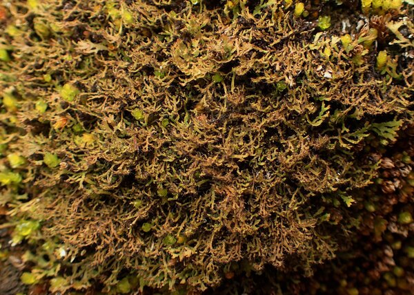
Phaeophyscia constipata (Norrl. & Nyl.) Moberg
Symb. Bot. Upsal., 22, 1: 33, 1977. Basionym: Physcia constipata Norrl. & Nyl. - Herb. Lich. Fenn.: nr. 218, 1882.
Synonyms: Physcia pulverulenta var. tenuis Th. Fr.
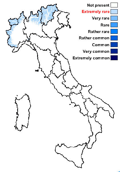
Distribution: N - TAA, Lomb, Piem (Morisi & Sereno 1995), VA (Piervittori & Isocrono 1999).
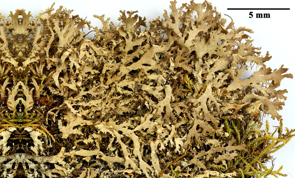
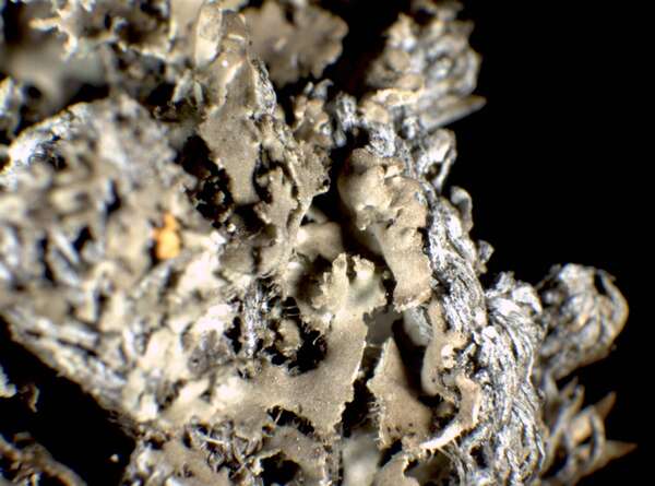
Description: Thallus foliose to minutely subfruticose, heteromerous, dorsiventral, narrow-lobed, thin, loosely attached to ascending, very fragile when dry, forming irregular, up to 3 cm wide tufts. Lobes to 0.3-0.5(-1) mm wide, linear, flattened, ascending, the tips broadened and lacerate-divided, richly and irregularly branched, often with projecting marginal rhizines. Upper surface brownish, becoming distinctly greenish when wet, smooth or rarely with thin transparent hairs which tend to fall off easily. Lower surface whitish to pale brown in the centre, with pale to dark (especially in central parts), mostly marginal, simple rhizines. Upper and lower cortex paraplectenchymatous; medulla white. Apothecia very rare, lecanorine, sessile to short-stipitate, to 1.5(-2) mm across, with a flat, brown disc and a smooth thalline margin. Asci 8-spored, clavate, the K/I+ blue tholus penetrated by a faintly amyloid apical cushion with parallel or diverging flanks, the wall K/I-, surrounded by a K/I+ blue outer layer, Lecanora-type. Ascospores 1-septate, brown, ellipsoid, (16-)18-21(-23) x (7-)9-11(-13) µm, Physcia-type. Pycnidia rare, dark, immersed. Conidia straight, narrowly ellipsoid, 2-4 x c. 1 µm. Photobiont chlorococcoid. Spot tests: cortex and medulla K-, C-, KC-, P-, UV-. Chemistry: without lichen substances. Note: a a mainly circumboreal-montane species found on mosses and plant debris on basic siliceous substrata, sometimes on soil, in upland areas; in Italy probably restricted to the Alps, in dry-warm situations.
Growth form: Foliose, narrow lobed
Substrata: soil, terricolous mosses, and plant debris
Photobiont: green algae other than Trentepohlia
Reproductive strategy: mainly sexual
Commonnes-rarity: (info)
Alpine belt: extremely rare
Subalpine belt: very rare
Oromediterranean belt: absent
Montane belt: extremely rare
Submediterranean belt: absent
Padanian area: absent
Humid submediterranean belt: absent
Humid mediterranean belt: absent
Dry mediterranean belt: absent
Predictive model
Herbarium samples

Felix Schumm - CC BY-SA 4.0
[GZU H208], Finland, Ks. Kuusamo, Oulanka national park, calcareous rock wall S of biological station. Leg. Tauno Ulvinen, 07.07.1969. EX HERBARIO UNIVERSITATIS OULUENSIS - PLANTAE FENNICAE

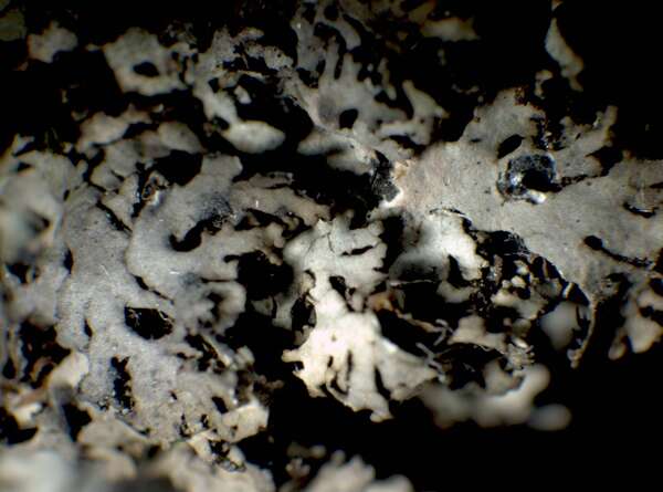
P.L. Nimis; Owner: Department of Life Sciences, University of Trieste
Herbarium: TSB (28976)
2001/12/15

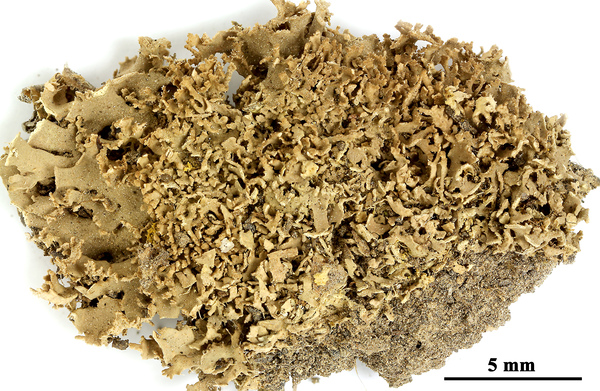
P.L. Nimis; Owner: Department of Life Sciences, University of Trieste
Herbarium: TSB (34623)
2002/01/22

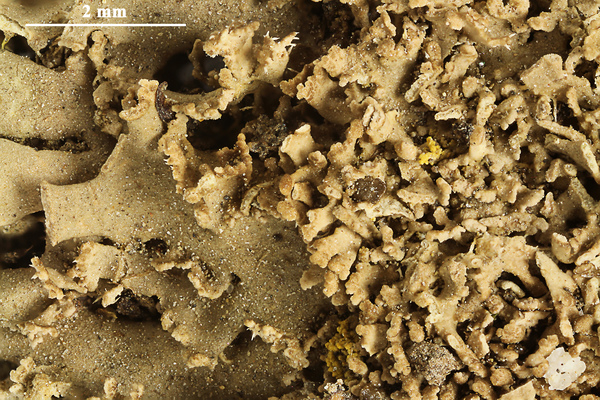
Felix Schumm - CC BY-SA 4.0
[GZU 5-P1], Österreich, Tirol, Rhätische Alpen, Samnaun-Gruppe, Fuß einer Föhre am Kapellenhügel östlich Serfaus, 1430 m. Leg. J. Poelt, 09.1972. Aus dem Vergleichsherbar J. Poelt Nr. 11538.

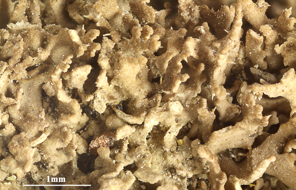
Felix Schumm - CC BY-SA 4.0
[GZU 5-P1], Österreich, Tirol, Rhätische Alpen, Samnaun-Gruppe, Fuß einer Föhre am Kapellenhügel östlich Serfaus, 1430 m. Leg. J. Poelt, 09.1972. Aus dem Vergleichsherbar J. Poelt Nr. 11538.

Felix Schumm - CC BY-SA 4.0
[GZU 5-P1], Österreich, Tirol, Rhätische Alpen, Samnaun-Gruppe, Fuß einer Föhre am Kapellenhügel östlich Serfaus, 1430 m. Leg. J. Poelt, 09.1972. Aus dem Vergleichsherbar J. Poelt Nr. 11538.
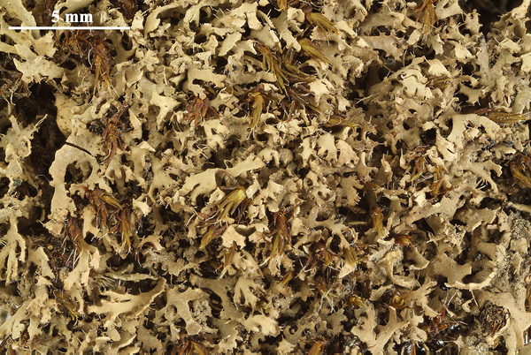

Felix Schumm - CC BY-SA 4.0
[GZU 6-P1], Italien, Aostatal, St. Nicolas bei St. Pierre, ca 1100 m, südseitige Trockenhänge. Leg. A. Buschardt, 1.11.1973, det. J. Poelt. Ex Herb. A. Buschardt Nr. 2138, im Vergleichsherbar J. Poelt Nr. 12652
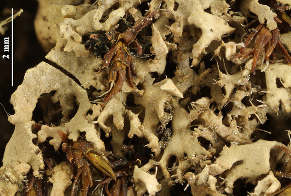

Felix Schumm - CC BY-SA 4.0
[GZU 6-P1], Italien, Aostatal, St. Nicolas bei St. Pierre, ca 1100 m, südseitige Trockenhänge. Leg. A. Buschardt, 1.11.1973, det. J. Poelt. Ex Herb. A. Buschardt Nr. 2138, im Vergleichsherbar J. Poelt Nr. 12652
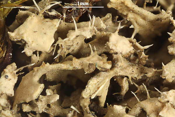

Felix Schumm - CC BY-SA 4.0
[GZU 6-P1], Italien, Aostatal, St. Nicolas bei St. Pierre, ca 1100 m, südseitige Trockenhänge. Leg. A. Buschardt, 1.11.1973, det. J. Poelt. Ex Herb. A. Buschardt Nr. 2138, im Vergleichsherbar J. Poelt Nr. 12652
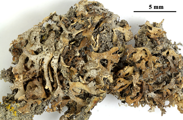

Felix Schumm - CC BY-SA 4.0
[GZU 97-82], W-Grönland, Söndre Strömfjord, S-exponierter steiler Steppenhang über dem Flugplatz von S.Strömfjord, 30-50 m. Stark sandiger Boden mit Carex supina zwischen Silikatfelsen. Leg. J. Poelt, 14.08.1982
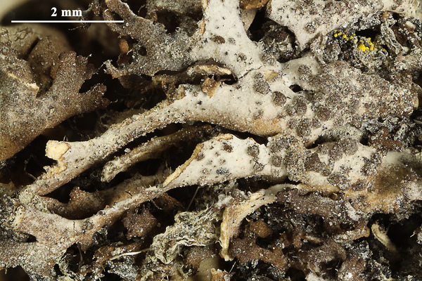

Felix Schumm - CC BY-SA 4.0
[GZU 97-82], W-Grönland, Söndre Strömfjord, S-exponierter steiler Steppenhang über dem Flugplatz von S.Strömfjord, 30-50 m. Stark sandiger Boden mit Carex supina zwischen Silikatfelsen. Leg. J. Poelt, 14.08.1982
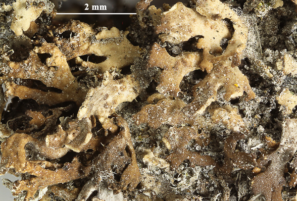

Felix Schumm - CC BY-SA 4.0
[GZU 97-82], W-Grönland, Söndre Strömfjord, S-exponierter steiler Steppenhang über dem Flugplatz von S.Strömfjord, 30-50 m. Stark sandiger Boden mit Carex supina zwischen Silikatfelsen. Leg. J. Poelt, 14.08.1982
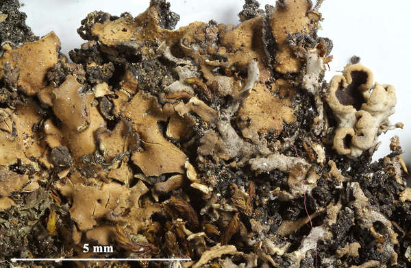

Felix Schumm - CC BY-SA 4.0
[GZU 156-88], Österreich, Ost-Tirol, Hohe Tauern, Virgental, felsiger Rücken Burg bei Obermauern, 1360-1400 m. Leg. J. Poelt, 1.9.1988
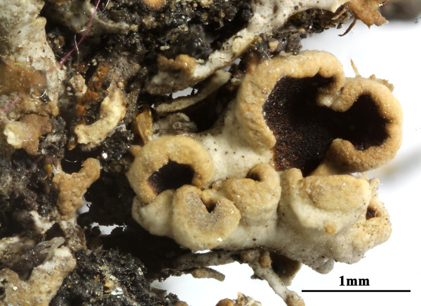

Felix Schumm - CC BY-SA 4.0
[GZU 156-88], Österreich, Ost-Tirol, Hohe Tauern, Virgental, felsiger Rücken Burg bei Obermauern, 1360-1400 m. Leg. J. Poelt, 1.9.1988
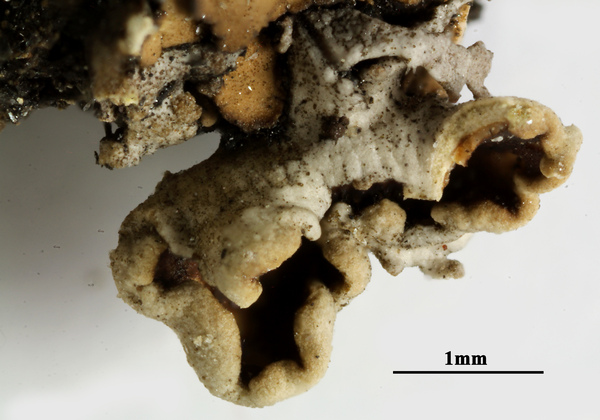

Felix Schumm - CC BY-SA 4.0
[GZU 156-88], Österreich, Ost-Tirol, Hohe Tauern, Virgental, felsiger Rücken Burg bei Obermauern, 1360-1400 m. Leg. J. Poelt, 1.9.1988
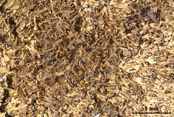

Felix Schumm - CC BY-SA 4.0
[GZU 213-80], Schweden, Torne Lappmark, Jukkasjärvi sn: Umgebung von Abisko, Pajep Paddustievva (Kliff Paddos), SE von Abisko, Felsabsätze, 600 m, 68°19’ N, 18°52’ E. Leg. J. Poelt, 08.08.1980
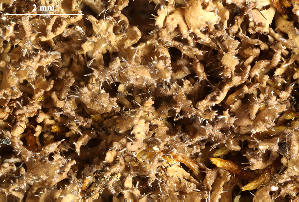

Felix Schumm - CC BY-SA 4.0
[GZU 213-80], Schweden, Torne Lappmark, Jukkasjärvi sn: Umgebung von Abisko, Pajep Paddustievva (Kliff Paddos), SE von Abisko, Felsabsätze, 600 m, 68°19’ N, 18°52’ E. Leg. J. Poelt, 08.08.1980
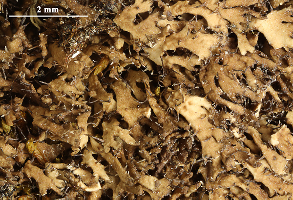

Felix Schumm - CC BY-SA 4.0
[GZU 213-80], Schweden, Torne Lappmark, Jukkasjärvi sn: Umgebung von Abisko, Pajep Paddustievva (Kliff Paddos), SE von Abisko, Felsabsätze, 600 m, 68°19’ N, 18°52’ E. Leg. J. Poelt, 08.08.1980
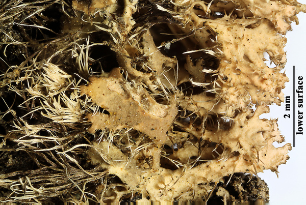

Felix Schumm - CC BY-SA 4.0
[GZU 213-80], Schweden, Torne Lappmark, Jukkasjärvi sn: Umgebung von Abisko, Pajep Paddustievva (Kliff Paddos), SE von Abisko, Felsabsätze, 600 m, 68°19’ N, 18°52’ E. Leg. J. Poelt, 08.08.1980
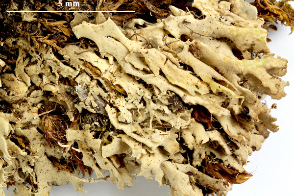

Felix Schumm - CC BY-SA 4.0
[GZU 217-80], Sweden,Torne Lappmark, par. Jukkasjärvi, Abisko, Paddos. On mossy ground, 700m. Leg. E. P. Vrang, July 1927, det. R. Moberg, 1980. MAGNUSSON: LICHENES SELECTI SCANDINAVICI EXSICCATI NO. 38.
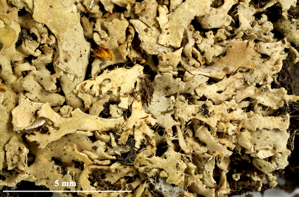

Felix Schumm - CC BY-SA 4.0
[GZU 217-80], Sweden,Torne Lappmark, par. Jukkasjärvi, Abisko, Paddos. On mossy ground, 700m. Leg. E. P. Vrang, July 1927, det. R. Moberg, 1980. MAGNUSSON: LICHENES SELECTI SCANDINAVICI EXSICCATI NO. 38.
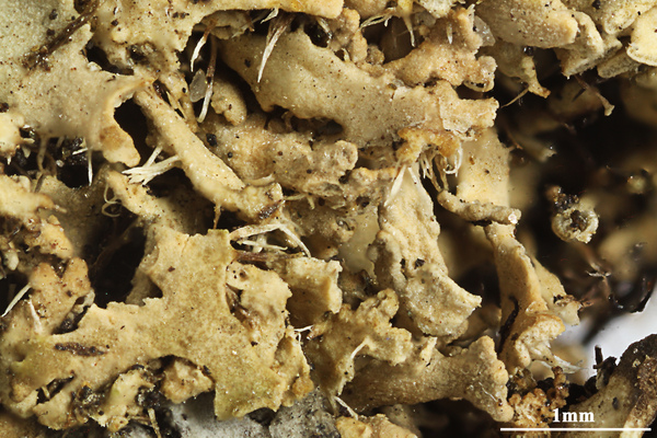

Felix Schumm - CC BY-SA 4.0
[GZU 217-80], Sweden,Torne Lappmark, par. Jukkasjärvi, Abisko, Paddos. On mossy ground, 700m. Leg. E. P. Vrang, July 1927, det. R. Moberg, 1980. MAGNUSSON: LICHENES SELECTI SCANDINAVICI EXSICCATI NO. 38.
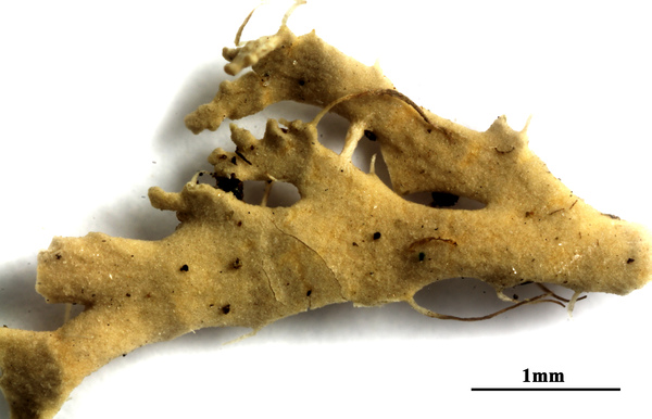

Felix Schumm - CC BY-SA 4.0
[GZU 217-80], Sweden,Torne Lappmark, par. Jukkasjärvi, Abisko, Paddos. On mossy ground, 700m. Leg. E. P. Vrang, July 1927, det. R. Moberg, 1980. MAGNUSSON: LICHENES SELECTI SCANDINAVICI EXSICCATI NO. 38.
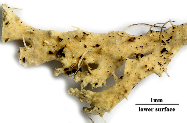

Felix Schumm - CC BY-SA 4.0
[GZU 217-80], Sweden,Torne Lappmark, par. Jukkasjärvi, Abisko, Paddos. On mossy ground, 700m. Leg. E. P. Vrang, July 1927, det. R. Moberg, 1980. MAGNUSSON: LICHENES SELECTI SCANDINAVICI EXSICCATI NO. 38.
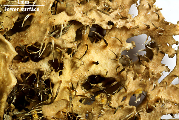

Felix Schumm - CC BY-SA 4.0
[GZU H208], Finland, Ks. Kuusamo, Oulanka national park, calcareous rock wall S of biological station. Leg. Tauno Ulvinen, 07.07.1969. EX HERBARIO UNIVERSITATIS OULUENSIS - PLANTAE FENNICAE
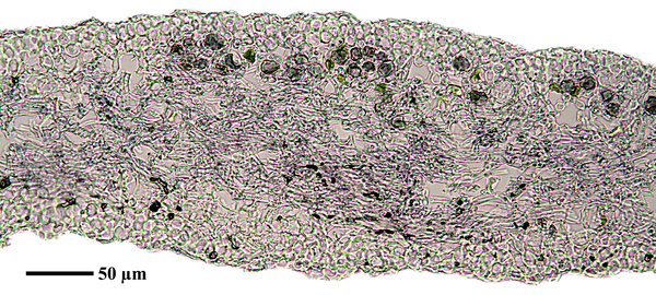

Felix Schumm - CC BY-SA 4.0
[GZU 217-80], Sweden,Torne Lappmark, par. Jukkasjärvi, Abisko, Paddos. On mossy ground, 700m. Leg. E. P. Vrang, July 1927, det. R. Moberg, 1980. MAGNUSSON: LICHENES SELECTI SCANDINAVICI EXSICCATI NO. 38.
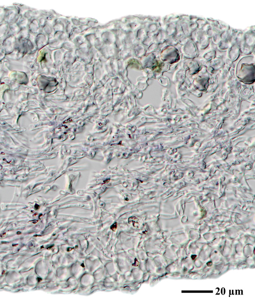

Felix Schumm - CC BY-SA 4.0
[GZU 217-80], Sweden,Torne Lappmark, par. Jukkasjärvi, Abisko, Paddos. On mossy ground, 700m. Leg. E. P. Vrang, July 1927, det. R. Moberg, 1980. MAGNUSSON: LICHENES SELECTI SCANDINAVICI EXSICCATI NO. 38.
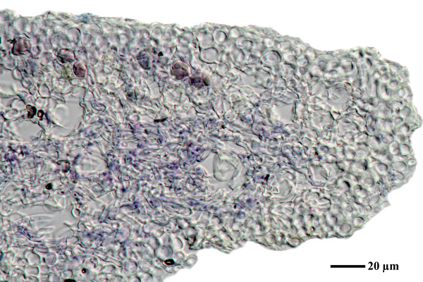

Felix Schumm - CC BY-SA 4.0
[GZU 217-80], Sweden,Torne Lappmark, par. Jukkasjärvi, Abisko, Paddos. On mossy ground, 700m. Leg. E. P. Vrang, July 1927, det. R. Moberg, 1980. MAGNUSSON: LICHENES SELECTI SCANDINAVICI EXSICCATI NO. 38.
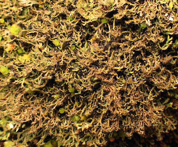

Curtis Randall Björk CC BY-SA 4.0
Canada, British Columbia, Hemp Creek Canyon, Wells Gray Provincial Park.
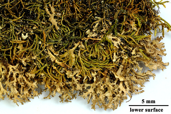

Felix Schumm - CC BY-SA 4.0
[GZU H208], Finland, Ks. Kuusamo, Oulanka national park, calcareous rock wall S of biological station. Leg. Tauno Ulvinen, 07.07.1969. EX HERBARIO UNIVERSITATIS OULUENSIS - PLANTAE FENNICAE
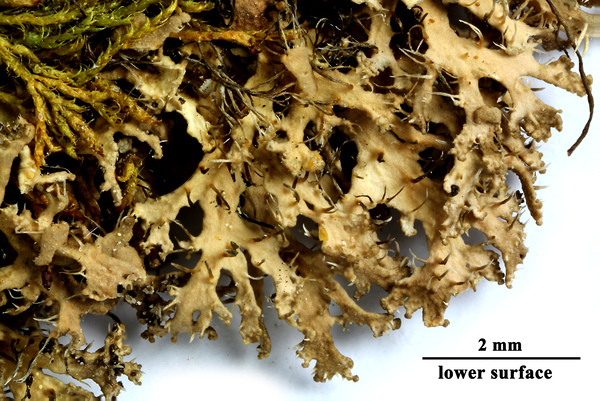

Felix Schumm - CC BY-SA 4.0
[GZU H208], Finland, Ks. Kuusamo, Oulanka national park, calcareous rock wall S of biological station. Leg. Tauno Ulvinen, 07.07.1969. EX HERBARIO UNIVERSITATIS OULUENSIS - PLANTAE FENNICAE
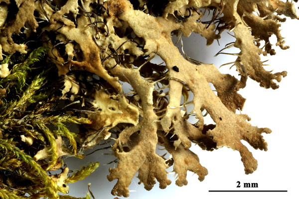

Felix Schumm - CC BY-SA 4.0
[GZU H208], Finland, Ks. Kuusamo, Oulanka national park, calcareous rock wall S of biological station. Leg. Tauno Ulvinen, 07.07.1969. EX HERBARIO UNIVERSITATIS OULUENSIS - PLANTAE FENNICAE
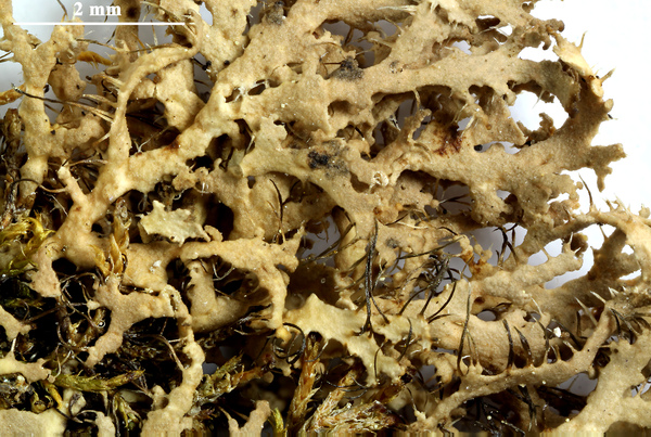

Felix Schumm - CC BY-SA 4.0
[GZU H208], Finland, Ks. Kuusamo, Oulanka national park, calcareous rock wall S of biological station. Leg. Tauno Ulvinen, 07.07.1969. EX HERBARIO UNIVERSITATIS OULUENSIS - PLANTAE FENNICAE
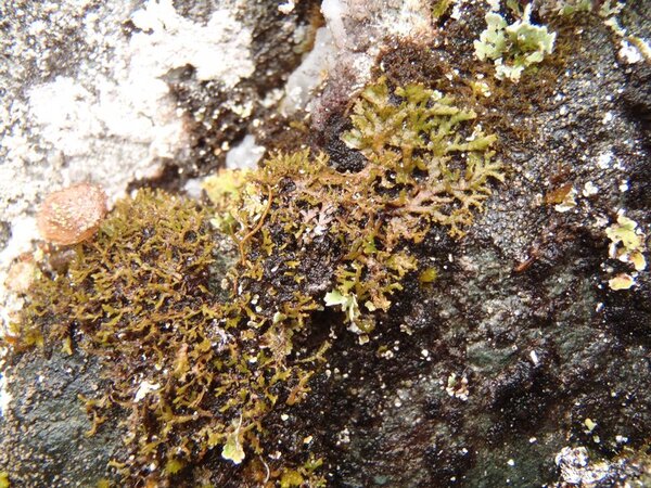

Curtis Randall Björk – CC BY-SA 4.0
British Columbia, Clearwater Valley Date: 2012-10-04 On cliffs over white-water river
Growth form: Foliose, narrow lobed
Substrata: soil, terricolous mosses, and plant debris
Photobiont: green algae other than Trentepohlia
Reproductive strategy: mainly sexual
Commonnes-rarity: (info)
Alpine belt: extremely rare
Subalpine belt: very rare
Oromediterranean belt: absent
Montane belt: extremely rare
Submediterranean belt: absent
Padanian area: absent
Humid submediterranean belt: absent
Humid mediterranean belt: absent
Dry mediterranean belt: absent

Predictive model
| Herbarium samples |


Felix Schumm - CC BY-SA 4.0
[GZU H208], Finland, Ks. Kuusamo, Oulanka national park, calcareous rock wall S of biological station. Leg. Tauno Ulvinen, 07.07.1969. EX HERBARIO UNIVERSITATIS OULUENSIS - PLANTAE FENNICAE


P.L. Nimis; Owner: Department of Life Sciences, University of Trieste
Herbarium: TSB (28976)
2001/12/15


P.L. Nimis; Owner: Department of Life Sciences, University of Trieste
Herbarium: TSB (34623)
2002/01/22


Felix Schumm - CC BY-SA 4.0
[GZU 5-P1], Österreich, Tirol, Rhätische Alpen, Samnaun-Gruppe, Fuß einer Föhre am Kapellenhügel östlich Serfaus, 1430 m. Leg. J. Poelt, 09.1972. Aus dem Vergleichsherbar J. Poelt Nr. 11538.


Felix Schumm - CC BY-SA 4.0
[GZU 5-P1], Österreich, Tirol, Rhätische Alpen, Samnaun-Gruppe, Fuß einer Föhre am Kapellenhügel östlich Serfaus, 1430 m. Leg. J. Poelt, 09.1972. Aus dem Vergleichsherbar J. Poelt Nr. 11538.


Felix Schumm - CC BY-SA 4.0
[GZU 5-P1], Österreich, Tirol, Rhätische Alpen, Samnaun-Gruppe, Fuß einer Föhre am Kapellenhügel östlich Serfaus, 1430 m. Leg. J. Poelt, 09.1972. Aus dem Vergleichsherbar J. Poelt Nr. 11538.


Felix Schumm - CC BY-SA 4.0
[GZU 6-P1], Italien, Aostatal, St. Nicolas bei St. Pierre, ca 1100 m, südseitige Trockenhänge. Leg. A. Buschardt, 1.11.1973, det. J. Poelt. Ex Herb. A. Buschardt Nr. 2138, im Vergleichsherbar J. Poelt Nr. 12652


Felix Schumm - CC BY-SA 4.0
[GZU 6-P1], Italien, Aostatal, St. Nicolas bei St. Pierre, ca 1100 m, südseitige Trockenhänge. Leg. A. Buschardt, 1.11.1973, det. J. Poelt. Ex Herb. A. Buschardt Nr. 2138, im Vergleichsherbar J. Poelt Nr. 12652


Felix Schumm - CC BY-SA 4.0
[GZU 6-P1], Italien, Aostatal, St. Nicolas bei St. Pierre, ca 1100 m, südseitige Trockenhänge. Leg. A. Buschardt, 1.11.1973, det. J. Poelt. Ex Herb. A. Buschardt Nr. 2138, im Vergleichsherbar J. Poelt Nr. 12652


Felix Schumm - CC BY-SA 4.0
[GZU 97-82], W-Grönland, Söndre Strömfjord, S-exponierter steiler Steppenhang über dem Flugplatz von S.Strömfjord, 30-50 m. Stark sandiger Boden mit Carex supina zwischen Silikatfelsen. Leg. J. Poelt, 14.08.1982


Felix Schumm - CC BY-SA 4.0
[GZU 97-82], W-Grönland, Söndre Strömfjord, S-exponierter steiler Steppenhang über dem Flugplatz von S.Strömfjord, 30-50 m. Stark sandiger Boden mit Carex supina zwischen Silikatfelsen. Leg. J. Poelt, 14.08.1982


Felix Schumm - CC BY-SA 4.0
[GZU 97-82], W-Grönland, Söndre Strömfjord, S-exponierter steiler Steppenhang über dem Flugplatz von S.Strömfjord, 30-50 m. Stark sandiger Boden mit Carex supina zwischen Silikatfelsen. Leg. J. Poelt, 14.08.1982


Felix Schumm - CC BY-SA 4.0
[GZU 156-88], Österreich, Ost-Tirol, Hohe Tauern, Virgental, felsiger Rücken Burg bei Obermauern, 1360-1400 m. Leg. J. Poelt, 1.9.1988


Felix Schumm - CC BY-SA 4.0
[GZU 156-88], Österreich, Ost-Tirol, Hohe Tauern, Virgental, felsiger Rücken Burg bei Obermauern, 1360-1400 m. Leg. J. Poelt, 1.9.1988


Felix Schumm - CC BY-SA 4.0
[GZU 156-88], Österreich, Ost-Tirol, Hohe Tauern, Virgental, felsiger Rücken Burg bei Obermauern, 1360-1400 m. Leg. J. Poelt, 1.9.1988


Felix Schumm - CC BY-SA 4.0
[GZU 213-80], Schweden, Torne Lappmark, Jukkasjärvi sn: Umgebung von Abisko, Pajep Paddustievva (Kliff Paddos), SE von Abisko, Felsabsätze, 600 m, 68°19’ N, 18°52’ E. Leg. J. Poelt, 08.08.1980


Felix Schumm - CC BY-SA 4.0
[GZU 213-80], Schweden, Torne Lappmark, Jukkasjärvi sn: Umgebung von Abisko, Pajep Paddustievva (Kliff Paddos), SE von Abisko, Felsabsätze, 600 m, 68°19’ N, 18°52’ E. Leg. J. Poelt, 08.08.1980


Felix Schumm - CC BY-SA 4.0
[GZU 213-80], Schweden, Torne Lappmark, Jukkasjärvi sn: Umgebung von Abisko, Pajep Paddustievva (Kliff Paddos), SE von Abisko, Felsabsätze, 600 m, 68°19’ N, 18°52’ E. Leg. J. Poelt, 08.08.1980


Felix Schumm - CC BY-SA 4.0
[GZU 213-80], Schweden, Torne Lappmark, Jukkasjärvi sn: Umgebung von Abisko, Pajep Paddustievva (Kliff Paddos), SE von Abisko, Felsabsätze, 600 m, 68°19’ N, 18°52’ E. Leg. J. Poelt, 08.08.1980


Felix Schumm - CC BY-SA 4.0
[GZU 217-80], Sweden,Torne Lappmark, par. Jukkasjärvi, Abisko, Paddos. On mossy ground, 700m. Leg. E. P. Vrang, July 1927, det. R. Moberg, 1980. MAGNUSSON: LICHENES SELECTI SCANDINAVICI EXSICCATI NO. 38.


Felix Schumm - CC BY-SA 4.0
[GZU 217-80], Sweden,Torne Lappmark, par. Jukkasjärvi, Abisko, Paddos. On mossy ground, 700m. Leg. E. P. Vrang, July 1927, det. R. Moberg, 1980. MAGNUSSON: LICHENES SELECTI SCANDINAVICI EXSICCATI NO. 38.


Felix Schumm - CC BY-SA 4.0
[GZU 217-80], Sweden,Torne Lappmark, par. Jukkasjärvi, Abisko, Paddos. On mossy ground, 700m. Leg. E. P. Vrang, July 1927, det. R. Moberg, 1980. MAGNUSSON: LICHENES SELECTI SCANDINAVICI EXSICCATI NO. 38.


Felix Schumm - CC BY-SA 4.0
[GZU 217-80], Sweden,Torne Lappmark, par. Jukkasjärvi, Abisko, Paddos. On mossy ground, 700m. Leg. E. P. Vrang, July 1927, det. R. Moberg, 1980. MAGNUSSON: LICHENES SELECTI SCANDINAVICI EXSICCATI NO. 38.


Felix Schumm - CC BY-SA 4.0
[GZU 217-80], Sweden,Torne Lappmark, par. Jukkasjärvi, Abisko, Paddos. On mossy ground, 700m. Leg. E. P. Vrang, July 1927, det. R. Moberg, 1980. MAGNUSSON: LICHENES SELECTI SCANDINAVICI EXSICCATI NO. 38.


Felix Schumm - CC BY-SA 4.0
[GZU H208], Finland, Ks. Kuusamo, Oulanka national park, calcareous rock wall S of biological station. Leg. Tauno Ulvinen, 07.07.1969. EX HERBARIO UNIVERSITATIS OULUENSIS - PLANTAE FENNICAE


Felix Schumm - CC BY-SA 4.0
[GZU 217-80], Sweden,Torne Lappmark, par. Jukkasjärvi, Abisko, Paddos. On mossy ground, 700m. Leg. E. P. Vrang, July 1927, det. R. Moberg, 1980. MAGNUSSON: LICHENES SELECTI SCANDINAVICI EXSICCATI NO. 38.


Felix Schumm - CC BY-SA 4.0
[GZU 217-80], Sweden,Torne Lappmark, par. Jukkasjärvi, Abisko, Paddos. On mossy ground, 700m. Leg. E. P. Vrang, July 1927, det. R. Moberg, 1980. MAGNUSSON: LICHENES SELECTI SCANDINAVICI EXSICCATI NO. 38.


Felix Schumm - CC BY-SA 4.0
[GZU 217-80], Sweden,Torne Lappmark, par. Jukkasjärvi, Abisko, Paddos. On mossy ground, 700m. Leg. E. P. Vrang, July 1927, det. R. Moberg, 1980. MAGNUSSON: LICHENES SELECTI SCANDINAVICI EXSICCATI NO. 38.


Curtis Randall Björk CC BY-SA 4.0
Canada, British Columbia, Hemp Creek Canyon, Wells Gray Provincial Park.


Felix Schumm - CC BY-SA 4.0
[GZU H208], Finland, Ks. Kuusamo, Oulanka national park, calcareous rock wall S of biological station. Leg. Tauno Ulvinen, 07.07.1969. EX HERBARIO UNIVERSITATIS OULUENSIS - PLANTAE FENNICAE


Felix Schumm - CC BY-SA 4.0
[GZU H208], Finland, Ks. Kuusamo, Oulanka national park, calcareous rock wall S of biological station. Leg. Tauno Ulvinen, 07.07.1969. EX HERBARIO UNIVERSITATIS OULUENSIS - PLANTAE FENNICAE


Felix Schumm - CC BY-SA 4.0
[GZU H208], Finland, Ks. Kuusamo, Oulanka national park, calcareous rock wall S of biological station. Leg. Tauno Ulvinen, 07.07.1969. EX HERBARIO UNIVERSITATIS OULUENSIS - PLANTAE FENNICAE


Felix Schumm - CC BY-SA 4.0
[GZU H208], Finland, Ks. Kuusamo, Oulanka national park, calcareous rock wall S of biological station. Leg. Tauno Ulvinen, 07.07.1969. EX HERBARIO UNIVERSITATIS OULUENSIS - PLANTAE FENNICAE


 INDEX FUNGORUM
 GBIF
GBIF
 DOLICHENS
