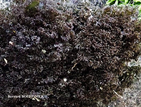
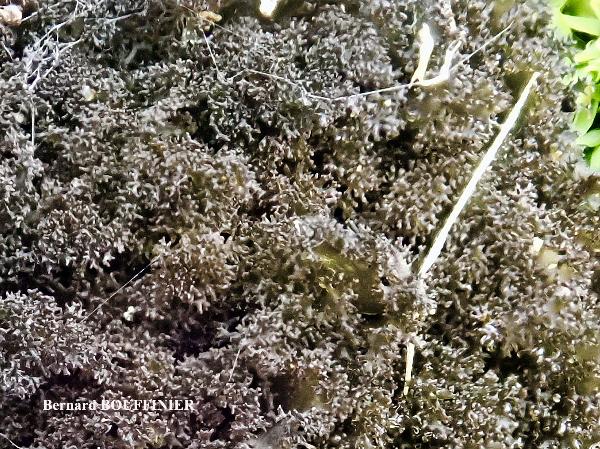
Scytinium pulvinatum (Hoffm.) Otálora, P.M. Jørg. & Wedin
in Otálora & Wedin, Mycosphere, 5: 502, 2014. Basionym: Collema pulvinatum Hoffm. - Deutschl. Fl.: 104, 1796.
Synonyms: Leptogium atrocoeruleum var. pulvinatum (Hoffm.) Beltr.; Leptogium lacerum var. pulvinatum (Hoffm.) Zahlbr.; Leptogium lichenoides var. pulvinatum (Hoffm.) Zahlbr.; Leptogium pulvinatum (Hoffm.) Cromb.
Distribution: N - VG (LD-1186681), Frl (TSB 12882), Ven, TAA (B 600108318), Lomb (S-L34070), Piem (TSB s.n.), Emil (Fariselli & al. 2020), Lig (Giordani & al. 2025). C - Sar (TSB 6244). S - Pugl (S- L33728), Bas (CLU 17799), Si (LD-1185405).
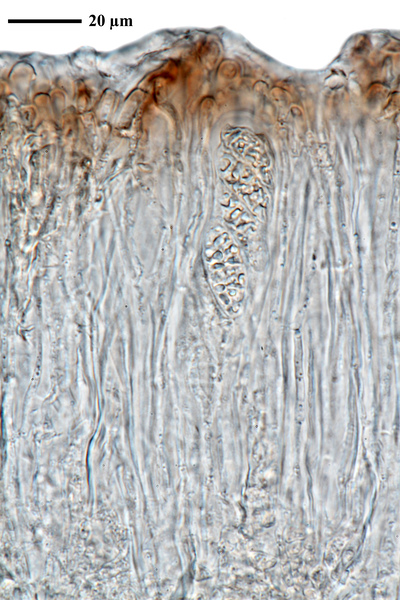
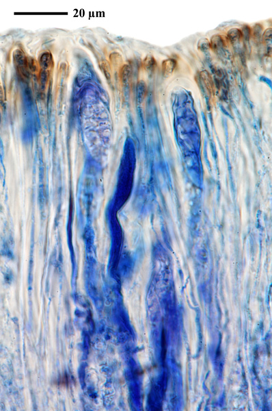
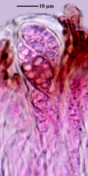
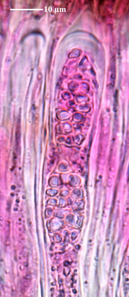
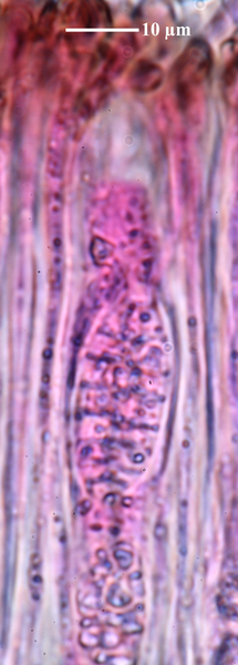
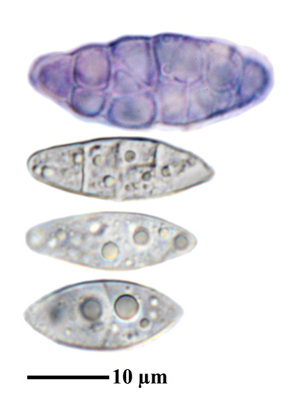
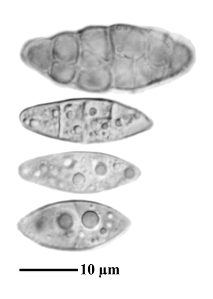
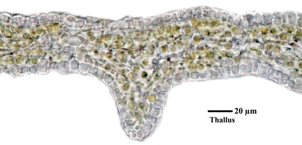
Description: Thallus minutely foliose to subfruticose, slightly gelatinous when wet, forming compact, convex, 1-4(-5) cm wide pillows. Lobes erect, 1-3(-4) mm wide, 0.5-5 mm long, 50–120 µm thick, red-brown to dark brown, elongate, often revolute, wrinkled, shiny, deeply laciniate-fringed at margins, the fringes usually flattened. Lower surface paler blue-grey, wrinkled, with a few, scattered, white hapters. Upper and lower pseudocortex of a single layer of angular, more or less isodiametrical, 6-9 µm wide cells, the layer inbetween of intertwined hyphae and loosely arranged chains of Nostoc. Apothecia rare, lecanorine, 0.2-0.8 mm across, with a concave, brown to red-brown disc and a well-developed, usually smooth thalline margin. Thalline exciple pseudocorticate; proper exciple euparaplectenchymatous, 10-40 µm wide laterally; epithecium brownish; hymenium colourless, 65-135 µm high, I+ blue; paraphyses coherent, mostly simple, c. 1.5 µm thick at mid-level, the apical cells 4-5 µm wide; hypothecium colourless to pale yellow. Asci 8-spored, narrowly clavate, the apex strongly thickened, the apical dome K/I+ pale blue, with a downwardly projecting K/I+ deep blue tubular structure. Ascospores submuriform to muriform, hyaline, ellipsoid. (28-)33-42(-47) x (12-)14-16(-18) μm, thin-walled. Photobiont cyanobacterial (Nostoc, the cells in short chains). Spot test: all negative. Chemistry: without lichen substances. Note: this species occurs among mosses at the base of trees or occasionally directly over bark of different trees, but also on walls, rocks or soil in open habitats over acrocarpous mosses, from the coast to the mountains. Though there is molecular evidence that this should be accepted as a species, it is hard to distinguish from extreme forms of S. lichenoides, and also the poor type is from a garden path in Oxford, a rather unlikely habitat for this arctic-alpine taxon (Jørgensen, in litt.). A revision of the S. lichenoides-complex in Italy is needed to clarify its present distribution. The specimen in B, originally labelled as Leptogium lichenoides, was identified by M. G. Otálora.
Growth form: Squamulose
Substrata: rocks, bark, soil, terricolous mosses, and plant debris
Photobiont: cyanobacteria, filamentous (e.g. Nostoc, Scytonema)
Reproductive strategy: mainly sexual
Poorly known taxon in need of further study
Commonnes-rarity: (info)
Alpine belt: common
Subalpine belt: extremely common
Oromediterranean belt: common
Montane belt: extremely common
Submediterranean belt: very common
Padanian area: extremely rare
Humid submediterranean belt: very common
Humid mediterranean belt: common
Dry mediterranean belt: rather rare
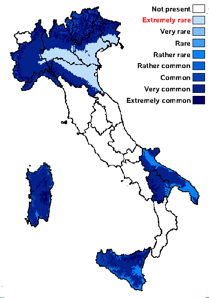
Predictive model
Herbarium samples
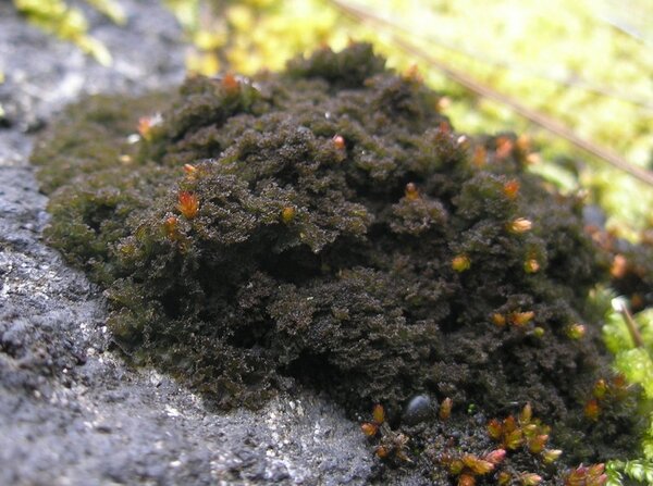

Curtis Randall Björk – CC BY-SA 4.0
Idaho, Idaho County, Salmon River Canyon, east of Riggins June, 2008 On seepy siliceous rock face in canyon bottom, near fast-flowing river
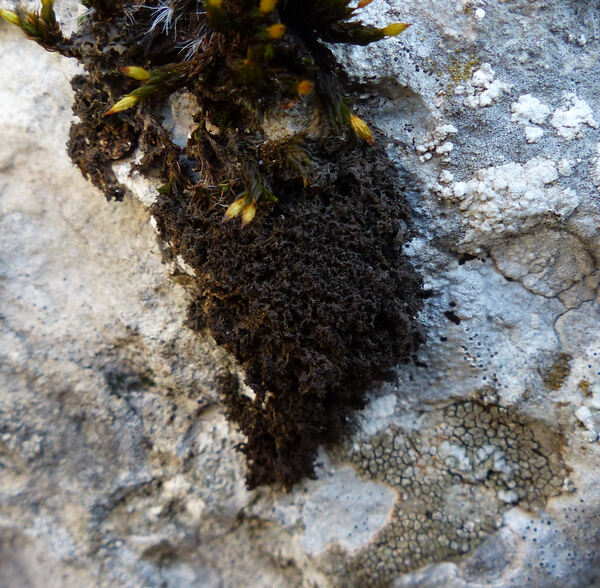

Andrea Moro; Owner: Department of Life Sciences, University of Triedte
Italy, Friuli Venezia Giulia, Trieste, Trieste Karst, Rocca di Monrupino
20/02/2017
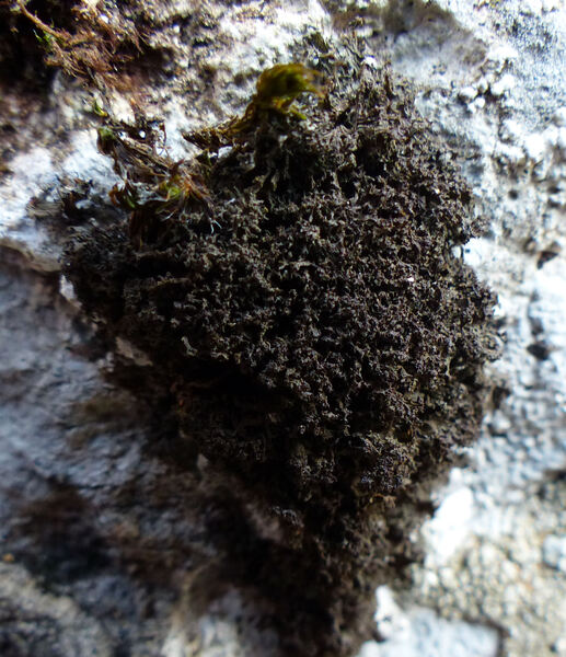

Andrea Moro; Owner: Department of Life Sciences, University of Triedte
Italy, Friuli Venezia Giulia, Trieste, Trieste Karst, Rocca di Monrupino
20/02/2017
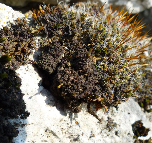

Andrea Moro; Owner: Department of Life Sciences, University of Triedte
Italy, Friuli Venezia Giulia, Trieste, Trieste Karst, Rocca di Monrupino
20/02/2017
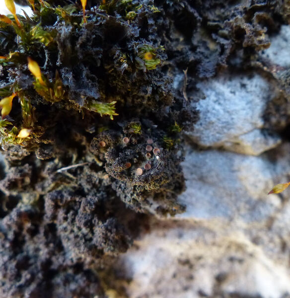

Andrea Moro; Owner: Department of Life Sciences, University of Triedte
Italy, Friuli Venezia Giulia, Trieste, Trieste Karst, Rocca di Monrupino
20/02/2017
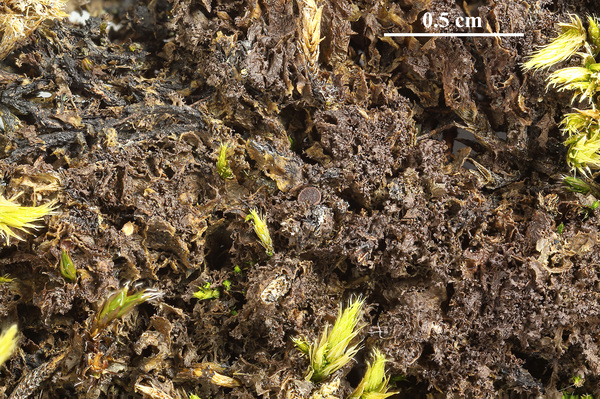

Felix Schumm - CC BY-SA 4.0
[19675], Germany, Baden-Württemberg, Schwäbische Alb, westlich von Ochsenwang, über Moosen auf Kalkfelsen im Randecker Maar, 48.57156° N, 9.52611° E, 708 m. TK 7423. Leg. et det. F. Schumm, 18.08.2017.
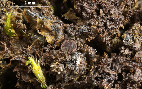

Felix Schumm - CC BY-SA 4.0
[19675], Germany, Baden-Württemberg, Schwäbische Alb, westlich von Ochsenwang, über Moosen auf Kalkfelsen im Randecker Maar, 48.57156° N, 9.52611° E, 708 m. TK 7423. Leg. et det. F. Schumm, 18.08.2017.
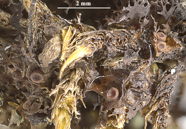

Felix Schumm - CC BY-SA 4.0
[19675], Germany, Baden-Württemberg, Schwäbische Alb, westlich von Ochsenwang, über Moosen auf Kalkfelsen im Randecker Maar, 48.57156° N, 9.52611° E, 708 m. TK 7423. Leg. et det. F. Schumm, 18.08.2017.
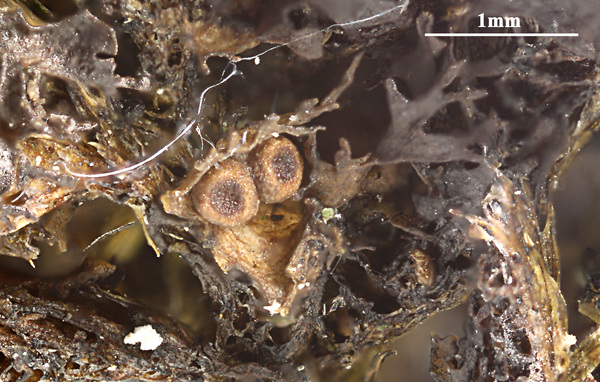

Felix Schumm - CC BY-SA 4.0
[19675], Germany, Baden-Württemberg, Schwäbische Alb, westlich von Ochsenwang, über Moosen auf Kalkfelsen im Randecker Maar, 48.57156° N, 9.52611° E, 708 m. TK 7423. Leg. et det. F. Schumm, 18.08.2017.
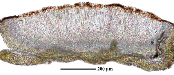

Felix Schumm - CC BY-SA 4.0
[19675], Germany, Baden-Württemberg, Schwäbische Alb, westlich von Ochsenwang, über Moosen auf Kalkfelsen im Randecker Maar, 48.57156° N, 9.52611° E, 708 m. TK 7423. Leg. et det. F. Schumm, 18.08.2017.
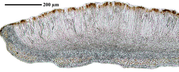

Felix Schumm - CC BY-SA 4.0
[19675], Germany, Baden-Württemberg, Schwäbische Alb, westlich von Ochsenwang, über Moosen auf Kalkfelsen im Randecker Maar, 48.57156° N, 9.52611° E, 708 m. TK 7423. Leg. et det. F. Schumm, 18.08.2017.
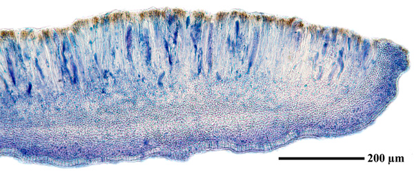

Felix Schumm - CC BY-SA 4.0
[19675], Germany, Baden-Württemberg, Schwäbische Alb, westlich von Ochsenwang, über Moosen auf Kalkfelsen im Randecker Maar, 48.57156° N, 9.52611° E, 708 m. TK 7423. Leg. et det. F. Schumm, 18.08.2017.
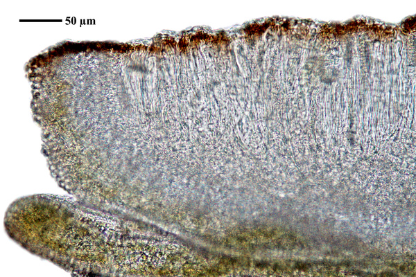

Felix Schumm - CC BY-SA 4.0
[19675], Germany, Baden-Württemberg, Schwäbische Alb, westlich von Ochsenwang, über Moosen auf Kalkfelsen im Randecker Maar, 48.57156° N, 9.52611° E, 708 m. TK 7423. Leg. et det. F. Schumm, 18.08.2017.
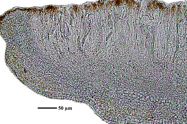

Felix Schumm - CC BY-SA 4.0
[19675], Germany, Baden-Württemberg, Schwäbische Alb, westlich von Ochsenwang, über Moosen auf Kalkfelsen im Randecker Maar, 48.57156° N, 9.52611° E, 708 m. TK 7423. Leg. et det. F. Schumm, 18.08.2017.
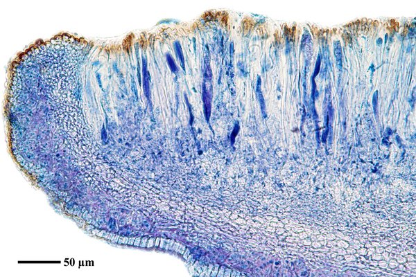

Felix Schumm - CC BY-SA 4.0
[19675], Germany, Baden-Württemberg, Schwäbische Alb, westlich von Ochsenwang, über Moosen auf Kalkfelsen im Randecker Maar, 48.57156° N, 9.52611° E, 708 m. TK 7423. Leg. et det. F. Schumm, 18.08.2017.
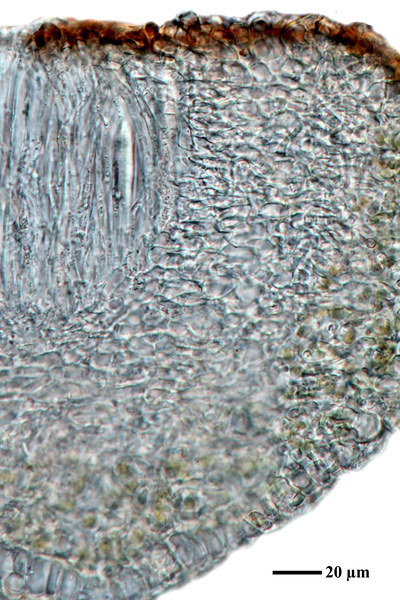

Felix Schumm - CC BY-SA 4.0
[19675], Germany, Baden-Württemberg, Schwäbische Alb, westlich von Ochsenwang, über Moosen auf Kalkfelsen im Randecker Maar, 48.57156° N, 9.52611° E, 708 m. TK 7423. Leg. et det. F. Schumm, 18.08.2017.
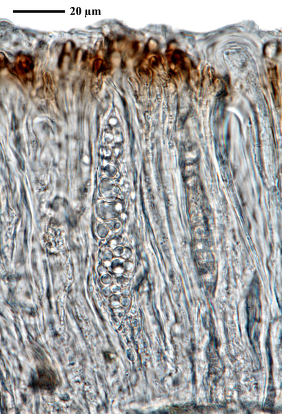

Felix Schumm - CC BY-SA 4.0
[19675], Germany, Baden-Württemberg, Schwäbische Alb, westlich von Ochsenwang, über Moosen auf Kalkfelsen im Randecker Maar, 48.57156° N, 9.52611° E, 708 m. TK 7423. Leg. et det. F. Schumm, 18.08.2017.

Felix Schumm - CC BY-SA 4.0
[19675], Germany, Baden-Württemberg, Schwäbische Alb, westlich von Ochsenwang, über Moosen auf Kalkfelsen im Randecker Maar, 48.57156° N, 9.52611° E, 708 m. TK 7423. Leg. et det. F. Schumm, 18.08.2017.

Felix Schumm - CC BY-SA 4.0
[19675], Germany, Baden-Württemberg, Schwäbische Alb, westlich von Ochsenwang, über Moosen auf Kalkfelsen im Randecker Maar, 48.57156° N, 9.52611° E, 708 m. TK 7423. Leg. et det. F. Schumm, 18.08.2017.

Felix Schumm - CC BY-SA 4.0
[19675], Germany, Baden-Württemberg, Schwäbische Alb, westlich von Ochsenwang, über Moosen auf Kalkfelsen im Randecker Maar, 48.57156° N, 9.52611° E, 708 m. TK 7423. Leg. et det. F. Schumm, 18.08.2017.

Felix Schumm - CC BY-SA 4.0
[19675], Germany, Baden-Württemberg, Schwäbische Alb, westlich von Ochsenwang, über Moosen auf Kalkfelsen im Randecker Maar, 48.57156° N, 9.52611° E, 708 m. TK 7423. Leg. et det. F. Schumm, 18.08.2017.

Felix Schumm - CC BY-SA 4.0
[19675], Germany, Baden-Württemberg, Schwäbische Alb, westlich von Ochsenwang, über Moosen auf Kalkfelsen im Randecker Maar, 48.57156° N, 9.52611° E, 708 m. TK 7423. Leg. et det. F. Schumm, 18.08.2017.


Felix Schumm - CC BY-SA 4.0
[19675], Germany, Baden-Württemberg, Schwäbische Alb, westlich von Ochsenwang, über Moosen auf Kalkfelsen im Randecker Maar, 48.57156° N, 9.52611° E, 708 m. TK 7423. Leg. et det. F. Schumm, 18.08.2017.

Felix Schumm - CC BY-SA 4.0
[19675], Germany, Baden-Württemberg, Schwäbische Alb, westlich von Ochsenwang, über Moosen auf Kalkfelsen im Randecker Maar, 48.57156° N, 9.52611° E, 708 m. TK 7423. Leg. et det. F. Schumm, 18.08.2017.

Felix Schumm - CC BY-SA 4.0
[19675], Germany, Baden-Württemberg, Schwäbische Alb, westlich von Ochsenwang, über Moosen auf Kalkfelsen im Randecker Maar, 48.57156° N, 9.52611° E, 708 m. TK 7423. Leg. et det. F. Schumm, 18.08.2017.

Felix Schumm - CC BY-SA 4.0
[19675], Germany, Baden-Württemberg, Schwäbische Alb, westlich von Ochsenwang, über Moosen auf Kalkfelsen im Randecker Maar, 48.57156° N, 9.52611° E, 708 m. TK 7423. Leg. et det. F. Schumm, 18.08.2017.
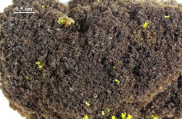
Felix Schumm - CC BY-SA 4.0
[19698], Germany, Baden Württemberg, Schwäbische Alb, Kreis Göppingen, 2.2 km südlich von Gammelshausen, Kornbergsattel, im Kalksteinbruch am Nortelweg zum Fliegerhaus, 48.621924° N, 9.650595° E 700 m. Leg. et det. F. Schumm, 26.10.2017
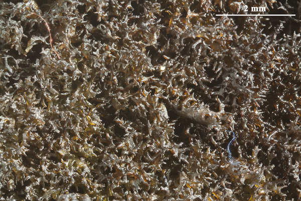
Felix Schumm - CC BY-SA 4.0
[19698], Germany, Baden Württemberg, Schwäbische Alb, Kreis Göppingen, 2.2 km südlich von Gammelshausen, Kornbergsattel, im Kalksteinbruch am Nortelweg zum Fliegerhaus, 48.621924° N, 9.650595° E 700 m. Leg. et det. F. Schumm, 26.10.2017
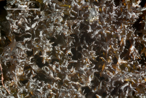
Felix Schumm - CC BY-SA 4.0
[19698], Germany, Baden Württemberg, Schwäbische Alb, Kreis Göppingen, 2.2 km südlich von Gammelshausen, Kornbergsattel, im Kalksteinbruch am Nortelweg zum Fliegerhaus, 48.621924° N, 9.650595° E 700 m. Leg. et det. F. Schumm, 26.10.2017
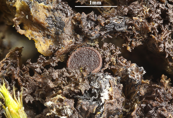

Felix Schumm - CC BY-SA 4.0
[19675], Germany, Baden-Württemberg, Schwäbische Alb, westlich von Ochsenwang, über Moosen auf Kalkfelsen im Randecker Maar, 48.57156° N, 9.52611° E, 708 m. TK 7423. Leg. et det. F. Schumm, 18.08.2017.
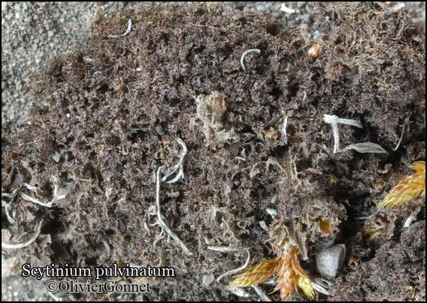
Courtesy Danièle et Olivier Gonnet - Source: https://www.afl-lichenologie.fr/Photos_AFL/Photos_AFL_S/Text_S/Scytinium_pulvinatum.htm
France, session AFL 2015 - Lot
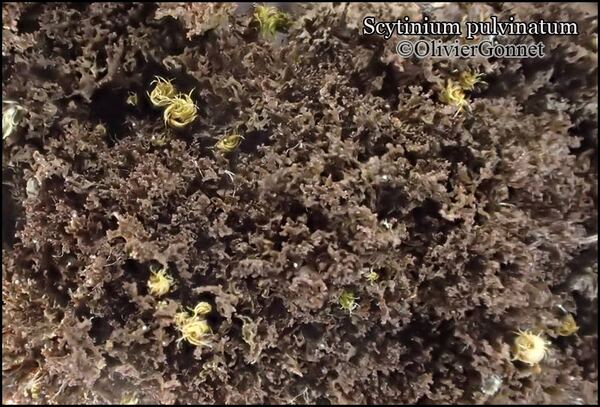
Courtesy Danièle et Olivier Gonnet - Source: https://www.afl-lichenologie.fr/Photos_AFL/Photos_AFL_S/Text_S/Scytinium_pulvinatum.htm
France, session AFL 2015 - Lot
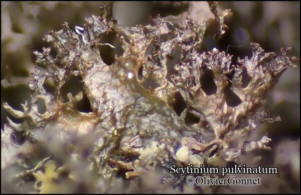
Courtesy Danièle et Olivier Gonnet - Source: https://www.afl-lichenologie.fr/Photos_AFL/Photos_AFL_S/Text_S/Scytinium_pulvinatum.htm
France, session AFL 2015 - Lot
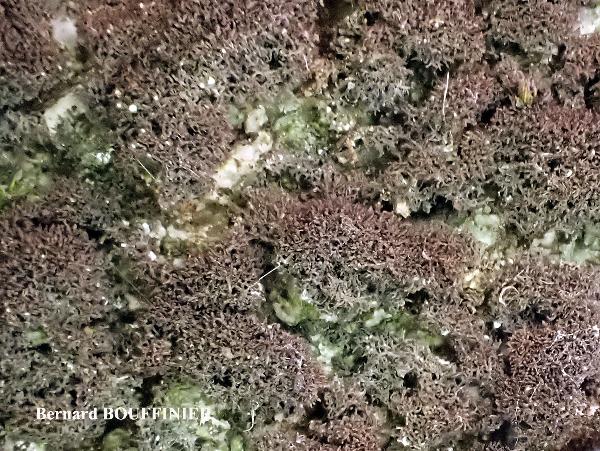
Bernard Bouffinier - Source: http://www.lichensmaritimes.org/index.php?task=fiche&lichen=1320&lang=en
France, Saint Thegonnec
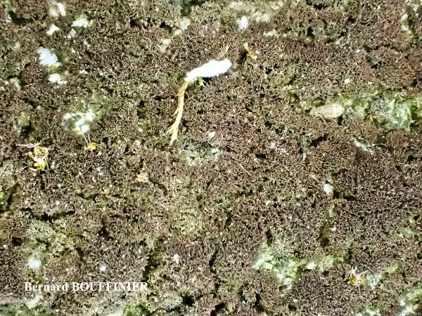
Bernard Bouffinier - Source: http://www.lichensmaritimes.org/index.php?task=fiche&lichen=1320&lang=en
France, Saint Thegonnec
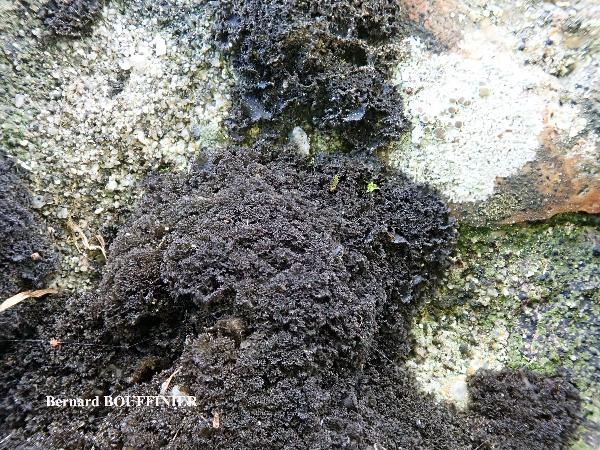
Bernard Bouffinier - Source: http://www.lichensmaritimes.org/index.php?task=fiche&lichen=1320&lang=en
France, Chateaulin
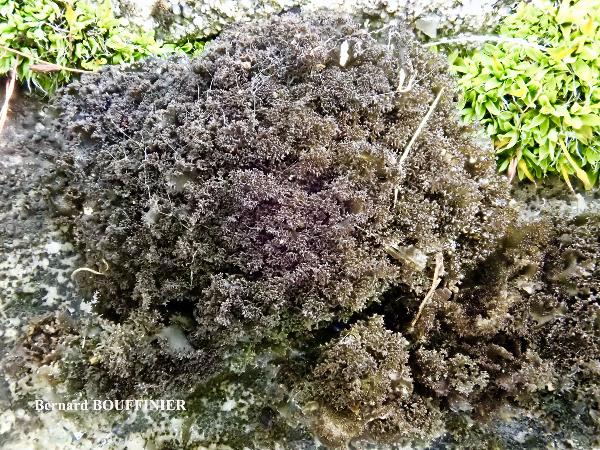
Bernard Bouffinier - Source: http://www.lichensmaritimes.org/index.php?task=fiche&lichen=1320&lang=en
France, Chateaulin
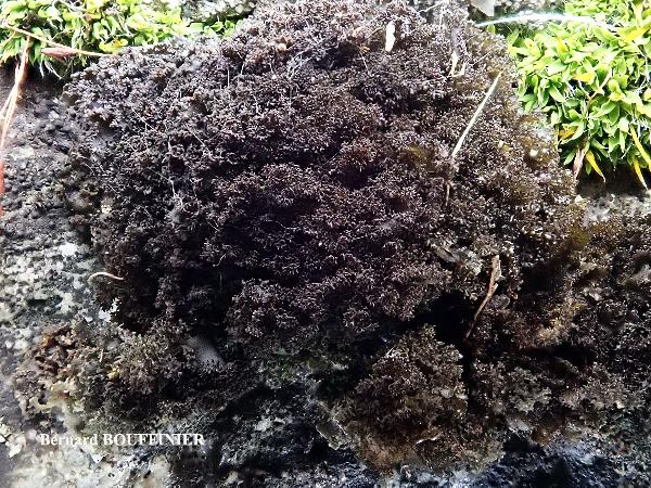
Bernard Bouffinier - Source: http://www.lichensmaritimes.org/index.php?task=fiche&lichen=1320&lang=en
France, Chateaulin
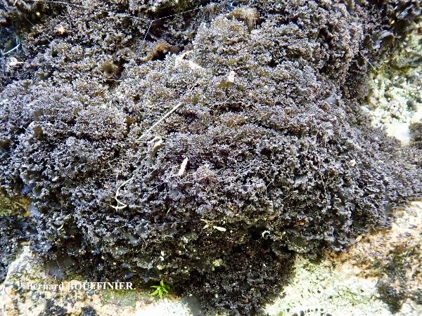
Bernard Bouffinier - Source: http://www.lichensmaritimes.org/index.php?task=fiche&lichen=1320&lang=en
France, Chateaulin
Growth form: Squamulose
Substrata: rocks, bark, soil, terricolous mosses, and plant debris
Photobiont: cyanobacteria, filamentous (e.g. Nostoc, Scytonema)
Reproductive strategy: mainly sexual
Poorly known taxon in need of further study
Commonnes-rarity: (info)
Alpine belt: common
Subalpine belt: extremely common
Oromediterranean belt: common
Montane belt: extremely common
Submediterranean belt: very common
Padanian area: extremely rare
Humid submediterranean belt: very common
Humid mediterranean belt: common
Dry mediterranean belt: rather rare

Predictive model
| Herbarium samples |


Curtis Randall Björk – CC BY-SA 4.0
Idaho, Idaho County, Salmon River Canyon, east of Riggins June, 2008 On seepy siliceous rock face in canyon bottom, near fast-flowing river


Andrea Moro; Owner: Department of Life Sciences, University of Triedte
Italy, Friuli Venezia Giulia, Trieste, Trieste Karst, Rocca di Monrupino
20/02/2017


Andrea Moro; Owner: Department of Life Sciences, University of Triedte
Italy, Friuli Venezia Giulia, Trieste, Trieste Karst, Rocca di Monrupino
20/02/2017


Andrea Moro; Owner: Department of Life Sciences, University of Triedte
Italy, Friuli Venezia Giulia, Trieste, Trieste Karst, Rocca di Monrupino
20/02/2017


Andrea Moro; Owner: Department of Life Sciences, University of Triedte
Italy, Friuli Venezia Giulia, Trieste, Trieste Karst, Rocca di Monrupino
20/02/2017


Felix Schumm - CC BY-SA 4.0
[19675], Germany, Baden-Württemberg, Schwäbische Alb, westlich von Ochsenwang, über Moosen auf Kalkfelsen im Randecker Maar, 48.57156° N, 9.52611° E, 708 m. TK 7423. Leg. et det. F. Schumm, 18.08.2017.


Felix Schumm - CC BY-SA 4.0
[19675], Germany, Baden-Württemberg, Schwäbische Alb, westlich von Ochsenwang, über Moosen auf Kalkfelsen im Randecker Maar, 48.57156° N, 9.52611° E, 708 m. TK 7423. Leg. et det. F. Schumm, 18.08.2017.


Felix Schumm - CC BY-SA 4.0
[19675], Germany, Baden-Württemberg, Schwäbische Alb, westlich von Ochsenwang, über Moosen auf Kalkfelsen im Randecker Maar, 48.57156° N, 9.52611° E, 708 m. TK 7423. Leg. et det. F. Schumm, 18.08.2017.


Felix Schumm - CC BY-SA 4.0
[19675], Germany, Baden-Württemberg, Schwäbische Alb, westlich von Ochsenwang, über Moosen auf Kalkfelsen im Randecker Maar, 48.57156° N, 9.52611° E, 708 m. TK 7423. Leg. et det. F. Schumm, 18.08.2017.


Felix Schumm - CC BY-SA 4.0
[19675], Germany, Baden-Württemberg, Schwäbische Alb, westlich von Ochsenwang, über Moosen auf Kalkfelsen im Randecker Maar, 48.57156° N, 9.52611° E, 708 m. TK 7423. Leg. et det. F. Schumm, 18.08.2017.


Felix Schumm - CC BY-SA 4.0
[19675], Germany, Baden-Württemberg, Schwäbische Alb, westlich von Ochsenwang, über Moosen auf Kalkfelsen im Randecker Maar, 48.57156° N, 9.52611° E, 708 m. TK 7423. Leg. et det. F. Schumm, 18.08.2017.


Felix Schumm - CC BY-SA 4.0
[19675], Germany, Baden-Württemberg, Schwäbische Alb, westlich von Ochsenwang, über Moosen auf Kalkfelsen im Randecker Maar, 48.57156° N, 9.52611° E, 708 m. TK 7423. Leg. et det. F. Schumm, 18.08.2017.


Felix Schumm - CC BY-SA 4.0
[19675], Germany, Baden-Württemberg, Schwäbische Alb, westlich von Ochsenwang, über Moosen auf Kalkfelsen im Randecker Maar, 48.57156° N, 9.52611° E, 708 m. TK 7423. Leg. et det. F. Schumm, 18.08.2017.


Felix Schumm - CC BY-SA 4.0
[19675], Germany, Baden-Württemberg, Schwäbische Alb, westlich von Ochsenwang, über Moosen auf Kalkfelsen im Randecker Maar, 48.57156° N, 9.52611° E, 708 m. TK 7423. Leg. et det. F. Schumm, 18.08.2017.


Felix Schumm - CC BY-SA 4.0
[19675], Germany, Baden-Württemberg, Schwäbische Alb, westlich von Ochsenwang, über Moosen auf Kalkfelsen im Randecker Maar, 48.57156° N, 9.52611° E, 708 m. TK 7423. Leg. et det. F. Schumm, 18.08.2017.


Felix Schumm - CC BY-SA 4.0
[19675], Germany, Baden-Württemberg, Schwäbische Alb, westlich von Ochsenwang, über Moosen auf Kalkfelsen im Randecker Maar, 48.57156° N, 9.52611° E, 708 m. TK 7423. Leg. et det. F. Schumm, 18.08.2017.


Felix Schumm - CC BY-SA 4.0
[19675], Germany, Baden-Württemberg, Schwäbische Alb, westlich von Ochsenwang, über Moosen auf Kalkfelsen im Randecker Maar, 48.57156° N, 9.52611° E, 708 m. TK 7423. Leg. et det. F. Schumm, 18.08.2017.


Felix Schumm - CC BY-SA 4.0
[19675], Germany, Baden-Württemberg, Schwäbische Alb, westlich von Ochsenwang, über Moosen auf Kalkfelsen im Randecker Maar, 48.57156° N, 9.52611° E, 708 m. TK 7423. Leg. et det. F. Schumm, 18.08.2017.


Felix Schumm - CC BY-SA 4.0
[19675], Germany, Baden-Württemberg, Schwäbische Alb, westlich von Ochsenwang, über Moosen auf Kalkfelsen im Randecker Maar, 48.57156° N, 9.52611° E, 708 m. TK 7423. Leg. et det. F. Schumm, 18.08.2017.


Felix Schumm - CC BY-SA 4.0
[19675], Germany, Baden-Württemberg, Schwäbische Alb, westlich von Ochsenwang, über Moosen auf Kalkfelsen im Randecker Maar, 48.57156° N, 9.52611° E, 708 m. TK 7423. Leg. et det. F. Schumm, 18.08.2017.


Felix Schumm - CC BY-SA 4.0
[19675], Germany, Baden-Württemberg, Schwäbische Alb, westlich von Ochsenwang, über Moosen auf Kalkfelsen im Randecker Maar, 48.57156° N, 9.52611° E, 708 m. TK 7423. Leg. et det. F. Schumm, 18.08.2017.


Felix Schumm - CC BY-SA 4.0
[19675], Germany, Baden-Württemberg, Schwäbische Alb, westlich von Ochsenwang, über Moosen auf Kalkfelsen im Randecker Maar, 48.57156° N, 9.52611° E, 708 m. TK 7423. Leg. et det. F. Schumm, 18.08.2017.


Felix Schumm - CC BY-SA 4.0
[19675], Germany, Baden-Württemberg, Schwäbische Alb, westlich von Ochsenwang, über Moosen auf Kalkfelsen im Randecker Maar, 48.57156° N, 9.52611° E, 708 m. TK 7423. Leg. et det. F. Schumm, 18.08.2017.


Felix Schumm - CC BY-SA 4.0
[19675], Germany, Baden-Württemberg, Schwäbische Alb, westlich von Ochsenwang, über Moosen auf Kalkfelsen im Randecker Maar, 48.57156° N, 9.52611° E, 708 m. TK 7423. Leg. et det. F. Schumm, 18.08.2017.


Felix Schumm - CC BY-SA 4.0
[19675], Germany, Baden-Württemberg, Schwäbische Alb, westlich von Ochsenwang, über Moosen auf Kalkfelsen im Randecker Maar, 48.57156° N, 9.52611° E, 708 m. TK 7423. Leg. et det. F. Schumm, 18.08.2017.


Felix Schumm - CC BY-SA 4.0
[19675], Germany, Baden-Württemberg, Schwäbische Alb, westlich von Ochsenwang, über Moosen auf Kalkfelsen im Randecker Maar, 48.57156° N, 9.52611° E, 708 m. TK 7423. Leg. et det. F. Schumm, 18.08.2017.

Felix Schumm - CC BY-SA 4.0
[19698], Germany, Baden Württemberg, Schwäbische Alb, Kreis Göppingen, 2.2 km südlich von Gammelshausen, Kornbergsattel, im Kalksteinbruch am Nortelweg zum Fliegerhaus, 48.621924° N, 9.650595° E 700 m. Leg. et det. F. Schumm, 26.10.2017

Felix Schumm - CC BY-SA 4.0
[19698], Germany, Baden Württemberg, Schwäbische Alb, Kreis Göppingen, 2.2 km südlich von Gammelshausen, Kornbergsattel, im Kalksteinbruch am Nortelweg zum Fliegerhaus, 48.621924° N, 9.650595° E 700 m. Leg. et det. F. Schumm, 26.10.2017

Felix Schumm - CC BY-SA 4.0
[19698], Germany, Baden Württemberg, Schwäbische Alb, Kreis Göppingen, 2.2 km südlich von Gammelshausen, Kornbergsattel, im Kalksteinbruch am Nortelweg zum Fliegerhaus, 48.621924° N, 9.650595° E 700 m. Leg. et det. F. Schumm, 26.10.2017


Felix Schumm - CC BY-SA 4.0
[19675], Germany, Baden-Württemberg, Schwäbische Alb, westlich von Ochsenwang, über Moosen auf Kalkfelsen im Randecker Maar, 48.57156° N, 9.52611° E, 708 m. TK 7423. Leg. et det. F. Schumm, 18.08.2017.

Courtesy Danièle et Olivier Gonnet - Source: https://www.afl-lichenologie.fr/Photos_AFL/Photos_AFL_S/Text_S/Scytinium_pulvinatum.htm
France, session AFL 2015 - Lot

Courtesy Danièle et Olivier Gonnet - Source: https://www.afl-lichenologie.fr/Photos_AFL/Photos_AFL_S/Text_S/Scytinium_pulvinatum.htm
France, session AFL 2015 - Lot

Courtesy Danièle et Olivier Gonnet - Source: https://www.afl-lichenologie.fr/Photos_AFL/Photos_AFL_S/Text_S/Scytinium_pulvinatum.htm
France, session AFL 2015 - Lot

Bernard Bouffinier - Source: http://www.lichensmaritimes.org/index.php?task=fiche&lichen=1320&lang=en
France, Saint Thegonnec

Bernard Bouffinier - Source: http://www.lichensmaritimes.org/index.php?task=fiche&lichen=1320&lang=en
France, Saint Thegonnec

Bernard Bouffinier - Source: http://www.lichensmaritimes.org/index.php?task=fiche&lichen=1320&lang=en
France, Chateaulin

Bernard Bouffinier - Source: http://www.lichensmaritimes.org/index.php?task=fiche&lichen=1320&lang=en
France, Chateaulin

Bernard Bouffinier - Source: http://www.lichensmaritimes.org/index.php?task=fiche&lichen=1320&lang=en
France, Chateaulin

 INDEX FUNGORUM
 GBIF
GBIF
 DOLICHENS
