Umbilicaria aprina Nyl.
Syn. Lich., 2: 12, 1863.
Synonyms: Gyrophora aprina (Nyl.) Nyl.
Distribution: N - Piem.
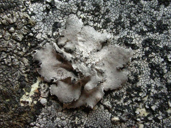
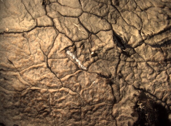
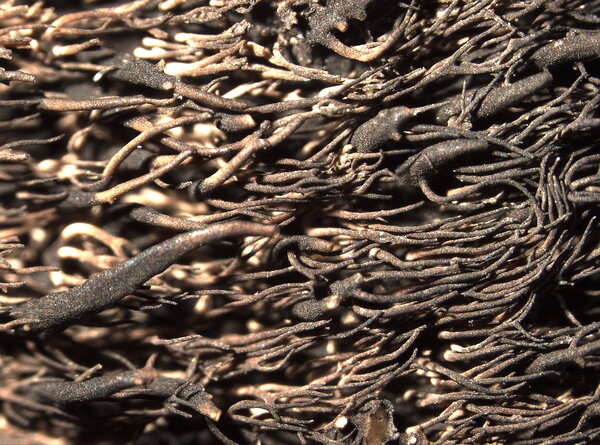
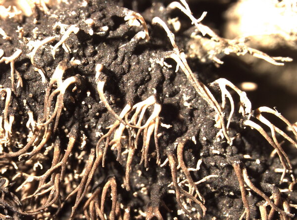
Description: Thallus foliose-umbilicate, heteromerous, dorsiventral. monophyllous, rigid, usually small and up to 3 cm wide, rarely larger, c. 0.3 mm thick, attached by a central holdfast. Upper surface pale grey to grey-brown, weakly reticulately ridged, depressed, areolate and with radiating ridges in central parts; lower surface sooty black, pale grey along a 1-2 mm wide marginal rim, smooth, sometimes areolate near the holdfast, with cream-coloured, simple or sparingly branched, terete or flattened, 2-3 mm long rhizinomorphs, which are usually lacking around the central holdfast; thalloconidia evenly produced on the lower surface, but not on the rhizinomorphs and along the marginal rim, 1-celled or rarely 2-celled, ovoid to globose, brown to black, 6-9 x 5-11 μm. Upper cortex palisade-plectenchymatous, 20-30 µm thick; medulla white, not always well-differentiated from the lower cortex; lower cortex scleroplectenchymatous, 50-70 µm thick. Apothecia extremely rare, omphalodisc or rarely gyrodisc, black, stipitate, up to 2.5 mm across. Ascospores usually poorly developed, simple, hyaline, 18-20 x 7-8 µm. Photobiont chlorococcoid. Spot tests: cortex K-, C-, KC-, P-; medulla K-, C+ red, KC+ red, P-. Chemistry: medulla with gyrophoric and lecanoric acids.Note: an arctic-alpine species of hard siliceous rocks above treeline, reaching the nival belt. The only record is from France, but near the border (Mt. Blanc).
Growth form: Foliose, umbilicate
Substrata: rocks
Photobiont: green algae other than Trentepohlia
Reproductive strategy: mainly asexual, by conidia and thalloconidia
Commonnes-rarity: (info)
Alpine belt: extremely rare
Subalpine belt: absent
Oromediterranean belt: absent
Montane belt: absent
Submediterranean belt: absent
Padanian area: absent
Humid submediterranean belt: absent
Humid mediterranean belt: absent
Dry mediterranean belt: absent
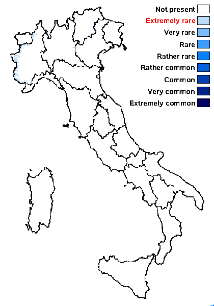
Predictive model
Herbarium samples
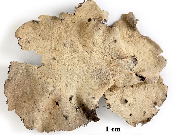

Felix Schumm - CC BY-SA 4.0
Quelltäler, Suengal-Tal. 71°12’ E, 35°55’ N, 3600 m. Auf Silikatfelsen. Medulla C+ rot. Leg. D. Podlech (15/7), 2.9.1969, det. E.A. Davydov, 10.2017. - (M. STEINER: ITER AFGHANICUM 1970)
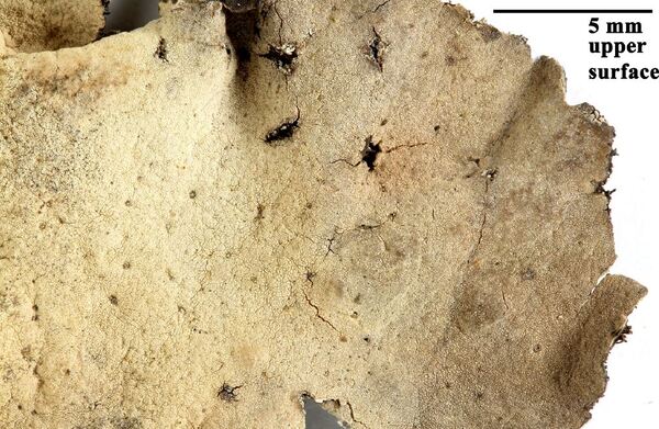

Felix Schumm - CC BY-SA 4.0
Quelltäler, Suengal-Tal. 71°12’ E, 35°55’ N, 3600 m. Auf Silikatfelsen. Medulla C+ rot. Leg. D. Podlech (15/7), 2.9.1969, det. E.A. Davydov, 10.2017. - (M. STEINER: ITER AFGHANICUM 1970)
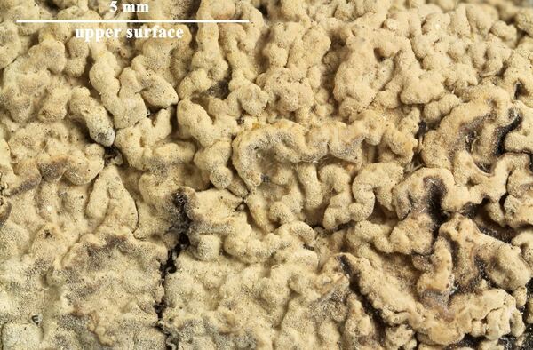

Felix Schumm - CC BY-SA 4.0
Quelltäler, Suengal-Tal. 71°12’ E, 35°55’ N, 3600 m. Auf Silikatfelsen. Medulla C+ rot. Leg. D. Podlech (15/7), 2.9.1969, det. E.A. Davydov, 10.2017. - (M. STEINER: ITER AFGHANICUM 1970)
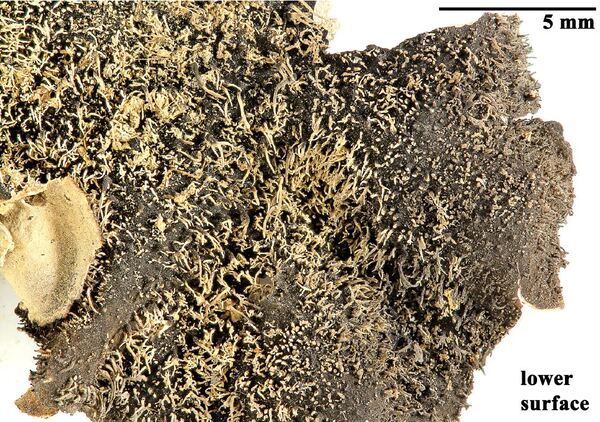

Felix Schumm - CC BY-SA 4.0
Quelltäler, Suengal-Tal. 71°12’ E, 35°55’ N, 3600 m. Auf Silikatfelsen. Medulla C+ rot. Leg. D. Podlech (15/7), 2.9.1969, det. E.A. Davydov, 10.2017. - (M. STEINER: ITER AFGHANICUM 1970)
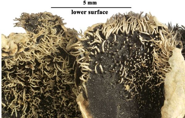

Felix Schumm - CC BY-SA 4.0
Quelltäler, Suengal-Tal. 71°12’ E, 35°55’ N, 3600 m. Auf Silikatfelsen. Medulla C+ rot. Leg. D. Podlech (15/7), 2.9.1969, det. E.A. Davydov, 10.2017. - (M. STEINER: ITER AFGHANICUM 1970)
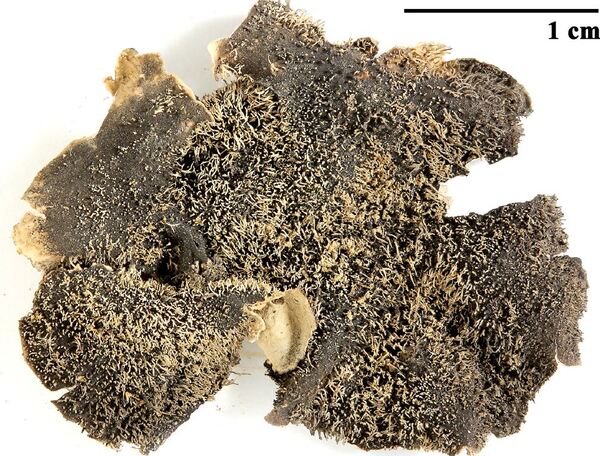

Felix Schumm - CC BY-SA 4.0
Quelltäler, Suengal-Tal. 71°12’ E, 35°55’ N, 3600 m. Auf Silikatfelsen. Medulla C+ rot. Leg. D. Podlech (15/7), 2.9.1969, det. E.A. Davydov, 10.2017. - (M. STEINER: ITER AFGHANICUM 1970)
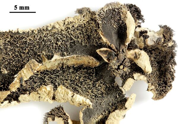

Felix Schumm - CC BY-SA 4.0
Quelltäler, Suengal-Tal. 71°12’ E, 35°55’ N, 3600 m. Auf Silikatfelsen. Medulla C+ rot. Leg. D. Podlech (15/7), 2.9.1969, det. E.A. Davydov, 10.2017. - (M. STEINER: ITER AFGHANICUM 1970)
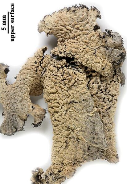

Felix Schumm - CC BY-SA 4.0
Quelltäler, Suengal-Tal. 71°12’ E, 35°55’ N, 3600 m. Auf Silikatfelsen. Medulla C+ rot. Leg. D. Podlech (15/7), 2.9.1969, det. E.A. Davydov, 10.2017. - (M. STEINER: ITER AFGHANICUM 1970)
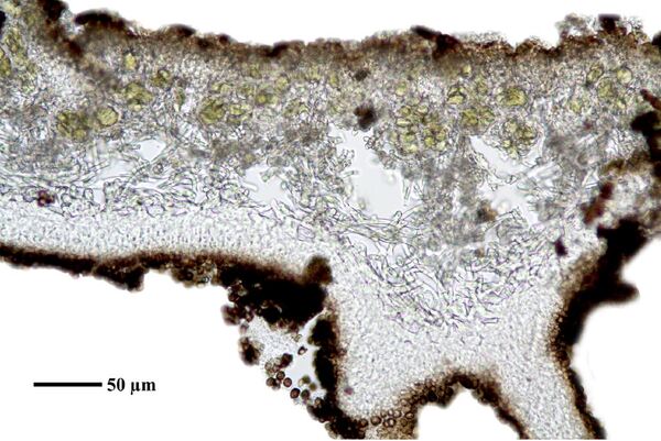

Felix Schumm - CC BY-SA 4.0
Quelltäler, Suengal-Tal. 71°12’ E, 35°55’ N, 3600 m. Auf Silikatfelsen. Medulla C+ rot. Leg. D. Podlech (15/7), 2.9.1969, det. E.A. Davydov, 10.2017. - (M. STEINER: ITER AFGHANICUM 1970)
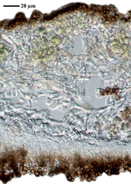

Felix Schumm - CC BY-SA 4.0
Quelltäler, Suengal-Tal. 71°12’ E, 35°55’ N, 3600 m. Auf Silikatfelsen. Medulla C+ rot. Leg. D. Podlech (15/7), 2.9.1969, det. E.A. Davydov, 10.2017. - (M. STEINER: ITER AFGHANICUM 1970)
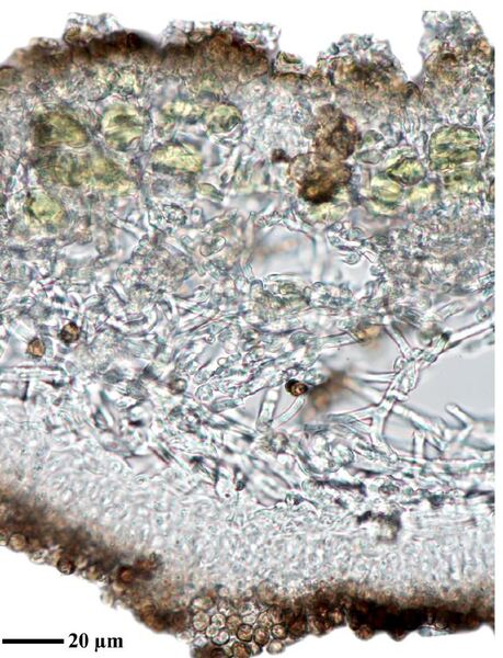

Felix Schumm - CC BY-SA 4.0
Quelltäler, Suengal-Tal. 71°12’ E, 35°55’ N, 3600 m. Auf Silikatfelsen. Medulla C+ rot. Leg. D. Podlech (15/7), 2.9.1969, det. E.A. Davydov, 10.2017. - (M. STEINER: ITER AFGHANICUM 1970)
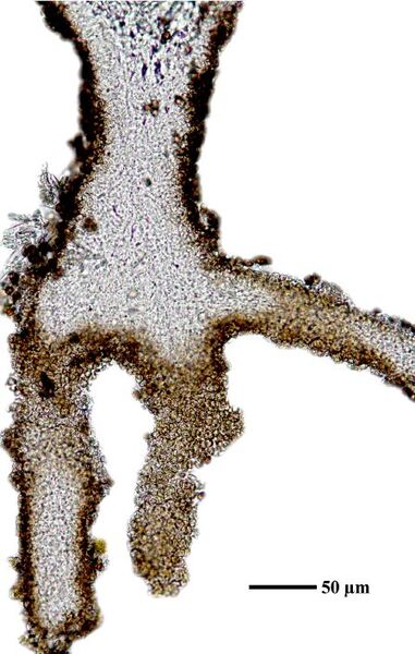

Felix Schumm - CC BY-SA 4.0
Quelltäler, Suengal-Tal. 71°12’ E, 35°55’ N, 3600 m. Auf Silikatfelsen. Medulla C+ rot. Leg. D. Podlech (15/7), 2.9.1969, det. E.A. Davydov, 10.2017. - (M. STEINER: ITER AFGHANICUM 1970)
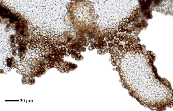

Felix Schumm - CC BY-SA 4.0
Quelltäler, Suengal-Tal. 71°12’ E, 35°55’ N, 3600 m. Auf Silikatfelsen. Medulla C+ rot. Leg. D. Podlech (15/7), 2.9.1969, det. E.A. Davydov, 10.2017. - (M. STEINER: ITER AFGHANICUM 1970)
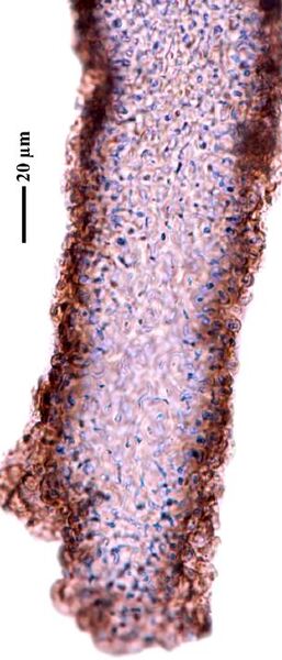

Felix Schumm - CC BY-SA 4.0
Quelltäler, Suengal-Tal. 71°12’ E, 35°55’ N, 3600 m. Auf Silikatfelsen. Medulla C+ rot. Leg. D. Podlech (15/7), 2.9.1969, det. E.A. Davydov, 10.2017. - (M. STEINER: ITER AFGHANICUM 1970)
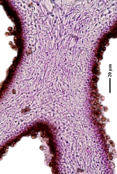

Felix Schumm - CC BY-SA 4.0
Quelltäler, Suengal-Tal. 71°12’ E, 35°55’ N, 3600 m. Auf Silikatfelsen. Medulla C+ rot. Leg. D. Podlech (15/7), 2.9.1969, det. E.A. Davydov, 10.2017. - (M. STEINER: ITER AFGHANICUM 1970)
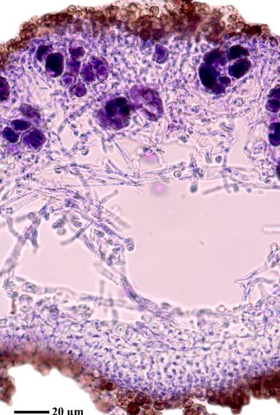

Felix Schumm - CC BY-SA 4.0
Quelltäler, Suengal-Tal. 71°12’ E, 35°55’ N, 3600 m. Auf Silikatfelsen. Medulla C+ rot. Leg. D. Podlech (15/7), 2.9.1969, det. E.A. Davydov, 10.2017. - (M. STEINER: ITER AFGHANICUM 1970)
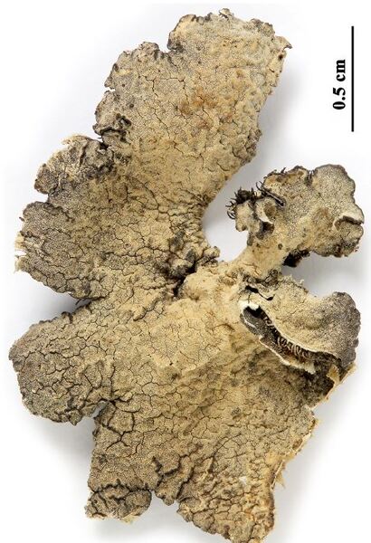

Felix Schumm - CC BY-SA 4.0
[LIAF_16]. Afghanistan, Prov. Kabul, Paghman-Gebirge, oberhalb des Ortes Paghman, an der Talgabelung Chap-Darrah und Rast-Darrah, 68°56’E, 34°37’ N, 2550 m. Steile Silikatfelsen, N-NW-Exposition. Leg. D. Podlech (58/1), 17.05.1977. LICHENOTHECA AFGHANICA NR. 16.
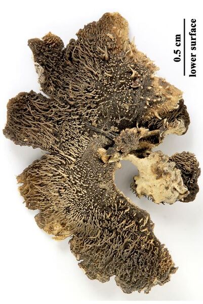

Felix Schumm - CC BY-SA 4.0
[LIAF_16]. Afghanistan, Prov. Kabul, Paghman-Gebirge, oberhalb des Ortes Paghman, an der Talgabelung Chap-Darrah und Rast-Darrah, 68°56’E, 34°37’ N, 2550 m. Steile Silikatfelsen, N-NW-Exposition. Leg. D. Podlech (58/1), 17.05.1977. LICHENOTHECA AFGHANICA NR. 16.
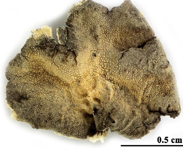

Felix Schumm - CC BY-SA 4.0
[LIAF_25], Afghanistan, Prov. Kabul, Paghman-Gebirge, oberhalb des Ortes Paghman, ca. 500 m unterhalb an der Talgabelung Chap-Darrah und Rast-Darrah, 68°56’E, 34°37’ N, 2540 m. Auf Silikatfelsen. Leg. D. Podlech (57/7), 10.04.1977. LICHENOTHECA AFGHANICA NR. 25
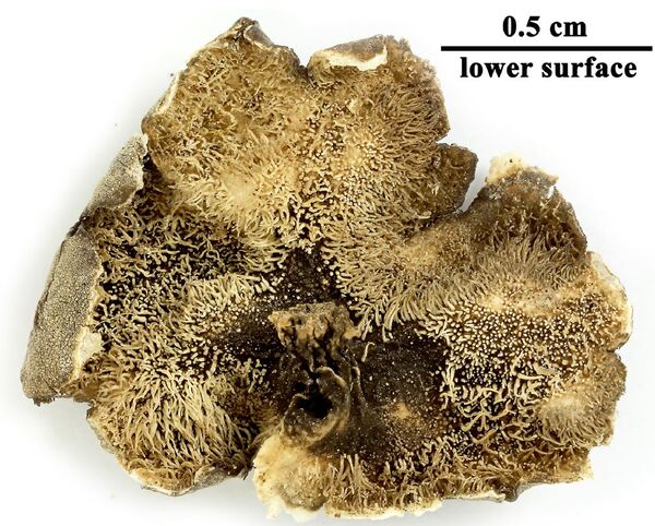

Felix Schumm - CC BY-SA 4.0
[LIAF_25], Afghanistan, Prov. Kabul, Paghman-Gebirge, oberhalb des Ortes Paghman, ca. 500 m unterhalb an der Talgabelung Chap-Darrah und Rast-Darrah, 68°56’E, 34°37’ N, 2540 m. Auf Silikatfelsen. Leg. D. Podlech (57/7), 10.04.1977. LICHENOTHECA AFGHANICA NR. 25
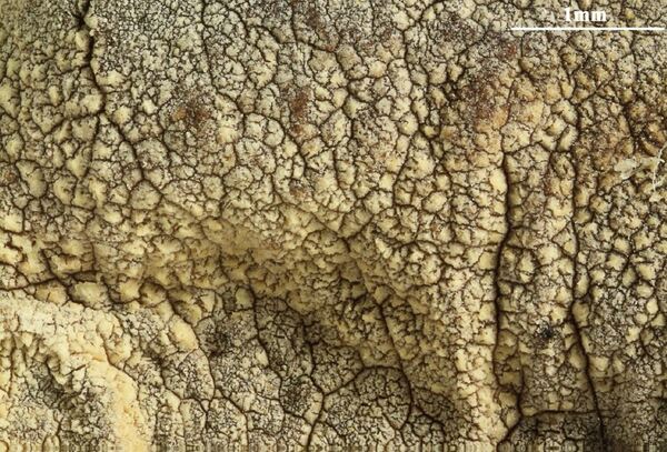

Felix Schumm - CC BY-SA 4.0
[LIAF_25], Afghanistan, Prov. Kabul, Paghman-Gebirge, oberhalb des Ortes Paghman, ca. 500 m unterhalb an der Talgabelung Chap-Darrah und Rast-Darrah, 68°56’E, 34°37’ N, 2540 m. Auf Silikatfelsen. Leg. D. Podlech (57/7), 10.04.1977. LICHENOTHECA AFGHANICA NR. 25
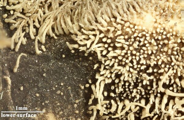

Felix Schumm - CC BY-SA 4.0
[LIAF_25], Afghanistan, Prov. Kabul, Paghman-Gebirge, oberhalb des Ortes Paghman, ca. 500 m unterhalb an der Talgabelung Chap-Darrah und Rast-Darrah, 68°56’E, 34°37’ N, 2540 m. Auf Silikatfelsen. Leg. D. Podlech (57/7), 10.04.1977. LICHENOTHECA AFGHANICA NR. 25
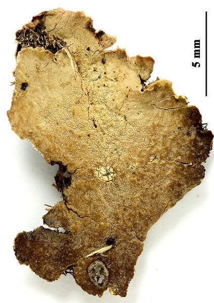

Felix Schumm - CC BY-SA 4.0
[LIAF_58], Afghanistan, Prov. Kabul, Paghman-Gebirge, oberhalb des Ortes Paghman, an der Talgabelung Chap-Darrah und Rast-Darrah, 68°56’E, 34°37’ N, 2500 m. Steile Silikatfelsen, N-NW-exponiert. Leg. M. Steiner (36/2, 59/4), 30.05. und 21.06.1970. LICHENOTHECA AFGHANICA NR. 58.
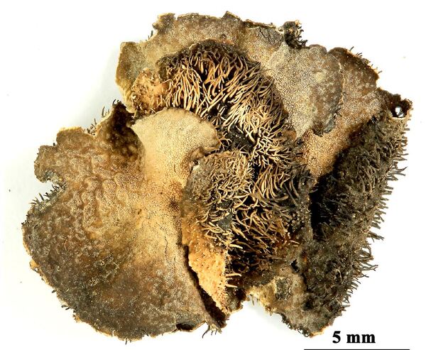
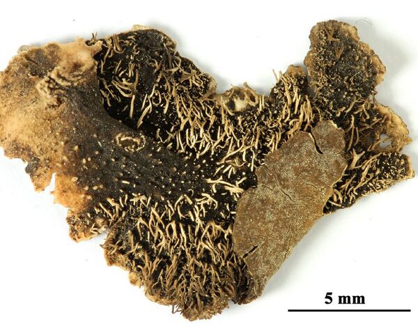
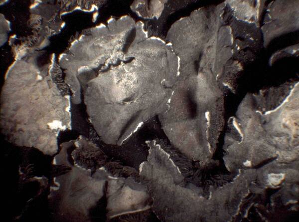
Miris Castello - CC BY-SA 4.0; Owner: Department of Life Sciences - University of Trieste
Antarctica, Terra Nova Bay.
Herbarium: TSB - Antarctic Herbarium
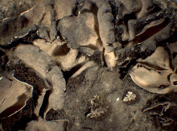
Miris Castello - CC BY-SA 4.0; Owner: Department of Life Sciences - University of Trieste
Antarctica, Terra Nova Bay.
Herbarium: TSB - Antarctic Herbarium
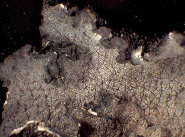
Miris Castello - CC BY-SA 4.0; Owner: Department of Life Sciences - University of Trieste
Antarctica, Terra Nova Bay.
Herbarium: TSB - Antarctic Herbarium
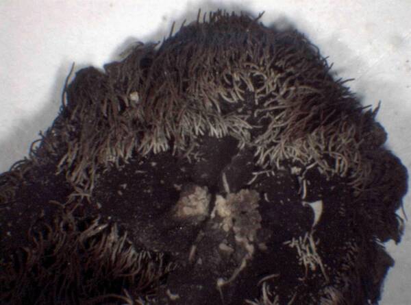
Miris Castello - CC BY-SA 4.0; Owner: Department of Life Sciences - University of Trieste
Antarctica, Terra Nova Bay.
Herbarium: TSB - Antarctic Herbarium
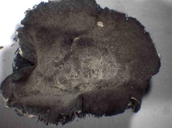
Miris Castello - CC BY-SA 4.0; Owner: Department of Life Sciences - University of Trieste
Antarctica, Terra Nova Bay.
Herbarium: TSB - Antarctic Herbarium
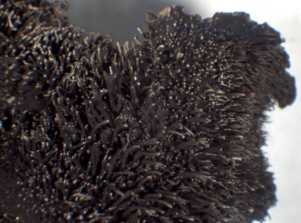
Miris Castello - CC BY-SA 4.0; Owner: Department of Life Sciences - University of Trieste
Antarctica, Terra Nova Bay.
Herbarium: TSB - Antarctic Herbarium
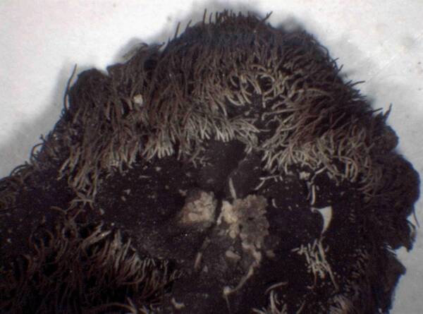
Miris Castello - CC BY-SA 4.0; Owner: Department of Life Sciences - University of Trieste
Antarctica, Terra Nova Bay.
Herbarium: TSB - Antarctic Herbarium
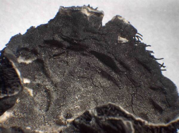
Miris Castello - CC BY-SA 4.0; Owner: Department of Life Sciences - University of Trieste
Antarctica, Terra Nova Bay.
Herbarium: TSB - Antarctic Herbarium
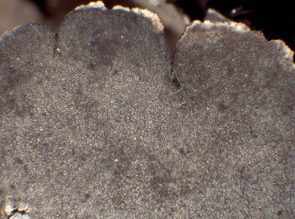
Miris Castello - CC BY-SA 4.0; Owner: Department of Life Sciences - University of Trieste
Antarctica, Terra Nova Bay.
Herbarium: TSB - Antarctic Herbarium
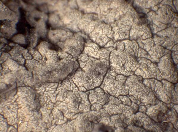
Miris Castello - CC BY-SA 4.0; Owner: Department of Life Sciences - University of Trieste
Antarctica, Terra Nova Bay.
Herbarium: TSB - Antarctic Herbarium
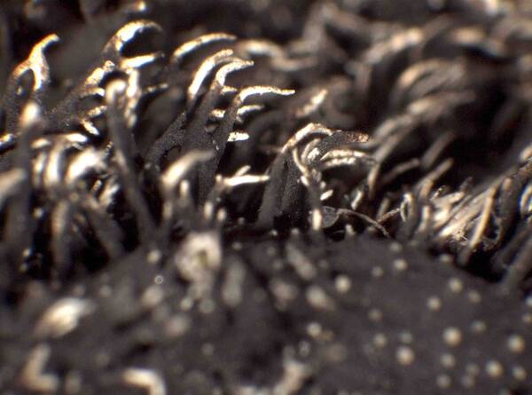
Miris Castello - CC BY-SA 4.0; Owner: Department of Life Sciences - University of Trieste
Antarctica, Terra Nova Bay.
Herbarium: TSB - Antarctic Herbarium


Felix Schumm - CC BY 4.0
[11631], Australien. Antarktis, Mc Robertson Land, Mawson Station,
E. Annistaon, 610 m, 67°36' S, 62°53´ E. Leg. R. O. Summer. 01.1954.
Ex Herbario Essen, Sammlung Feige, Nr. 19527
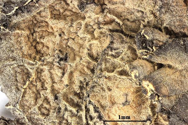

Felix Schumm - CC BY 4.0
[11631], Australien. Antarktis, Mc Robertson Land, Mawson Station,
E. Annistaon, 610 m, 67°36' S, 62°53´ E. Leg. R. O. Summer. 01.1954.
Ex Herbario Essen, Sammlung Feige, Nr. 19527


Felix Schumm - CC BY 4.0
[11631], Australien. Antarktis, Mc Robertson Land, Mawson Station,
E. Annistaon, 610 m, 67°36' S, 62°53´ E. Leg. R. O. Summer. 01.1954.
Ex Herbario Essen, Sammlung Feige, Nr. 19527


Felix Schumm - CC BY 4.0
[OH548], Antarctica. Langhovde. On rocks, 170 m. Leg. M. Inoue
(no. 18024), 17.12.1985, det. M. Inoue. EX Y. OHMURA: LICHENES
MINUS COGNITI EXSICCATI NR. 548.
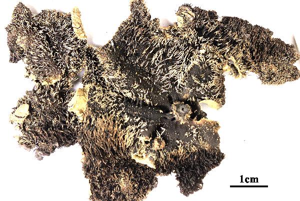

Felix Schumm - CC BY 4.0
[OH548], Antarctica. Langhovde. On rocks, 170 m. Leg. M. Inoue
(no. 18024), 17.12.1985, det. M. Inoue. EX Y. OHMURA: LICHENES
MINUS COGNITI EXSICCATI NR. 548.
Growth form: Foliose, umbilicate
Substrata: rocks
Photobiont: green algae other than Trentepohlia
Reproductive strategy: mainly asexual, by conidia and thalloconidia
Commonnes-rarity: (info)
Alpine belt: extremely rare
Subalpine belt: absent
Oromediterranean belt: absent
Montane belt: absent
Submediterranean belt: absent
Padanian area: absent
Humid submediterranean belt: absent
Humid mediterranean belt: absent
Dry mediterranean belt: absent

Predictive model
| Herbarium samples |


Felix Schumm - CC BY-SA 4.0
Quelltäler, Suengal-Tal. 71°12’ E, 35°55’ N, 3600 m. Auf Silikatfelsen. Medulla C+ rot. Leg. D. Podlech (15/7), 2.9.1969, det. E.A. Davydov, 10.2017. - (M. STEINER: ITER AFGHANICUM 1970)


Felix Schumm - CC BY-SA 4.0
Quelltäler, Suengal-Tal. 71°12’ E, 35°55’ N, 3600 m. Auf Silikatfelsen. Medulla C+ rot. Leg. D. Podlech (15/7), 2.9.1969, det. E.A. Davydov, 10.2017. - (M. STEINER: ITER AFGHANICUM 1970)


Felix Schumm - CC BY-SA 4.0
Quelltäler, Suengal-Tal. 71°12’ E, 35°55’ N, 3600 m. Auf Silikatfelsen. Medulla C+ rot. Leg. D. Podlech (15/7), 2.9.1969, det. E.A. Davydov, 10.2017. - (M. STEINER: ITER AFGHANICUM 1970)


Felix Schumm - CC BY-SA 4.0
Quelltäler, Suengal-Tal. 71°12’ E, 35°55’ N, 3600 m. Auf Silikatfelsen. Medulla C+ rot. Leg. D. Podlech (15/7), 2.9.1969, det. E.A. Davydov, 10.2017. - (M. STEINER: ITER AFGHANICUM 1970)


Felix Schumm - CC BY-SA 4.0
Quelltäler, Suengal-Tal. 71°12’ E, 35°55’ N, 3600 m. Auf Silikatfelsen. Medulla C+ rot. Leg. D. Podlech (15/7), 2.9.1969, det. E.A. Davydov, 10.2017. - (M. STEINER: ITER AFGHANICUM 1970)


Felix Schumm - CC BY-SA 4.0
Quelltäler, Suengal-Tal. 71°12’ E, 35°55’ N, 3600 m. Auf Silikatfelsen. Medulla C+ rot. Leg. D. Podlech (15/7), 2.9.1969, det. E.A. Davydov, 10.2017. - (M. STEINER: ITER AFGHANICUM 1970)


Felix Schumm - CC BY-SA 4.0
Quelltäler, Suengal-Tal. 71°12’ E, 35°55’ N, 3600 m. Auf Silikatfelsen. Medulla C+ rot. Leg. D. Podlech (15/7), 2.9.1969, det. E.A. Davydov, 10.2017. - (M. STEINER: ITER AFGHANICUM 1970)


Felix Schumm - CC BY-SA 4.0
Quelltäler, Suengal-Tal. 71°12’ E, 35°55’ N, 3600 m. Auf Silikatfelsen. Medulla C+ rot. Leg. D. Podlech (15/7), 2.9.1969, det. E.A. Davydov, 10.2017. - (M. STEINER: ITER AFGHANICUM 1970)


Felix Schumm - CC BY-SA 4.0
Quelltäler, Suengal-Tal. 71°12’ E, 35°55’ N, 3600 m. Auf Silikatfelsen. Medulla C+ rot. Leg. D. Podlech (15/7), 2.9.1969, det. E.A. Davydov, 10.2017. - (M. STEINER: ITER AFGHANICUM 1970)


Felix Schumm - CC BY-SA 4.0
Quelltäler, Suengal-Tal. 71°12’ E, 35°55’ N, 3600 m. Auf Silikatfelsen. Medulla C+ rot. Leg. D. Podlech (15/7), 2.9.1969, det. E.A. Davydov, 10.2017. - (M. STEINER: ITER AFGHANICUM 1970)


Felix Schumm - CC BY-SA 4.0
Quelltäler, Suengal-Tal. 71°12’ E, 35°55’ N, 3600 m. Auf Silikatfelsen. Medulla C+ rot. Leg. D. Podlech (15/7), 2.9.1969, det. E.A. Davydov, 10.2017. - (M. STEINER: ITER AFGHANICUM 1970)


Felix Schumm - CC BY-SA 4.0
Quelltäler, Suengal-Tal. 71°12’ E, 35°55’ N, 3600 m. Auf Silikatfelsen. Medulla C+ rot. Leg. D. Podlech (15/7), 2.9.1969, det. E.A. Davydov, 10.2017. - (M. STEINER: ITER AFGHANICUM 1970)


Felix Schumm - CC BY-SA 4.0
Quelltäler, Suengal-Tal. 71°12’ E, 35°55’ N, 3600 m. Auf Silikatfelsen. Medulla C+ rot. Leg. D. Podlech (15/7), 2.9.1969, det. E.A. Davydov, 10.2017. - (M. STEINER: ITER AFGHANICUM 1970)


Felix Schumm - CC BY-SA 4.0
Quelltäler, Suengal-Tal. 71°12’ E, 35°55’ N, 3600 m. Auf Silikatfelsen. Medulla C+ rot. Leg. D. Podlech (15/7), 2.9.1969, det. E.A. Davydov, 10.2017. - (M. STEINER: ITER AFGHANICUM 1970)


Felix Schumm - CC BY-SA 4.0
Quelltäler, Suengal-Tal. 71°12’ E, 35°55’ N, 3600 m. Auf Silikatfelsen. Medulla C+ rot. Leg. D. Podlech (15/7), 2.9.1969, det. E.A. Davydov, 10.2017. - (M. STEINER: ITER AFGHANICUM 1970)


Felix Schumm - CC BY-SA 4.0
Quelltäler, Suengal-Tal. 71°12’ E, 35°55’ N, 3600 m. Auf Silikatfelsen. Medulla C+ rot. Leg. D. Podlech (15/7), 2.9.1969, det. E.A. Davydov, 10.2017. - (M. STEINER: ITER AFGHANICUM 1970)


Felix Schumm - CC BY-SA 4.0
[LIAF_16]. Afghanistan, Prov. Kabul, Paghman-Gebirge, oberhalb des Ortes Paghman, an der Talgabelung Chap-Darrah und Rast-Darrah, 68°56’E, 34°37’ N, 2550 m. Steile Silikatfelsen, N-NW-Exposition. Leg. D. Podlech (58/1), 17.05.1977. LICHENOTHECA AFGHANICA NR. 16.


Felix Schumm - CC BY-SA 4.0
[LIAF_16]. Afghanistan, Prov. Kabul, Paghman-Gebirge, oberhalb des Ortes Paghman, an der Talgabelung Chap-Darrah und Rast-Darrah, 68°56’E, 34°37’ N, 2550 m. Steile Silikatfelsen, N-NW-Exposition. Leg. D. Podlech (58/1), 17.05.1977. LICHENOTHECA AFGHANICA NR. 16.


Felix Schumm - CC BY-SA 4.0
[LIAF_25], Afghanistan, Prov. Kabul, Paghman-Gebirge, oberhalb des Ortes Paghman, ca. 500 m unterhalb an der Talgabelung Chap-Darrah und Rast-Darrah, 68°56’E, 34°37’ N, 2540 m. Auf Silikatfelsen. Leg. D. Podlech (57/7), 10.04.1977. LICHENOTHECA AFGHANICA NR. 25


Felix Schumm - CC BY-SA 4.0
[LIAF_25], Afghanistan, Prov. Kabul, Paghman-Gebirge, oberhalb des Ortes Paghman, ca. 500 m unterhalb an der Talgabelung Chap-Darrah und Rast-Darrah, 68°56’E, 34°37’ N, 2540 m. Auf Silikatfelsen. Leg. D. Podlech (57/7), 10.04.1977. LICHENOTHECA AFGHANICA NR. 25


Felix Schumm - CC BY-SA 4.0
[LIAF_25], Afghanistan, Prov. Kabul, Paghman-Gebirge, oberhalb des Ortes Paghman, ca. 500 m unterhalb an der Talgabelung Chap-Darrah und Rast-Darrah, 68°56’E, 34°37’ N, 2540 m. Auf Silikatfelsen. Leg. D. Podlech (57/7), 10.04.1977. LICHENOTHECA AFGHANICA NR. 25


Felix Schumm - CC BY-SA 4.0
[LIAF_25], Afghanistan, Prov. Kabul, Paghman-Gebirge, oberhalb des Ortes Paghman, ca. 500 m unterhalb an der Talgabelung Chap-Darrah und Rast-Darrah, 68°56’E, 34°37’ N, 2540 m. Auf Silikatfelsen. Leg. D. Podlech (57/7), 10.04.1977. LICHENOTHECA AFGHANICA NR. 25


Felix Schumm - CC BY-SA 4.0
[LIAF_58], Afghanistan, Prov. Kabul, Paghman-Gebirge, oberhalb des Ortes Paghman, an der Talgabelung Chap-Darrah und Rast-Darrah, 68°56’E, 34°37’ N, 2500 m. Steile Silikatfelsen, N-NW-exponiert. Leg. M. Steiner (36/2, 59/4), 30.05. und 21.06.1970. LICHENOTHECA AFGHANICA NR. 58.

Miris Castello - CC BY-SA 4.0; Owner: Department of Life Sciences - University of Trieste
Antarctica, Terra Nova Bay.
Herbarium: TSB - Antarctic Herbarium

Miris Castello - CC BY-SA 4.0; Owner: Department of Life Sciences - University of Trieste
Antarctica, Terra Nova Bay.
Herbarium: TSB - Antarctic Herbarium

Miris Castello - CC BY-SA 4.0; Owner: Department of Life Sciences - University of Trieste
Antarctica, Terra Nova Bay.
Herbarium: TSB - Antarctic Herbarium

Miris Castello - CC BY-SA 4.0; Owner: Department of Life Sciences - University of Trieste
Antarctica, Terra Nova Bay.
Herbarium: TSB - Antarctic Herbarium

Miris Castello - CC BY-SA 4.0; Owner: Department of Life Sciences - University of Trieste
Antarctica, Terra Nova Bay.
Herbarium: TSB - Antarctic Herbarium

Miris Castello - CC BY-SA 4.0; Owner: Department of Life Sciences - University of Trieste
Antarctica, Terra Nova Bay.
Herbarium: TSB - Antarctic Herbarium

Miris Castello - CC BY-SA 4.0; Owner: Department of Life Sciences - University of Trieste
Antarctica, Terra Nova Bay.
Herbarium: TSB - Antarctic Herbarium

Miris Castello - CC BY-SA 4.0; Owner: Department of Life Sciences - University of Trieste
Antarctica, Terra Nova Bay.
Herbarium: TSB - Antarctic Herbarium

Miris Castello - CC BY-SA 4.0; Owner: Department of Life Sciences - University of Trieste
Antarctica, Terra Nova Bay.
Herbarium: TSB - Antarctic Herbarium

Miris Castello - CC BY-SA 4.0; Owner: Department of Life Sciences - University of Trieste
Antarctica, Terra Nova Bay.
Herbarium: TSB - Antarctic Herbarium

Miris Castello - CC BY-SA 4.0; Owner: Department of Life Sciences - University of Trieste
Antarctica, Terra Nova Bay.
Herbarium: TSB - Antarctic Herbarium


Felix Schumm - CC BY 4.0
[11631], Australien. Antarktis, Mc Robertson Land, Mawson Station, E. Annistaon, 610 m, 67°36' S, 62°53´ E. Leg. R. O. Summer. 01.1954. Ex Herbario Essen, Sammlung Feige, Nr. 19527


Felix Schumm - CC BY 4.0
[11631], Australien. Antarktis, Mc Robertson Land, Mawson Station, E. Annistaon, 610 m, 67°36' S, 62°53´ E. Leg. R. O. Summer. 01.1954. Ex Herbario Essen, Sammlung Feige, Nr. 19527


Felix Schumm - CC BY 4.0
[11631], Australien. Antarktis, Mc Robertson Land, Mawson Station, E. Annistaon, 610 m, 67°36' S, 62°53´ E. Leg. R. O. Summer. 01.1954. Ex Herbario Essen, Sammlung Feige, Nr. 19527


Felix Schumm - CC BY 4.0
[OH548], Antarctica. Langhovde. On rocks, 170 m. Leg. M. Inoue (no. 18024), 17.12.1985, det. M. Inoue. EX Y. OHMURA: LICHENES MINUS COGNITI EXSICCATI NR. 548.


 INDEX FUNGORUM
 GBIF
GBIF
