Lempholemma chalazanum (Ach.) B. de Lesd.
Recher. Lich. Dunkerque: 261, 1910. Basionym: Collema chalazanum Ach. - Lichenogr. Univ.: 630, 1810.
Synonyms: Lempholemma franconicum (A. Massal.) Schwend.; Physma chalazanum (Ach.) Arnold; Physma franconicum A. Massal.
Distribution: N - VG, Ven, Piem. C - Tosc.
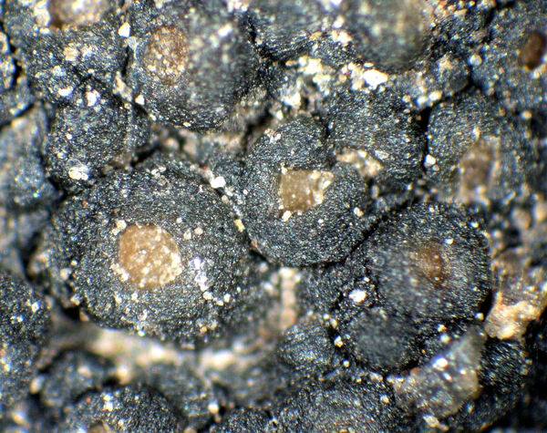
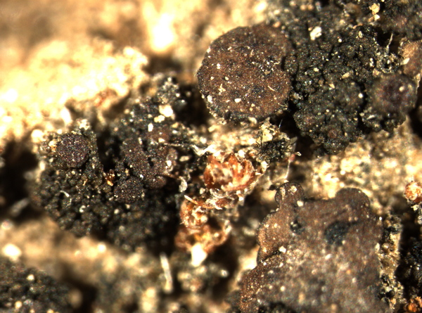
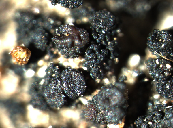
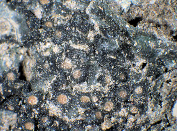
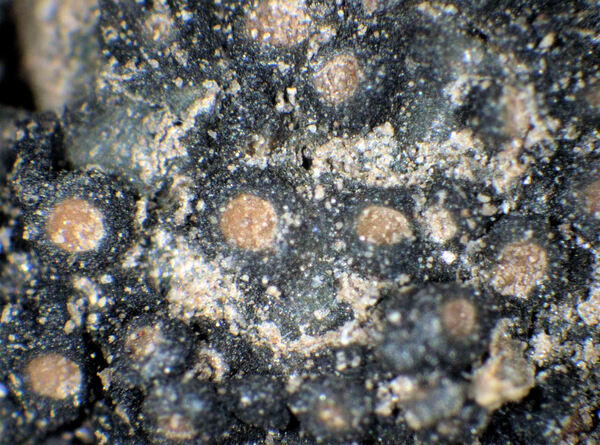
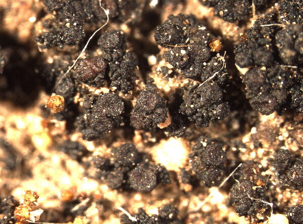
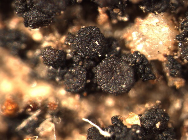
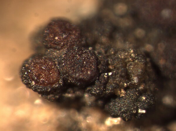
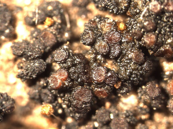
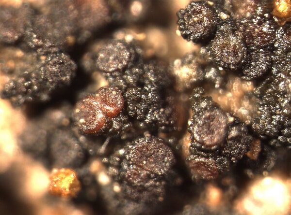
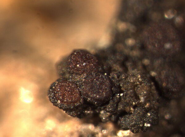
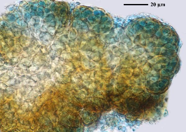
Description: Thallus subcrustose, membranous, rather loosely attached, homoiomerous, gelatinous when wet, dark greenish brown when wet, black to bluish black when dry, granular-nodulose throughout or with poorly developed marginal lobes, up to 2 cm in diam.; lower surface paler, attached by scattered, whitish rhizohyphae. Upper and lower cortices absent. Apothecia developing from ascogones arising beneath pycnidia (pycnoascocarps), frequent, laminal, semi-immersed, rounded, 0.2-0.3(-0.5) mm across, with a brown, concave to flat, smooth, initially pore-like disc, and a thin to thick, smooth, persistent proper margin. Proper exciple of parallel hyphae; epithecium brownish; hymenium colourless, 100-130(-200) µm high, the hymenial gel I+ reddish brown, K/I+ blue; paraphyses mostly simple, not apically thickened, coherent; hypothecium colourless to yellowish brown. Asci 8-spored, clavate to cylindrical, with a very thin wall disintegrating or opening by apical ruptures, Lichina-type. Ascospores 1-celled, hyaline, ellipsoid, (18-)20-33 x 9-13(-15) μm, with a gelatinous perispore which dissolves in K. Pycnidia dark, laminal, immersed, pyriform. Conidia acrogenous, cylindrical, 2-3 x 1-1.5 μm. Photobiont cyanobacterial (Nostoc, the cells in chains). Spot tests: all negative. Chemistry: without lichen substances.Note: a mainly temperate lichen found on soil in open dry grasslands, sometimes overgrowing bryophytes and plant debris, but also on walls, probably overlooked and perhaps more widespread.
Growth form: Crustose
Substrata: soil, terricolous mosses, and plant debris
Photobiont: cyanobacteria, filamentous (e.g. Nostoc, Scytonema)
Reproductive strategy: mainly sexual
Commonnes-rarity: (info)
Alpine belt: absent
Subalpine belt: absent
Oromediterranean belt: absent
Montane belt: extremely rare
Submediterranean belt: very rare
Padanian area: absent
Humid submediterranean belt: rare
Humid mediterranean belt: rare
Dry mediterranean belt: absent
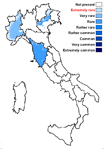
Predictive model
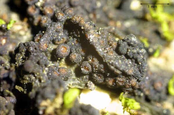

Felix Schumm – CC BY-SA 4.0
[12250], Germany, Baden-Württemberg, Alb-Donau Kreis, nördlich von Urspring bei der Bahnunterführung an der Straße nach Amstetten, auf Moosen über Kalksteinen, 48°33.296'N, 9°53.442' E, 570 m. Leg. Schumm 29.10.2005.
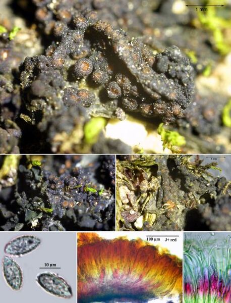

Felix Schumm – CC BY-SA 4.0
[12250], Germany, Baden-Württemberg, Alb-Donau Kreis, nördlich von Urspring bei der Bahnunterführung an der Straße nach Amstetten, auf Moosen über Kalksteinen, 48°33.296'N, 9°53.442' E, 570 m. Leg. Schumm 29.10.2005.
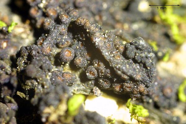

Felix Schumm - CC BY-SA 4.0
[12250], Germany, Baden-Württemberg, Alb-Donau Kreis, nördlich
von Urspring bei der Bahnunterführung an der Straße nach Amstetten,
auf Moosen über Kalksteinen, 48°33.296'N, 9°53.442' E, 570 m. Leg.
Schumm 29.10.2005.
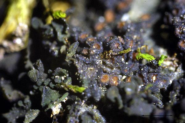

Felix Schumm - CC BY-SA 4.0
[12250], Germany, Baden-Württemberg, Alb-Donau Kreis, nördlich
von Urspring bei der Bahnunterführung an der Straße nach Amstetten,
auf Moosen über Kalksteinen, 48°33.296'N, 9°53.442' E, 570 m. Leg.
Schumm 29.10.2005.
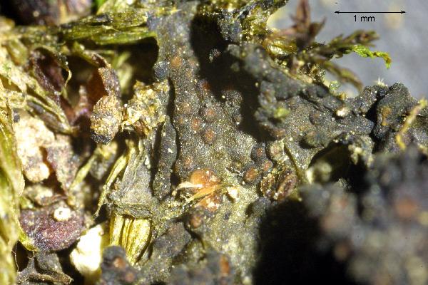

Felix Schumm - CC BY-SA 4.0
[12250], Germany, Baden-Württemberg, Alb-Donau Kreis, nördlich
von Urspring bei der Bahnunterführung an der Straße nach Amstetten,
auf Moosen über Kalksteinen, 48°33.296'N, 9°53.442' E, 570 m. Leg.
Schumm 29.10.2005.
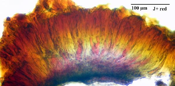

Felix Schumm - CC BY-SA 4.0
[12250], Germany, Baden-Württemberg, Alb-Donau Kreis, nördlich
von Urspring bei der Bahnunterführung an der Straße nach Amstetten,
auf Moosen über Kalksteinen, 48°33.296'N, 9°53.442' E, 570 m. Leg.
Schumm 29.10.2005.
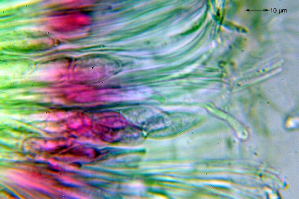

Felix Schumm - CC BY-SA 4.0
[12250], Germany, Baden-Württemberg, Alb-Donau Kreis, nördlich
von Urspring bei der Bahnunterführung an der Straße nach Amstetten,
auf Moosen über Kalksteinen, 48°33.296'N, 9°53.442' E, 570 m. Leg.
Schumm 29.10.2005.
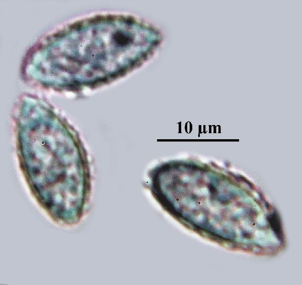

Felix Schumm - CC BY-SA 4.0
[12250], Germany, Baden-Württemberg, Alb-Donau Kreis, nördlich
von Urspring bei der Bahnunterführung an der Straße nach Amstetten,
auf Moosen über Kalksteinen, 48°33.296'N, 9°53.442' E, 570 m. Leg.
Schumm 29.10.2005.
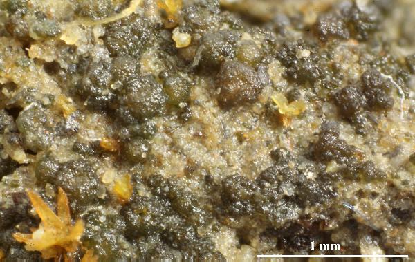

Felix Schumm - CC BY-SA 4.0
[ABL52733], Taiwan, Hualian County. Taroko National Park, Hohuan
Shan near Field Station. 24°09’21’’ N, 121°17’16’’ E, 3200 m, On soil
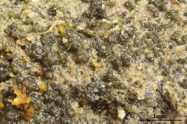

Felix Schumm - CC BY-SA 4.0
[ABL52733], Taiwan, Hualian County. Taroko National Park, Hohuan
Shan near Field Station. 24°09’21’’ N, 121°17’16’’ E, 3200 m, On soil
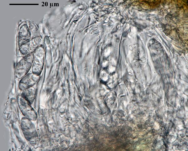

Felix Schumm - CC BY-SA 4.0
[ABL52733], Taiwan, Hualian County. Taroko National Park, Hohuan
Shan near Field Station. 24°09’21’’ N, 121°17’16’’ E, 3200 m, On soil
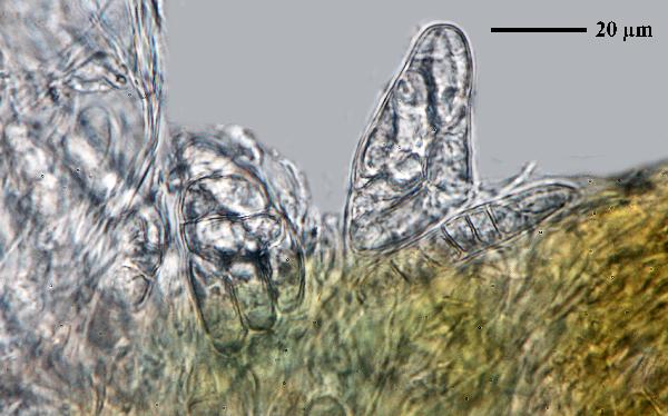

Felix Schumm - CC BY-SA 4.0
[ABL52733], Taiwan, Hualian County. Taroko National Park, Hohuan
Shan near Field Station. 24°09’21’’ N, 121°17’16’’ E, 3200 m, On soil
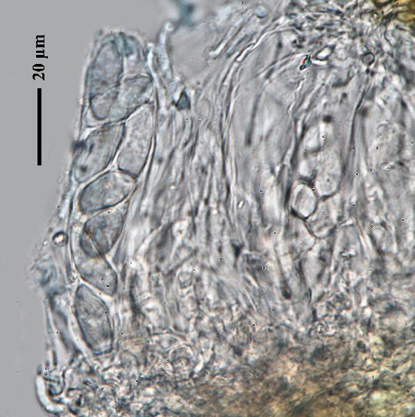

Felix Schumm - CC BY-SA 4.0
[ABL52733], Taiwan, Hualian County. Taroko National Park, Hohuan
Shan near Field Station. 24°09’21’’ N, 121°17’16’’ E, 3200 m, On soil
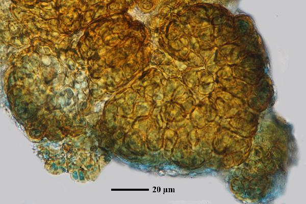

Felix Schumm - CC BY-SA 4.0
[ABL52733], Taiwan, Hualian County. Taroko National Park, Hohuan
Shan near Field Station. 24°09’21’’ N, 121°17’16’’ E, 3200 m, On soil
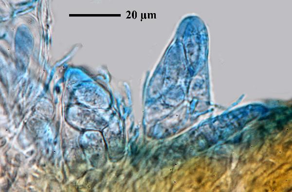

Felix Schumm - CC BY-SA 4.0
[ABL52733], Taiwan, Hualian County. Taroko National Park, Hohuan
Shan near Field Station. 24°09’21’’ N, 121°17’16’’ E, 3200 m, On soil
Growth form: Crustose
Substrata: soil, terricolous mosses, and plant debris
Photobiont: cyanobacteria, filamentous (e.g. Nostoc, Scytonema)
Reproductive strategy: mainly sexual
Commonnes-rarity: (info)
Alpine belt: absent
Subalpine belt: absent
Oromediterranean belt: absent
Montane belt: extremely rare
Submediterranean belt: very rare
Padanian area: absent
Humid submediterranean belt: rare
Humid mediterranean belt: rare
Dry mediterranean belt: absent

Predictive model


Felix Schumm – CC BY-SA 4.0
[12250], Germany, Baden-Württemberg, Alb-Donau Kreis, nördlich von Urspring bei der Bahnunterführung an der Straße nach Amstetten, auf Moosen über Kalksteinen, 48°33.296'N, 9°53.442' E, 570 m. Leg. Schumm 29.10.2005.


Felix Schumm – CC BY-SA 4.0
[12250], Germany, Baden-Württemberg, Alb-Donau Kreis, nördlich von Urspring bei der Bahnunterführung an der Straße nach Amstetten, auf Moosen über Kalksteinen, 48°33.296'N, 9°53.442' E, 570 m. Leg. Schumm 29.10.2005.


Felix Schumm - CC BY-SA 4.0
[12250], Germany, Baden-Württemberg, Alb-Donau Kreis, nördlich von Urspring bei der Bahnunterführung an der Straße nach Amstetten, auf Moosen über Kalksteinen, 48°33.296'N, 9°53.442' E, 570 m. Leg. Schumm 29.10.2005.


Felix Schumm - CC BY-SA 4.0
[12250], Germany, Baden-Württemberg, Alb-Donau Kreis, nördlich von Urspring bei der Bahnunterführung an der Straße nach Amstetten, auf Moosen über Kalksteinen, 48°33.296'N, 9°53.442' E, 570 m. Leg. Schumm 29.10.2005.


Felix Schumm - CC BY-SA 4.0
[12250], Germany, Baden-Württemberg, Alb-Donau Kreis, nördlich von Urspring bei der Bahnunterführung an der Straße nach Amstetten, auf Moosen über Kalksteinen, 48°33.296'N, 9°53.442' E, 570 m. Leg. Schumm 29.10.2005.


Felix Schumm - CC BY-SA 4.0
[12250], Germany, Baden-Württemberg, Alb-Donau Kreis, nördlich von Urspring bei der Bahnunterführung an der Straße nach Amstetten, auf Moosen über Kalksteinen, 48°33.296'N, 9°53.442' E, 570 m. Leg. Schumm 29.10.2005.


Felix Schumm - CC BY-SA 4.0
[12250], Germany, Baden-Württemberg, Alb-Donau Kreis, nördlich von Urspring bei der Bahnunterführung an der Straße nach Amstetten, auf Moosen über Kalksteinen, 48°33.296'N, 9°53.442' E, 570 m. Leg. Schumm 29.10.2005.


Felix Schumm - CC BY-SA 4.0
[12250], Germany, Baden-Württemberg, Alb-Donau Kreis, nördlich von Urspring bei der Bahnunterführung an der Straße nach Amstetten, auf Moosen über Kalksteinen, 48°33.296'N, 9°53.442' E, 570 m. Leg. Schumm 29.10.2005.


Felix Schumm - CC BY-SA 4.0
[ABL52733], Taiwan, Hualian County. Taroko National Park, Hohuan Shan near Field Station. 24°09’21’’ N, 121°17’16’’ E, 3200 m, On soil


Felix Schumm - CC BY-SA 4.0
[ABL52733], Taiwan, Hualian County. Taroko National Park, Hohuan Shan near Field Station. 24°09’21’’ N, 121°17’16’’ E, 3200 m, On soil


Felix Schumm - CC BY-SA 4.0
[ABL52733], Taiwan, Hualian County. Taroko National Park, Hohuan Shan near Field Station. 24°09’21’’ N, 121°17’16’’ E, 3200 m, On soil


Felix Schumm - CC BY-SA 4.0
[ABL52733], Taiwan, Hualian County. Taroko National Park, Hohuan Shan near Field Station. 24°09’21’’ N, 121°17’16’’ E, 3200 m, On soil


Felix Schumm - CC BY-SA 4.0
[ABL52733], Taiwan, Hualian County. Taroko National Park, Hohuan Shan near Field Station. 24°09’21’’ N, 121°17’16’’ E, 3200 m, On soil


Felix Schumm - CC BY-SA 4.0
[ABL52733], Taiwan, Hualian County. Taroko National Park, Hohuan Shan near Field Station. 24°09’21’’ N, 121°17’16’’ E, 3200 m, On soil


 INDEX FUNGORUM
 GBIF
GBIF
 DOLICHENS
