Alyxoria varia (Pers.) Ertz & Tehler
Fungal Divers., 49: 53, 2011. Basionym: Opegrapha varia Pers. - Ann. Bot. (Usteri), 1: 30, 1794.
Synonyms: Opegrapha chlorina Pers.; Opegrapha cymbiformis Flörke; Opegrapha diaphora Ach.; Opegrapha lichenoides Pers.; Opegrapha lichenoides var. chlorina (Pers.) Redinger; Opegrapha lichenoides var. nigrocaesia Chevall.; Opegrapha maroccana Müll. Arg.; Opegrapha pitardi var. viridans Maheu & Werner; Opegrapha pollinii A. Massal.; Opegrapha pulicaris auct. p.p. non Pers. ex Fr.; Opegrapha rimalis Pers.; Opegrapha signata (Ach.) Ach.; Opegrapha varia f. subericola Jatta; Opegrapha varia var. confluens A. Massal.; Opegrapha varia var. diaphora (Ach.) Fr.; Opegrapha varia var. fagicola A. Massal.; Opegrapha varia var. juglandis A. Massal.; Opegrapha violatra A. Massal.; Opegrapha vulvella Ach.
Distribution: N - VG (Castello 1996), Frl (Bernini & al. 2010), Ven (Lazzarin 2000b, Nascimbene & al. 2005b, 2006c, Nascimbene 2008, 2008c), TAA (Nascimbene & al. 2007b, 2014, 2022, Nascimbene 2014, Nimis & al. 2015), Lomb (Zocchi & al. 1997, Arosio & al. 2003, Furlanetto 2010), Piem (Arosio & al. 1998, Piervittori 2003, Isocrono & al. 2004, 2007, Griselli & al. 2003, Isocrono & Piervittori 2008), VA (Piervittori & Isocrono 1999), Emil (Nimis & al. 1996, Sallese 2003, Tretiach & al. 2008, Fariselli & al. 2020), Lig (Valcuvia & al. 2000). C - Tosc (Tretiach & Nimis 1994, Putortì & al. 1998, Loppi & al. 2002c, 2004c, Loppi & Frati 2006, Frati & al. 2006b, 2008, Brunialti & Frati 2010, Loppi & Nascimbene 2010, Benesperi 2011, Brackel 2015, Fačkovcová & al. 2024), Marc (Nimis & Tretiach 1999, Frati & Brunialti 2006), Umb (Ravera 1998, Panfili 2000b, Ravera & al. 2006, Brackel 2025), Laz (Bartoli & al. 1997, Ravera & al. 1999, Ravera 2002, Massari & Ravera 2002, Nimis & Tretiach 2004, Ruisi & al. 2005, Stofer 2006, Munzi & al. 2007, Ravera & Genovesi 2008, Zucconi & al. 2013), Abr (Recchia & al. 1993, Olivieri & al. 1997, 1997b, Loppi & al. 1999, Nimis & Tretiach 1999, Caporale & al. 2016, Corona & al. 2016, Gheza & al. 2021), Mol (Garofalo & al. 1999, Nimis & Tretiach 1999, Caporale & al. 2008, Ravera & al. 2010, Caporale & Ravera 2020), Sar (Zedda 1995, 2002, Loi & al. 2000, Zedda & al. 2001, Rizzi & al. 2011, Cossu 2013, Di Nuzzo & al. 2022). S - Camp (Garofalo & al. 1999, 2010, 2002b, Ricciardi & al. 2000, Aprile & al. 2002, 2003b, Blasi & al. 2010, Brunialti & al. 2013, Ravera & Brunialti 2013, Catalano & al. 2016), Pugl (Garofalo & al. 1999, Nimis & Tretiach 1999, Brackel 2011), Bas (Bartoli & Puntillo 1998, Nimis & Tretiach 1999, Potenza 2006, Potenza & al. 2010, Cassola & al. 2025), Cal (Puntillo 1995, 1996, Stofer 2006, Puntillo & Puntillo 2012), Si (Grillo & Cristaudo 1995, Grillo & Caniglia 2004, Caniglia & Grillo 2006b, Campisi & al. 2020, Ravera & al. 2023b).
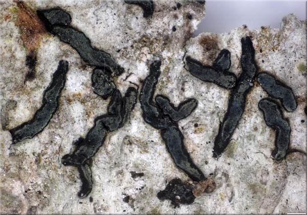
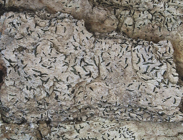
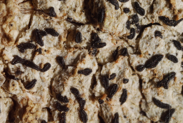
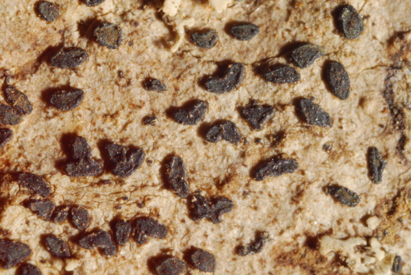
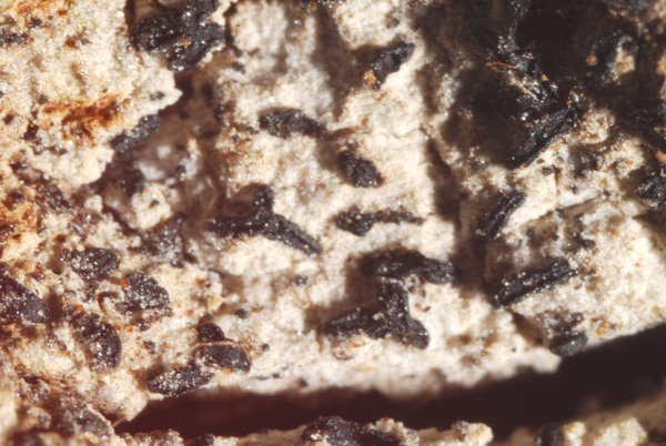
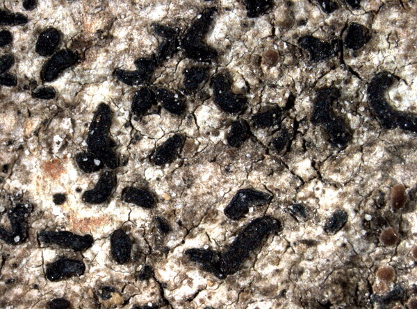
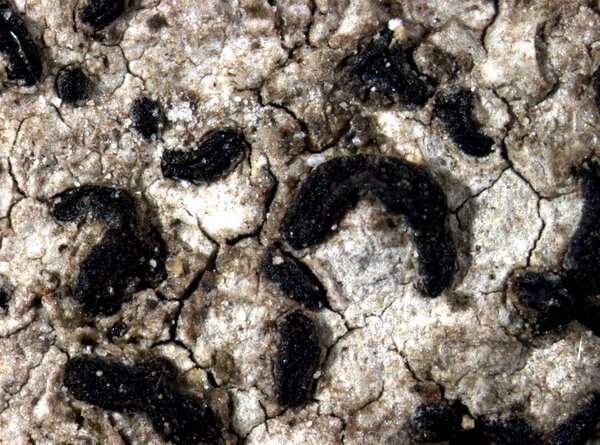
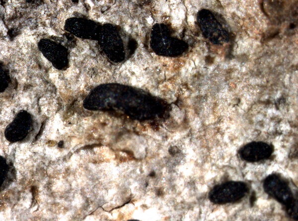
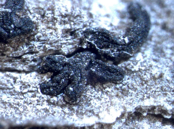
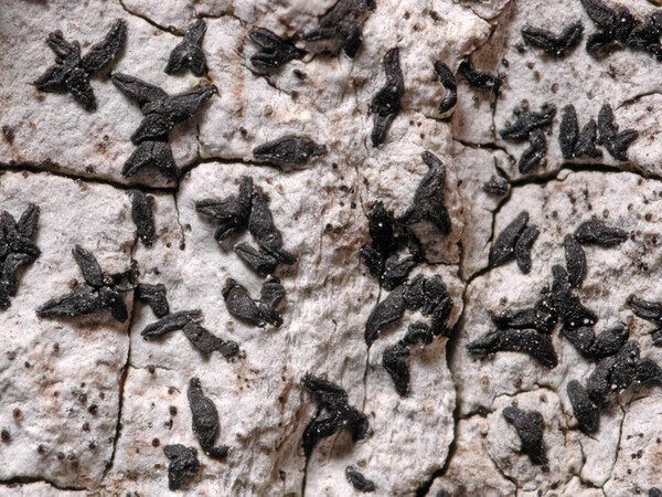
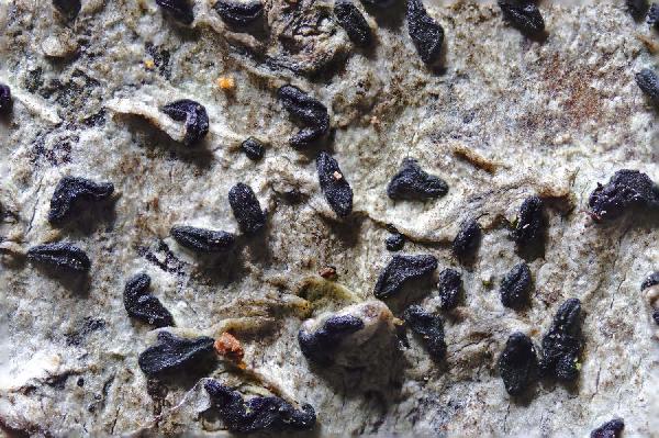
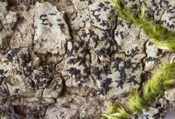
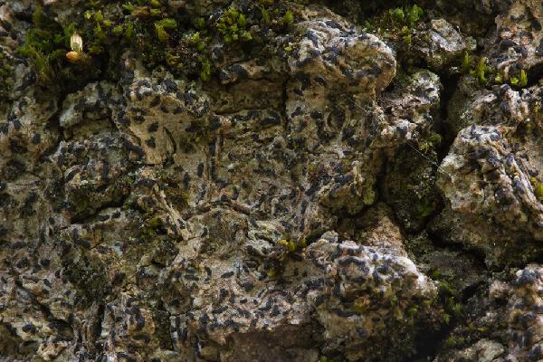
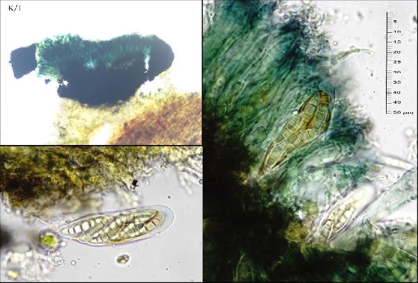
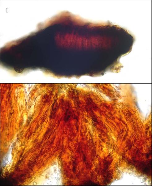
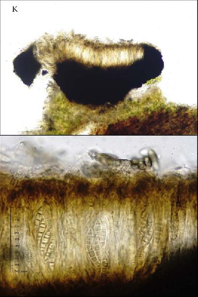
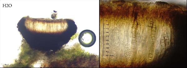
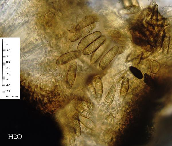
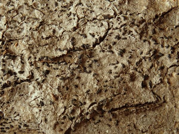
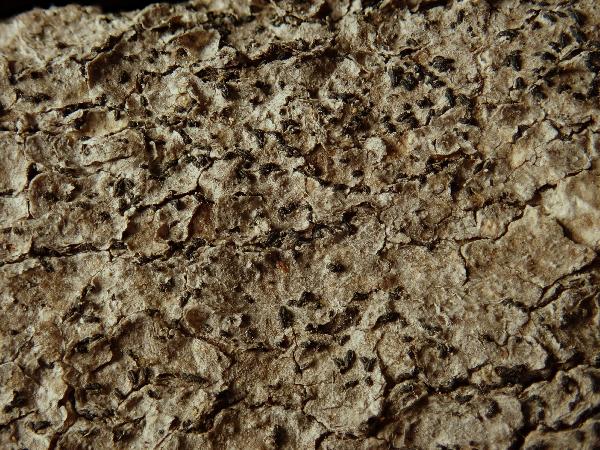
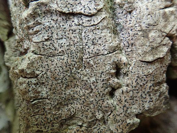
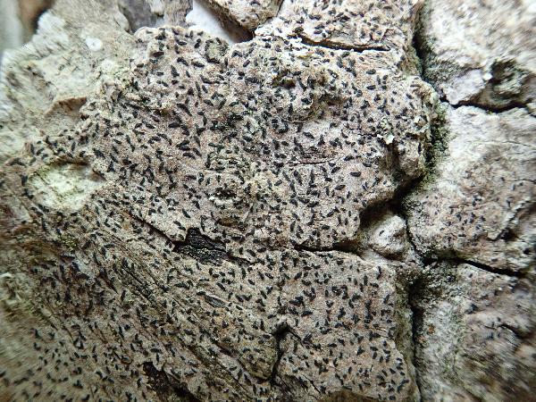
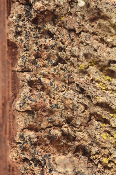
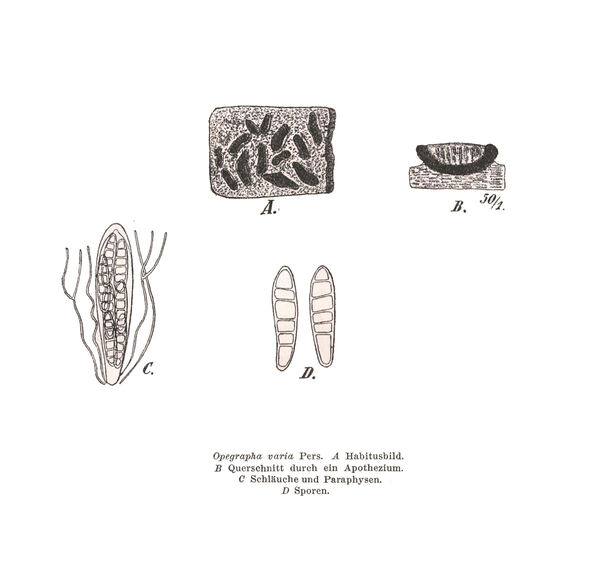
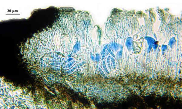
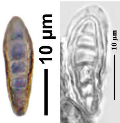
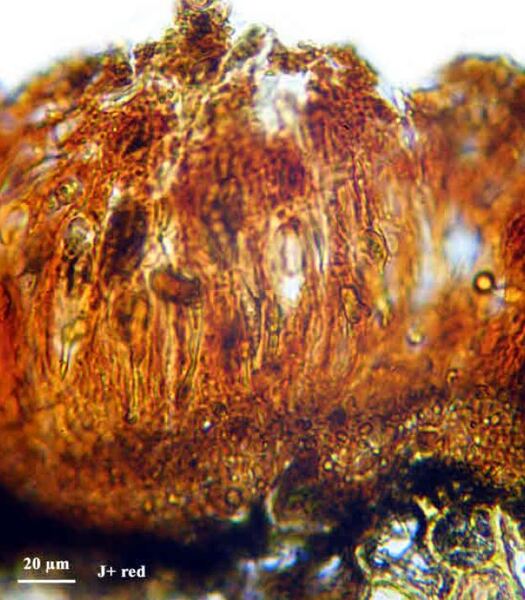
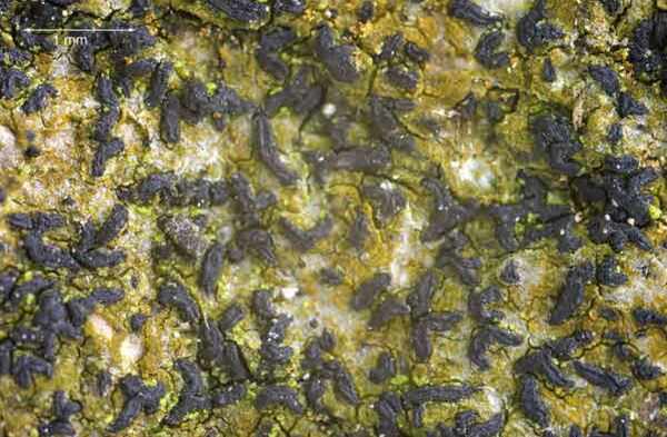
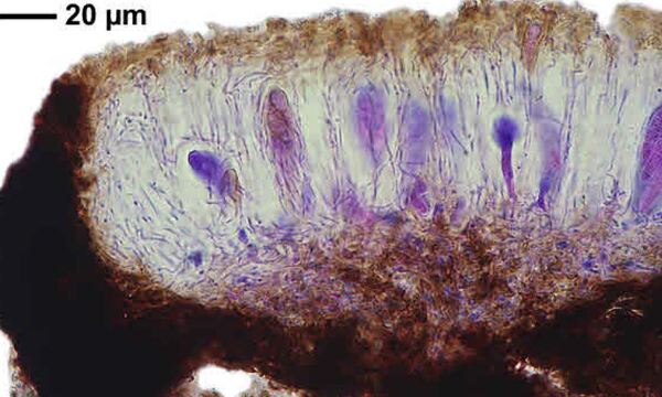
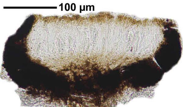
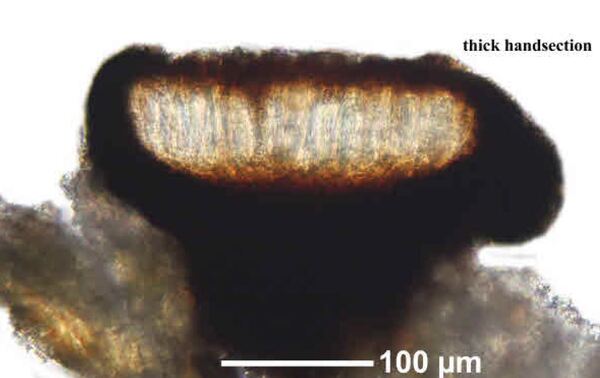
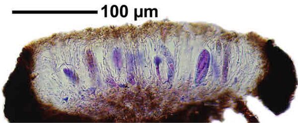
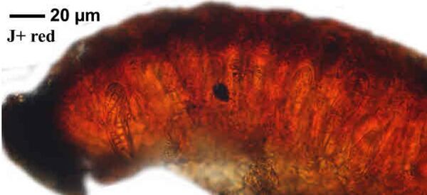
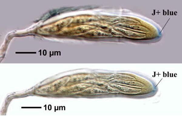
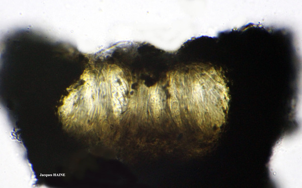
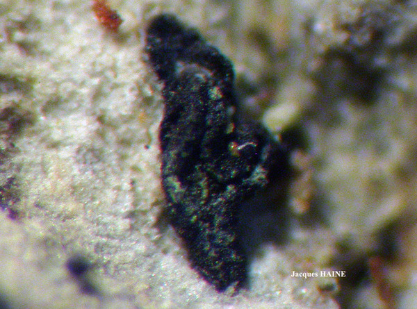
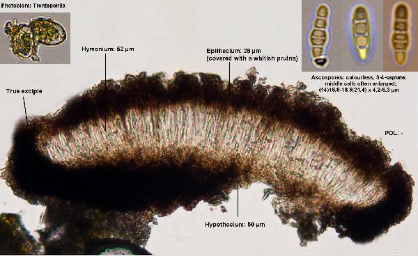
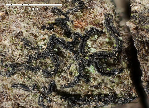
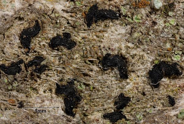
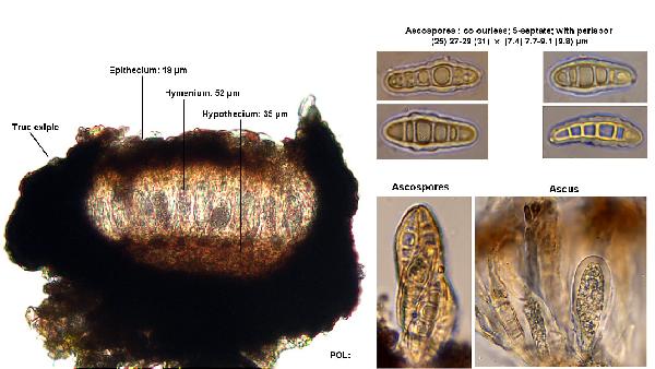
Description: Thallus crustose, thin, smooth or finely cracked, whitish to dark grey, sometimes poorly evident. Apothecia lirelliform, black, (0.3-)0.5-2.5(-4) x 0.2-0.5(-0.8) mm, mostly elongate, sometimes oblong, rarely branched, sessile, with a slit-like to slightly expanded, sometimes more or less grey- or green-pruinose disc. Proper exciple dark, carbonized, extending below the hymenium, 20-45 µm thick laterally, K-; epithecium brown, 15-25 µm high, K- (when pruinose, the pruina reacts K+ yellow); hymenium colourless, (40-)60-80(-90) µm high, hemiamyloid; paraphysoids branched and anastomosing, 1-1.5 µm thick; subhymenium dark brown; hypothecium black, carbonized. Asci 8-spored, cylindrical-clavate, the inner layer of endoascus amyloid in upper part, with a I+ blue ring visible around a small ocular chamber, Varia-type, 30-70 x 12-18(-20) µm. Ascospores 4-6-septate, somewhat clavate, the central cell distinctly enlarged, hyaline but turning brown with age, (15-)20-34(-37) x (4-)6-7(-9) µm, with a hyaline, 1-2 µm thick, gelatinous perispore. Pycnidia semi-immersed, often faintly white- or greenish-pruinose, (100-)120-200(-250) μm across. Conidia bacilliform to dumbbell-shaped, straight or slightly curved, 3-5 x 0.5-1.5(-2) µm. Photobiont trentepohlioid. Spot tests: thallus K-, KC-, C-, P-, UV-. Chemistry: without lichen substances.Note: a mainly temperate lichen found on old trees in humid but rather open forests, occasionally on basic siliceous rocks in humid and shaded situations. The delimitation of this species is still an open problem: here it is still treated as a collective taxon.
Growth form: Crustose
Substrata: bark
Photobiont: Trentepohlia
Reproductive strategy: mainly sexual
Commonnes-rarity: (info)
Alpine belt: absent
Subalpine belt: extremely rare
Oromediterranean belt: absent
Montane belt: very rare
Submediterranean belt: rare
Padanian area: extremely rare
Humid submediterranean belt: rather rare
Humid mediterranean belt: rare
Dry mediterranean belt: absent

Predictive model
Herbarium samples
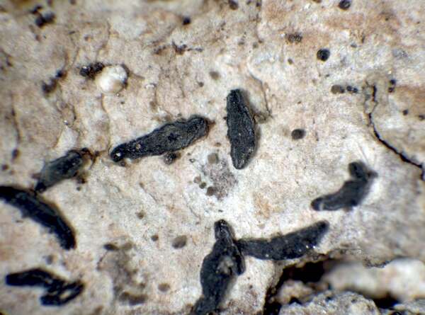

P.L. Nimis; Owner: Department of Life Sciences, University of Trieste
Herbarium: TSB (7615)
2001/11/27
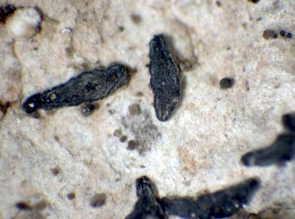

P.L. Nimis; Owner: Department of Life Sciences, University of Trieste
Herbarium: TSB (7615)
2001/11/27
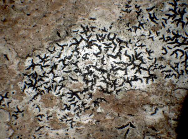

P.L. Nimis; Owner: Department of Life Sciences, University of Trieste
Herbarium: TSB (19647)
2001/11/27
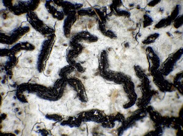

P.L. Nimis; Owner: Department of Life Sciences, University of Trieste
Herbarium: TSB (19647)
2001/11/27
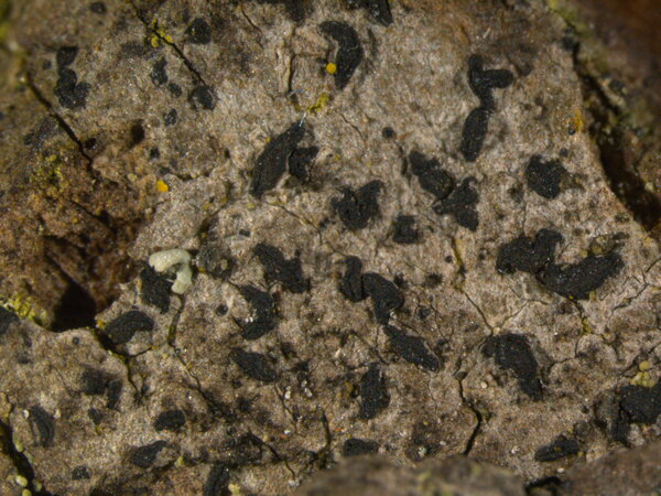

Juri Nascimbene; Owner: Department of Life Sciences, University of Trieste
Italy, Trentino-Alto Adige, Trento, Villa Welsperg, Centro Visitatori del Parco di Paneveggio; altitude: 1030 m
03.04.2009
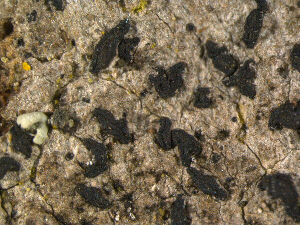

Juri Nascimbene; Owner: Department of Life Sciences, University of Trieste
Italy, Trentino-Alto Adige, Trento, Villa Welsperg, Centro Visitatori del Parco di Paneveggio; altitude: 1030 m
03.04.2009
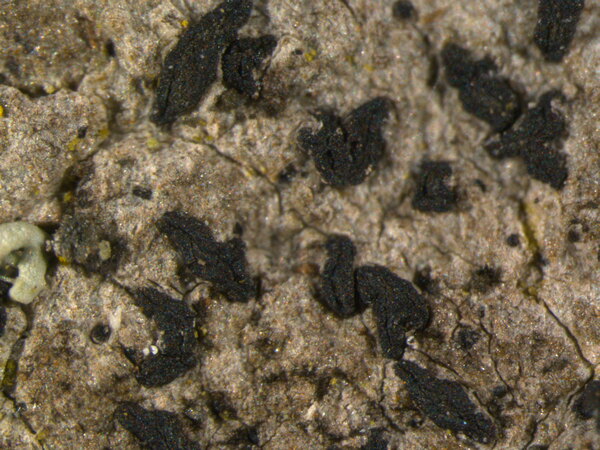

Juri Nascimbene; Owner: Department of Life Sciences, University of Trieste
Italy, Trentino-Alto Adige, Trento, Villa Welsperg, Centro Visitatori del Parco di Paneveggio; altitude: 1030 m
03.04.2009
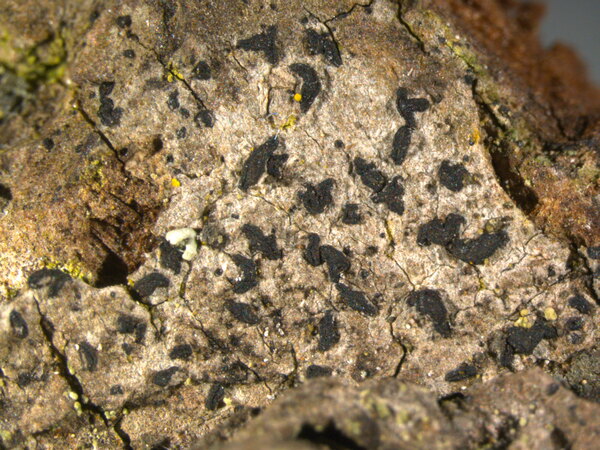

Juri Nascimbene; Owner: Department of Life Sciences, University of Trieste
Italy, Trentino-Alto Adige, Trento, Villa Welsperg, Centro Visitatori del Parco di Paneveggio; altitude: 1030 m
03.04.2009
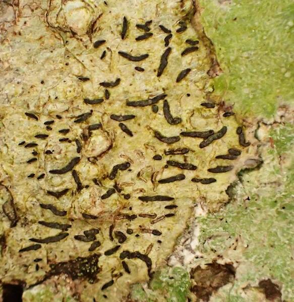

Curtis Randall Björk, - CC BY-SA 4.0
Campus of Royal Roads University, Victoria, British Columbia, Canada Canada
2017
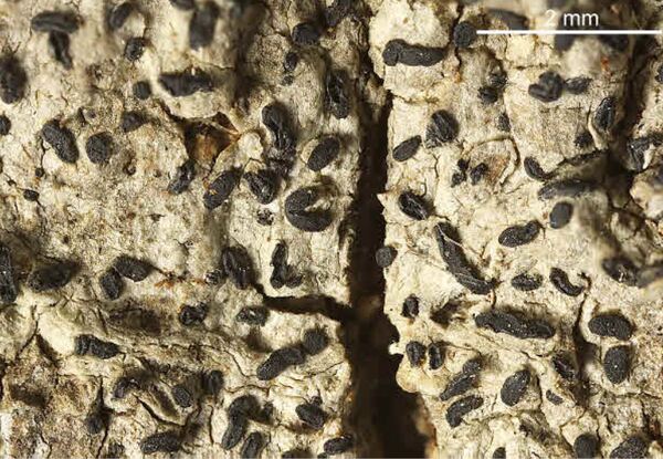

Felix Schumm – CC BY-SA 4.0
[1030], Gemany, Baden-Württemberg, Schwäbische Alb, Kreis Heidenheim, im Wental an Laubbäumen, ca 600 m. TK: 7226. Leg. F. Schumm 04.1967, det. F. Schumm.
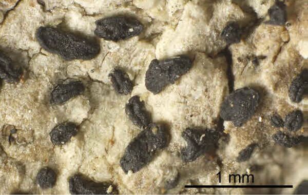

Felix Schumm – CC BY-SA 4.0
[1030], Gemany, Baden-Württemberg, Schwäbische Alb, Kreis Heidenheim, im Wental an Laubbäumen, ca 600 m. TK: 7226. Leg. F. Schumm 04.1967, det. F. Schumm.
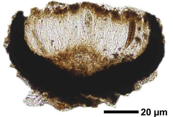

Felix Schumm – CC BY-SA 4.0
[1030], Gemany, Baden-Württemberg, Schwäbische Alb, Kreis Heidenheim, im Wental an Laubbäumen, ca 600 m. TK: 7226. Leg. F. Schumm 04.1967, det. F. Schumm.
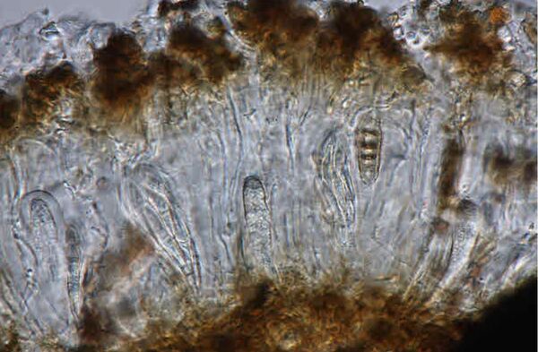

Felix Schumm – CC BY-SA 4.0
[1030], Gemany, Baden-Württemberg, Schwäbische Alb, Kreis Heidenheim, im Wental an Laubbäumen, ca 600 m. TK: 7226. Leg. F. Schumm 04.1967, det. F. Schumm.
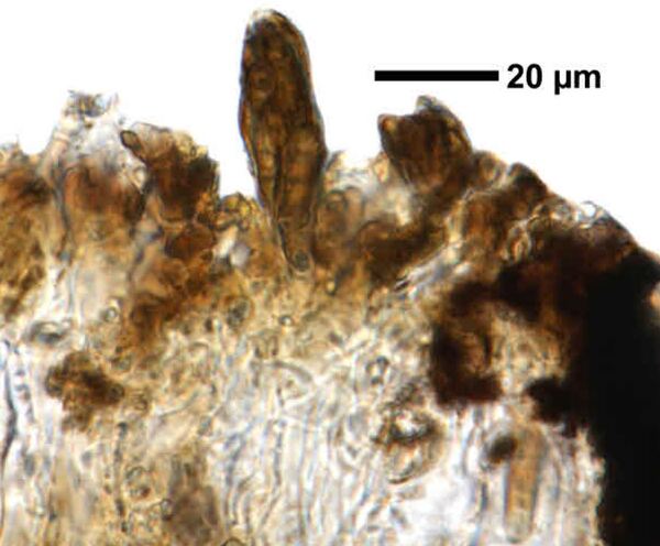

Felix Schumm – CC BY-SA 4.0
[1030], Gemany, Baden-Württemberg, Schwäbische Alb, Kreis Heidenheim, im Wental an Laubbäumen, ca 600 m. TK: 7226. Leg. F. Schumm 04.1967, det. F. Schumm.
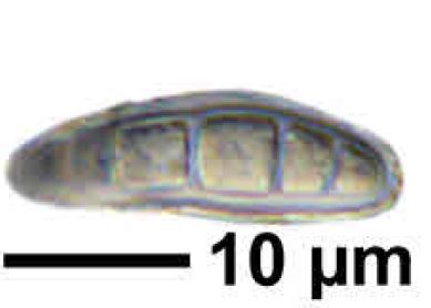

Felix Schumm – CC BY-SA 4.0
[1030], Gemany, Baden-Württemberg, Schwäbische Alb, Kreis Heidenheim, im Wental an Laubbäumen, ca 600 m. TK: 7226. Leg. F. Schumm 04.1967, det. F. Schumm.
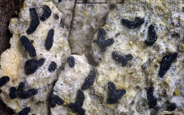

Felix Schumm – CC BY-SA 4.0
[6967], Germany, Baden-Württemberg, Rems-Murr-Kreis, 5 km westlich von Welzheim im Rotal, Stubensandsteingebiet, an Eiche, luftfeucht; 440 m, TK: 7124/NW. Leg. Schumm & Schwarz 23.04.2000, det. F. Schumm 2007
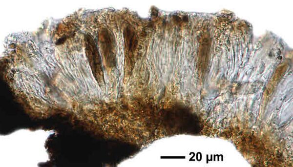

Felix Schumm – CC BY-SA 4.0
[6967], Germany, Baden-Württemberg, Rems-Murr-Kreis, 5 km westlich von Welzheim im Rotal, Stubensandsteingebiet, an Eiche, luftfeucht; 440 m, TK: 7124/NW. Leg. Schumm & Schwarz 23.04.2000, det. F. Schumm 2007
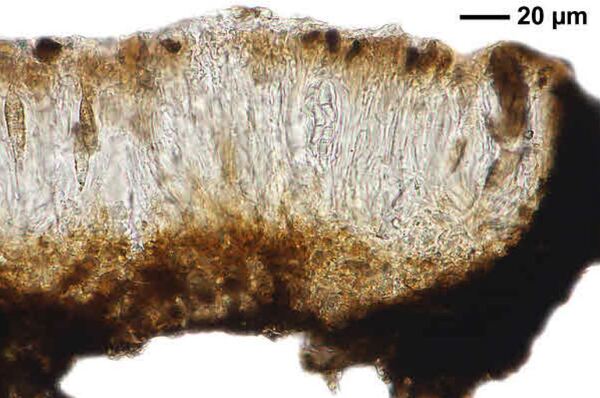

Felix Schumm – CC BY-SA 4.0
[6967], Germany, Baden-Württemberg, Rems-Murr-Kreis, 5 km westlich von Welzheim im Rotal, Stubensandsteingebiet, an Eiche, luftfeucht; 440 m, TK: 7124/NW. Leg. Schumm & Schwarz 23.04.2000, det. F. Schumm 2007
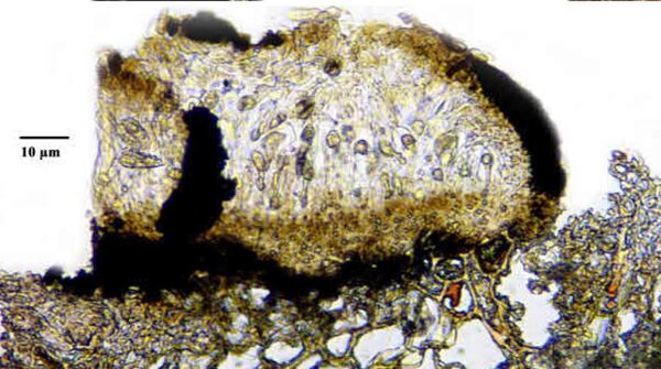

Felix Schumm – CC BY-SA 4.0
[6967], Germany, Baden-Württemberg, Rems-Murr-Kreis, 5 km westlich von Welzheim im Rotal, Stubensandsteingebiet, an Eiche, luftfeucht; 440 m, TK: 7124/NW. Leg. Schumm & Schwarz 23.04.2000, det. F. Schumm 2007
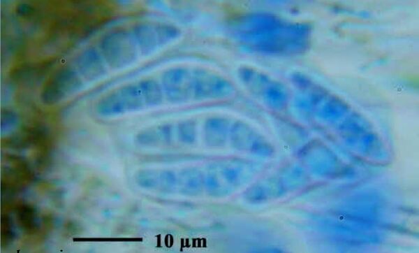

Felix Schumm – CC BY-SA 4.0
[6967], Germany, Baden-Württemberg, Rems-Murr-Kreis, 5 km westlich von Welzheim im Rotal, Stubensandsteingebiet, an Eiche, luftfeucht; 440 m, TK: 7124/NW. Leg. Schumm & Schwarz 23.04.2000, det. F. Schumm 2007
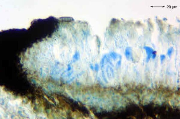

Felix Schumm – CC BY-SA 4.0
[6967], Germany, Baden-Württemberg, Rems-Murr-Kreis, 5 km westlich von Welzheim im Rotal, Stubensandsteingebiet, an Eiche, luftfeucht; 440 m, TK: 7124/NW. Leg. Schumm & Schwarz 23.04.2000, det. F. Schumm 2007
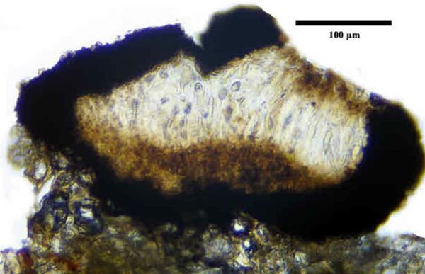

Felix Schumm – CC BY-SA 4.0
[6967], Germany, Baden-Württemberg, Rems-Murr-Kreis, 5 km westlich von Welzheim im Rotal, Stubensandsteingebiet, an Eiche, luftfeucht; 440 m, TK: 7124/NW. Leg. Schumm & Schwarz 23.04.2000, det. F. Schumm 2007
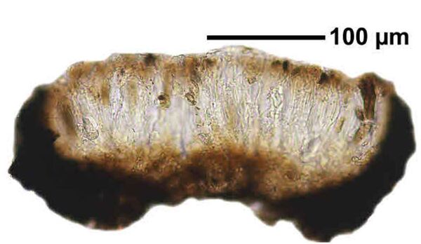

Felix Schumm – CC BY-SA 4.0
[6967], Germany, Baden-Württemberg, Rems-Murr-Kreis, 5 km westlich von Welzheim im Rotal, Stubensandsteingebiet, an Eiche, luftfeucht; 440 m, TK: 7124/NW. Leg. Schumm & Schwarz 23.04.2000, det. F. Schumm 2007
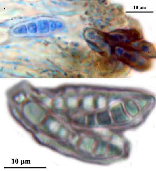

Felix Schumm – CC BY-SA 4.0
[6967], Germany, Baden-Württemberg, Rems-Murr-Kreis, 5 km westlich von Welzheim im Rotal, Stubensandsteingebiet, an Eiche, luftfeucht; 440 m, TK: 7124/NW. Leg. Schumm & Schwarz 23.04.2000, det. F. Schumm 2007

Felix Schumm – CC BY-SA 4.0
[6967], Germany, Baden-Württemberg, Rems-Murr-Kreis, 5 km westlich von Welzheim im Rotal, Stubensandsteingebiet, an Eiche, luftfeucht; 440 m, TK: 7124/NW. Leg. Schumm & Schwarz 23.04.2000, det. F. Schumm 2007

Felix Schumm – CC BY-SA 4.0
[6967], Germany, Baden-Württemberg, Rems-Murr-Kreis, 5 km westlich von Welzheim im Rotal, Stubensandsteingebiet, an Eiche, luftfeucht; 440 m, TK: 7124/NW. Leg. Schumm & Schwarz 23.04.2000, det. F. Schumm 2007

Felix Schumm – CC BY-SA 4.0
[6967], Germany, Baden-Württemberg, Rems-Murr-Kreis, 5 km westlich von Welzheim im Rotal, Stubensandsteingebiet, an Eiche, luftfeucht; 440 m, TK: 7124/NW. Leg. Schumm & Schwarz 23.04.2000, det. F. Schumm 2007

Felix Schumm – CC BY-SA 4.0
[13631], Germany, Baden-Württemberg, Kreis Göppingen, südwestlich von Adelberg nahe dem Herrenbachstausee, Buhwiesenweg, corticol im Mischwald, ca. 48°44'N, 9°33'E, 412 m. Leg. Schumm 08.02.2008
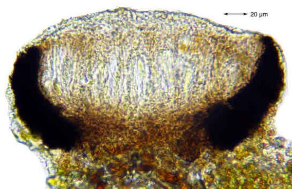

Felix Schumm – CC BY-SA 4.0
[13631], Germany, Baden-Württemberg, Kreis Göppingen, südwestlich von Adelberg nahe dem Herrenbachstausee, Buhwiesenweg, corticol im Mischwald, ca. 48°44'N, 9°33'E, 412 m. Leg. Schumm 08.02.2008
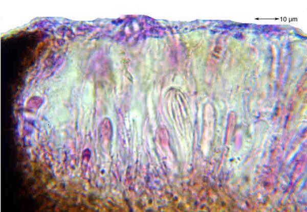

Felix Schumm – CC BY-SA 4.0
[13631], Germany, Baden-Württemberg, Kreis Göppingen, südwestlich von Adelberg nahe dem Herrenbachstausee, Buhwiesenweg, corticol im Mischwald, ca. 48°44'N, 9°33'E, 412 m. Leg. Schumm 08.02.2008
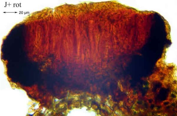

Felix Schumm – CC BY-SA 4.0
[13631], Germany, Baden-Württemberg, Kreis Göppingen, südwestlich von Adelberg nahe dem Herrenbachstausee, Buhwiesenweg, corticol im Mischwald, ca. 48°44'N, 9°33'E, 412 m. Leg. Schumm 08.02.2008
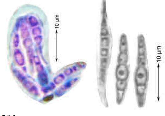

Felix Schumm – CC BY-SA 4.0
[13631], Germany, Baden-Württemberg, Kreis Göppingen, südwestlich von Adelberg nahe dem Herrenbachstausee, Buhwiesenweg, corticol im Mischwald, ca. 48°44'N, 9°33'E, 412 m. Leg. Schumm 08.02.2008
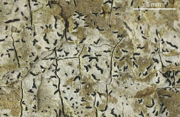

Felix Schumm – CC BY-SA 4.0
[16464], GERMANY, Baden-Württemberg, Kreis Göppingen, im Herrenbachtal zwischen Rechberghausen und der Zachersmühle, 48.74100°N, 9.62803° E, 330 m. Leg. Schumm 11.04.2010.
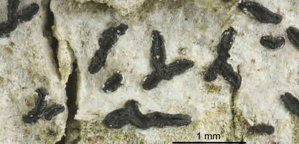

Felix Schumm – CC BY-SA 4.0
[16464], GERMANY, Baden-Württemberg, Kreis Göppingen, im Herrenbachtal zwischen Rechberghausen und der Zachersmühle, 48.74100°N, 9.62803° E, 330 m. Leg. Schumm 11.04.2010.
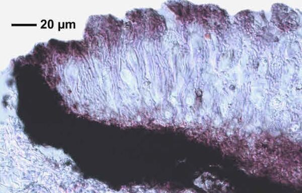

Felix Schumm – CC BY-SA 4.0
[16464], GERMANY, Baden-Württemberg, Kreis Göppingen, im Herrenbachtal zwischen Rechberghausen und der Zachersmühle, 48.74100°N, 9.62803° E, 330 m. Leg. Schumm 11.04.2010.
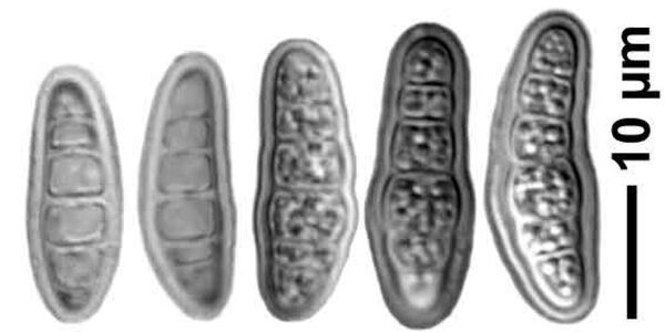

Felix Schumm – CC BY-SA 4.0
[16464], GERMANY, Baden-Württemberg, Kreis Göppingen, im Herrenbachtal zwischen Rechberghausen und der Zachersmühle, 48.74100°N, 9.62803° E, 330 m. Leg. Schumm 11.04.2010.
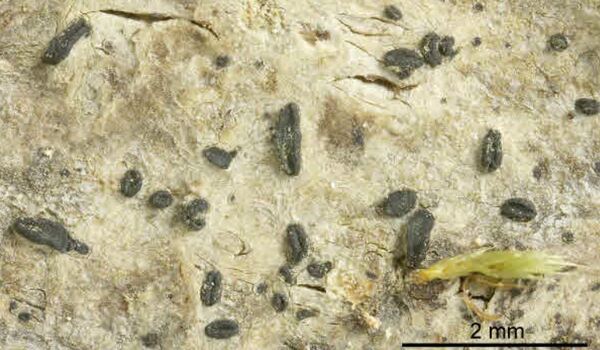

Felix Schumm – CC BY-SA 4.0
[18569], Germany, Rheinland-Pfalz, Kreis Kaiserslautern, Pfälzer Wald, Karlstal südwestlich von Trippstadt, 300-350 m, Buntsandsteingebiet, Schluchtwald (Luzulo-Fagetum), an Fagus sylvatica. Leg. Schumm & Lauer 10.06.1978, det. Schumm.
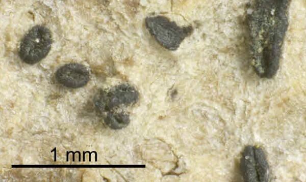

Felix Schumm – CC BY-SA 4.0
[18569], Germany, Rheinland-Pfalz, Kreis Kaiserslautern, Pfälzer Wald, Karlstal südwestlich von Trippstadt, 300-350 m, Buntsandsteingebiet, Schluchtwald (Luzulo-Fagetum), an Fagus sylvatica. Leg. Schumm & Lauer 10.06.1978, det. Schumm.
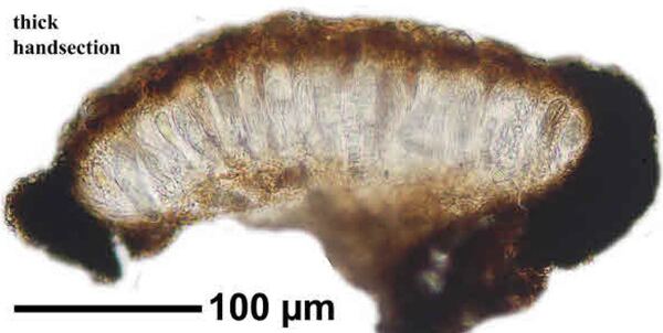

Felix Schumm – CC BY-SA 4.0
[18569], Germany, Rheinland-Pfalz, Kreis Kaiserslautern, Pfälzer Wald, Karlstal südwestlich von Trippstadt, 300-350 m, Buntsandsteingebiet, Schluchtwald (Luzulo-Fagetum), an Fagus sylvatica. Leg. Schumm & Lauer 10.06.1978, det. Schumm.
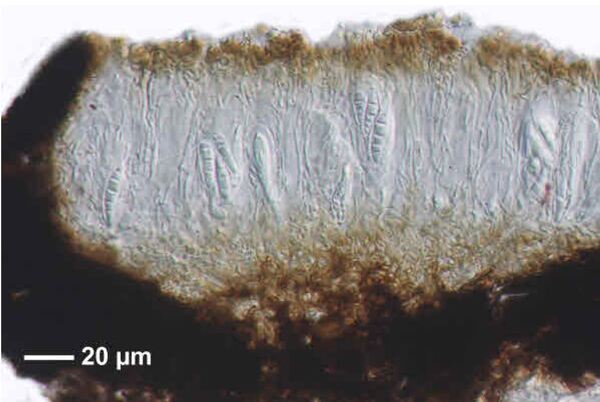

Felix Schumm – CC BY-SA 4.0
[18569], Germany, Rheinland-Pfalz, Kreis Kaiserslautern, Pfälzer Wald, Karlstal südwestlich von Trippstadt, 300-350 m, Buntsandsteingebiet, Schluchtwald (Luzulo-Fagetum), an Fagus sylvatica. Leg. Schumm & Lauer 10.06.1978, det. Schumm.

Felix Schumm – CC BY-SA 4.0
[18569], Germany, Rheinland-Pfalz, Kreis Kaiserslautern, Pfälzer Wald, Karlstal südwestlich von Trippstadt, 300-350 m, Buntsandsteingebiet, Schluchtwald (Luzulo-Fagetum), an Fagus sylvatica. Leg. Schumm & Lauer 10.06.1978, det. Schumm.

Felix Schumm – CC BY-SA 4.0
[18569], Germany, Rheinland-Pfalz, Kreis Kaiserslautern, Pfälzer Wald, Karlstal südwestlich von Trippstadt, 300-350 m, Buntsandsteingebiet, Schluchtwald (Luzulo-Fagetum), an Fagus sylvatica. Leg. Schumm & Lauer 10.06.1978, det. Schumm.

Felix Schumm – CC BY-SA 4.0
[18569], Germany, Rheinland-Pfalz, Kreis Kaiserslautern, Pfälzer Wald, Karlstal südwestlich von Trippstadt, 300-350 m, Buntsandsteingebiet, Schluchtwald (Luzulo-Fagetum), an Fagus sylvatica. Leg. Schumm & Lauer 10.06.1978, det. Schumm.

Felix Schumm – CC BY-SA 4.0
[18569], Germany, Rheinland-Pfalz, Kreis Kaiserslautern, Pfälzer Wald, Karlstal südwestlich von Trippstadt, 300-350 m, Buntsandsteingebiet, Schluchtwald (Luzulo-Fagetum), an Fagus sylvatica. Leg. Schumm & Lauer 10.06.1978, det. Schumm.
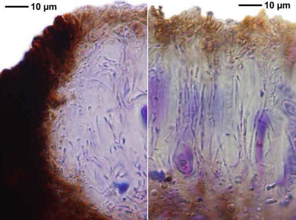

Felix Schumm – CC BY-SA 4.0
[18569], Germany, Rheinland-Pfalz, Kreis Kaiserslautern, Pfälzer Wald, Karlstal südwestlich von Trippstadt, 300-350 m, Buntsandsteingebiet, Schluchtwald (Luzulo-Fagetum), an Fagus sylvatica. Leg. Schumm & Lauer 10.06.1978, det. Schumm.
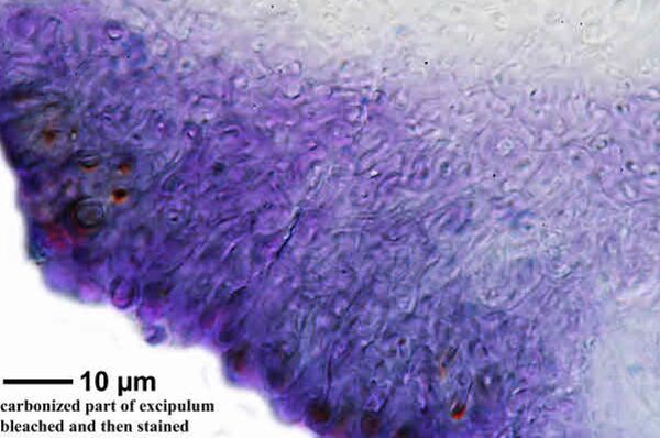

Felix Schumm – CC BY-SA 4.0
[18569], Germany, Rheinland-Pfalz, Kreis Kaiserslautern, Pfälzer Wald, Karlstal südwestlich von Trippstadt, 300-350 m, Buntsandsteingebiet, Schluchtwald (Luzulo-Fagetum), an Fagus sylvatica. Leg. Schumm & Lauer 10.06.1978, det. Schumm.
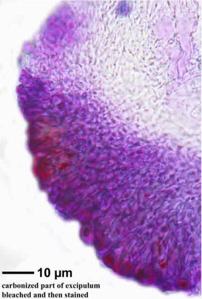

Felix Schumm – CC BY-SA 4.0
[18569], Germany, Rheinland-Pfalz, Kreis Kaiserslautern, Pfälzer Wald, Karlstal südwestlich von Trippstadt, 300-350 m, Buntsandsteingebiet, Schluchtwald (Luzulo-Fagetum), an Fagus sylvatica. Leg. Schumm & Lauer 10.06.1978, det. Schumm.
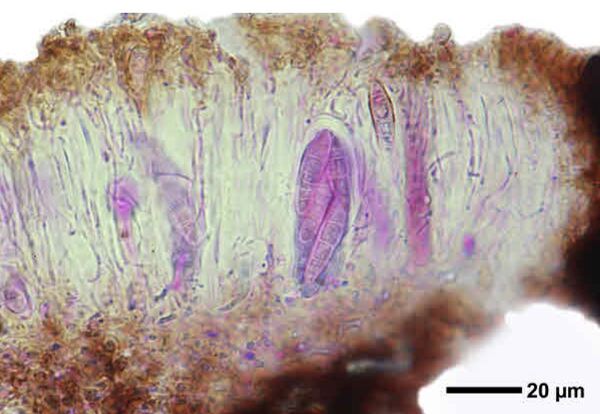

Felix Schumm – CC BY-SA 4.0
[18569], Germany, Rheinland-Pfalz, Kreis Kaiserslautern, Pfälzer Wald, Karlstal südwestlich von Trippstadt, 300-350 m, Buntsandsteingebiet, Schluchtwald (Luzulo-Fagetum), an Fagus sylvatica. Leg. Schumm & Lauer 10.06.1978, det. Schumm.

Felix Schumm – CC BY-SA 4.0
[18569], Germany, Rheinland-Pfalz, Kreis Kaiserslautern, Pfälzer Wald, Karlstal südwestlich von Trippstadt, 300-350 m, Buntsandsteingebiet, Schluchtwald (Luzulo-Fagetum), an Fagus sylvatica. Leg. Schumm & Lauer 10.06.1978, det. Schumm.

Felix Schumm – CC BY-SA 4.0
[18569], Germany, Rheinland-Pfalz, Kreis Kaiserslautern, Pfälzer Wald, Karlstal südwestlich von Trippstadt, 300-350 m, Buntsandsteingebiet, Schluchtwald (Luzulo-Fagetum), an Fagus sylvatica. Leg. Schumm & Lauer 10.06.1978, det. Schumm.


Felix Schumm – CC BY-SA 4.0
[18569], Germany, Rheinland-Pfalz, Kreis Kaiserslautern, Pfälzer Wald, Karlstal südwestlich von Trippstadt, 300-350 m, Buntsandsteingebiet, Schluchtwald (Luzulo-Fagetum), an Fagus sylvatica. Leg. Schumm & Lauer 10.06.1978, det. Schumm.


Felix Schumm – CC BY-SA 4.0
[18569], Germany, Rheinland-Pfalz, Kreis Kaiserslautern, Pfälzer Wald, Karlstal südwestlich von Trippstadt, 300-350 m, Buntsandsteingebiet, Schluchtwald (Luzulo-Fagetum), an Fagus sylvatica. Leg. Schumm & Lauer 10.06.1978, det. Schumm.
Jacques Haine - Source: http://www.lichensmaritimes.org/index.php?task=fiche&lichen=583&lang=en
France, Couvin
Jacques Haine - Source: http://www.lichensmaritimes.org/index.php?task=fiche&lichen=583&lang=en
France, Couvin
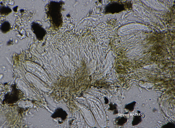
Jacques Haine - Source: http://www.lichensmaritimes.org/index.php?task=fiche&lichen=583&lang=en
France, Couvin
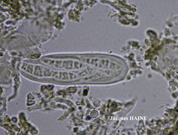
Jacques Haine - Source: http://www.lichensmaritimes.org/index.php?task=fiche&lichen=583&lang=en
France, Couvin
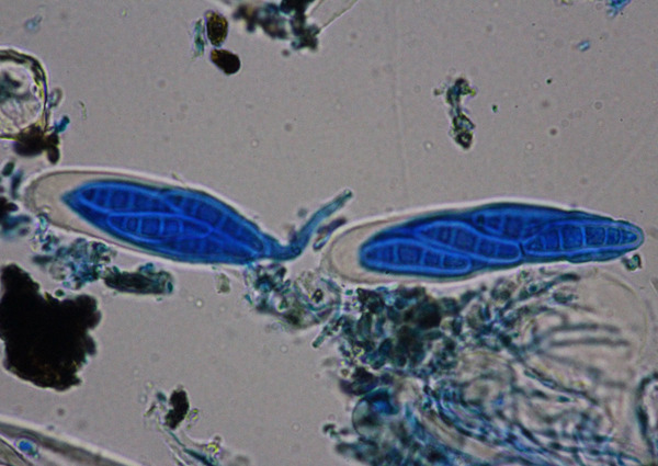
Jacques Haine - Source: http://www.lichensmaritimes.org/index.php?task=fiche&lichen=583&lang=en
France, Couvin
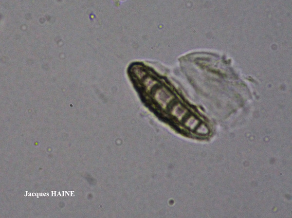
Jacques Haine - Source: http://www.lichensmaritimes.org/index.php?task=fiche&lichen=583&lang=en
France, Couvin
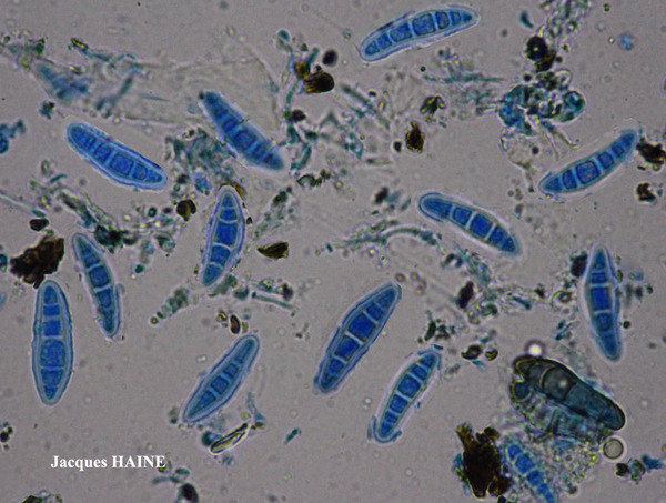
Jacques Haine - Source: http://www.lichensmaritimes.org/index.php?task=fiche&lichen=583&lang=en
France, Couvin
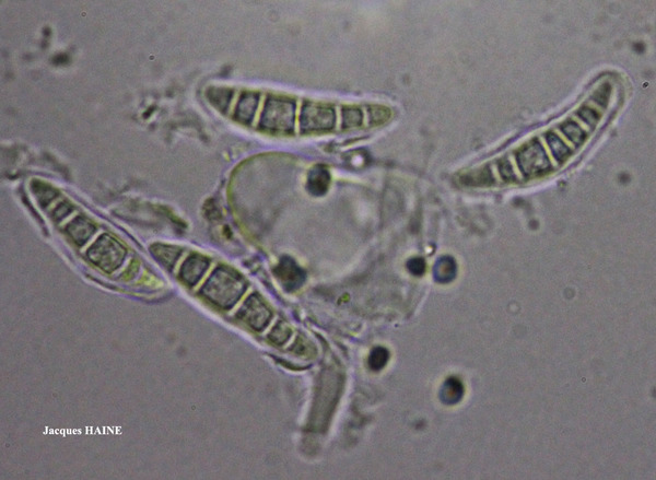
Jacques Haine - Source: http://www.lichensmaritimes.org/index.php?task=fiche&lichen=583&lang=en
France, Couvin
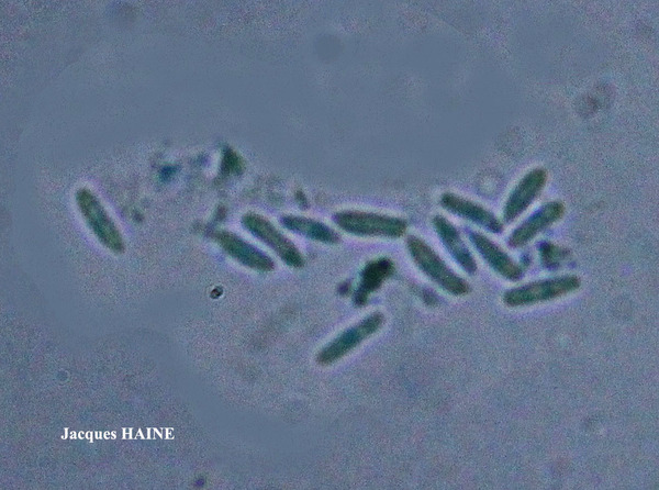
Jacques Haine - Source: http://www.lichensmaritimes.org/index.php?task=fiche&lichen=583&lang=en
France, Couvin
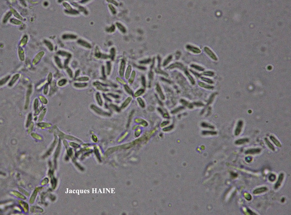
Jacques Haine - Source: http://www.lichensmaritimes.org/index.php?task=fiche&lichen=583&lang=en
France, Couvin
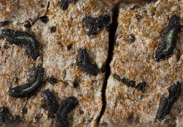
Ulrich Kirschbaum CC BY-SA 4.0 - Source: https://www.thm.de/lse/ulrich-kirschbaum/flechtenbilder
Central Europe; Germany: Hesse.(Coll/ident: Eichler/Cezanne).
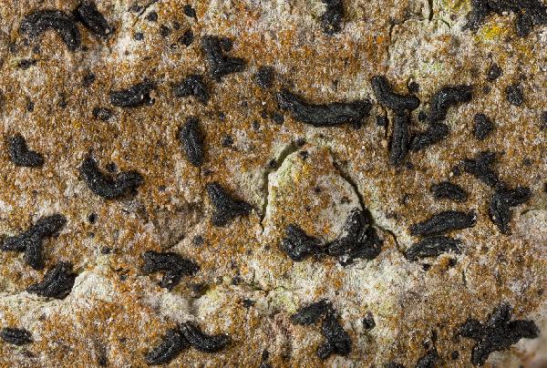
Ulrich Kirschbaum CC BY-SA 4.0 - Source: https://www.thm.de/lse/ulrich-kirschbaum/flechtenbilder
Central Europe; Germany: Hesse.(Coll/ident: Eichler/Cezanne).
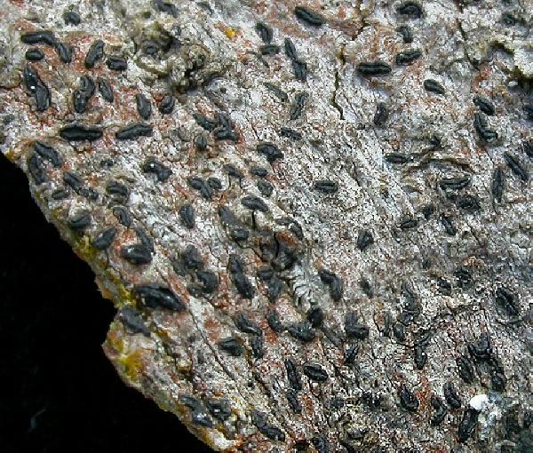
Ulrich Kirschbaum CC BY-SA 4.0 - Source: https://www.thm.de/lse/ulrich-kirschbaum/flechtenbilder
Central Europe; Germany: Hesse. (Coll/ident: Eichler/Cezanne).
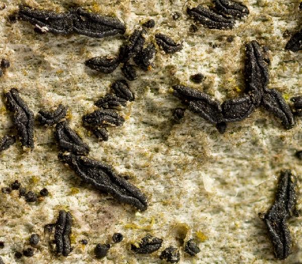
Ulrich Kirschbaum CC BY-SA 4.0 - Source: https://www.thm.de/lse/ulrich-kirschbaum/flechtenbilder
Central Europe; Germany: Baden-Württemberg.
Ulrich Kirschbaum CC BY-SA 4.0 - Source: https://www.thm.de/lse/ulrich-kirschbaum/flechtenbilder
SE Europe; N-Cyprus; E of Girne; Beşparmak Mountains; between Kantara Village and Kantara Castle (picnic area); on Cupressus sempervirens
Ulrich Kirschbaum CC BY-SA 4.0 - Source: https://www.thm.de/lse/ulrich-kirschbaum/flechtenbilder
E Europe; N-Cyprus; SE of Girne; Beşparmak Mountains; between Alevkaya and Antiphonitis Monastery; on Pinus

Ulrich Kirschbaum CC BY-SA 4.0 - Source: https://www.thm.de/lse/ulrich-kirschbaum/flechtenbilder
E Europe; N-Cyprus; SE of Girne; Beşparmak Mountains; between Alevkaya and Antiphonitis Monastery; on Pinus
Ulrich Kirschbaum CC BY-SA 4.0 - Source: https://www.thm.de/lse/ulrich-kirschbaum/flechtenbilder
E Europe; N-Cyprus; SE of Girne; Beşparmak Mountains; between Alevkaya and Antiphonitis Monastery; on Pinus
Ulrich Kirschbaum CC BY-SA 4.0 - Source: https://www.thm.de/lse/ulrich-kirschbaum/flechtenbilder
E Europe; Cyprus; E of Girne: Besparma Mountains; on Cupressus
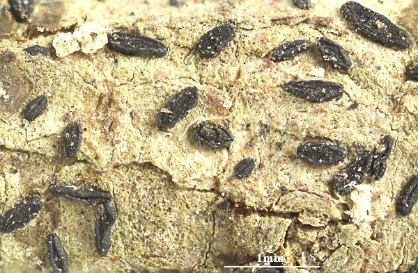

Felix Schumm - CC BY-SA 4.0
[ABL42207], Brazil, Alagoas, Quebrangulo, Pedra Talhada private
area. In Atlantic rain forest on tree bark. 9°15’ S, 36°25’35’’ W, 500-700
m. Leg. M. Cáceres & A. Aptroot (no 42207), 21-23.10.2017. Det. A.
Aptroot, 2017. - Spores 4-septate, 25 x 5 μm with 3μm gel.
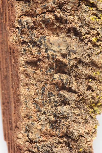
Collezione lichenologica Abramo Massalongo del Museo di Storia Naturale G. Ligabue di Venezia - Autori: Seggi, Linda; Trabucco, Raffaella Proprietà: Fondazione Musei Civici di Venezia - CC BY-NC
Italy, Veneto, in op. Badia
as Opegrapha varia α lichenoides Schaer!
Growth form: Crustose
Substrata: bark
Photobiont: Trentepohlia
Reproductive strategy: mainly sexual
Commonnes-rarity: (info)
Alpine belt: absent
Subalpine belt: extremely rare
Oromediterranean belt: absent
Montane belt: very rare
Submediterranean belt: rare
Padanian area: extremely rare
Humid submediterranean belt: rather rare
Humid mediterranean belt: rare
Dry mediterranean belt: absent

Predictive model
| Herbarium samples |


P.L. Nimis; Owner: Department of Life Sciences, University of Trieste
Herbarium: TSB (7615)
2001/11/27


P.L. Nimis; Owner: Department of Life Sciences, University of Trieste
Herbarium: TSB (7615)
2001/11/27


P.L. Nimis; Owner: Department of Life Sciences, University of Trieste
Herbarium: TSB (19647)
2001/11/27


P.L. Nimis; Owner: Department of Life Sciences, University of Trieste
Herbarium: TSB (19647)
2001/11/27


Juri Nascimbene; Owner: Department of Life Sciences, University of Trieste
Italy, Trentino-Alto Adige, Trento, Villa Welsperg, Centro Visitatori del Parco di Paneveggio; altitude: 1030 m
03.04.2009


Juri Nascimbene; Owner: Department of Life Sciences, University of Trieste
Italy, Trentino-Alto Adige, Trento, Villa Welsperg, Centro Visitatori del Parco di Paneveggio; altitude: 1030 m
03.04.2009


Juri Nascimbene; Owner: Department of Life Sciences, University of Trieste
Italy, Trentino-Alto Adige, Trento, Villa Welsperg, Centro Visitatori del Parco di Paneveggio; altitude: 1030 m
03.04.2009


Juri Nascimbene; Owner: Department of Life Sciences, University of Trieste
Italy, Trentino-Alto Adige, Trento, Villa Welsperg, Centro Visitatori del Parco di Paneveggio; altitude: 1030 m
03.04.2009


Curtis Randall Björk, - CC BY-SA 4.0
Campus of Royal Roads University, Victoria, British Columbia, Canada Canada
2017


Felix Schumm – CC BY-SA 4.0
[1030], Gemany, Baden-Württemberg, Schwäbische Alb, Kreis Heidenheim, im Wental an Laubbäumen, ca 600 m. TK: 7226. Leg. F. Schumm 04.1967, det. F. Schumm.


Felix Schumm – CC BY-SA 4.0
[1030], Gemany, Baden-Württemberg, Schwäbische Alb, Kreis Heidenheim, im Wental an Laubbäumen, ca 600 m. TK: 7226. Leg. F. Schumm 04.1967, det. F. Schumm.


Felix Schumm – CC BY-SA 4.0
[1030], Gemany, Baden-Württemberg, Schwäbische Alb, Kreis Heidenheim, im Wental an Laubbäumen, ca 600 m. TK: 7226. Leg. F. Schumm 04.1967, det. F. Schumm.


Felix Schumm – CC BY-SA 4.0
[1030], Gemany, Baden-Württemberg, Schwäbische Alb, Kreis Heidenheim, im Wental an Laubbäumen, ca 600 m. TK: 7226. Leg. F. Schumm 04.1967, det. F. Schumm.


Felix Schumm – CC BY-SA 4.0
[1030], Gemany, Baden-Württemberg, Schwäbische Alb, Kreis Heidenheim, im Wental an Laubbäumen, ca 600 m. TK: 7226. Leg. F. Schumm 04.1967, det. F. Schumm.


Felix Schumm – CC BY-SA 4.0
[1030], Gemany, Baden-Württemberg, Schwäbische Alb, Kreis Heidenheim, im Wental an Laubbäumen, ca 600 m. TK: 7226. Leg. F. Schumm 04.1967, det. F. Schumm.


Felix Schumm – CC BY-SA 4.0
[6967], Germany, Baden-Württemberg, Rems-Murr-Kreis, 5 km westlich von Welzheim im Rotal, Stubensandsteingebiet, an Eiche, luftfeucht; 440 m, TK: 7124/NW. Leg. Schumm & Schwarz 23.04.2000, det. F. Schumm 2007


Felix Schumm – CC BY-SA 4.0
[6967], Germany, Baden-Württemberg, Rems-Murr-Kreis, 5 km westlich von Welzheim im Rotal, Stubensandsteingebiet, an Eiche, luftfeucht; 440 m, TK: 7124/NW. Leg. Schumm & Schwarz 23.04.2000, det. F. Schumm 2007


Felix Schumm – CC BY-SA 4.0
[6967], Germany, Baden-Württemberg, Rems-Murr-Kreis, 5 km westlich von Welzheim im Rotal, Stubensandsteingebiet, an Eiche, luftfeucht; 440 m, TK: 7124/NW. Leg. Schumm & Schwarz 23.04.2000, det. F. Schumm 2007


Felix Schumm – CC BY-SA 4.0
[6967], Germany, Baden-Württemberg, Rems-Murr-Kreis, 5 km westlich von Welzheim im Rotal, Stubensandsteingebiet, an Eiche, luftfeucht; 440 m, TK: 7124/NW. Leg. Schumm & Schwarz 23.04.2000, det. F. Schumm 2007


Felix Schumm – CC BY-SA 4.0
[6967], Germany, Baden-Württemberg, Rems-Murr-Kreis, 5 km westlich von Welzheim im Rotal, Stubensandsteingebiet, an Eiche, luftfeucht; 440 m, TK: 7124/NW. Leg. Schumm & Schwarz 23.04.2000, det. F. Schumm 2007


Felix Schumm – CC BY-SA 4.0
[6967], Germany, Baden-Württemberg, Rems-Murr-Kreis, 5 km westlich von Welzheim im Rotal, Stubensandsteingebiet, an Eiche, luftfeucht; 440 m, TK: 7124/NW. Leg. Schumm & Schwarz 23.04.2000, det. F. Schumm 2007


Felix Schumm – CC BY-SA 4.0
[6967], Germany, Baden-Württemberg, Rems-Murr-Kreis, 5 km westlich von Welzheim im Rotal, Stubensandsteingebiet, an Eiche, luftfeucht; 440 m, TK: 7124/NW. Leg. Schumm & Schwarz 23.04.2000, det. F. Schumm 2007


Felix Schumm – CC BY-SA 4.0
[6967], Germany, Baden-Württemberg, Rems-Murr-Kreis, 5 km westlich von Welzheim im Rotal, Stubensandsteingebiet, an Eiche, luftfeucht; 440 m, TK: 7124/NW. Leg. Schumm & Schwarz 23.04.2000, det. F. Schumm 2007


Felix Schumm – CC BY-SA 4.0
[6967], Germany, Baden-Württemberg, Rems-Murr-Kreis, 5 km westlich von Welzheim im Rotal, Stubensandsteingebiet, an Eiche, luftfeucht; 440 m, TK: 7124/NW. Leg. Schumm & Schwarz 23.04.2000, det. F. Schumm 2007


Felix Schumm – CC BY-SA 4.0
[6967], Germany, Baden-Württemberg, Rems-Murr-Kreis, 5 km westlich von Welzheim im Rotal, Stubensandsteingebiet, an Eiche, luftfeucht; 440 m, TK: 7124/NW. Leg. Schumm & Schwarz 23.04.2000, det. F. Schumm 2007


Felix Schumm – CC BY-SA 4.0
[6967], Germany, Baden-Württemberg, Rems-Murr-Kreis, 5 km westlich von Welzheim im Rotal, Stubensandsteingebiet, an Eiche, luftfeucht; 440 m, TK: 7124/NW. Leg. Schumm & Schwarz 23.04.2000, det. F. Schumm 2007


Felix Schumm – CC BY-SA 4.0
[6967], Germany, Baden-Württemberg, Rems-Murr-Kreis, 5 km westlich von Welzheim im Rotal, Stubensandsteingebiet, an Eiche, luftfeucht; 440 m, TK: 7124/NW. Leg. Schumm & Schwarz 23.04.2000, det. F. Schumm 2007


Felix Schumm – CC BY-SA 4.0
[13631], Germany, Baden-Württemberg, Kreis Göppingen, südwestlich von Adelberg nahe dem Herrenbachstausee, Buhwiesenweg, corticol im Mischwald, ca. 48°44'N, 9°33'E, 412 m. Leg. Schumm 08.02.2008


Felix Schumm – CC BY-SA 4.0
[13631], Germany, Baden-Württemberg, Kreis Göppingen, südwestlich von Adelberg nahe dem Herrenbachstausee, Buhwiesenweg, corticol im Mischwald, ca. 48°44'N, 9°33'E, 412 m. Leg. Schumm 08.02.2008


Felix Schumm – CC BY-SA 4.0
[13631], Germany, Baden-Württemberg, Kreis Göppingen, südwestlich von Adelberg nahe dem Herrenbachstausee, Buhwiesenweg, corticol im Mischwald, ca. 48°44'N, 9°33'E, 412 m. Leg. Schumm 08.02.2008


Felix Schumm – CC BY-SA 4.0
[13631], Germany, Baden-Württemberg, Kreis Göppingen, südwestlich von Adelberg nahe dem Herrenbachstausee, Buhwiesenweg, corticol im Mischwald, ca. 48°44'N, 9°33'E, 412 m. Leg. Schumm 08.02.2008


Felix Schumm – CC BY-SA 4.0
[13631], Germany, Baden-Württemberg, Kreis Göppingen, südwestlich von Adelberg nahe dem Herrenbachstausee, Buhwiesenweg, corticol im Mischwald, ca. 48°44'N, 9°33'E, 412 m. Leg. Schumm 08.02.2008


Felix Schumm – CC BY-SA 4.0
[16464], GERMANY, Baden-Württemberg, Kreis Göppingen, im Herrenbachtal zwischen Rechberghausen und der Zachersmühle, 48.74100°N, 9.62803° E, 330 m. Leg. Schumm 11.04.2010.


Felix Schumm – CC BY-SA 4.0
[16464], GERMANY, Baden-Württemberg, Kreis Göppingen, im Herrenbachtal zwischen Rechberghausen und der Zachersmühle, 48.74100°N, 9.62803° E, 330 m. Leg. Schumm 11.04.2010.


Felix Schumm – CC BY-SA 4.0
[16464], GERMANY, Baden-Württemberg, Kreis Göppingen, im Herrenbachtal zwischen Rechberghausen und der Zachersmühle, 48.74100°N, 9.62803° E, 330 m. Leg. Schumm 11.04.2010.


Felix Schumm – CC BY-SA 4.0
[16464], GERMANY, Baden-Württemberg, Kreis Göppingen, im Herrenbachtal zwischen Rechberghausen und der Zachersmühle, 48.74100°N, 9.62803° E, 330 m. Leg. Schumm 11.04.2010.


Felix Schumm – CC BY-SA 4.0
[18569], Germany, Rheinland-Pfalz, Kreis Kaiserslautern, Pfälzer Wald, Karlstal südwestlich von Trippstadt, 300-350 m, Buntsandsteingebiet, Schluchtwald (Luzulo-Fagetum), an Fagus sylvatica. Leg. Schumm & Lauer 10.06.1978, det. Schumm.


Felix Schumm – CC BY-SA 4.0
[18569], Germany, Rheinland-Pfalz, Kreis Kaiserslautern, Pfälzer Wald, Karlstal südwestlich von Trippstadt, 300-350 m, Buntsandsteingebiet, Schluchtwald (Luzulo-Fagetum), an Fagus sylvatica. Leg. Schumm & Lauer 10.06.1978, det. Schumm.


Felix Schumm – CC BY-SA 4.0
[18569], Germany, Rheinland-Pfalz, Kreis Kaiserslautern, Pfälzer Wald, Karlstal südwestlich von Trippstadt, 300-350 m, Buntsandsteingebiet, Schluchtwald (Luzulo-Fagetum), an Fagus sylvatica. Leg. Schumm & Lauer 10.06.1978, det. Schumm.


Felix Schumm – CC BY-SA 4.0
[18569], Germany, Rheinland-Pfalz, Kreis Kaiserslautern, Pfälzer Wald, Karlstal südwestlich von Trippstadt, 300-350 m, Buntsandsteingebiet, Schluchtwald (Luzulo-Fagetum), an Fagus sylvatica. Leg. Schumm & Lauer 10.06.1978, det. Schumm.


Felix Schumm – CC BY-SA 4.0
[18569], Germany, Rheinland-Pfalz, Kreis Kaiserslautern, Pfälzer Wald, Karlstal südwestlich von Trippstadt, 300-350 m, Buntsandsteingebiet, Schluchtwald (Luzulo-Fagetum), an Fagus sylvatica. Leg. Schumm & Lauer 10.06.1978, det. Schumm.


Felix Schumm – CC BY-SA 4.0
[18569], Germany, Rheinland-Pfalz, Kreis Kaiserslautern, Pfälzer Wald, Karlstal südwestlich von Trippstadt, 300-350 m, Buntsandsteingebiet, Schluchtwald (Luzulo-Fagetum), an Fagus sylvatica. Leg. Schumm & Lauer 10.06.1978, det. Schumm.


Felix Schumm – CC BY-SA 4.0
[18569], Germany, Rheinland-Pfalz, Kreis Kaiserslautern, Pfälzer Wald, Karlstal südwestlich von Trippstadt, 300-350 m, Buntsandsteingebiet, Schluchtwald (Luzulo-Fagetum), an Fagus sylvatica. Leg. Schumm & Lauer 10.06.1978, det. Schumm.


Felix Schumm – CC BY-SA 4.0
[18569], Germany, Rheinland-Pfalz, Kreis Kaiserslautern, Pfälzer Wald, Karlstal südwestlich von Trippstadt, 300-350 m, Buntsandsteingebiet, Schluchtwald (Luzulo-Fagetum), an Fagus sylvatica. Leg. Schumm & Lauer 10.06.1978, det. Schumm.


Felix Schumm – CC BY-SA 4.0
[18569], Germany, Rheinland-Pfalz, Kreis Kaiserslautern, Pfälzer Wald, Karlstal südwestlich von Trippstadt, 300-350 m, Buntsandsteingebiet, Schluchtwald (Luzulo-Fagetum), an Fagus sylvatica. Leg. Schumm & Lauer 10.06.1978, det. Schumm.


Felix Schumm – CC BY-SA 4.0
[18569], Germany, Rheinland-Pfalz, Kreis Kaiserslautern, Pfälzer Wald, Karlstal südwestlich von Trippstadt, 300-350 m, Buntsandsteingebiet, Schluchtwald (Luzulo-Fagetum), an Fagus sylvatica. Leg. Schumm & Lauer 10.06.1978, det. Schumm.


Felix Schumm – CC BY-SA 4.0
[18569], Germany, Rheinland-Pfalz, Kreis Kaiserslautern, Pfälzer Wald, Karlstal südwestlich von Trippstadt, 300-350 m, Buntsandsteingebiet, Schluchtwald (Luzulo-Fagetum), an Fagus sylvatica. Leg. Schumm & Lauer 10.06.1978, det. Schumm.


Felix Schumm – CC BY-SA 4.0
[18569], Germany, Rheinland-Pfalz, Kreis Kaiserslautern, Pfälzer Wald, Karlstal südwestlich von Trippstadt, 300-350 m, Buntsandsteingebiet, Schluchtwald (Luzulo-Fagetum), an Fagus sylvatica. Leg. Schumm & Lauer 10.06.1978, det. Schumm.


Felix Schumm – CC BY-SA 4.0
[18569], Germany, Rheinland-Pfalz, Kreis Kaiserslautern, Pfälzer Wald, Karlstal südwestlich von Trippstadt, 300-350 m, Buntsandsteingebiet, Schluchtwald (Luzulo-Fagetum), an Fagus sylvatica. Leg. Schumm & Lauer 10.06.1978, det. Schumm.


Felix Schumm – CC BY-SA 4.0
[18569], Germany, Rheinland-Pfalz, Kreis Kaiserslautern, Pfälzer Wald, Karlstal südwestlich von Trippstadt, 300-350 m, Buntsandsteingebiet, Schluchtwald (Luzulo-Fagetum), an Fagus sylvatica. Leg. Schumm & Lauer 10.06.1978, det. Schumm.


Felix Schumm – CC BY-SA 4.0
[18569], Germany, Rheinland-Pfalz, Kreis Kaiserslautern, Pfälzer Wald, Karlstal südwestlich von Trippstadt, 300-350 m, Buntsandsteingebiet, Schluchtwald (Luzulo-Fagetum), an Fagus sylvatica. Leg. Schumm & Lauer 10.06.1978, det. Schumm.


Felix Schumm – CC BY-SA 4.0
[18569], Germany, Rheinland-Pfalz, Kreis Kaiserslautern, Pfälzer Wald, Karlstal südwestlich von Trippstadt, 300-350 m, Buntsandsteingebiet, Schluchtwald (Luzulo-Fagetum), an Fagus sylvatica. Leg. Schumm & Lauer 10.06.1978, det. Schumm.

Jacques Haine - Source: http://www.lichensmaritimes.org/index.php?task=fiche&lichen=583&lang=en
France, Couvin

Jacques Haine - Source: http://www.lichensmaritimes.org/index.php?task=fiche&lichen=583&lang=en
France, Couvin

Jacques Haine - Source: http://www.lichensmaritimes.org/index.php?task=fiche&lichen=583&lang=en
France, Couvin

Jacques Haine - Source: http://www.lichensmaritimes.org/index.php?task=fiche&lichen=583&lang=en
France, Couvin

Jacques Haine - Source: http://www.lichensmaritimes.org/index.php?task=fiche&lichen=583&lang=en
France, Couvin

Jacques Haine - Source: http://www.lichensmaritimes.org/index.php?task=fiche&lichen=583&lang=en
France, Couvin

Jacques Haine - Source: http://www.lichensmaritimes.org/index.php?task=fiche&lichen=583&lang=en
France, Couvin

Jacques Haine - Source: http://www.lichensmaritimes.org/index.php?task=fiche&lichen=583&lang=en
France, Couvin

Jacques Haine - Source: http://www.lichensmaritimes.org/index.php?task=fiche&lichen=583&lang=en
France, Couvin

Jacques Haine - Source: http://www.lichensmaritimes.org/index.php?task=fiche&lichen=583&lang=en
France, Couvin

Ulrich Kirschbaum CC BY-SA 4.0 - Source: https://www.thm.de/lse/ulrich-kirschbaum/flechtenbilder
Central Europe; Germany: Hesse.(Coll/ident: Eichler/Cezanne).

Ulrich Kirschbaum CC BY-SA 4.0 - Source: https://www.thm.de/lse/ulrich-kirschbaum/flechtenbilder
Central Europe; Germany: Hesse.(Coll/ident: Eichler/Cezanne).

Ulrich Kirschbaum CC BY-SA 4.0 - Source: https://www.thm.de/lse/ulrich-kirschbaum/flechtenbilder
Central Europe; Germany: Hesse. (Coll/ident: Eichler/Cezanne).

Ulrich Kirschbaum CC BY-SA 4.0 - Source: https://www.thm.de/lse/ulrich-kirschbaum/flechtenbilder
Central Europe; Germany: Baden-Württemberg.

Ulrich Kirschbaum CC BY-SA 4.0 - Source: https://www.thm.de/lse/ulrich-kirschbaum/flechtenbilder
SE Europe; N-Cyprus; E of Girne; Beşparmak Mountains; between Kantara Village and Kantara Castle (picnic area); on Cupressus sempervirens

Ulrich Kirschbaum CC BY-SA 4.0 - Source: https://www.thm.de/lse/ulrich-kirschbaum/flechtenbilder
E Europe; N-Cyprus; SE of Girne; Beşparmak Mountains; between Alevkaya and Antiphonitis Monastery; on Pinus

Ulrich Kirschbaum CC BY-SA 4.0 - Source: https://www.thm.de/lse/ulrich-kirschbaum/flechtenbilder
E Europe; N-Cyprus; SE of Girne; Beşparmak Mountains; between Alevkaya and Antiphonitis Monastery; on Pinus

Ulrich Kirschbaum CC BY-SA 4.0 - Source: https://www.thm.de/lse/ulrich-kirschbaum/flechtenbilder
E Europe; N-Cyprus; SE of Girne; Beşparmak Mountains; between Alevkaya and Antiphonitis Monastery; on Pinus

Ulrich Kirschbaum CC BY-SA 4.0 - Source: https://www.thm.de/lse/ulrich-kirschbaum/flechtenbilder
E Europe; Cyprus; E of Girne: Besparma Mountains; on Cupressus


Felix Schumm - CC BY-SA 4.0
[ABL42207], Brazil, Alagoas, Quebrangulo, Pedra Talhada private area. In Atlantic rain forest on tree bark. 9°15’ S, 36°25’35’’ W, 500-700 m. Leg. M. Cáceres & A. Aptroot (no 42207), 21-23.10.2017. Det. A. Aptroot, 2017. - Spores 4-septate, 25 x 5 μm with 3μm gel.

 INDEX FUNGORUM
 GBIF
GBIF
 DOLICHENS
