Acarospora laqueata Stizenb.
in Flagey, Herbor. Lich. Envir. Constantine: 131, 1888.
Synonyms: Acarospora caesiocinerea B. de Lesd.?; Acarospora cervina f. larvata (Müll. Arg.) H. Magn.?; Acarospora pitardii B. de Lesd.?; Lecanora laqueata (Stizenb.) Stizenb.
Distribution: N - Ven (Nascimbene & al. 2021), Lomb. C - Mol (Nimis & Tretiach 1999, Caporale & al. 2008). S - Camp (Aprile & al. 2003b), Si (Nascimbene & al. 2021).
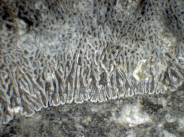
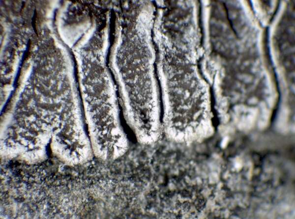
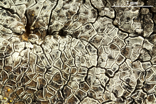
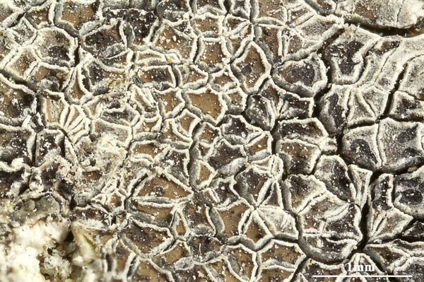
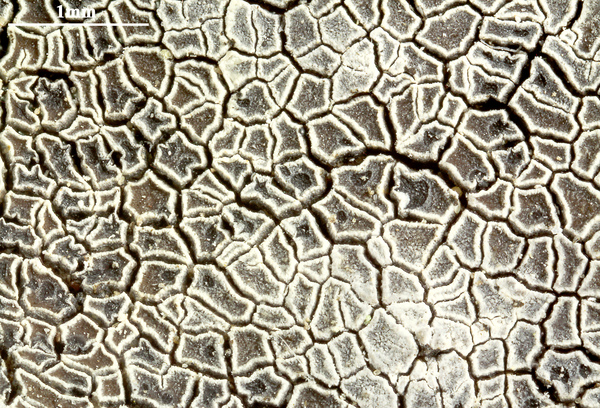
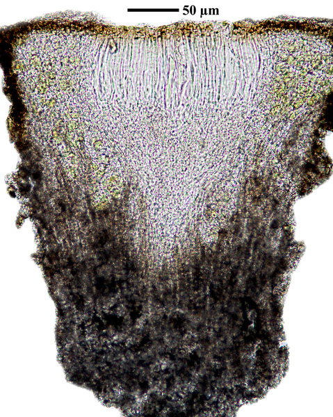
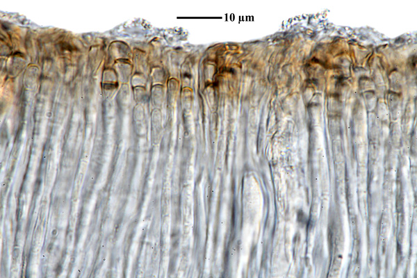
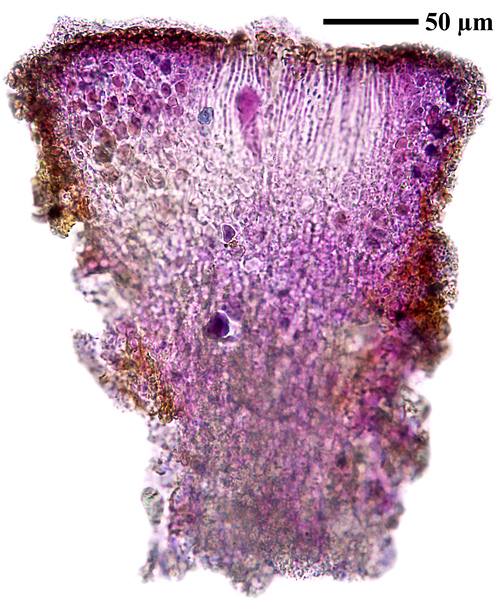
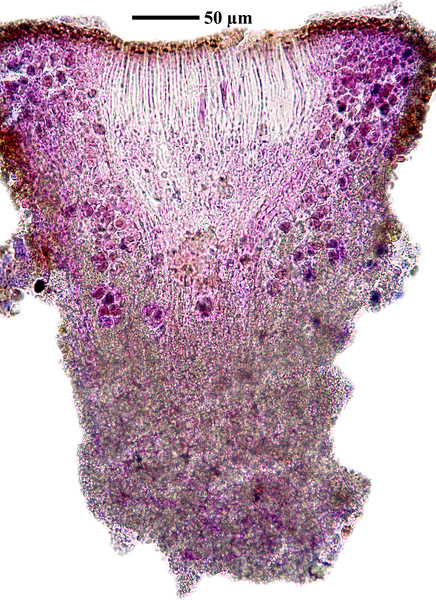
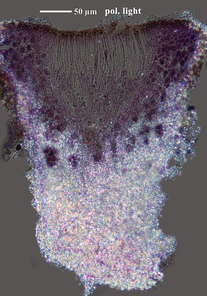
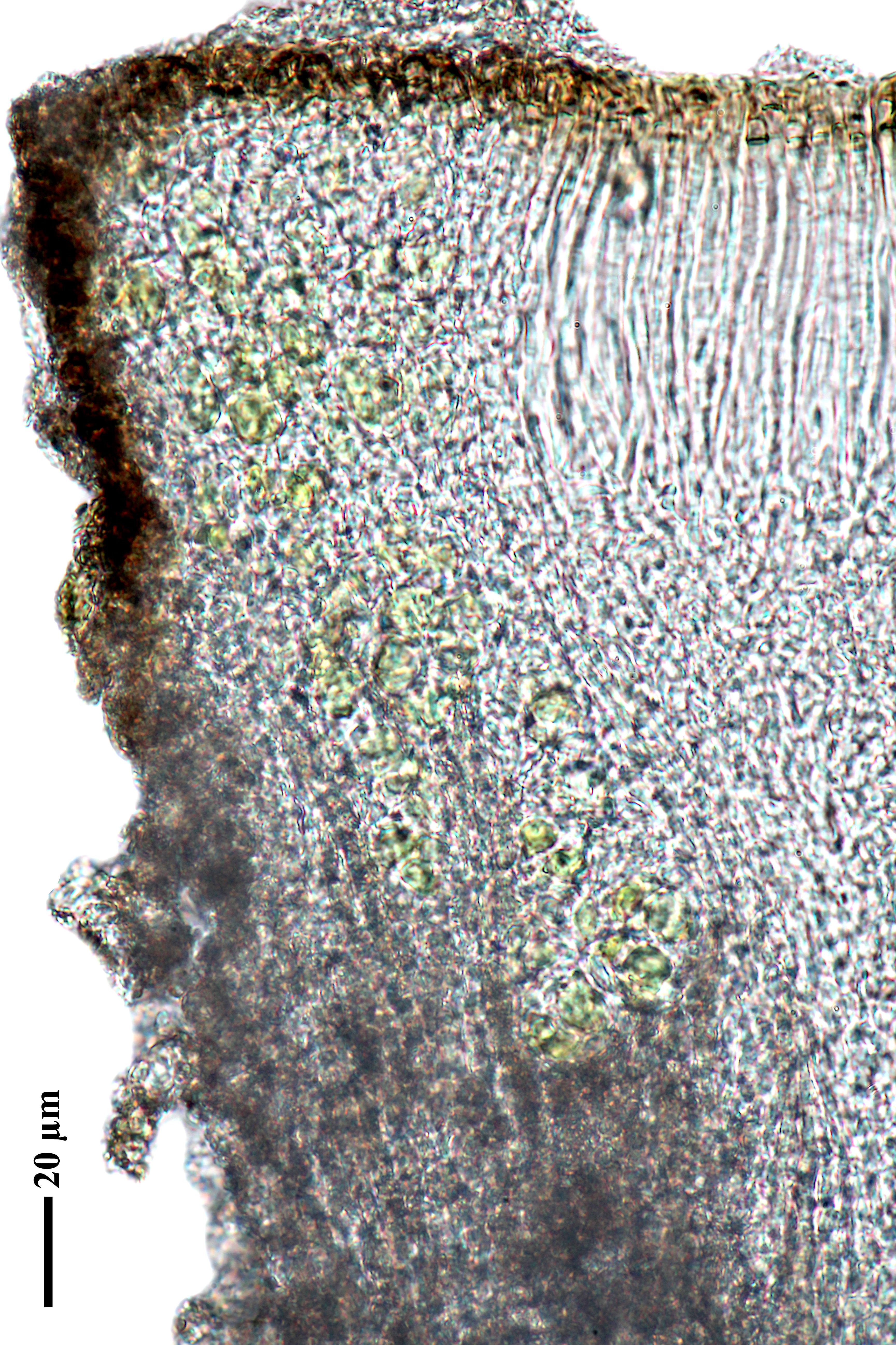
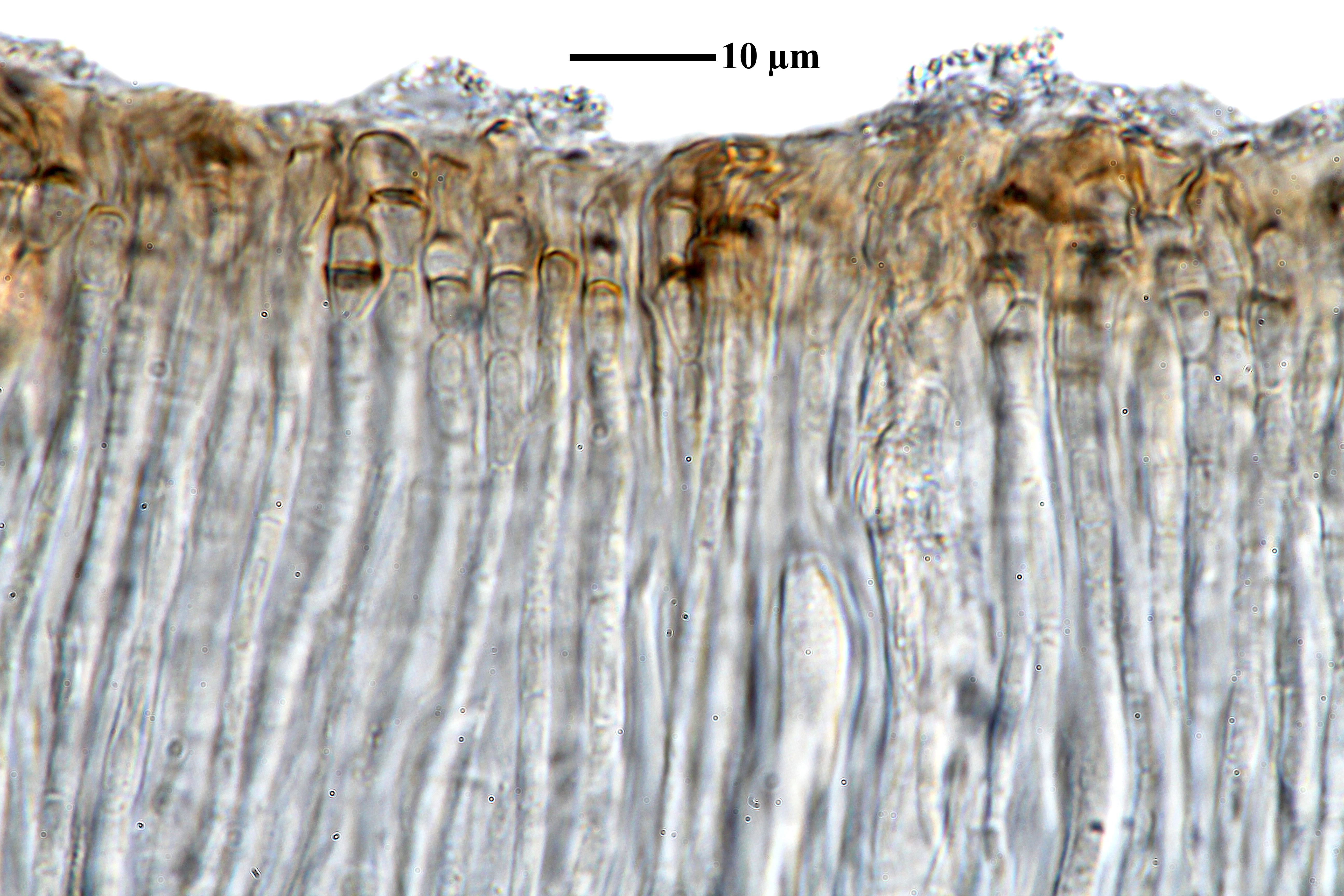
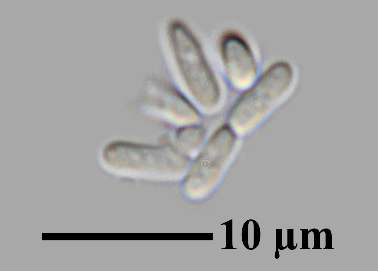
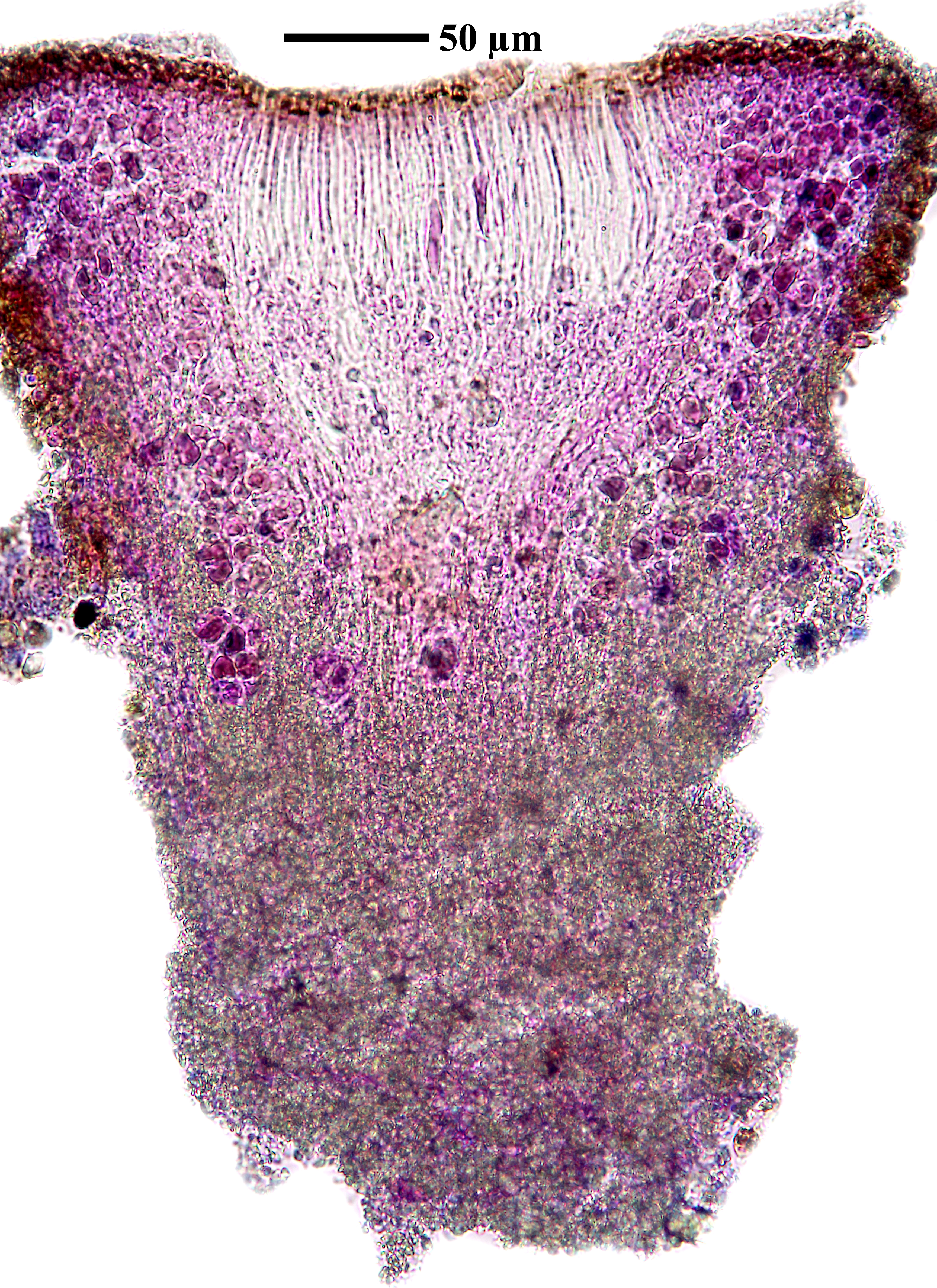
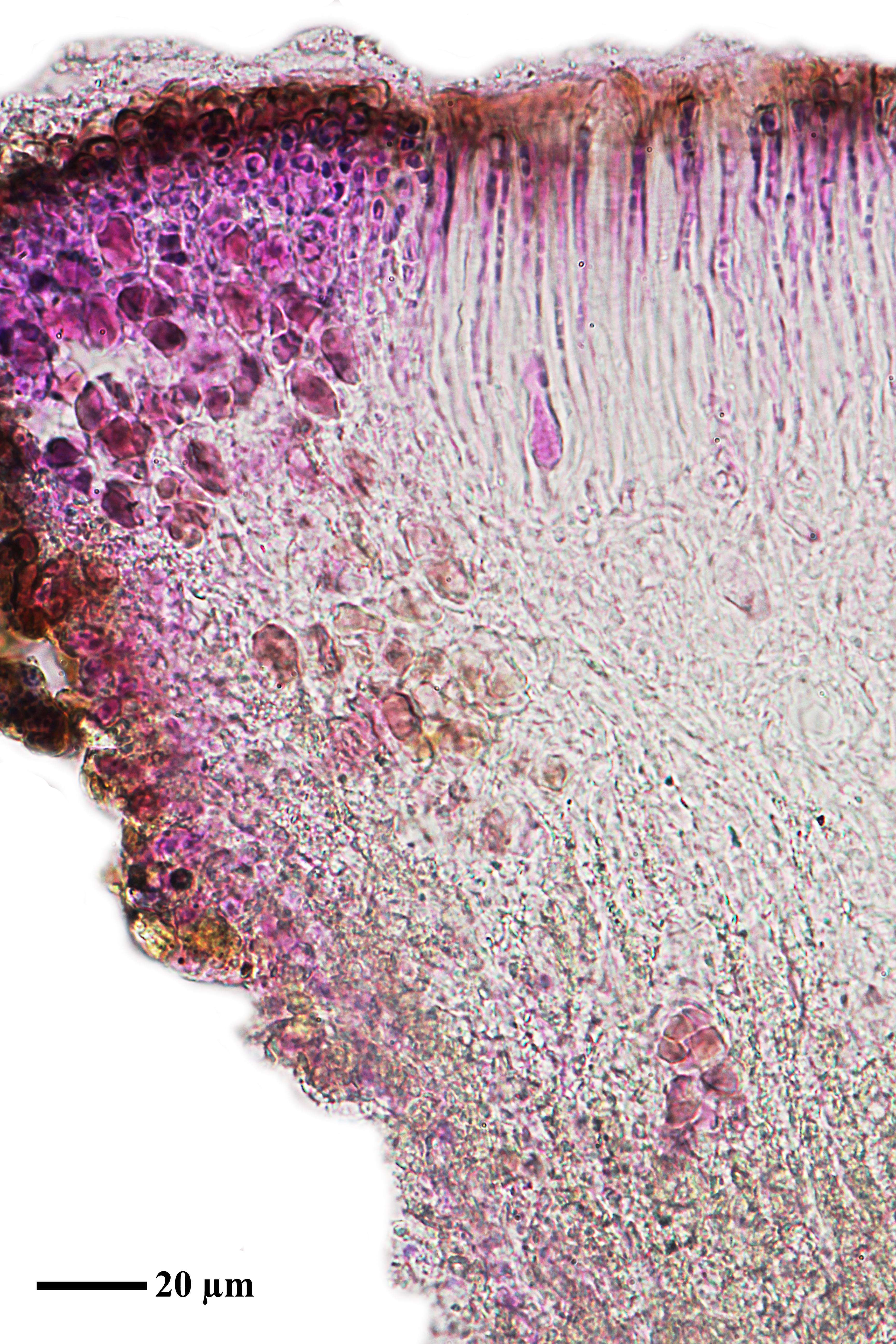
Description: Thallus crustose-placodioid, episubstratic, areolate in central parts, clearly lobed at margins, pale to dark brown, but densely white- or blue-grey-pruinose, forming orbicular rosettes to 12 cm across. Areoles 0.2-0.8 mm wide, slightly concave to flat, angular, with raised, white margins; lobes 0.2-0.8 mm wide, 0.6-3 mm long, mostly flat, contiguous, with slightly enlarged tips, often surrounded by a white rim. Algal layer continuous in upper part, 50-65 μm thick; medulla white to grey-white, thick, filled with crystals. Apothecia cryptolecanorine, immersed, 1-2(-5) per areole, 0.2-0.6 mm across, round or angular, with a concave, reddish brown to brown-black disc, and an indistinct thalline margin. Proper exciple thin, inconspicuous; epithecium brown; hymenium colourless, 80-120 μm high, I+ blue; paraphyses 2-3.5 μm thick at base, the apical cells slightly swollen; hypothecium colourless, 30-100 μm high. Asci >100-spored, clavate, the apical dome K/I-. Ascospores 1-celled, hyaline, long-ellipsoid, 4-6(-8) x 1.5-3 μm. Photobiont chlorococcoid. Spot tests: cortex and medulla K-, C-, KC-, P-, UV-. Chemistry: without lichen substances. Note: on hard calcareous rocks, both on vertical faces and at the top of birds' perching sites in dry-continental areas (eastern side of the Peninsula, continental Alpine valleys), below the subalpine belt.
Growth form: Crustose placodiomorph
Substrata: rocks
Photobiont: green algae other than Trentepohlia
Reproductive strategy: mainly sexual
Subcontinental: restricted to areas with a dry-subcontinental climate (e.g. dry Alpine valleys, parts of Mediterranean Italy)
Commonnes-rarity: (info)
Alpine belt: extremely rare
Subalpine belt: extremely rare
Oromediterranean belt: absent
Montane belt: extremely rare
Submediterranean belt: very rare
Padanian area: absent
Humid submediterranean belt: absent
Humid mediterranean belt: absent
Dry mediterranean belt: extremely rare
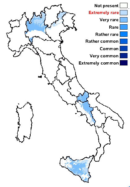
Predictive model
Herbarium samples

P.L. Nimis (CC BY-SA 4.0)
TSB 27085
P.L. Nimis; Owner: Department of Life Sciences, University of Trieste
Herbarium: TSB (27085)
2001/12/08
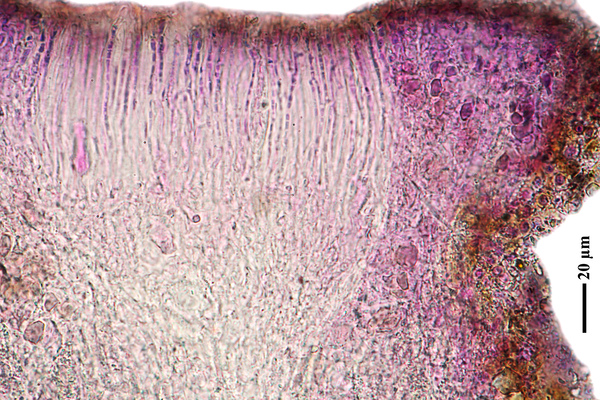
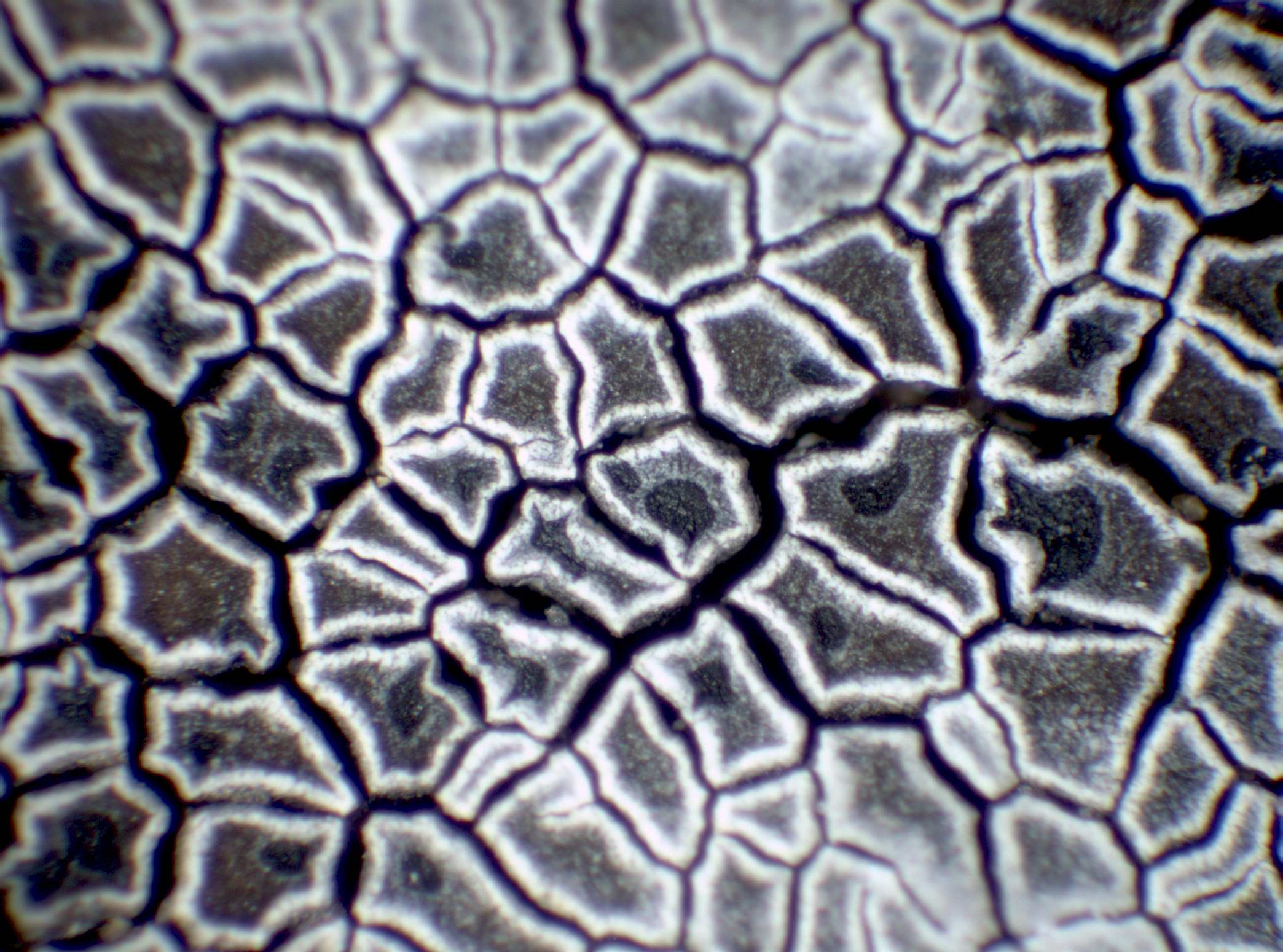
tip of marginal lobes

P.L. Nimis; Owner: Department of Life Sciences, University of Trieste
Herbarium: TSB (27085)
2001/12/08
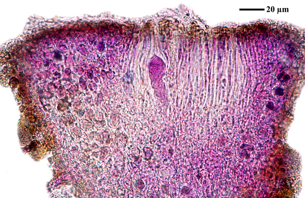
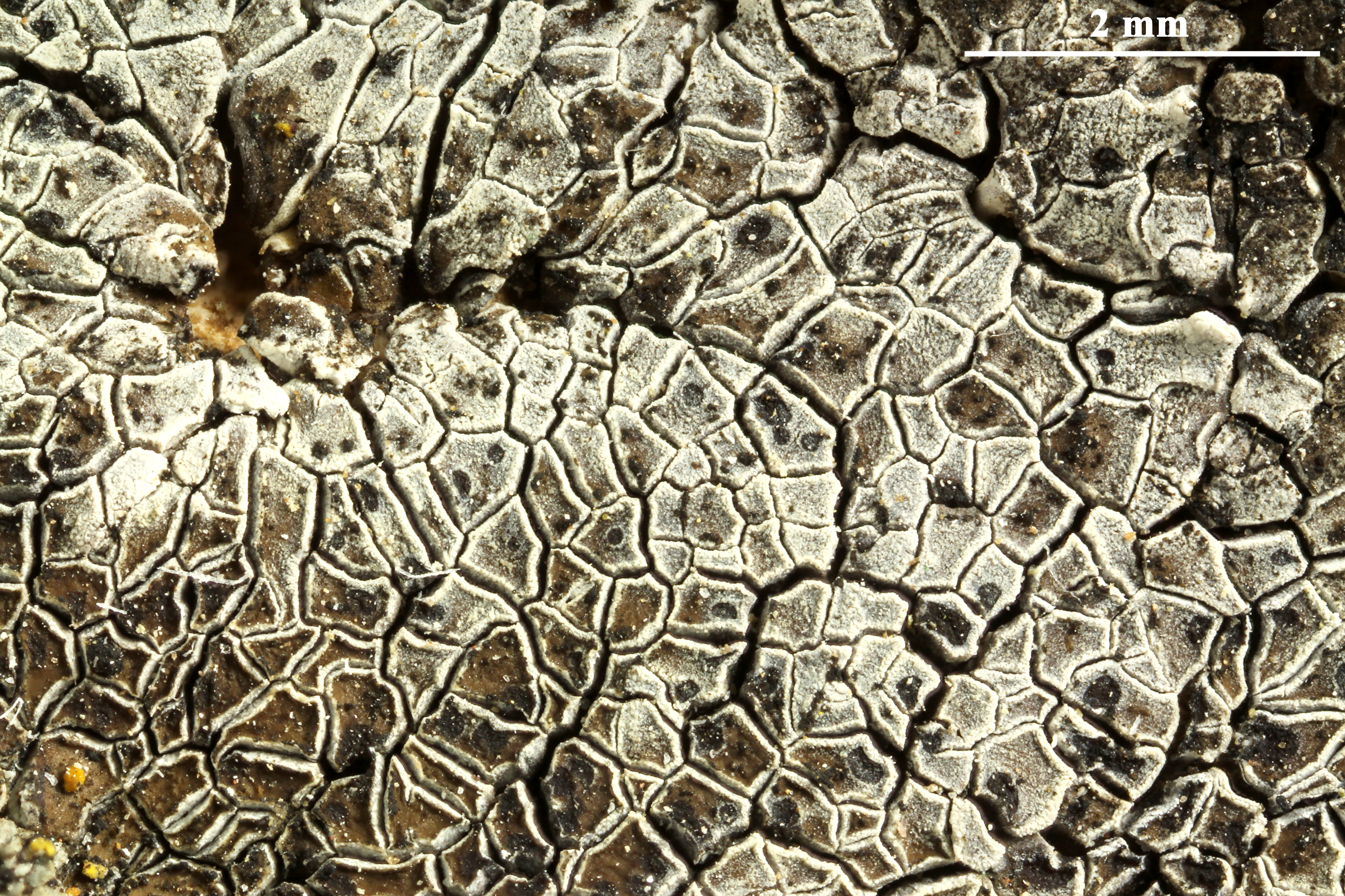
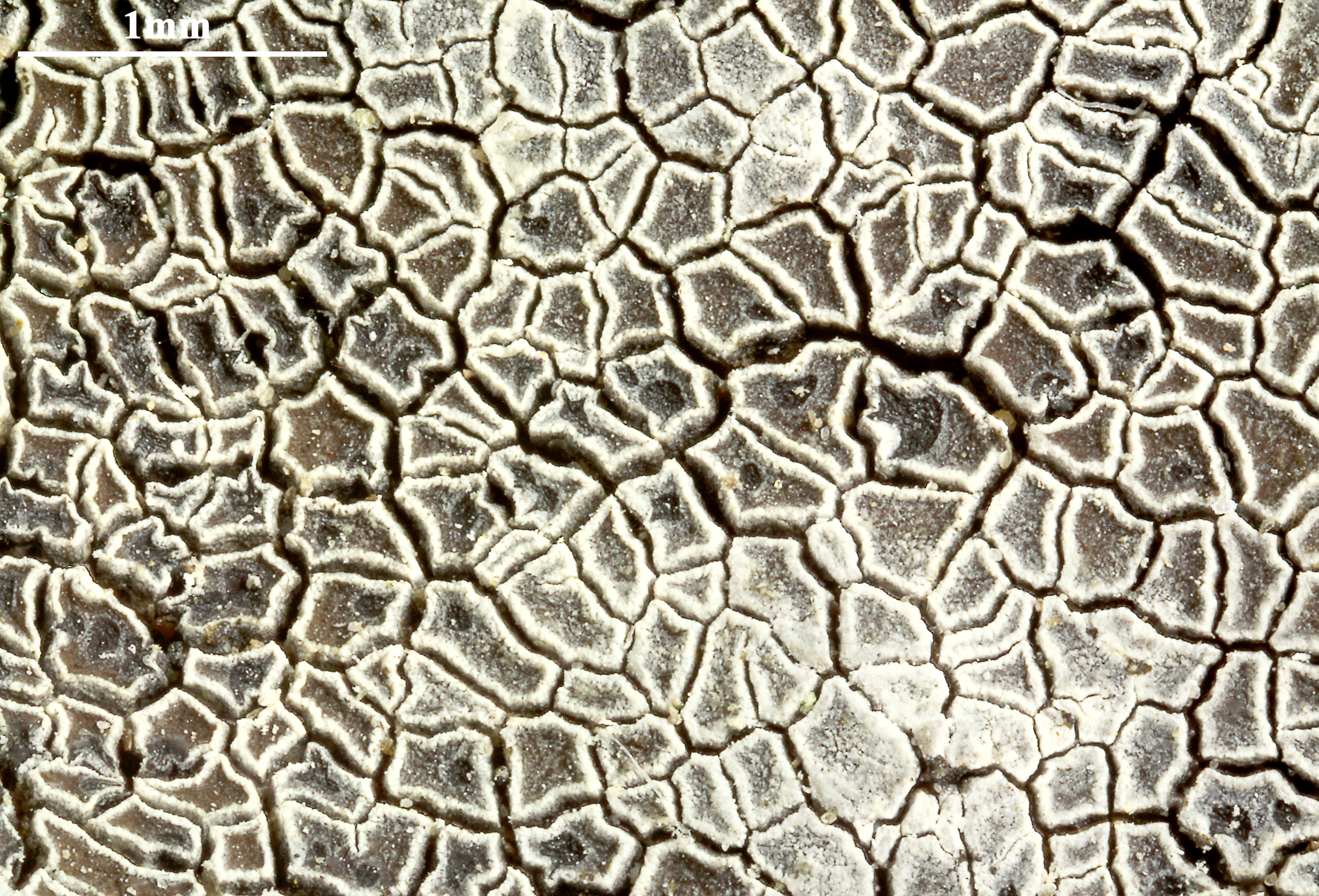
thallus center with apothecia
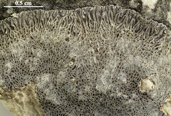
Felix Schumm; Owner: CC BY-SA 4.0
[TSB 27085], Italy, Molise, Prov. Campobasso, below Lupara along River Biferno, dry calcareous rocks, 280 m, 11°44’36’’ N, 14°44’32’’ E. Leg. P.L. Nimis & M. Tretiach, 04.04.1997

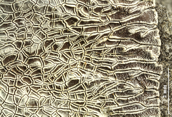
Felix Schumm; Owner: CC BY-SA 4.0
[TSB 27085], Italy, Molise, Prov. Campobasso, below Lupara along River Biferno, dry calcareous rocks, 280 m, 11°44’36’’ N, 14°44’32’’ E. Leg. P.L. Nimis & M. Tretiach, 04.04.1997
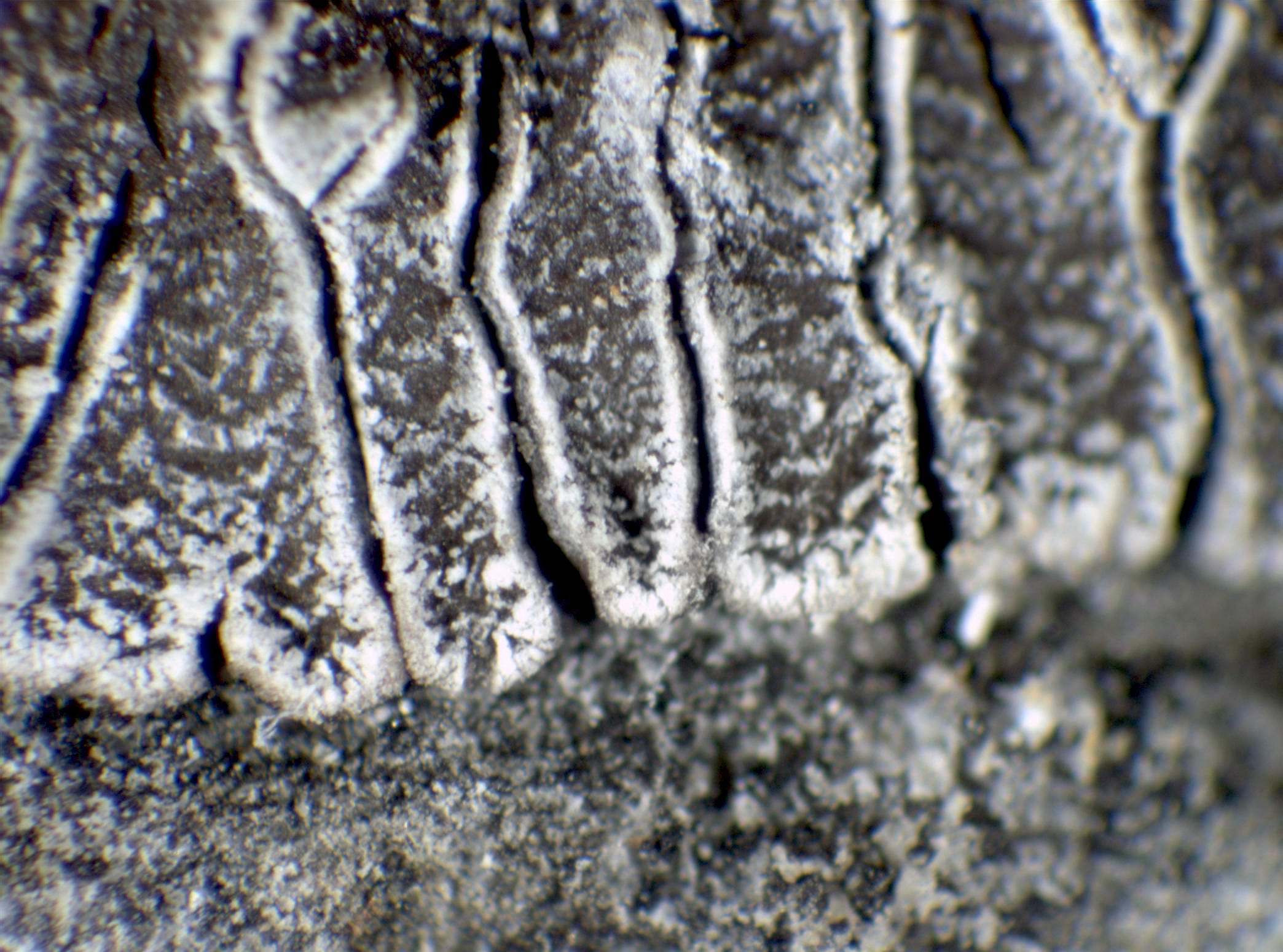
Felix Schumm; Owner: CC BY-SA 4.0
[TSB 27085], Italy, Molise, Prov. Campobasso, below Lupara along River Biferno, dry calcareous rocks, 280 m, 11°44’36’’ N, 14°44’32’’ E. Leg. P.L. Nimis & M. Tretiach, 04.04.1997
Felix Schumm; Owner: CC BY-SA 4.0
[TSB 27085], Italy, Molise, Prov. Campobasso, below Lupara along River Biferno, dry calcareous rocks, 280 m, 11°44’36’’ N, 14°44’32’’ E. Leg. P.L. Nimis & M. Tretiach, 04.04.1997
Felix Schumm; Owner: CC BY-SA 4.0
[TSB 27085], Italy, Molise, Prov. Campobasso, below Lupara along River Biferno, dry calcareous rocks, 280 m, 11°44’36’’ N, 14°44’32’’ E. Leg. P.L. Nimis & M. Tretiach, 04.04.1997
Felix Schumm - CC BY-SA 4.0
[TSB 27085], Italy, Molise, Prov. Campobasso, below Lupara along River Biferno, dry calcareous rocks, 280 m, 11°44’36’’ N, 14°44’32’’ E. Leg. P.L. Nimis & M. Tretiach, 04.04.1997

Felix Schumm - CC BY-SA 4.0
[TSB 27085], Italy, Molise, Prov. Campobasso, below Lupara along River Biferno, dry calcareous rocks, 280 m, 11°44’36’’ N, 14°44’32’’ E. Leg. P.L. Nimis & M. Tretiach, 04.04.1997
Felix Schumm - CC BY-SA 4.0
[TSB 27085], Italy, Molise, Prov. Campobasso, below Lupara along River Biferno, dry calcareous rocks, 280 m, 11°44’36’’ N, 14°44’32’’ E. Leg. P.L. Nimis & M. Tretiach, 04.04.1997

Felix Schumm - CC BY-SA 4.0
[TSB 27085], Italy, Molise, Prov. Campobasso, below Lupara along River Biferno, dry calcareous rocks, 280 m, 11°44’36’’ N, 14°44’32’’ E. Leg. P.L. Nimis & M. Tretiach, 04.04.1997
Felix Schumm - CC BY-SA 4.0
[TSB 27085], Italy, Molise, Prov. Campobasso, below Lupara along River Biferno, dry calcareous rocks, 280 m, 11°44’36’’ N, 14°44’32’’ E. Leg. P.L. Nimis & M. Tretiach, 04.04.1997
Felix Schumm - CC BY-SA 4.0
[TSB 27085], Italy, Molise, Prov. Campobasso, below Lupara along River Biferno, dry calcareous rocks, 280 m, 11°44’36’’ N, 14°44’32’’ E. Leg. P.L. Nimis & M. Tretiach, 04.04.1997
Felix Schumm - CC BY-SA 4.0
[TSB 27085], Italy, Molise, Prov. Campobasso, below Lupara along River Biferno, dry calcareous rocks, 280 m, 11°44’36’’ N, 14°44’32’’ E. Leg. P.L. Nimis & M. Tretiach, 04.04.1997
Felix Schumm - CC BY-SA 4.0
[TSB 27085], Italy, Molise, Prov. Campobasso, below Lupara along River Biferno, dry calcareous rocks, 280 m, 11°44’36’’ N, 14°44’32’’ E. Leg. P.L. Nimis & M. Tretiach, 04.04.1997

Felix Schumm - CC BY-SA 4.0
[TSB 27085], Italy, Molise, Prov. Campobasso, below Lupara along River Biferno, dry calcareous rocks, 280 m, 11°44’36’’ N, 14°44’32’’ E. Leg. P.L. Nimis & M. Tretiach, 04.04.1997
Felix Schumm - CC BY-SA 4.0
[TSB 27085], Italy, Molise, Prov. Campobasso, below Lupara along River Biferno, dry calcareous rocks, 280 m, 11°44’36’’ N, 14°44’32’’ E. Leg. P.L. Nimis & M. Tretiach, 04.04.1997
Felix Schumm; Owner: CC BY-SA 4.0
[TSB 27085], Italy, Molise, Prov. Campobasso, below Lupara along River Biferno, dry calcareous rocks, 280 m, 11°44’36’’ N, 14°44’32’’ E. Leg. P.L. Nimis & M. Tretiach, 04.04.1997
Growth form: Crustose placodiomorph
Substrata: rocks
Photobiont: green algae other than Trentepohlia
Reproductive strategy: mainly sexual
Subcontinental: restricted to areas with a dry-subcontinental climate (e.g. dry Alpine valleys, parts of Mediterranean Italy)
Commonnes-rarity: (info)
Alpine belt: extremely rare
Subalpine belt: extremely rare
Oromediterranean belt: absent
Montane belt: extremely rare
Submediterranean belt: very rare
Padanian area: absent
Humid submediterranean belt: absent
Humid mediterranean belt: absent
Dry mediterranean belt: extremely rare
Predictive model
| Herbarium samples |

P.L. Nimis (CC BY-SA 4.0)
TSB 27085
P.L. Nimis; Owner: Department of Life Sciences, University of Trieste
Herbarium: TSB (27085)
2001/12/08
tip of marginal lobes
P.L. Nimis; Owner: Department of Life Sciences, University of Trieste
Herbarium: TSB (27085)
2001/12/08
thallus center with apothecia

Felix Schumm; Owner: CC BY-SA 4.0
[TSB 27085], Italy, Molise, Prov. Campobasso, below Lupara along River Biferno, dry calcareous rocks, 280 m, 11°44’36’’ N, 14°44’32’’ E. Leg. P.L. Nimis & M. Tretiach, 04.04.1997
Felix Schumm; Owner: CC BY-SA 4.0
[TSB 27085], Italy, Molise, Prov. Campobasso, below Lupara along River Biferno, dry calcareous rocks, 280 m, 11°44’36’’ N, 14°44’32’’ E. Leg. P.L. Nimis & M. Tretiach, 04.04.1997

Felix Schumm; Owner: CC BY-SA 4.0
[TSB 27085], Italy, Molise, Prov. Campobasso, below Lupara along River Biferno, dry calcareous rocks, 280 m, 11°44’36’’ N, 14°44’32’’ E. Leg. P.L. Nimis & M. Tretiach, 04.04.1997

Felix Schumm; Owner: CC BY-SA 4.0
[TSB 27085], Italy, Molise, Prov. Campobasso, below Lupara along River Biferno, dry calcareous rocks, 280 m, 11°44’36’’ N, 14°44’32’’ E. Leg. P.L. Nimis & M. Tretiach, 04.04.1997
Felix Schumm; Owner: CC BY-SA 4.0
[TSB 27085], Italy, Molise, Prov. Campobasso, below Lupara along River Biferno, dry calcareous rocks, 280 m, 11°44’36’’ N, 14°44’32’’ E. Leg. P.L. Nimis & M. Tretiach, 04.04.1997

Felix Schumm - CC BY-SA 4.0
[TSB 27085], Italy, Molise, Prov. Campobasso, below Lupara along River Biferno, dry calcareous rocks, 280 m, 11°44’36’’ N, 14°44’32’’ E. Leg. P.L. Nimis & M. Tretiach, 04.04.1997
Felix Schumm - CC BY-SA 4.0
[TSB 27085], Italy, Molise, Prov. Campobasso, below Lupara along River Biferno, dry calcareous rocks, 280 m, 11°44’36’’ N, 14°44’32’’ E. Leg. P.L. Nimis & M. Tretiach, 04.04.1997
Felix Schumm - CC BY-SA 4.0
[TSB 27085], Italy, Molise, Prov. Campobasso, below Lupara along River Biferno, dry calcareous rocks, 280 m, 11°44’36’’ N, 14°44’32’’ E. Leg. P.L. Nimis & M. Tretiach, 04.04.1997
Felix Schumm - CC BY-SA 4.0
[TSB 27085], Italy, Molise, Prov. Campobasso, below Lupara along River Biferno, dry calcareous rocks, 280 m, 11°44’36’’ N, 14°44’32’’ E. Leg. P.L. Nimis & M. Tretiach, 04.04.1997

Felix Schumm - CC BY-SA 4.0
[TSB 27085], Italy, Molise, Prov. Campobasso, below Lupara along River Biferno, dry calcareous rocks, 280 m, 11°44’36’’ N, 14°44’32’’ E. Leg. P.L. Nimis & M. Tretiach, 04.04.1997
Felix Schumm - CC BY-SA 4.0
[TSB 27085], Italy, Molise, Prov. Campobasso, below Lupara along River Biferno, dry calcareous rocks, 280 m, 11°44’36’’ N, 14°44’32’’ E. Leg. P.L. Nimis & M. Tretiach, 04.04.1997

Felix Schumm - CC BY-SA 4.0
[TSB 27085], Italy, Molise, Prov. Campobasso, below Lupara along River Biferno, dry calcareous rocks, 280 m, 11°44’36’’ N, 14°44’32’’ E. Leg. P.L. Nimis & M. Tretiach, 04.04.1997

Felix Schumm - CC BY-SA 4.0
[TSB 27085], Italy, Molise, Prov. Campobasso, below Lupara along River Biferno, dry calcareous rocks, 280 m, 11°44’36’’ N, 14°44’32’’ E. Leg. P.L. Nimis & M. Tretiach, 04.04.1997
Felix Schumm - CC BY-SA 4.0
[TSB 27085], Italy, Molise, Prov. Campobasso, below Lupara along River Biferno, dry calcareous rocks, 280 m, 11°44’36’’ N, 14°44’32’’ E. Leg. P.L. Nimis & M. Tretiach, 04.04.1997

Felix Schumm - CC BY-SA 4.0
[TSB 27085], Italy, Molise, Prov. Campobasso, below Lupara along River Biferno, dry calcareous rocks, 280 m, 11°44’36’’ N, 14°44’32’’ E. Leg. P.L. Nimis & M. Tretiach, 04.04.1997