Cladonia furcata subsp. subrangiformis auct. non (Sandst.) Abbayes
Bull. Soc. Scient. Bretagne, 13, 1937 comb. inval.. Basionym: Cladonia subrangiformis Sandst. - Abh. Nat. Ver. Bremen, 25: 165, 1922.
Synonyms:
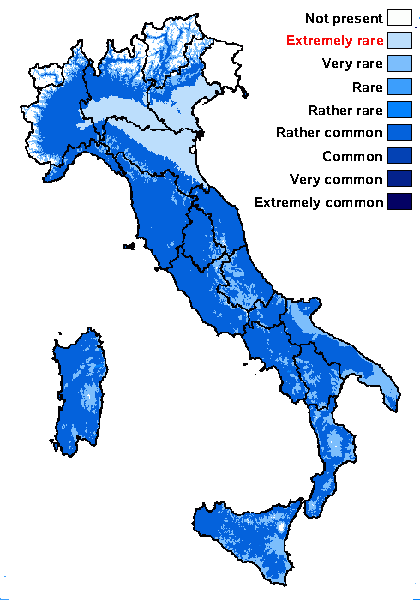
Distribution: N - VG, Ven (Lazzarin 2000b), TAA (Nascimbene 1997, 2000), Lomb (Ravera & al. 2017), Piem (Gheza 2020), VA (Piervittori & Isocrono 1999), Emil (Nimis & al. 1996, Fariselli & al. 2020), Lig. C - Tosc (Tretiach & Nimis 1994, Loppi & al. 1998, 2004b, Brackel 2015), Marc (Nimis & Tretiach 1999), Umb (Nimis & Tretiach 1999, Panfili 2000b, 2007, Ravera & al. 2006), Laz (Brackel 2015, Di Pietro & al. 2022), Abr (Recchia & Villa 1996, Nimis & Tretiach 1999, Brackel 2015, Gheza & al. 2021), Mol (Nimis & Tretiach, 1999, 2004, Caporale & al. 2008), Sar. S - Camp (Garofalo & al. 1999, 2010, Aprile & al. 2002, 2003, 2003b, Nimis & Tretiach 2004, Catalano & al. 2016), Pugl (Nimis & Tretiach 1999, Brackel 2011, Gianfreda & Matino 2020), Bas (Nimis & Tretiach 1999), Cal (Puntillo 1996), Si (Ottonello & Salone 1994, Ottonello & al. 1994, 2011, Ottonello 1996, Ottonello & Romano 1997, Gianguzzi & al. 2009).
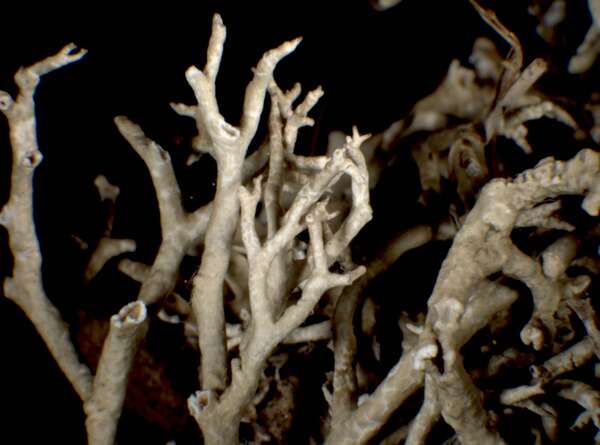
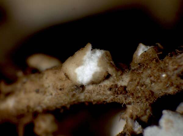
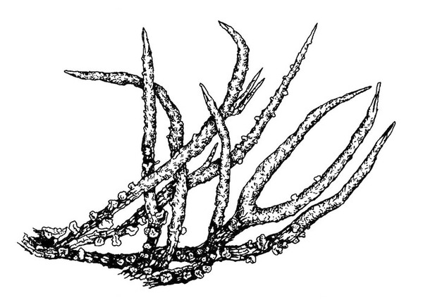
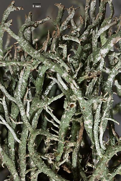
Description: Primary thallus squamulose, the squamules middle-sized (1-3 mm long and broad), most often ephemeral, brownish green above, white beneath. Podetia branched, hollow inside, brown, stout, to 10 cm tall (usually less), forming irregular tufts, with pointed apices and a smooth to wrinkled surface, non- or very sparsely squamulose, with evident, convex, white medullary outbursts at the base. Apothecia rare, dark brown, convex. Asci 8-spored, clavate, thickened at apex, with a K/I+ blue tholus and a K/I+ strongly blue outer gelatinous sheath, Cladonia-type. Ascospores 1-celled, hyaline, ellipsoid. Pycnidia dark, semi-immersed on the tips of podetia, with a colourless jelly. Conidia hyaline, curved. Photobiont chlorococcoid. Spot tests: K- or K+ yellowish slowly turning brown, C-, KC-, P+ red. Chemistry: atranorin and fumarprotocetraric acid. Note: a mild-temperate lichen found on mineral calciferous soil, often amongst bryophytes. This taxon has so far no valid name at subspecific rank, and recent molecular data do not support its separation from C. furcata (Pino-Bodas & al. 2015) so that it could be better treated at the level of forma (Ahti in litt.), but the epithet subrangiformis is a later homonym for f. subrangiformis Vain. ex Zahlbr. Pending further study, I still maintain it here, albeit under an invalid name.
Growth form: Fruticose
Substrata: soil, terricolous mosses, and plant debris
Photobiont: green algae other than Trentepohlia
Reproductive strategy: mainly sexual
Commonnes-rarity: (info)
Alpine belt: absent
Subalpine belt: absent
Oromediterranean belt: absent
Montane belt: very rare
Submediterranean belt: rather common
Padanian area: extremely rare
Humid submediterranean belt: rather common
Humid mediterranean belt: rather common
Dry mediterranean belt: very rare
Predictive model
Herbarium samples

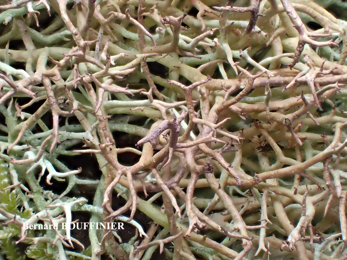
Bernard Bouffinier - Source: http://www.lichensmaritimes.org/index.php?task=fiche&lichen=281&lang=en
France, Pointe de Treberon

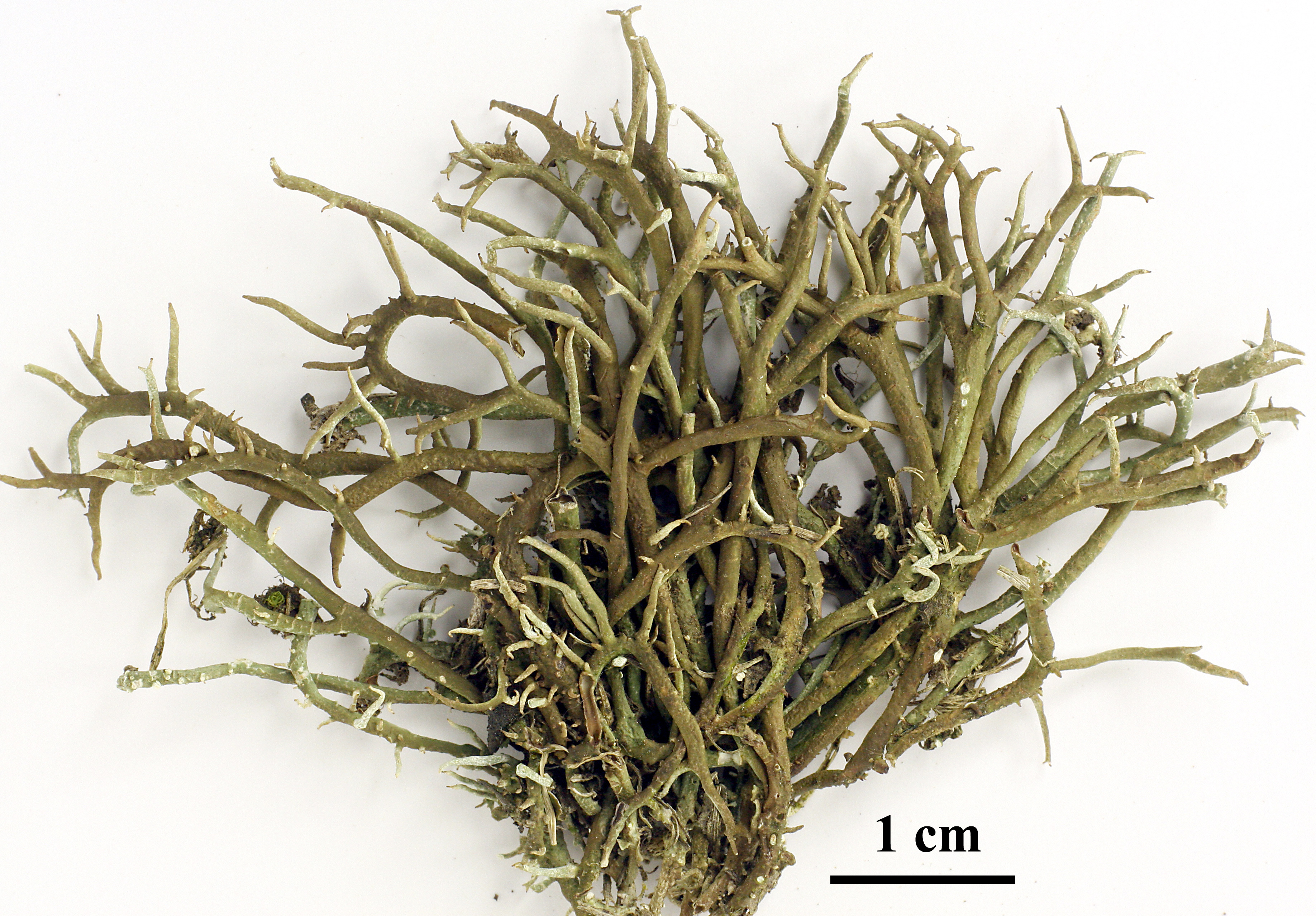
P.L. Nimis; Owner: Department of Life Sciences, University of Trieste
Herbarium: TSB (613)
2001/12/04
P.L. Nimis; Owner: Department of Life Sciences, University of Trieste
Herbarium: TSB (613)
2001/12/04
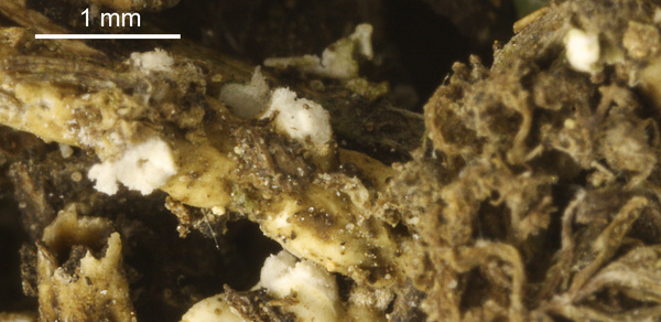
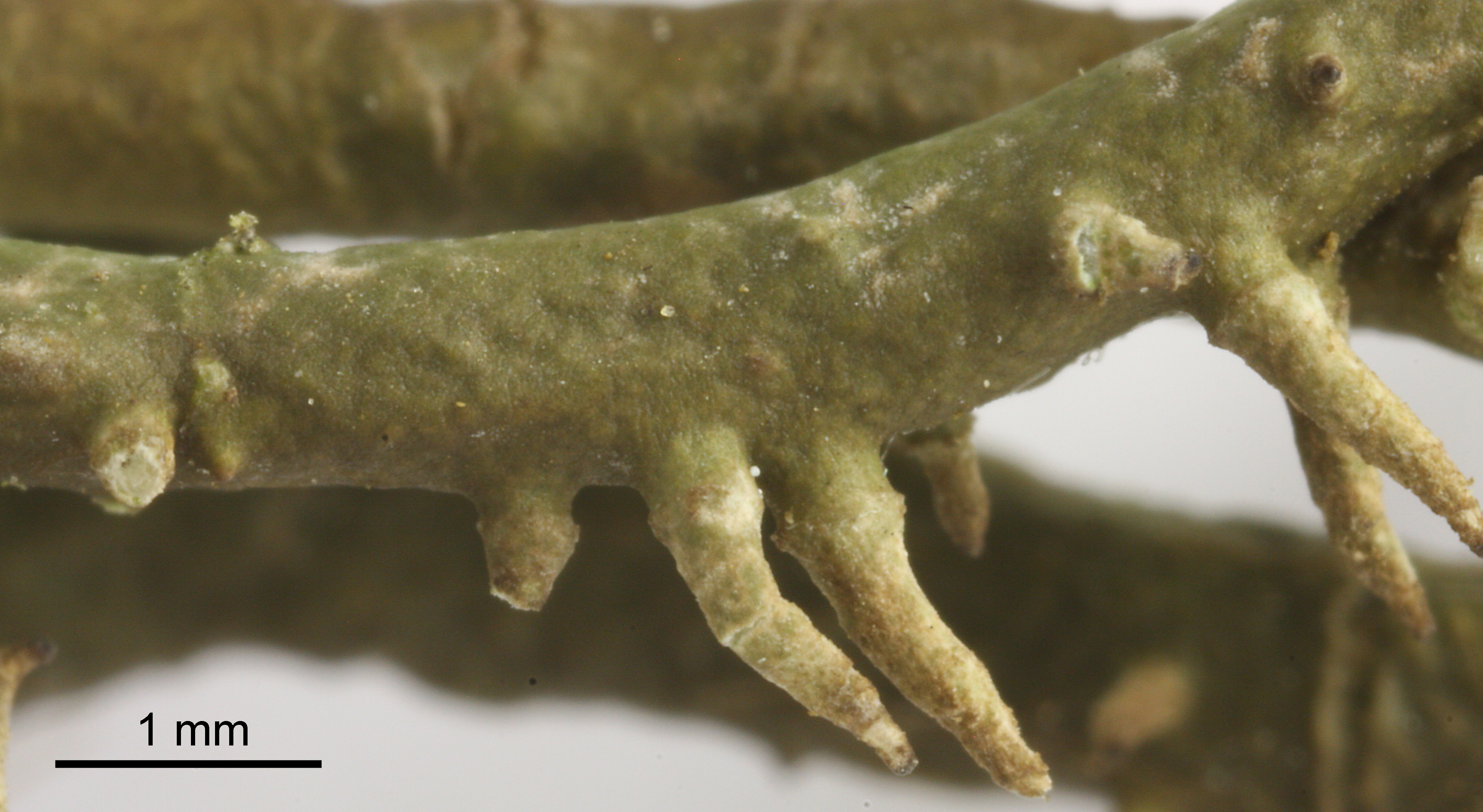
detail of white knot at the base of the podetium
Triin Aimla; Owner: University of Tartu
Felix Schumm – CC BY-SA 4.0
16553], Germany, Baden-Württemberg, Kreis Heidenheim, östlich von Söhnstetten an der Abzweigung zum Dudelhof. 48,66772° N, 10,00954° E, 570 m. Zwischen Kalkblöcken in Kalktrockenrasen. Leg. et det. Schumm 25.07.2010

Felix Schumm – CC BY-SA 4.0
16553], Germany, Baden-Württemberg, Kreis Heidenheim, östlich von Söhnstetten an der Abzweigung zum Dudelhof. 48,66772° N, 10,00954° E, 570 m. Zwischen Kalkblöcken in Kalktrockenrasen. Leg. et det. Schumm 25.07.2010
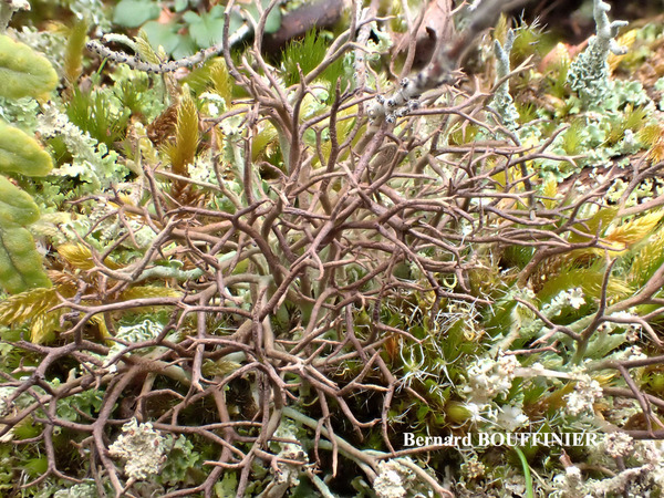
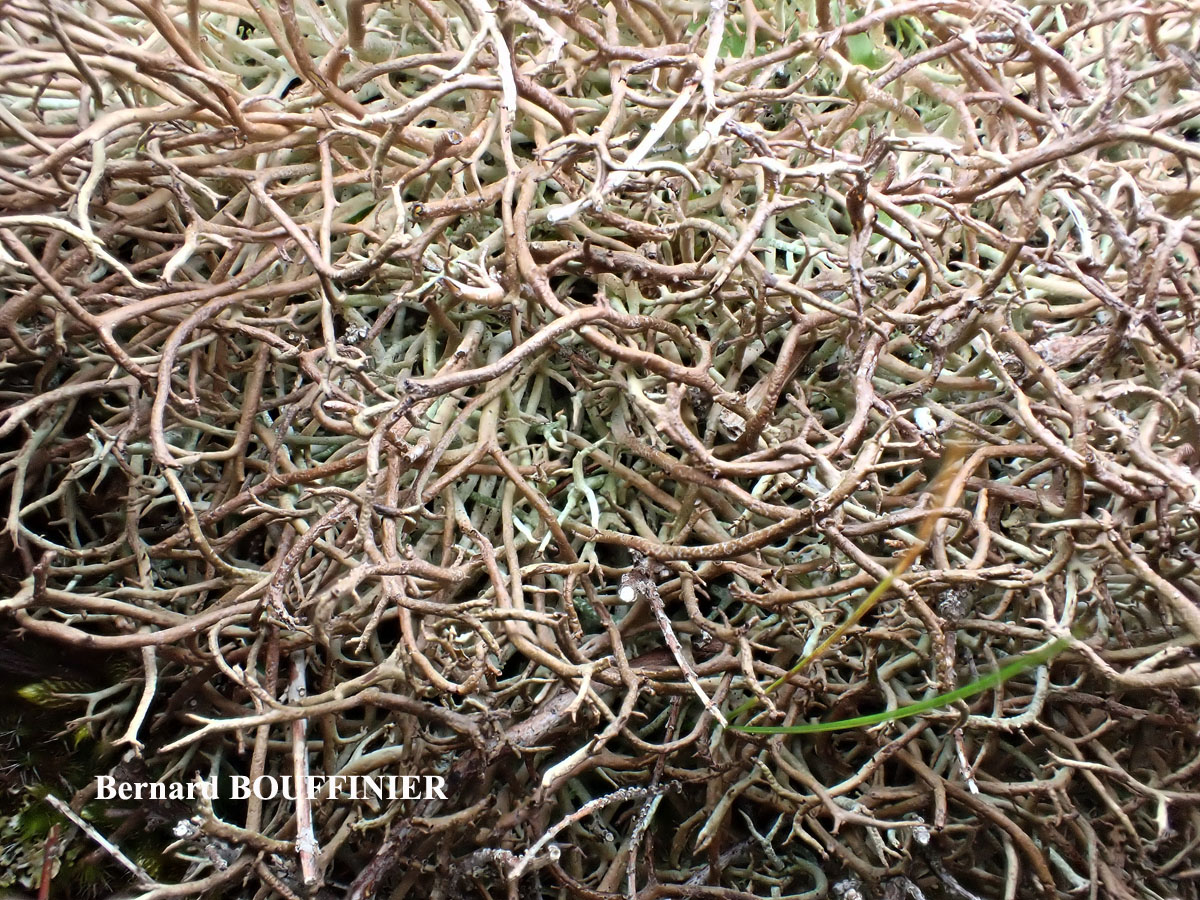
Bernard Bouffinier - Source: http://www.lichensmaritimes.org/index.php?task=fiche&lichen=281&lang=en
France, Pointe de Treberon

Felix Schumm – CC BY-SA 4.0
16553], Germany, Baden-Württemberg, Kreis Heidenheim, östlich von Söhnstetten an der Abzweigung zum Dudelhof. 48,66772° N, 10,00954° E, 570 m. Zwischen Kalkblöcken in Kalktrockenrasen. Leg. et det. Schumm 25.07.2010
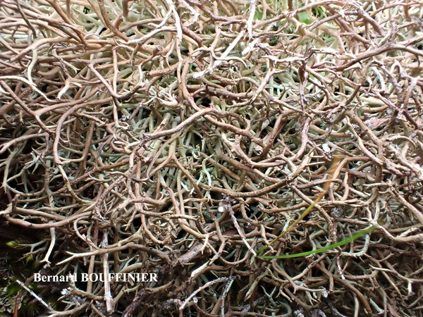
Bernard Bouffinier - Source: http://www.lichensmaritimes.org/index.php?task=fiche&lichen=281&lang=en
France, Pointe de Treberon
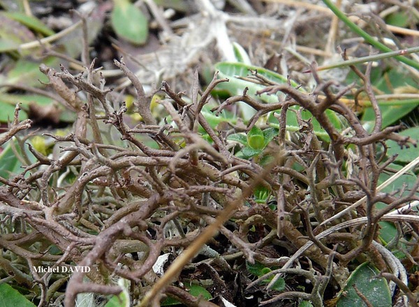
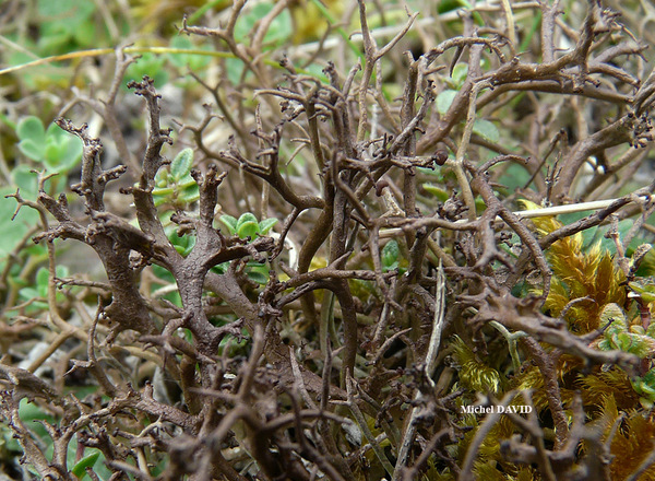
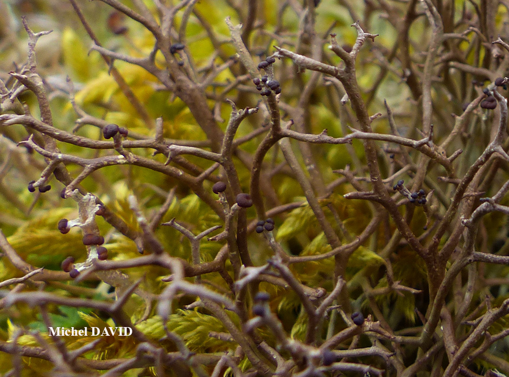
Michel David - Source: http://www.lichensmaritimes.org/index.php?task=fiche&lichen=281&lang=en
France, La Palue
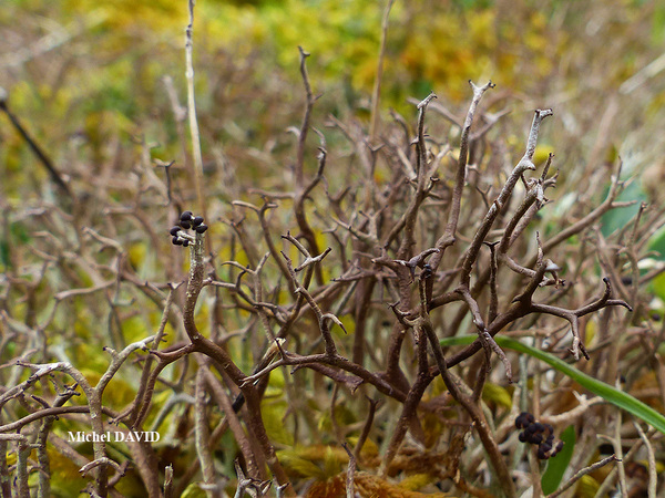
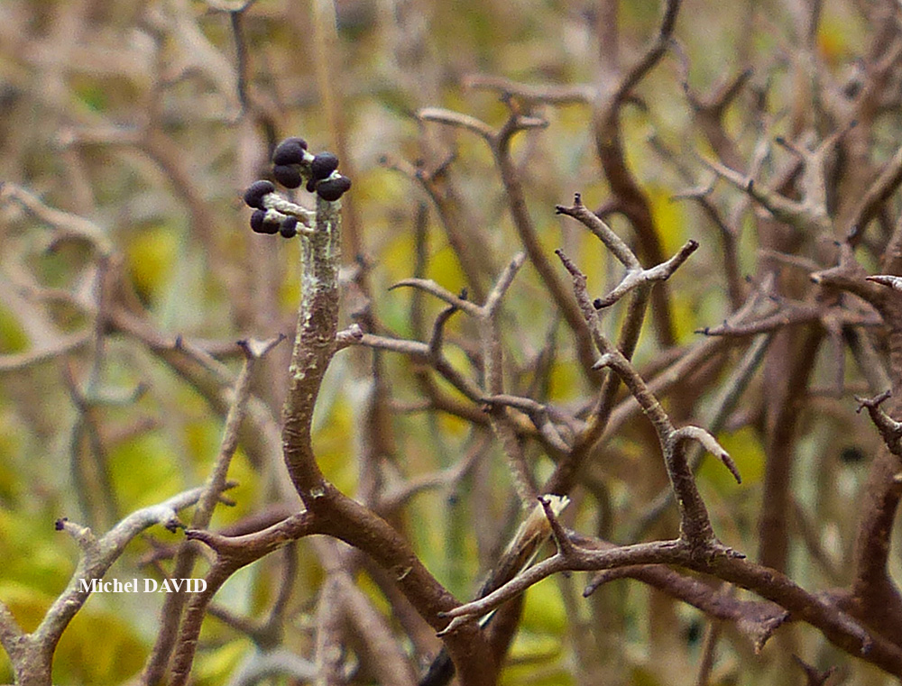
Michel David - Source: http://www.lichensmaritimes.org/index.php?task=fiche&lichen=281&lang=en
France, La Palue
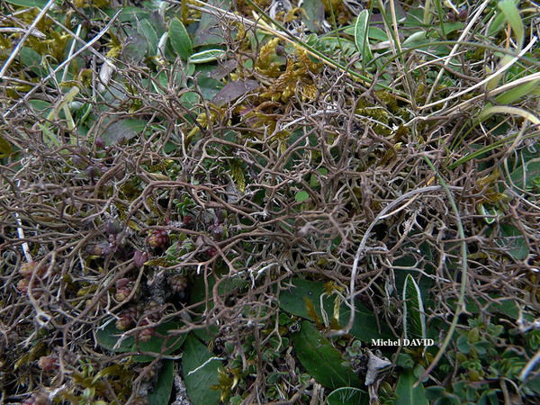
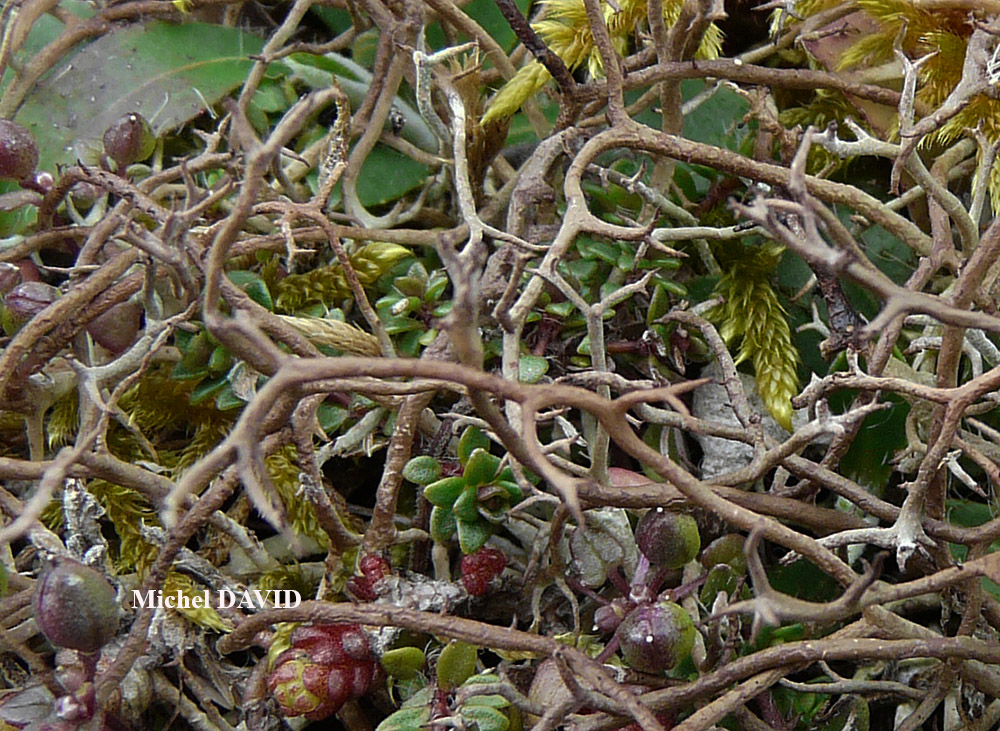
Michel David - Source: http://www.lichensmaritimes.org/index.php?task=fiche&lichen=281&lang=en
France, La Palue

Michel David - Source: http://www.lichensmaritimes.org/index.php?task=fiche&lichen=281&lang=en
France, La Palue

Michel David - Source: http://www.lichensmaritimes.org/index.php?task=fiche&lichen=281&lang=en
France, La Palue
Michel David - Source: http://www.lichensmaritimes.org/index.php?task=fiche&lichen=281&lang=en
France, La Palue

Michel David - Source: http://www.lichensmaritimes.org/index.php?task=fiche&lichen=281&lang=en
France, La Palue
Ulrich Kirschbaum CC BY-SA 4.0 - Source: https://www.thm.de/lse/ulrich-kirschbaum/flechtenbilder
Central Europe; Germany: Hesse.

Ulrich Kirschbaum CC BY-SA 4.0 - Source: https://www.thm.de/lse/ulrich-kirschbaum/flechtenbilder
Central Europe; Germany: Hesse.
Growth form: Fruticose
Substrata: soil, terricolous mosses, and plant debris
Photobiont: green algae other than Trentepohlia
Reproductive strategy: mainly sexual
Commonnes-rarity: (info)
Alpine belt: absent
Subalpine belt: absent
Oromediterranean belt: absent
Montane belt: very rare
Submediterranean belt: rather common
Padanian area: extremely rare
Humid submediterranean belt: rather common
Humid mediterranean belt: rather common
Dry mediterranean belt: very rare
Predictive model
| Herbarium samples |
Bernard Bouffinier - Source: http://www.lichensmaritimes.org/index.php?task=fiche&lichen=281&lang=en
France, Pointe de Treberon

P.L. Nimis; Owner: Department of Life Sciences, University of Trieste
Herbarium: TSB (613)
2001/12/04

P.L. Nimis; Owner: Department of Life Sciences, University of Trieste
Herbarium: TSB (613)
2001/12/04
detail of white knot at the base of the podetium

Triin Aimla; Owner: University of Tartu

Felix Schumm – CC BY-SA 4.0
16553], Germany, Baden-Württemberg, Kreis Heidenheim, östlich von Söhnstetten an der Abzweigung zum Dudelhof. 48,66772° N, 10,00954° E, 570 m. Zwischen Kalkblöcken in Kalktrockenrasen. Leg. et det. Schumm 25.07.2010
Felix Schumm – CC BY-SA 4.0
16553], Germany, Baden-Württemberg, Kreis Heidenheim, östlich von Söhnstetten an der Abzweigung zum Dudelhof. 48,66772° N, 10,00954° E, 570 m. Zwischen Kalkblöcken in Kalktrockenrasen. Leg. et det. Schumm 25.07.2010

Bernard Bouffinier - Source: http://www.lichensmaritimes.org/index.php?task=fiche&lichen=281&lang=en
France, Pointe de Treberon
Felix Schumm – CC BY-SA 4.0
16553], Germany, Baden-Württemberg, Kreis Heidenheim, östlich von Söhnstetten an der Abzweigung zum Dudelhof. 48,66772° N, 10,00954° E, 570 m. Zwischen Kalkblöcken in Kalktrockenrasen. Leg. et det. Schumm 25.07.2010
Bernard Bouffinier - Source: http://www.lichensmaritimes.org/index.php?task=fiche&lichen=281&lang=en
France, Pointe de Treberon

Michel David - Source: http://www.lichensmaritimes.org/index.php?task=fiche&lichen=281&lang=en
France, La Palue

Michel David - Source: http://www.lichensmaritimes.org/index.php?task=fiche&lichen=281&lang=en
France, La Palue

Michel David - Source: http://www.lichensmaritimes.org/index.php?task=fiche&lichen=281&lang=en
France, La Palue
Michel David - Source: http://www.lichensmaritimes.org/index.php?task=fiche&lichen=281&lang=en
France, La Palue
Michel David - Source: http://www.lichensmaritimes.org/index.php?task=fiche&lichen=281&lang=en
France, La Palue

Michel David - Source: http://www.lichensmaritimes.org/index.php?task=fiche&lichen=281&lang=en
France, La Palue
Michel David - Source: http://www.lichensmaritimes.org/index.php?task=fiche&lichen=281&lang=en
France, La Palue

Ulrich Kirschbaum CC BY-SA 4.0 - Source: https://www.thm.de/lse/ulrich-kirschbaum/flechtenbilder
Central Europe; Germany: Hesse.