
Phaeophyscia cernohorskyi (Nádv.) Essl.
Mycotaxon, 7: 294, 1978. Basionym: Physcia cernohorskyi Nádv. - Stud. Bot. Cech., 8: 98, 1947.
Synonyms: Phaeophyscia strigosa (Poelt & Buschardt) N.S. Golubk.; Physcia hirsuta var. echinella Poelt; Physcia setosa var. albociliata B. de Lesd.; Physcia strigosa Poelt & Buschardt
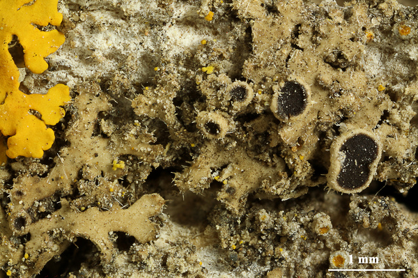
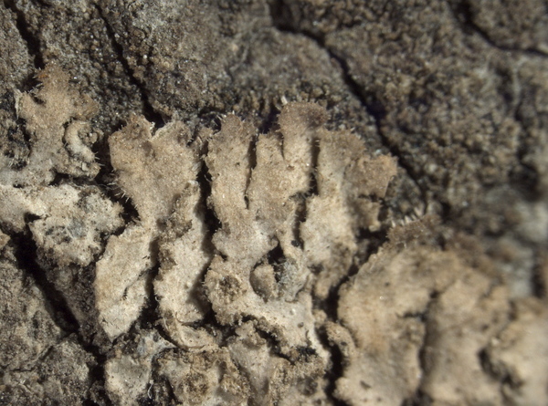
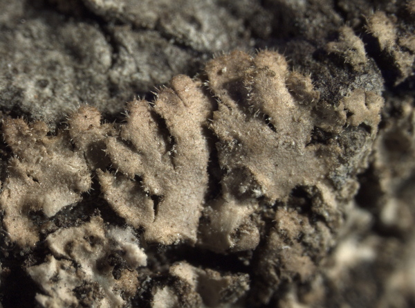
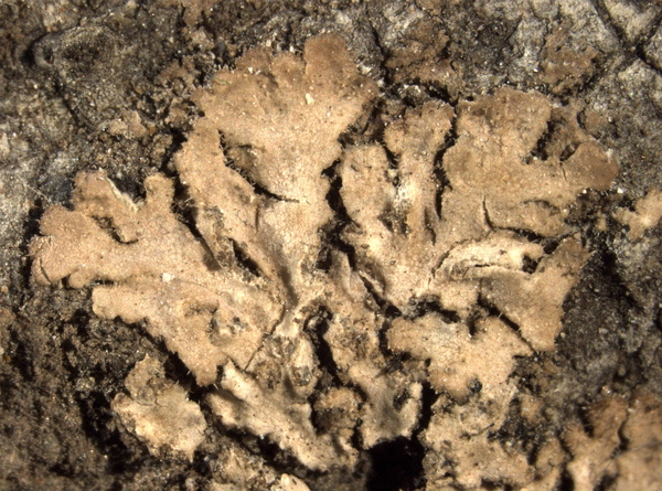
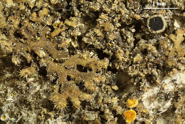
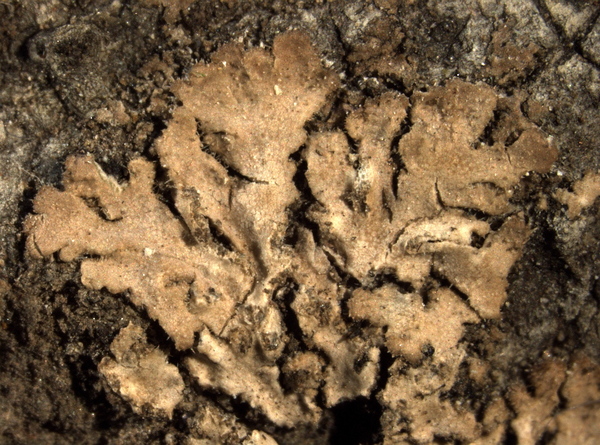
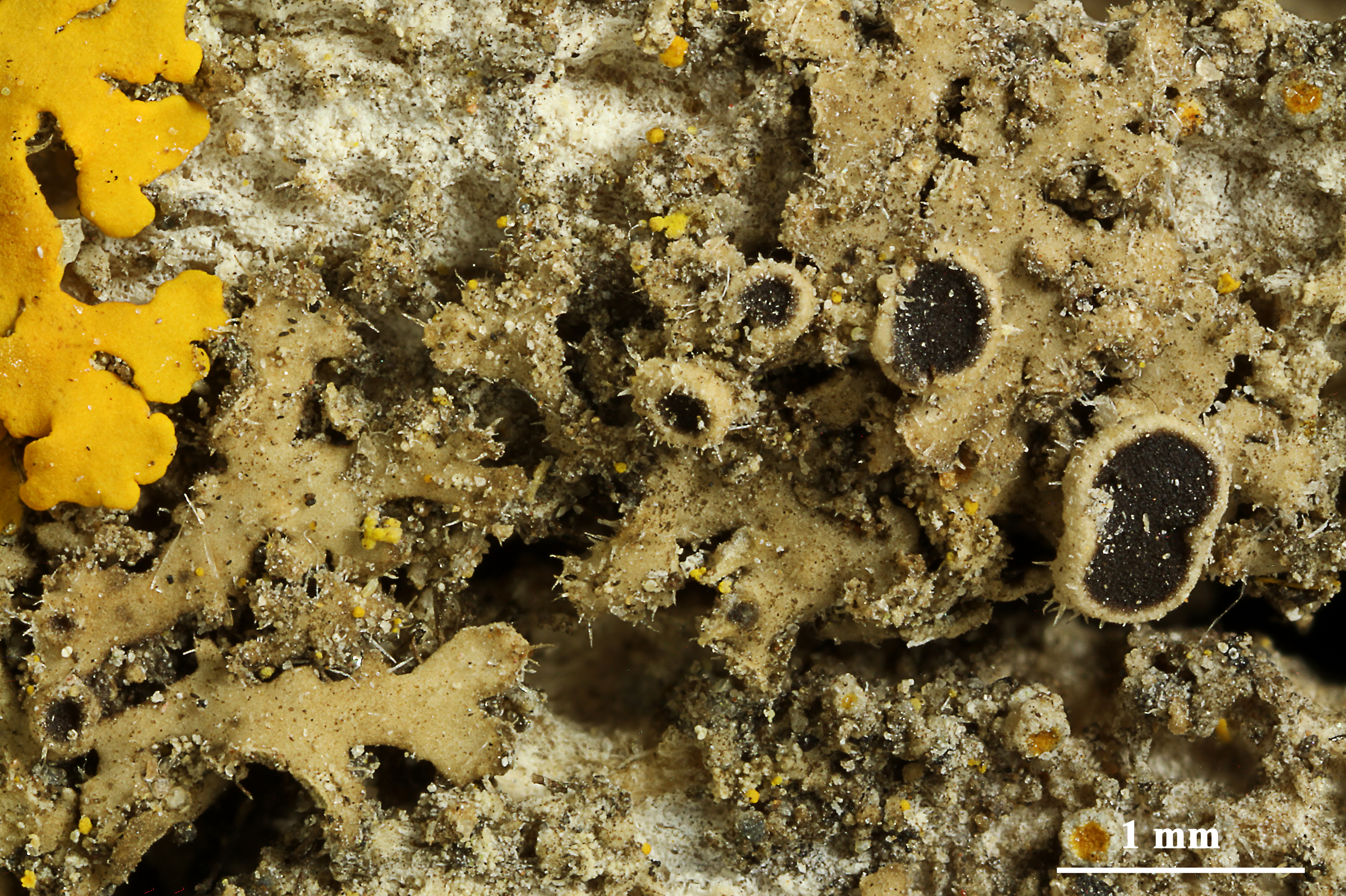
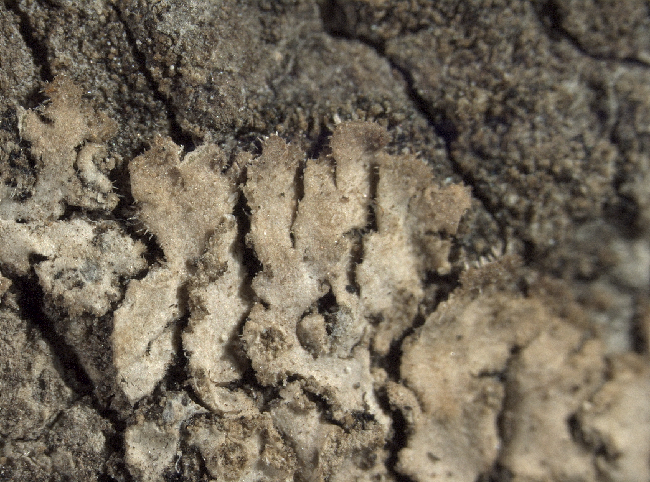
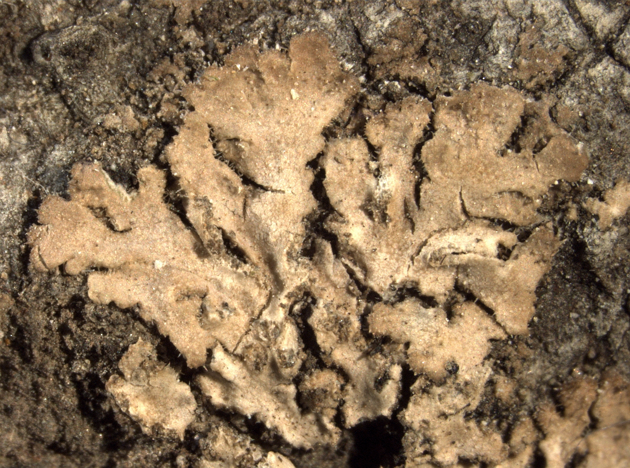
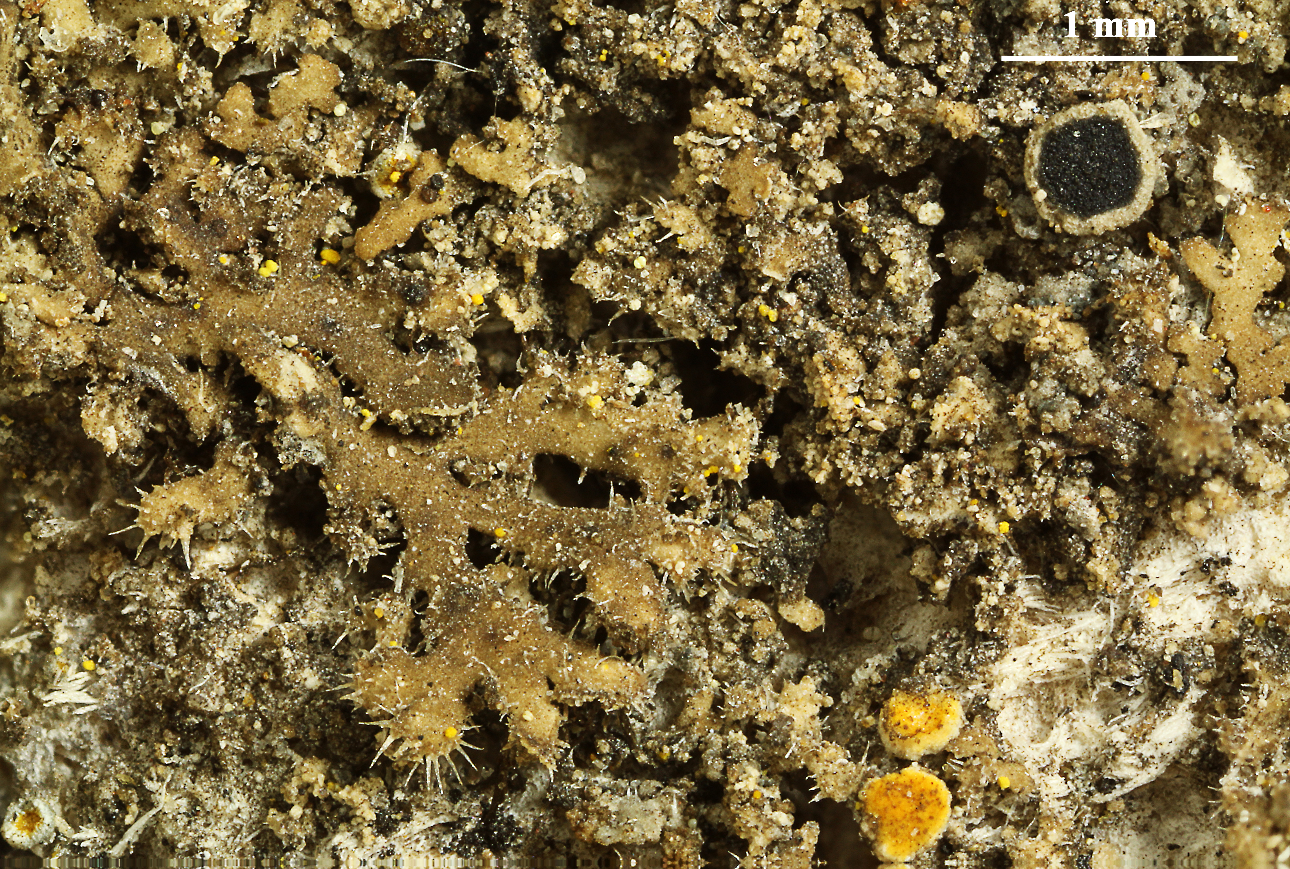
Description: Thallus foliose, heteromerous, dorsiventral, narrow-lobed, forming irregular to orbicular, up to 3(-4) cm wide rosettes. Lobes discrete to partly imbricate, 0.5-1 mm wide, usually flat, dark grey to dark brown, sometimes maculate, with sparse to numerous, multicellular cortical hairs near the lobe tips, epruinose, with elongate, mainly marginal soralia. Lower surface black, with simple rhizines. Upper and lower cortex paraplectenchymatous; medulla white. Apothecia rare, lecanorine, to 2 mm across, the thalline margin with cortical hairs. Epithecium brown; hymenium and hypothecium colourless; paraphyses slender, often forked in upper part, the apical cells clavate, with a thin dark cap. Asci 8-spored, clavate, the K/I+ blue tholus penetrated by a faintly amyloid apical cushion with parallel or diverging flanks, the wall K/I-, surrounded by a K/I+ blue outer layer, Lecanora-type. Ascospores 1-septate, brown, ellipsoid, 19-26 x 7-13 µm. Pycnidia rare, immersed. Conidia ellipsoid. Photobiont chlorococcoid. Spot tests: cortex and medulla K-, C-, KC-, P-, UV-. Chemistry: without lichen substances.
Growth form: Foliose, narrow lobed
Substrata: bark and rocks
Photobiont: green algae other than Trentepohlia
Reproductive strategy: mainly asexual, by soredia, or soredia-like structures (e.g. blastidia)
Commonnes-rarity: (info)
Alpine belt: absent
Subalpine belt: absent
Montane belt: extremely rare
Dry submediterranean belt: very rare
Humid submediterranean belt: very rare
Padanian area: absent
pH of the substrata:
1 2 3 4 5

Solar irradiation:
1 2 3 4 5
Aridity:
1 2 3 4 5
Eutrophication:
1 2 3 4 5
Poleotolerance:
0 1 2 3
Altitudinal distribution:
1 2 3 4 5 6
Rarity
absent
extremely rare
very rare
rare
rather rare
rather common
common
very common
extremely common
Loading data...
Occurrence data
Predictive map
Felix Schumm - CC BY.SA 4.0
[11640], USA, Nebraska, Dawes County: Nebraska National Forest; 18 miles (30 km) SW of Chadron at over-grown picnic area along West Ash Road; 4.5 road miles S of the junction of West Ash Road and Forest Service Road 704; open pine-ash-cottonwood streamside; 42°38’50’’ N, 103°15’53’’ W, 110 m. Leg. S. Morgan & R. Egan, 25. May 2000 Nr. 415.Ex UNIVERSITY OF NEBRASKA AT OMAHA HERB. (OMA)
E. Pittao
TSB 18339)
E. Pittao
TSB 18339)
E. Pittao
TSB 18339)
Felix Schumm - CC BY.SA 4.0
[11640], USA, Nebraska, Dawes County: Nebraska National Forest; 18 miles (30 km) SW of Chadron at over-grown picnic area along West Ash Road; 4.5 road miles S of the junction of West Ash Road and Forest Service Road 704; open pine-ash-cottonwood streamside; 42°38’50’’ N, 103°15’53’’ W, 110 m. Leg. S. Morgan & R. Egan, 25. May 2000 Nr. 415.Ex UNIVERSITY OF NEBRASKA AT OMAHA HERB. (OMA)
E. Pittao
TSB 18339)
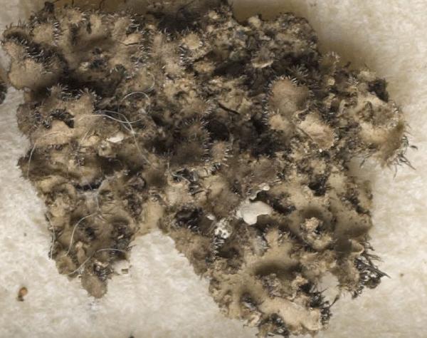
Detail from: https://gzu.jacq.org/GZU000288990
GZU000288990 - Collector Poelt,C. & Poelt,J. Lichenes Alpium 179
Date 1962-04
Location Italy / Liguria
Label Appenino Ligure, Liguria: A un muro un poco ombroso, sopra Fabiano presso La Spezia ; Alt. 50 m - 100 m
Habitat A un muro un poco ombroso
passando delle pietre al muscho - as Physcia hirsuta var. echinella
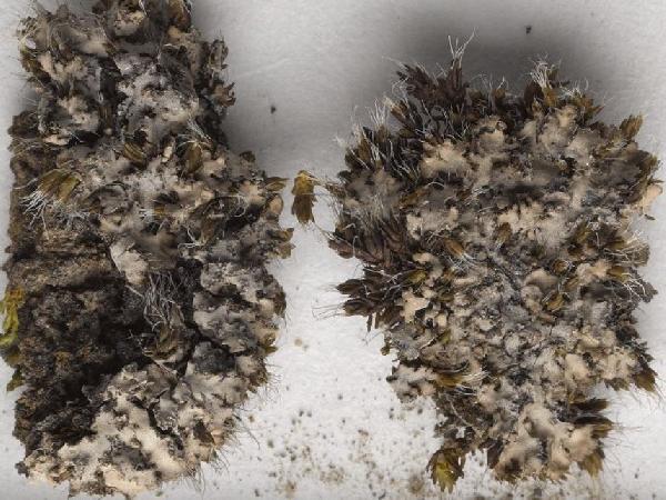
Detail from: https://gzu.jacq.org/GZU000286316
GZU000286316 - Collector Buschardt,A. 756
Date 1972-07-07
Location Italy / Trentino-Alto Adige
Label Südtirol/Vinschgau, Laatsch ; Alt. 1100 m HOLOTYPE of Physcia strigosa
Growth form: Foliose, narrow lobed
Substrata: bark and rocks
Photobiont: green algae other than Trentepohlia
Reproductive strategy: mainly asexual, by soredia, or soredia-like structures (e.g. blastidia)
Commonnes-rarity: (info)
Alpine belt: absent
Subalpine belt: absent
Montane belt: extremely rare
Dry submediterranean belt: very rare
Humid submediterranean belt: very rare
Padanian area: absent
pH of the substrata:
| 1 | 2 | 3 | 4 | 5 |
Solar irradiation:
| 1 | 2 | 3 | 4 | 5 |
Aridity:
| 1 | 2 | 3 | 4 | 5 |
Eutrophication:
| 1 | 2 | 3 | 4 | 5 |
Poleotolerance:
| 0 | 1 | 2 | 3 |
Altitudinal distribution:
| 1 | 2 | 3 | 4 | 5 | 6 |
Rarity
absent
extremely rare
very rare
rare
rather rare
rather common
common
very common
extremely common
Loading data...
Occurrence data
Predictive map
Felix Schumm - CC BY.SA 4.0
[11640], USA, Nebraska, Dawes County: Nebraska National Forest; 18 miles (30 km) SW of Chadron at over-grown picnic area along West Ash Road; 4.5 road miles S of the junction of West Ash Road and Forest Service Road 704; open pine-ash-cottonwood streamside; 42°38’50’’ N, 103°15’53’’ W, 110 m. Leg. S. Morgan & R. Egan, 25. May 2000 Nr. 415.Ex UNIVERSITY OF NEBRASKA AT OMAHA HERB. (OMA)
E. Pittao
TSB 18339)

E. Pittao
TSB 18339)
E. Pittao
TSB 18339)
Felix Schumm - CC BY.SA 4.0
[11640], USA, Nebraska, Dawes County: Nebraska National Forest; 18 miles (30 km) SW of Chadron at over-grown picnic area along West Ash Road; 4.5 road miles S of the junction of West Ash Road and Forest Service Road 704; open pine-ash-cottonwood streamside; 42°38’50’’ N, 103°15’53’’ W, 110 m. Leg. S. Morgan & R. Egan, 25. May 2000 Nr. 415.Ex UNIVERSITY OF NEBRASKA AT OMAHA HERB. (OMA)

E. Pittao
TSB 18339)

Detail from: https://gzu.jacq.org/GZU000288990
GZU000288990 - Collector Poelt,C. & Poelt,J. Lichenes Alpium 179 Date 1962-04 Location Italy / Liguria Label Appenino Ligure, Liguria: A un muro un poco ombroso, sopra Fabiano presso La Spezia ; Alt. 50 m - 100 m Habitat A un muro un poco ombroso passando delle pietre al muscho - as Physcia hirsuta var. echinella


