
Physconia muscigena (Ach.) Poelt var. muscigena
Nova Hedwigia, 9: 30, 1965. Basionym: Parmelia muscigena Ach. - Lichenogr. Univ.: 472, 1810.
Synonyms: Hagenia pulverulenta var. muscigena (Ach.) Bagl. & Carestia; Physcia muscigena (Ach.) Nyl.; Physcia pulverulenta subsp. muscigena (Ach.) Nyl.; Physcia pulverulenta var. muscigena (Ach.) Nyl.
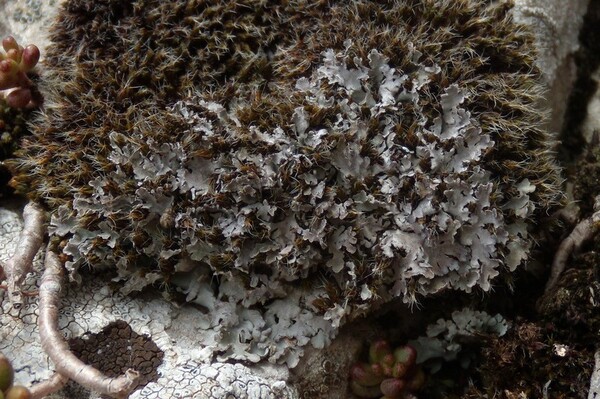
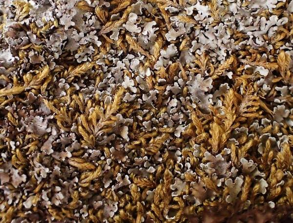
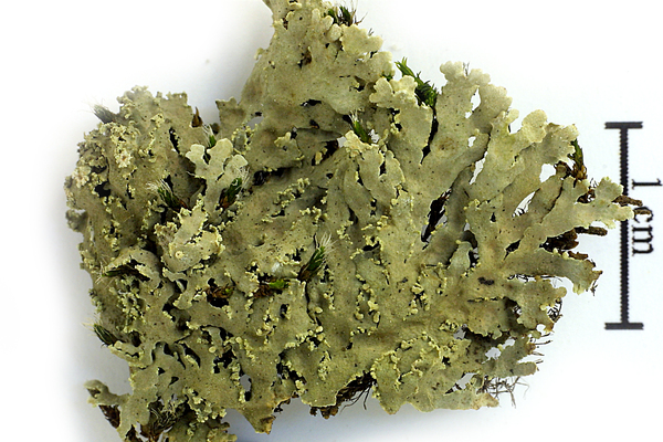
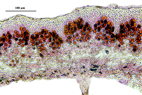
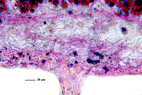
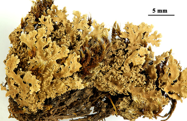
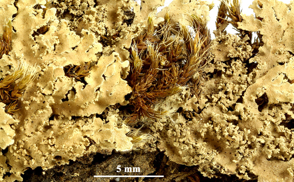
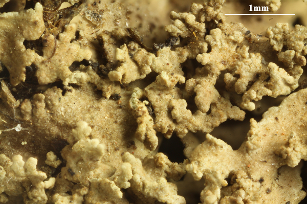
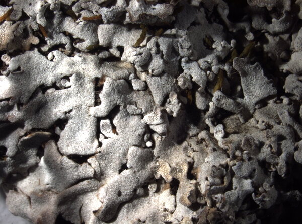
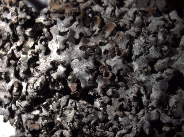
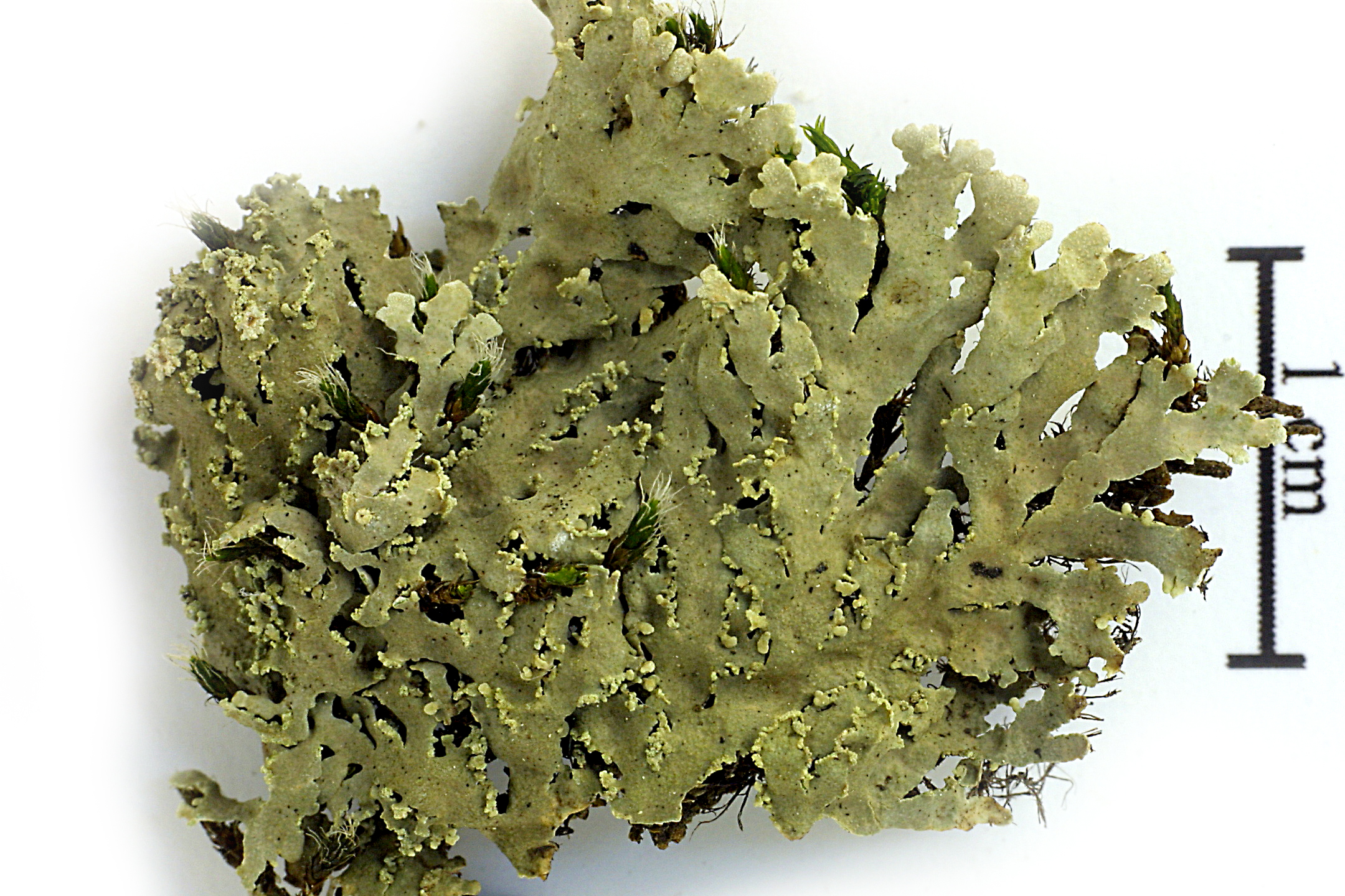
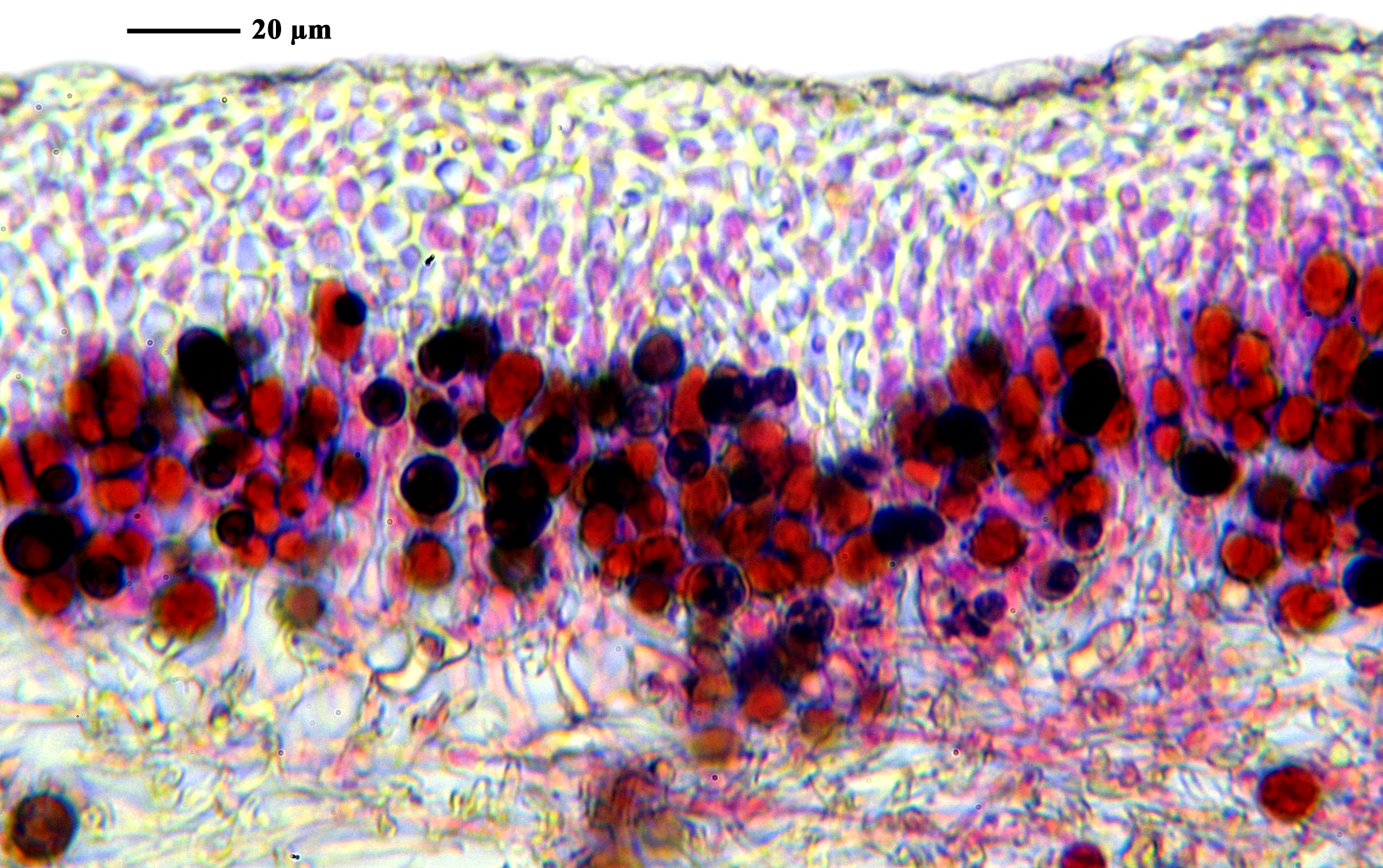
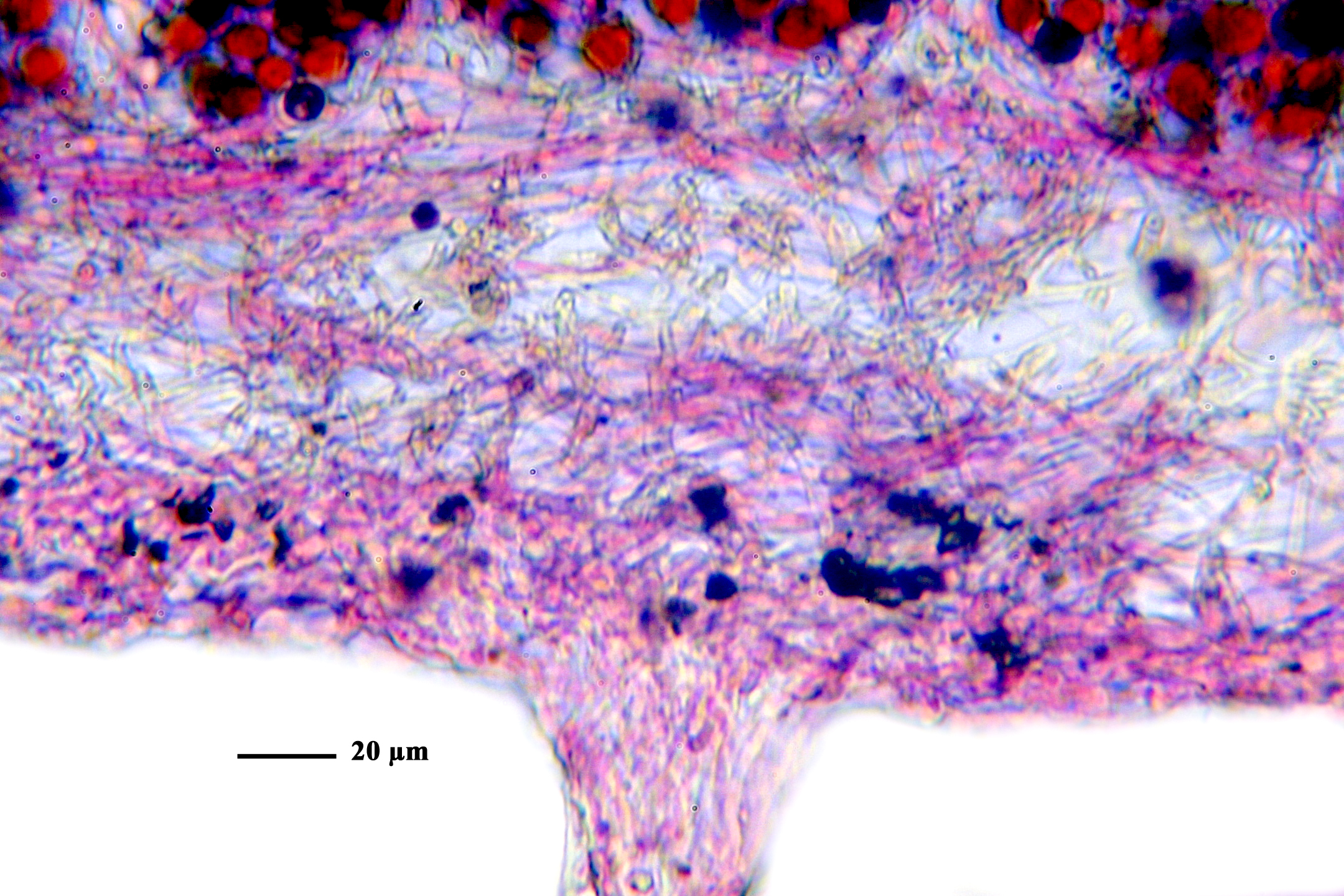
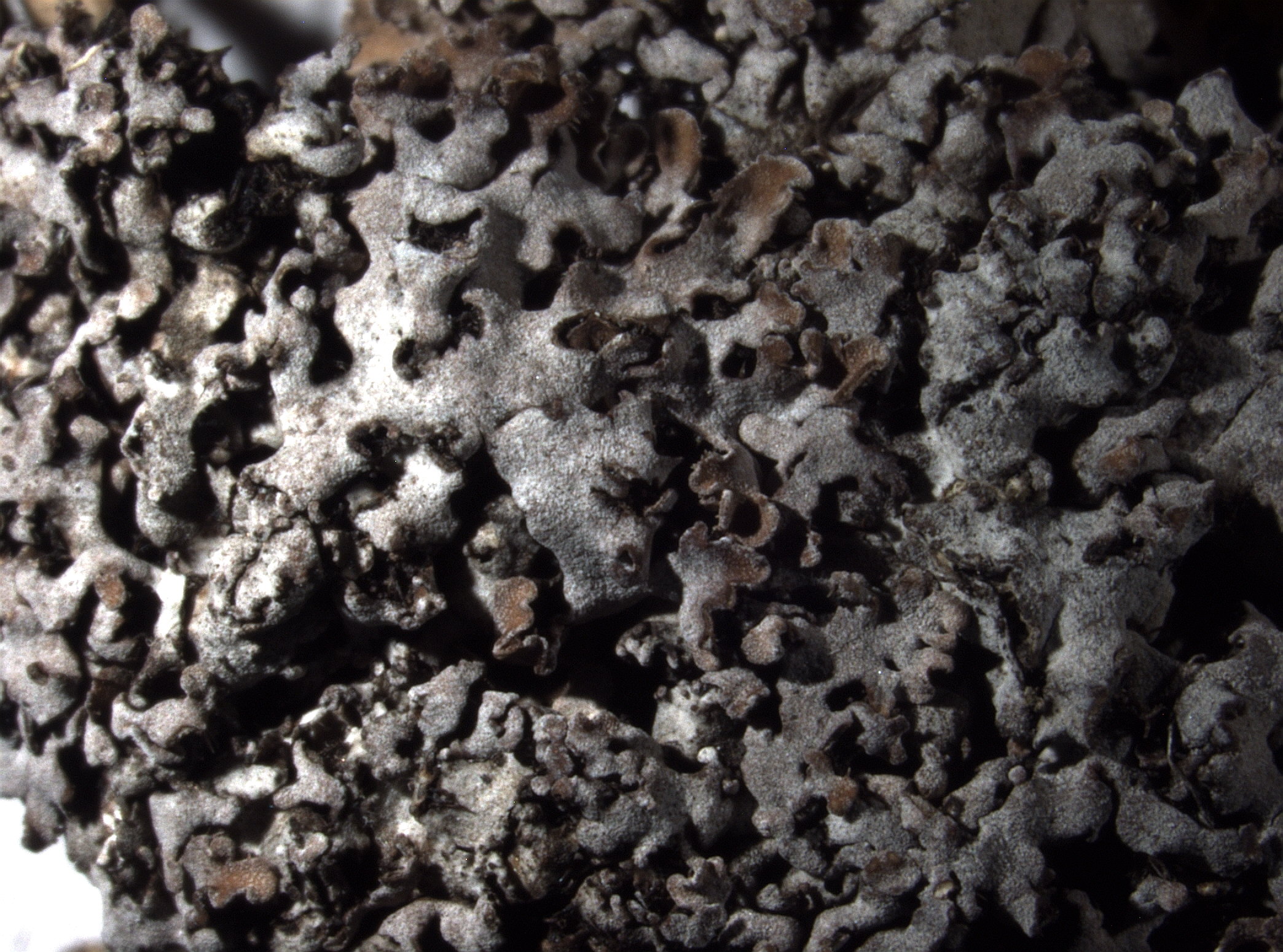
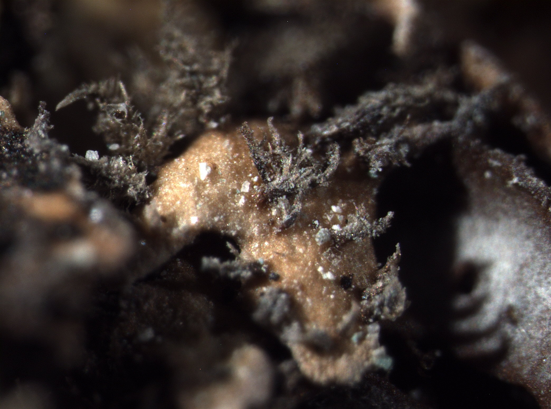
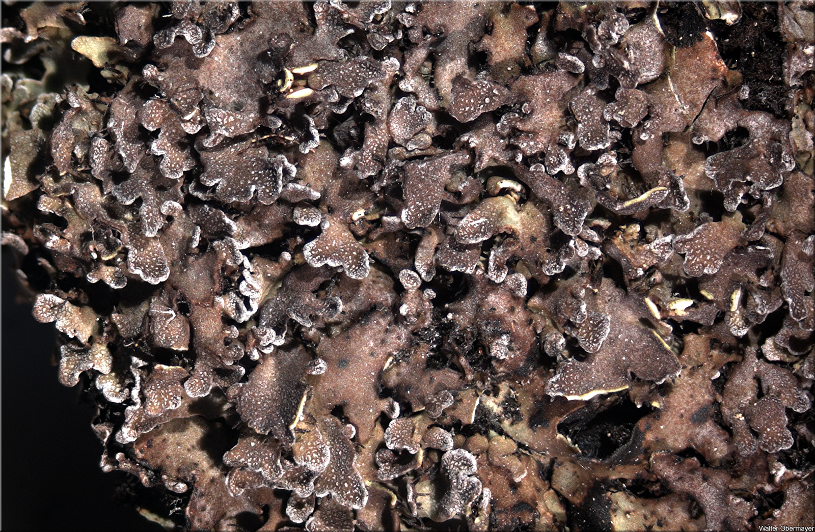
Description: Thallus foliose, heteromerous, dorsiventral, loosely attached, several thalli joining into very irregular, up to 5 (or more) cm wide patches. Lobes 1-2(-3) mm broad, elongate, flattened, often imbricate or entangled and divided into erect smaller lobules especially in central parts, usually forming dense mats. Upper surface grey to grey-brown, but often densely white-pruinose; lower surface whitish at margin, black in central parts, with black, squarrosely branched rhizines. Upper cortex paraplectenchymatous; medulla white; lower cortex irregularly prosoplectenchymatous. Apothecia rare, lecanorine, to 5 mm across, with a dark but often white-pruinose disc and an often lobulate thalline margin. Epithecium brown; hymenium and hypothecium colourless; paraphyses slender, simple or forked in upper part, the apical cells clavate, with a thin, dark brown cap. Asci 8-spored, clavate, the K/I+ blue tholus penetrated by a faintly amyloid apical cushion with parallel or diverging flanks, the wall K/I-, surrounded by a K/I+ blue outer layer, Lecanora-type. Ascospores 1-septate, brown, ellipsoid, 22-33(-35) x 12-17 µm, thickened at septum but not at apices, Physconia-type. Pycnidia frequent, black, immersed. Conidia bacilliform. Photobiont chlorococcoid. Spot tests: cortex and medulla K-, C-, KC-, P-, UV-. Chemistry: without lichen substances, very rarely with variolaric acid.
Growth form: Foliose, narrow lobed
Substrata: soil, terricolous mosses, and plant debris
Photobiont: green algae other than Trentepohlia
Reproductive strategy: mainly sexual
Commonnes-rarity: (info)
Alpine belt: extremely common
Subalpine belt: extremely common
Montane belt: rare
Dry submediterranean belt: absent
Humid submediterranean belt: absent
Padanian area: absent
pH of the substrata:
1 2 3 4 5

Solar irradiation:
1 2 3 4 5
Aridity:
1 2 3 4 5
Eutrophication:
1 2 3 4 5
Poleotolerance:
0 1 2 3
Altitudinal distribution:
1 2 3 4 5 6
Rarity
absent
extremely rare
very rare
rare
rather rare
rather common
common
very common
extremely common
Loading data...
Occurrence data
Predictive map
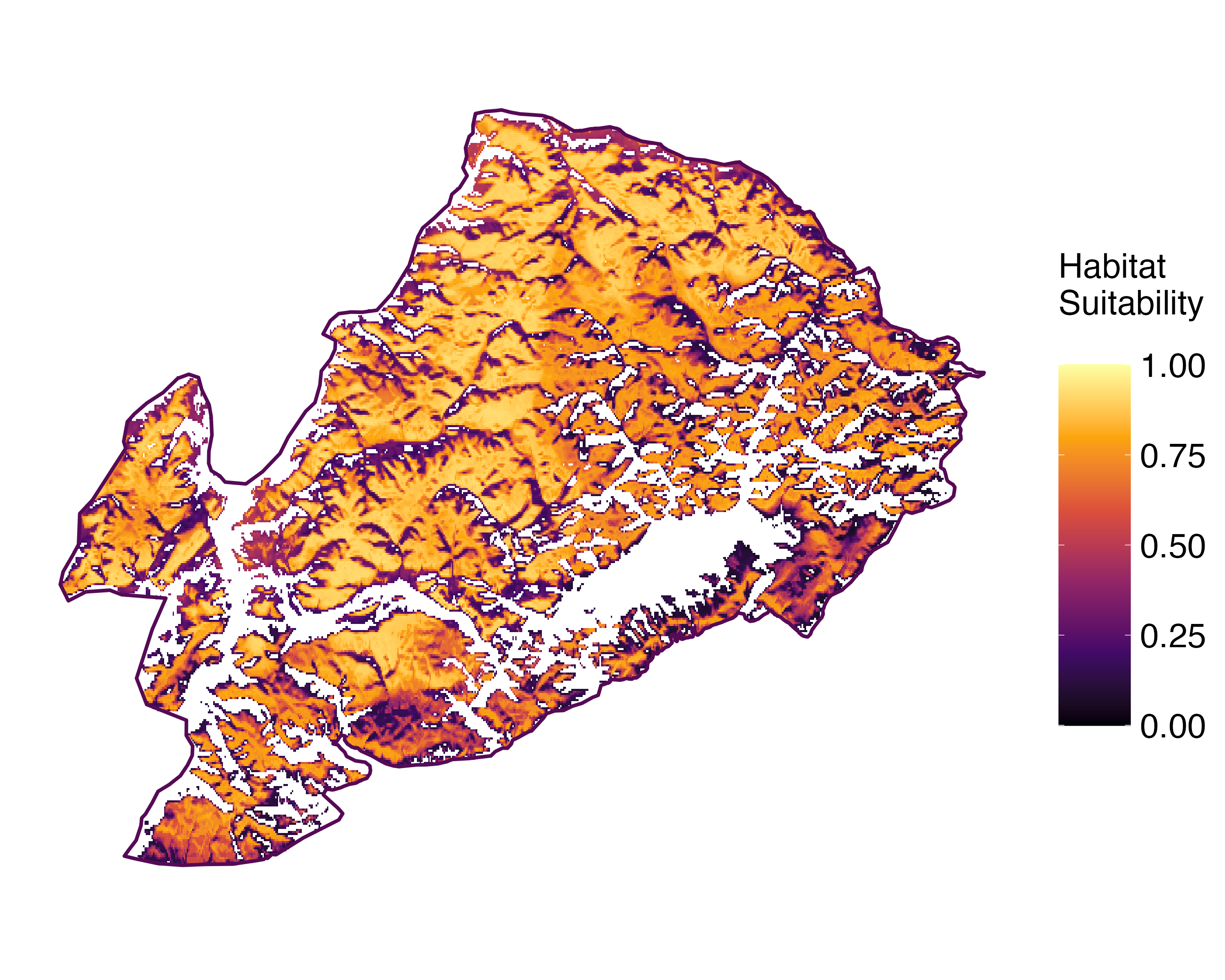 Current prediction (1981-2010)
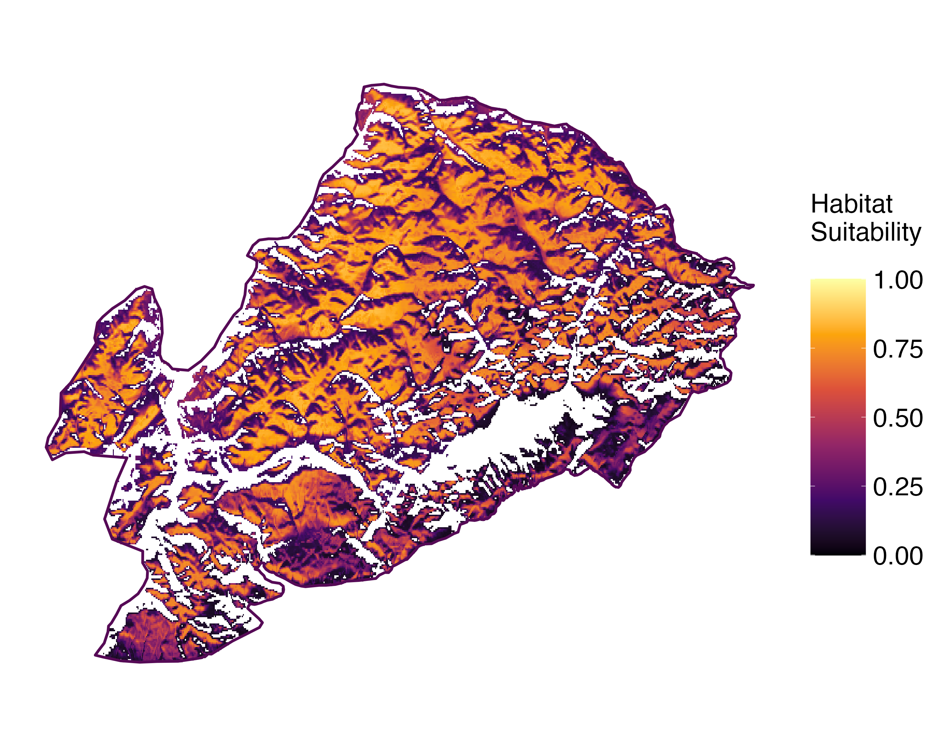 Future prediction (2071-2100) SSP 1-2.6
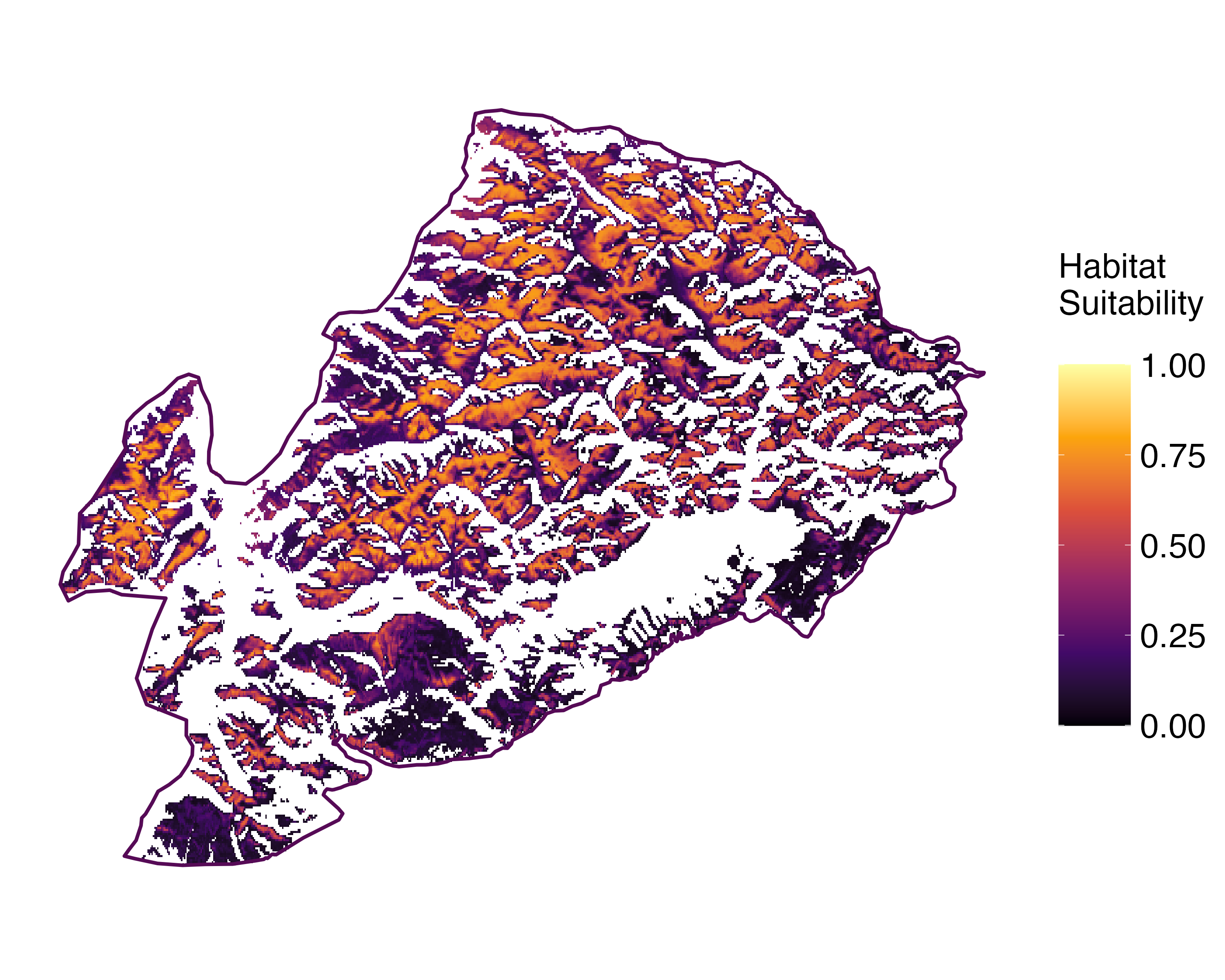 Future prediction (2071-2100) SSP 5-8.5Predictive maps according to Francesconi et al. 2025
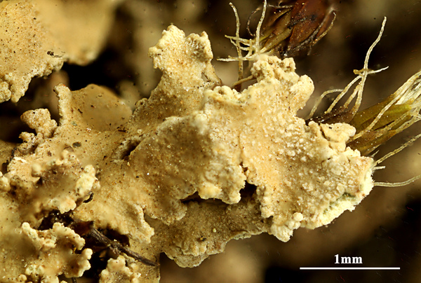
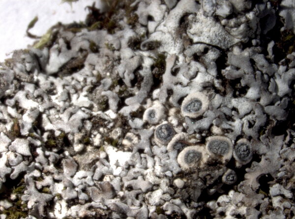
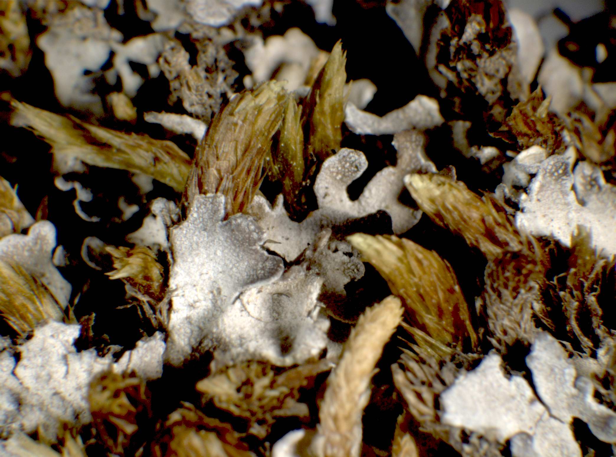
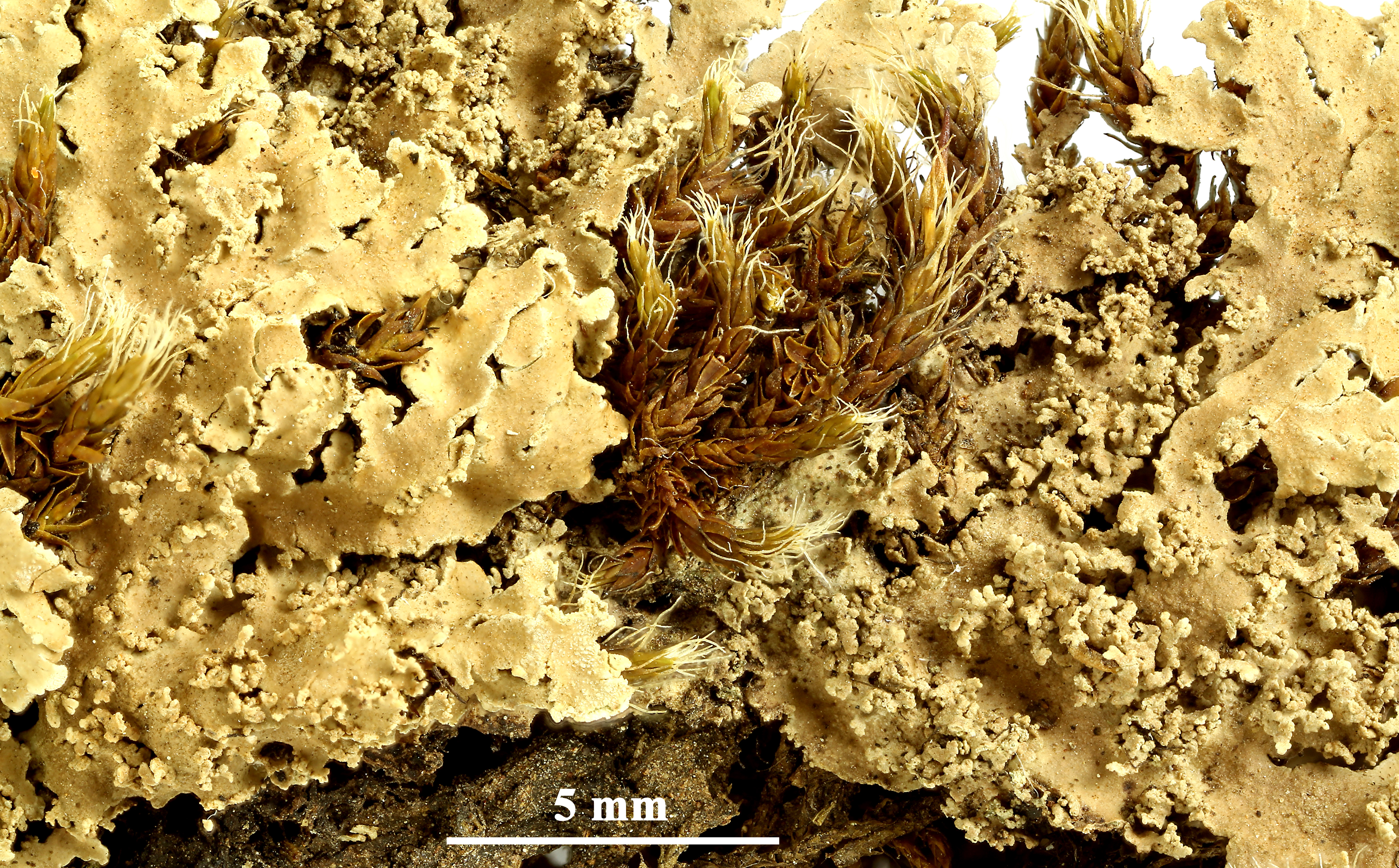
P.L. Nimis; Owner: Department of Life Sciences, University of Trieste
Herbarium: TSB (12763)
2001/12/05

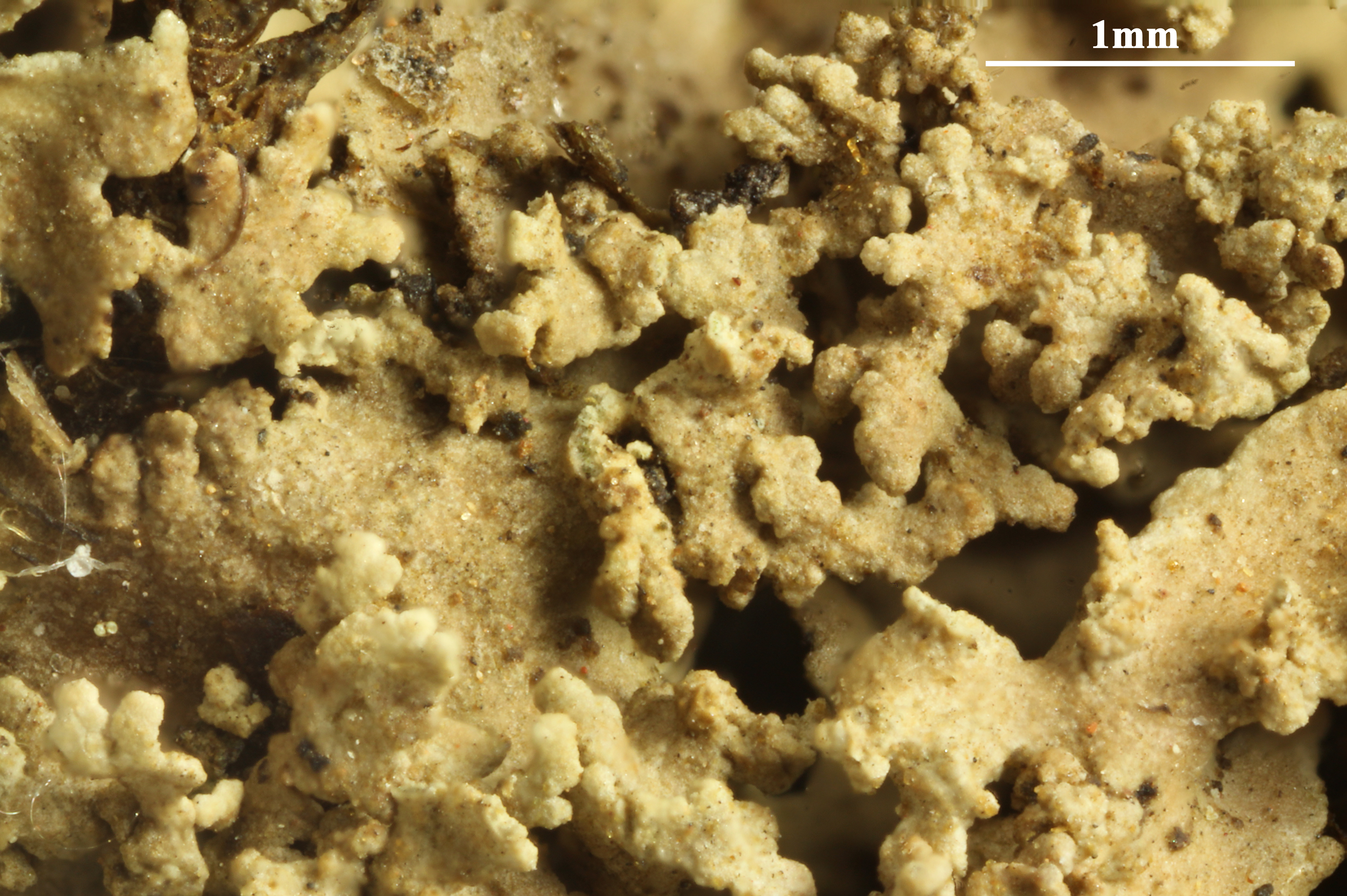
P.L. Nimis; Owner: Department of Life Sciences, University of Trieste
Herbarium: TSB (11561)
2001/12/05
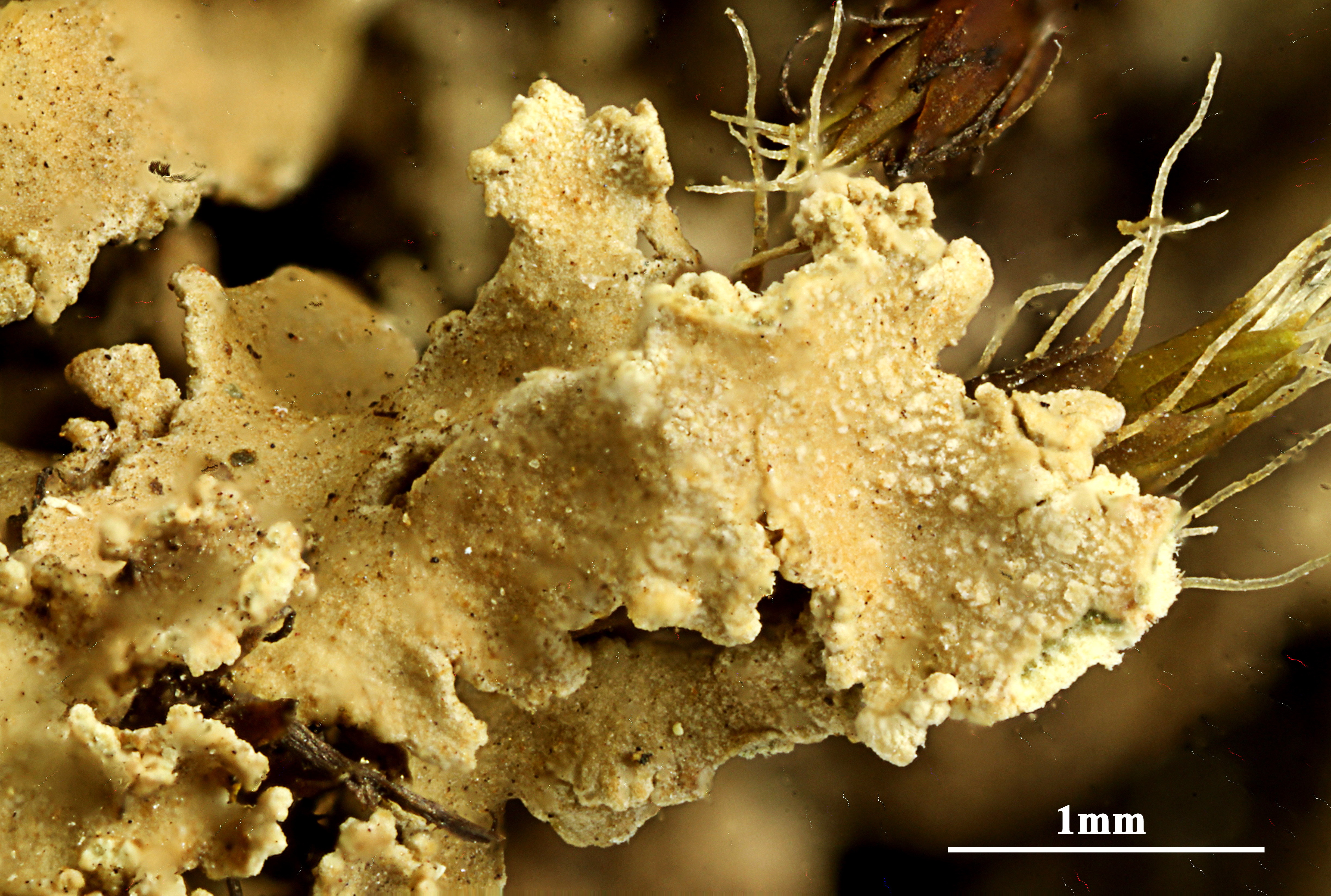
P.L. Nimis; Owner: Department of Life Sciences, University of Trieste
Herbarium: TSB (12763)
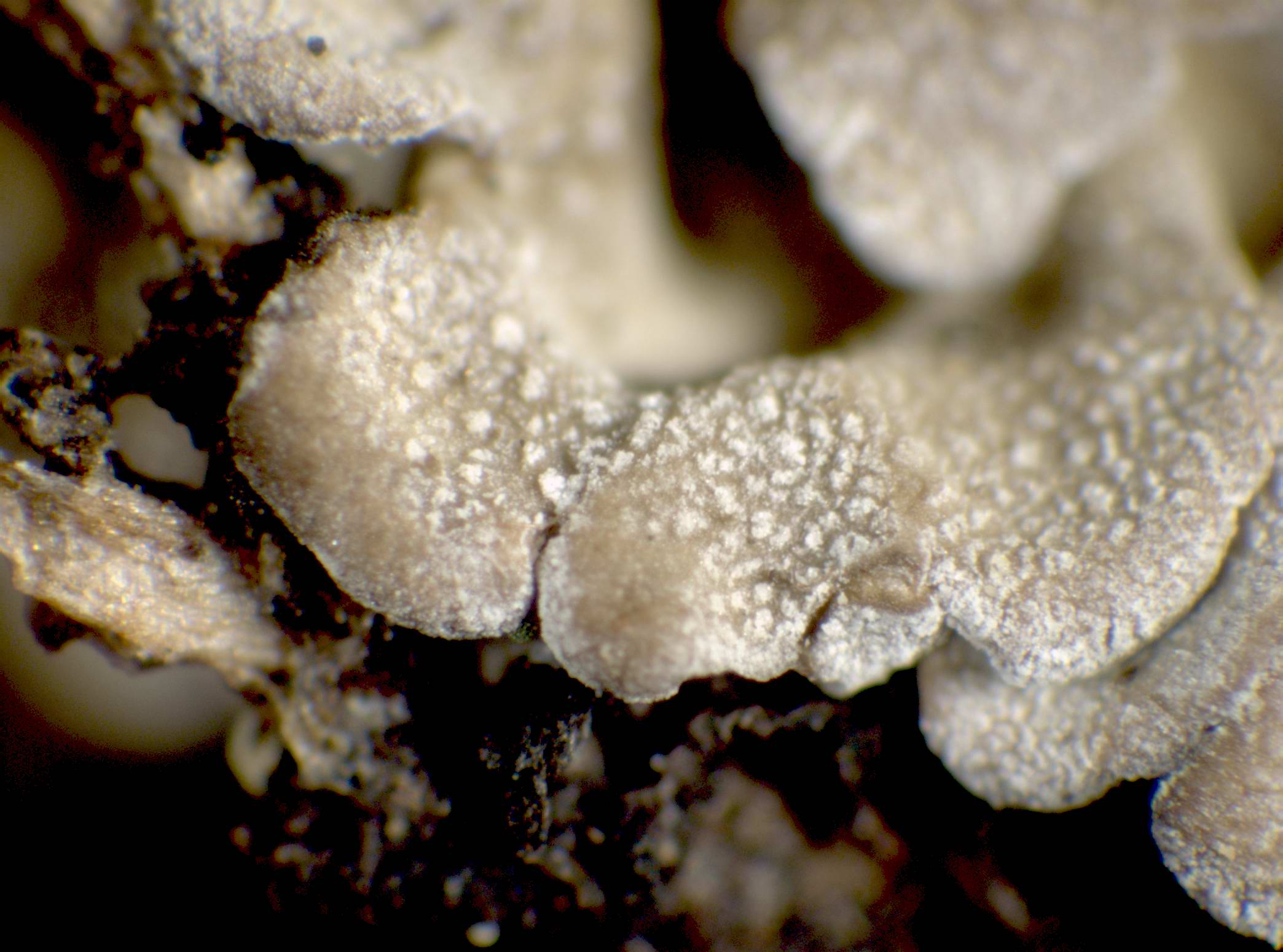
2001/12/05
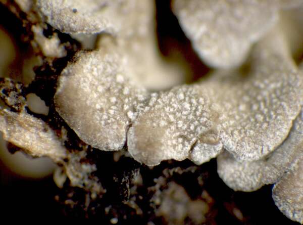
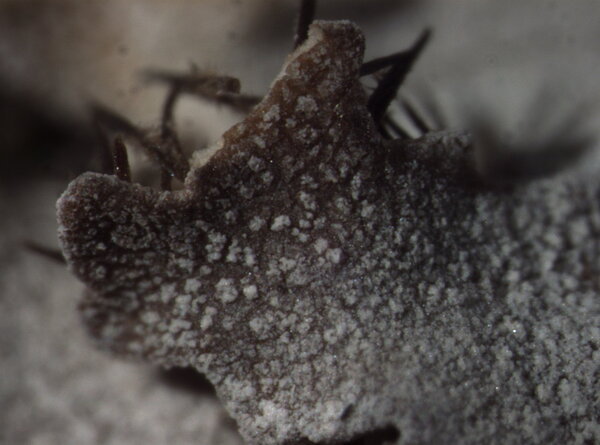
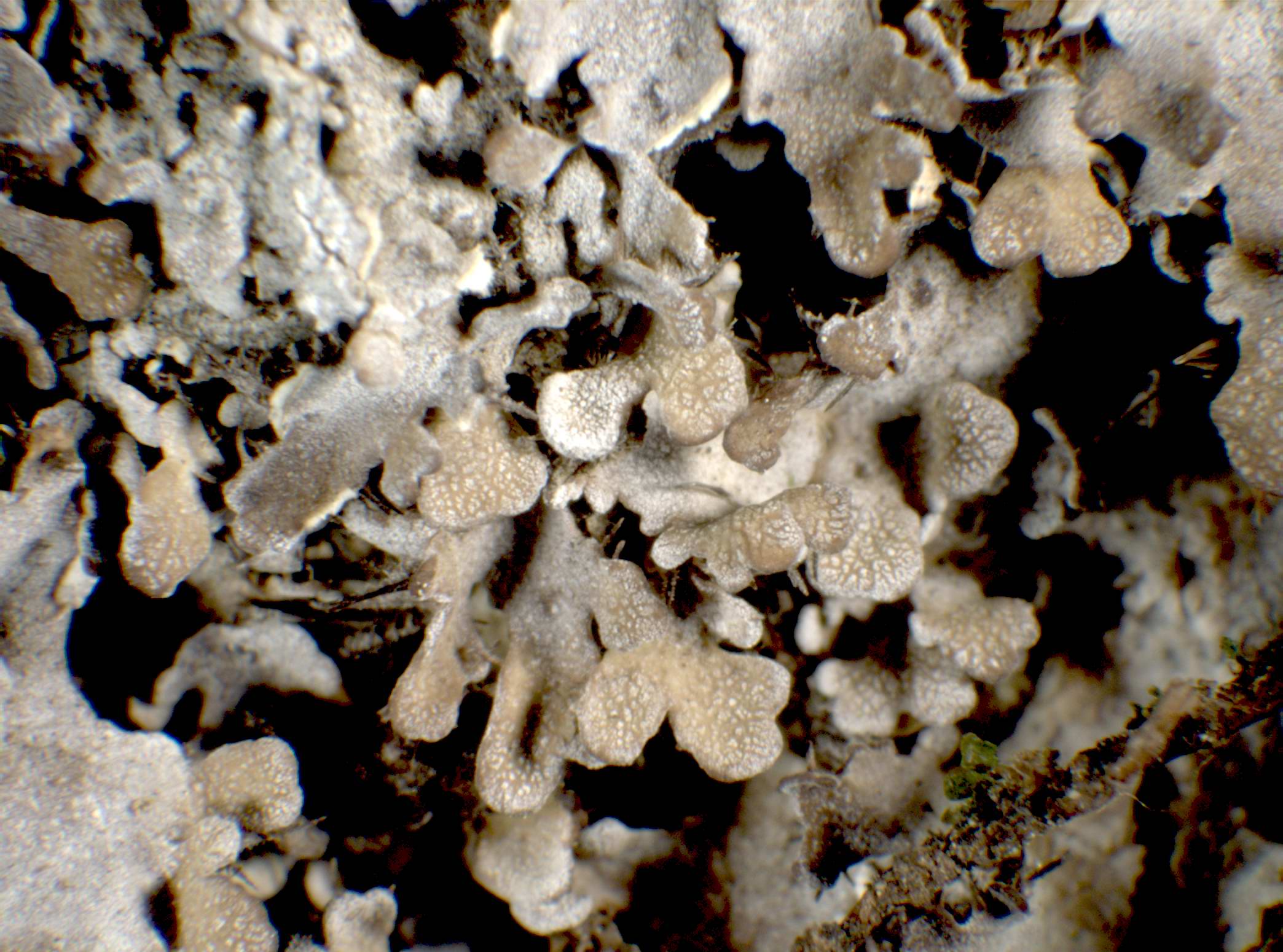
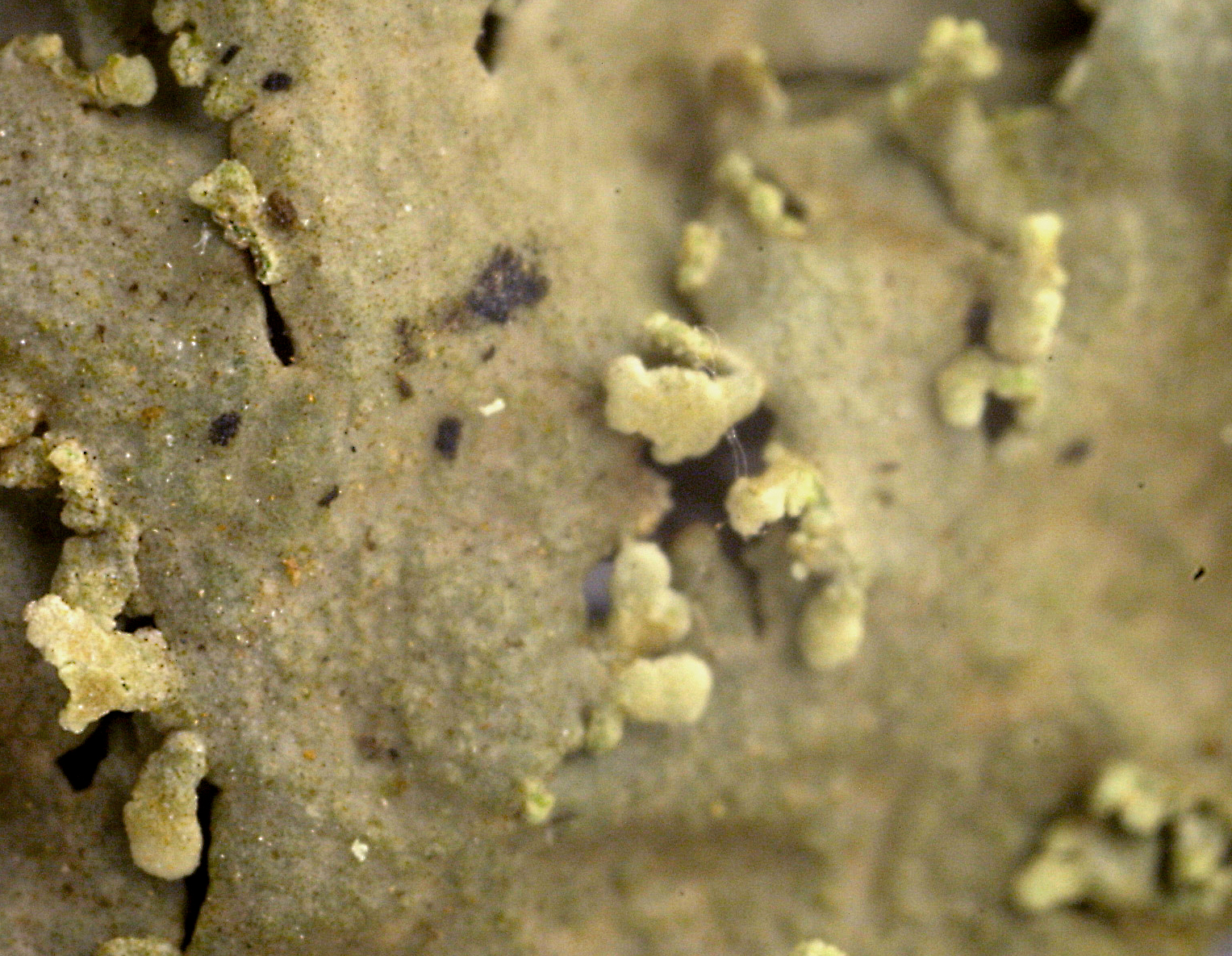
tip of lobe with pruina

Manilio Prignano; Owner: Manilio Prignano
Italia, M. Navegna, Appennino Centrale
2010
Manilio Prignano; Owner: Manilio Prignano
Italia, M. Navegna, Appennino Centrale
2010
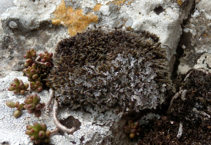
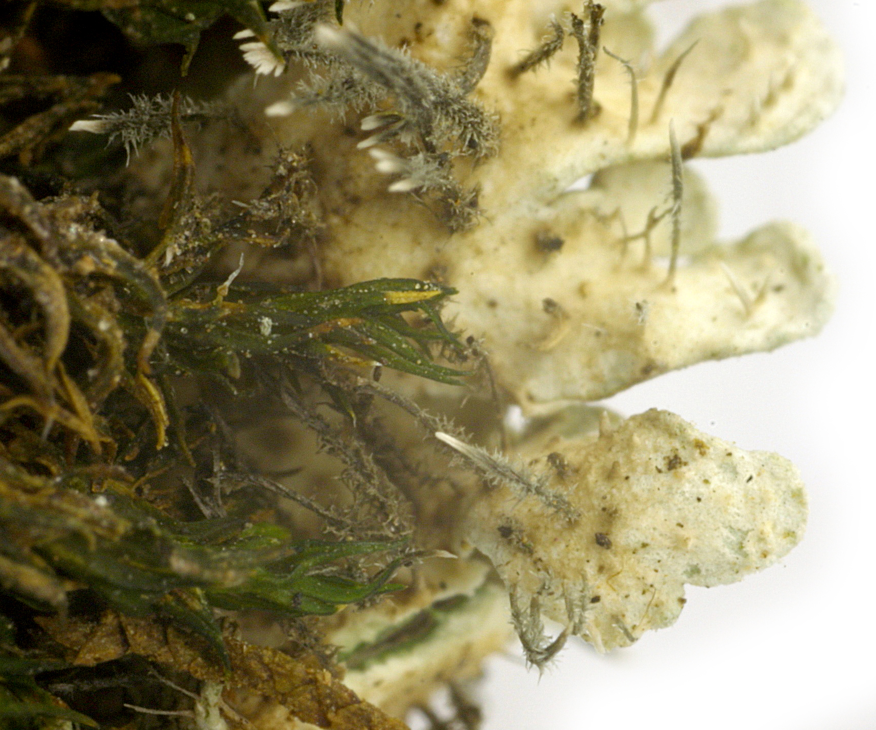
Curtis Randall Björk, - CC BY-SA 4.0
Sugarbowl-Grizzly Den Provincial Park, British Columbia, Canada
August 2017
as v. tilesii
Felix Schumm – CC BY-SA 4.0
[10026], Spanien, Kanaren, Gran Canaria, östlich des Roque Nublo an der Straße zwischen Ayacata und Telde nahe Pozo de las Nieves; meist über Moosen an Kanaren-Kiefern teils auch an Pfirsich (?); 27°58.506' N, 15°34.956' W, ca. 1700 m. Leg. et det. F. Schumm, 03.03.2003

Felix Schumm – CC BY-SA 4.0
[10026], Spanien, Kanaren, Gran Canaria, östlich des Roque Nublo an der Straße zwischen Ayacata und Telde nahe Pozo de las Nieves; meist über Moosen an Kanaren-Kiefern teils auch an Pfirsich (?); 27°58.506' N, 15°34.956' W, ca. 1700 m. Leg. et det. F. Schumm, 03.03.2003

Felix Schumm – CC BY-SA 4.0
[10026], Spanien, Kanaren, Gran Canaria, östlich des Roque Nublo an der Straße zwischen Ayacata und Telde nahe Pozo de las Nieves; meist über Moosen an Kanaren-Kiefern teils auch an Pfirsich (?); 27°58.506' N, 15°34.956' W, ca. 1700 m. Leg. et det. F. Schumm, 03.03.2003
Felix Schumm – CC BY-SA 4.0
[10026], Spanien, Kanaren, Gran Canaria, östlich des Roque Nublo an der Straße zwischen Ayacata und Telde nahe Pozo de las Nieves; meist über Moosen an Kanaren-Kiefern teils auch an Pfirsich (?); 27°58.506' N, 15°34.956' W, ca. 1700 m. Leg. et det. F. Schumm, 03.03.2003

Felix Schumm – CC BY-SA 4.0
[10026], Spanien, Kanaren, Gran Canaria, östlich des Roque Nublo an der Straße zwischen Ayacata und Telde nahe Pozo de las Nieves; meist über Moosen an Kanaren-Kiefern teils auch an Pfirsich (?); 27°58.506' N, 15°34.956' W, ca. 1700 m. Leg. et det. F. Schumm, 03.03.2003
Felix Schumm – CC BY-SA 4.0
[10026], Spanien, Kanaren, Gran Canaria, östlich des Roque Nublo an der Straße zwischen Ayacata und Telde nahe Pozo de las Nieves; meist über Moosen an Kanaren-Kiefern teils auch an Pfirsich (?); 27°58.506' N, 15°34.956' W, ca. 1700 m. Leg. et det. F. Schumm, 03.03.2003
Felix Schumm – CC BY-SA 4.0
[10026], Spanien, Kanaren, Gran Canaria, östlich des Roque Nublo an der Straße zwischen Ayacata und Telde nahe Pozo de las Nieves; meist über Moosen an Kanaren-Kiefern teils auch an Pfirsich (?); 27°58.506' N, 15°34.956' W, ca. 1700 m. Leg. et det. F. Schumm, 03.03.2003
Felix Schumm – CC BY-SA 4.0
[10026], Spanien, Kanaren, Gran Canaria, östlich des Roque Nublo an der Straße zwischen Ayacata und Telde nahe Pozo de las Nieves; meist über Moosen an Kanaren-Kiefern teils auch an Pfirsich (?); 27°58.506' N, 15°34.956' W, ca. 1700 m. Leg. et det. F. Schumm, 03.03.2003
Felix Schumm – CC BY-SA 4.0
[10026], Spanien, Kanaren, Gran Canaria, östlich des Roque Nublo an der Straße zwischen Ayacata und Telde nahe Pozo de las Nieves; meist über Moosen an Kanaren-Kiefern teils auch an Pfirsich (?); 27°58.506' N, 15°34.956' W, ca. 1700 m. Leg. et det. F. Schumm, 03.03.2003
Felix Schumm – CC BY-SA 4.0
[10026], Spanien, Kanaren, Gran Canaria, östlich des Roque Nublo an der Straße zwischen Ayacata und Telde nahe Pozo de las Nieves; meist über Moosen an Kanaren-Kiefern teils auch an Pfirsich (?); 27°58.506' N, 15°34.956' W, ca. 1700 m. Leg. et det. F. Schumm, 03.03.2003
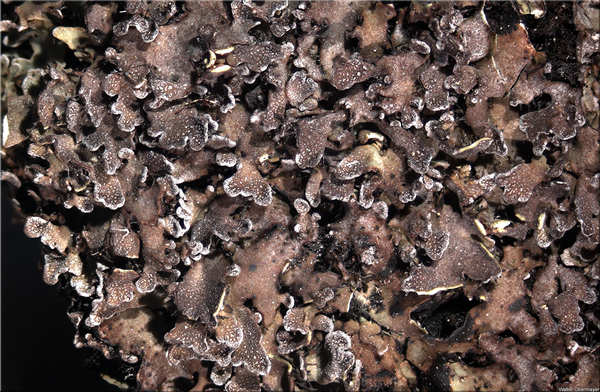
Pier Luigi Nimis CC BY-SA 4.0
TSB 37202
Pier Luigi Nimis CC BY-SA 4.0
TSB 37202
Pier Luigi Nimis CC BY-SA 4.0
TSB 37605

Pier Luigi Nimis CC BY-SA 4.0
TSB 37608
P.L. Nimis CC BY-SA 4.0
TSB 44079
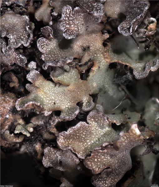
Walter Obermayer CC BY-SA 4.0 - Source: Lichens of Noricum - http://lichens-of-noricum.uni-graz.at/
Woelkergogel
2012
Walter Obermayer CC BY-SA 4.0 - Source: Lichens of Noricum - http://lichens-of-noricum.uni-graz.at/
Woelkergogel
2012

Wolfgang von Brackel - CC BY-4.0
Germany, Bavaria, Hohenfels

Wolfgang von Brackel - CC BY-4.0
Germany, Bavaria, Hohenfels

Wolfgang von Brackel - CC BY-4.0
Germany, Bavaria, Hohenfels

Wolfgang von Brackel - CC BY-4.0
Germany, Bavaria, Hohenfels

Wolfgang von Brackel - CC BY-4.0
Germany, Bavaria, Hohenfels

Wolfgang von Brackel - CC BY-4.0
Germany, Bavaria, Hohenfels

Wolfgang von Brackel - CC BY-4.0
Germany, Bavaria, Hohenfels

Wolfgang von Brackel - CC BY-4.0
Germany, Bavaria, Hohenfels

Wolfgang von Brackel - CC BY-4.0
Germany, Bavaria, Hohenfels

Wolfgang von Brackel - CC BY-4.0
Germany, Bavaria, Hohenfels

Wolfgang von Brackel - CC BY-4.0
Germany, Bavaria, Hohenfels

Wolfgang von Brackel - CC BY-4.0
Germany, Bavaria, Hohenfels

Wolfgang von Brackel - CC BY-4.0
Germany, Bavaria, Lauterachtal
Growth form: Foliose, narrow lobed
Substrata: soil, terricolous mosses, and plant debris
Photobiont: green algae other than Trentepohlia
Reproductive strategy: mainly sexual
Commonnes-rarity: (info)
Alpine belt: extremely common
Subalpine belt: extremely common
Montane belt: rare
Dry submediterranean belt: absent
Humid submediterranean belt: absent
Padanian area: absent
pH of the substrata:
| 1 | 2 | 3 | 4 | 5 |
Solar irradiation:
| 1 | 2 | 3 | 4 | 5 |
Aridity:
| 1 | 2 | 3 | 4 | 5 |
Eutrophication:
| 1 | 2 | 3 | 4 | 5 |
Poleotolerance:
| 0 | 1 | 2 | 3 |
Altitudinal distribution:
| 1 | 2 | 3 | 4 | 5 | 6 |
Rarity
absent
extremely rare
very rare
rare
rather rare
rather common
common
very common
extremely common
Loading data...
Occurrence data
Predictive map
Current prediction (1981-2010)Future prediction (2071-2100) SSP 1-2.6Future prediction (2071-2100) SSP 5-8.5Predictive maps according to Francesconi et al. 2025
P.L. Nimis; Owner: Department of Life Sciences, University of Trieste
Herbarium: TSB (12763)
2001/12/05
P.L. Nimis; Owner: Department of Life Sciences, University of Trieste
Herbarium: TSB (11561)
2001/12/05
P.L. Nimis; Owner: Department of Life Sciences, University of Trieste
Herbarium: TSB (12763)
2001/12/05
tip of lobe with pruina
Manilio Prignano; Owner: Manilio Prignano
Italia, M. Navegna, Appennino Centrale
2010

Manilio Prignano; Owner: Manilio Prignano
Italia, M. Navegna, Appennino Centrale
2010

Curtis Randall Björk, - CC BY-SA 4.0
Sugarbowl-Grizzly Den Provincial Park, British Columbia, Canada
August 2017
as v. tilesii
Felix Schumm – CC BY-SA 4.0
[10026], Spanien, Kanaren, Gran Canaria, östlich des Roque Nublo an der Straße zwischen Ayacata und Telde nahe Pozo de las Nieves; meist über Moosen an Kanaren-Kiefern teils auch an Pfirsich (?); 27°58.506' N, 15°34.956' W, ca. 1700 m. Leg. et det. F. Schumm, 03.03.2003
Felix Schumm – CC BY-SA 4.0
[10026], Spanien, Kanaren, Gran Canaria, östlich des Roque Nublo an der Straße zwischen Ayacata und Telde nahe Pozo de las Nieves; meist über Moosen an Kanaren-Kiefern teils auch an Pfirsich (?); 27°58.506' N, 15°34.956' W, ca. 1700 m. Leg. et det. F. Schumm, 03.03.2003
Felix Schumm – CC BY-SA 4.0
[10026], Spanien, Kanaren, Gran Canaria, östlich des Roque Nublo an der Straße zwischen Ayacata und Telde nahe Pozo de las Nieves; meist über Moosen an Kanaren-Kiefern teils auch an Pfirsich (?); 27°58.506' N, 15°34.956' W, ca. 1700 m. Leg. et det. F. Schumm, 03.03.2003

Felix Schumm – CC BY-SA 4.0
[10026], Spanien, Kanaren, Gran Canaria, östlich des Roque Nublo an der Straße zwischen Ayacata und Telde nahe Pozo de las Nieves; meist über Moosen an Kanaren-Kiefern teils auch an Pfirsich (?); 27°58.506' N, 15°34.956' W, ca. 1700 m. Leg. et det. F. Schumm, 03.03.2003
Felix Schumm – CC BY-SA 4.0
[10026], Spanien, Kanaren, Gran Canaria, östlich des Roque Nublo an der Straße zwischen Ayacata und Telde nahe Pozo de las Nieves; meist über Moosen an Kanaren-Kiefern teils auch an Pfirsich (?); 27°58.506' N, 15°34.956' W, ca. 1700 m. Leg. et det. F. Schumm, 03.03.2003
Felix Schumm – CC BY-SA 4.0
[10026], Spanien, Kanaren, Gran Canaria, östlich des Roque Nublo an der Straße zwischen Ayacata und Telde nahe Pozo de las Nieves; meist über Moosen an Kanaren-Kiefern teils auch an Pfirsich (?); 27°58.506' N, 15°34.956' W, ca. 1700 m. Leg. et det. F. Schumm, 03.03.2003

Felix Schumm – CC BY-SA 4.0
[10026], Spanien, Kanaren, Gran Canaria, östlich des Roque Nublo an der Straße zwischen Ayacata und Telde nahe Pozo de las Nieves; meist über Moosen an Kanaren-Kiefern teils auch an Pfirsich (?); 27°58.506' N, 15°34.956' W, ca. 1700 m. Leg. et det. F. Schumm, 03.03.2003
Felix Schumm – CC BY-SA 4.0
[10026], Spanien, Kanaren, Gran Canaria, östlich des Roque Nublo an der Straße zwischen Ayacata und Telde nahe Pozo de las Nieves; meist über Moosen an Kanaren-Kiefern teils auch an Pfirsich (?); 27°58.506' N, 15°34.956' W, ca. 1700 m. Leg. et det. F. Schumm, 03.03.2003
Felix Schumm – CC BY-SA 4.0
[10026], Spanien, Kanaren, Gran Canaria, östlich des Roque Nublo an der Straße zwischen Ayacata und Telde nahe Pozo de las Nieves; meist über Moosen an Kanaren-Kiefern teils auch an Pfirsich (?); 27°58.506' N, 15°34.956' W, ca. 1700 m. Leg. et det. F. Schumm, 03.03.2003
Felix Schumm – CC BY-SA 4.0
[10026], Spanien, Kanaren, Gran Canaria, östlich des Roque Nublo an der Straße zwischen Ayacata und Telde nahe Pozo de las Nieves; meist über Moosen an Kanaren-Kiefern teils auch an Pfirsich (?); 27°58.506' N, 15°34.956' W, ca. 1700 m. Leg. et det. F. Schumm, 03.03.2003
Pier Luigi Nimis CC BY-SA 4.0
TSB 37202

Pier Luigi Nimis CC BY-SA 4.0
TSB 37202
Pier Luigi Nimis CC BY-SA 4.0
TSB 37605
Pier Luigi Nimis CC BY-SA 4.0
TSB 37608

P.L. Nimis CC BY-SA 4.0
TSB 44079
Walter Obermayer CC BY-SA 4.0 - Source: Lichens of Noricum - http://lichens-of-noricum.uni-graz.at/
Woelkergogel
2012

Walter Obermayer CC BY-SA 4.0 - Source: Lichens of Noricum - http://lichens-of-noricum.uni-graz.at/
Woelkergogel
2012

Wolfgang von Brackel - CC BY-4.0
Germany, Bavaria, Hohenfels

Wolfgang von Brackel - CC BY-4.0
Germany, Bavaria, Hohenfels

Wolfgang von Brackel - CC BY-4.0
Germany, Bavaria, Hohenfels

Wolfgang von Brackel - CC BY-4.0
Germany, Bavaria, Hohenfels

Wolfgang von Brackel - CC BY-4.0
Germany, Bavaria, Hohenfels

Wolfgang von Brackel - CC BY-4.0
Germany, Bavaria, Hohenfels

Wolfgang von Brackel - CC BY-4.0
Germany, Bavaria, Hohenfels

Wolfgang von Brackel - CC BY-4.0
Germany, Bavaria, Hohenfels

Wolfgang von Brackel - CC BY-4.0
Germany, Bavaria, Hohenfels

Wolfgang von Brackel - CC BY-4.0
Germany, Bavaria, Hohenfels

Wolfgang von Brackel - CC BY-4.0
Germany, Bavaria, Hohenfels

Wolfgang von Brackel - CC BY-4.0
Germany, Bavaria, Hohenfels


