
Ramalina subfarinacea (Cromb.) Nyl.
Bull. Soc. Linn. Normandie, sér. 2, 6: 258, 1872. Basionym: Ramalina scopulorum var. subfarinacea Nyl. ex Cromb. - J. Bot. London, 10: 74, 1872.
Synonyms: Ramalina angustissima (Anzi) Vain.; Ramalina farinacea f. saxicola Jatta; Ramalina farinacea var. angustissima Anzi; Ramalina farinacea var. rubescens Räsänen
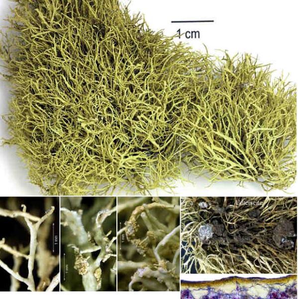
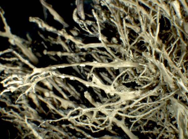
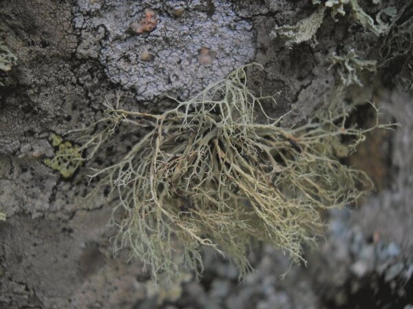
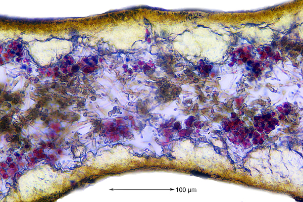
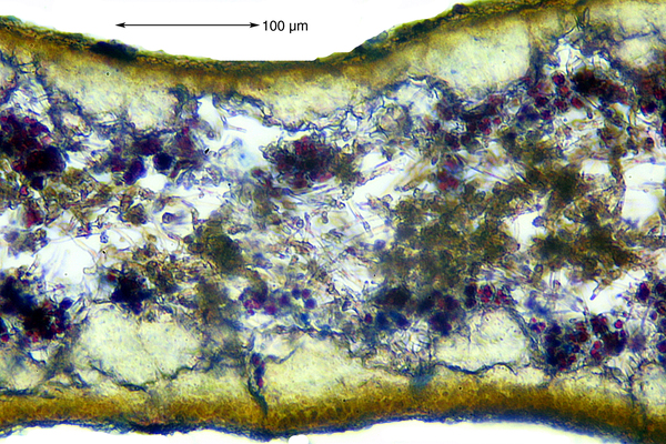
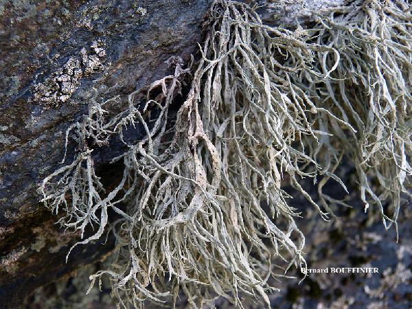
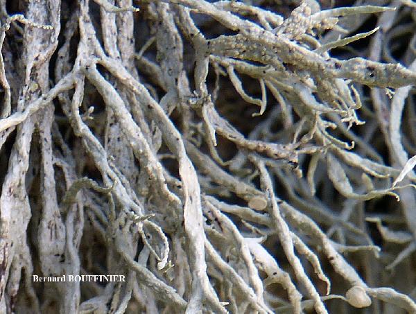
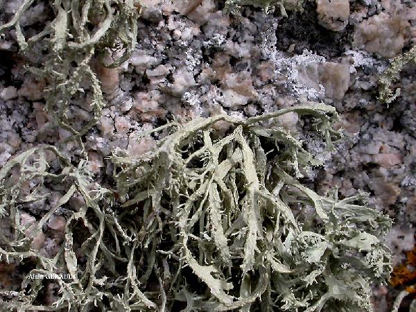
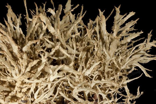
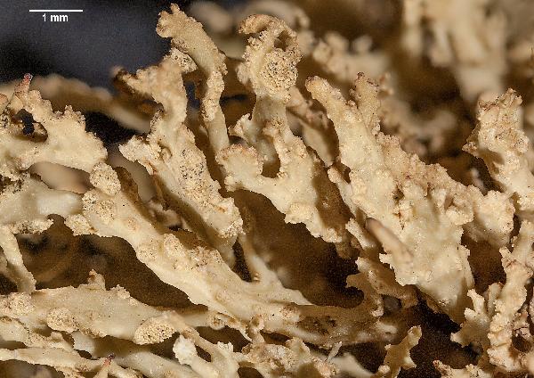
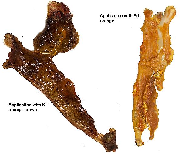
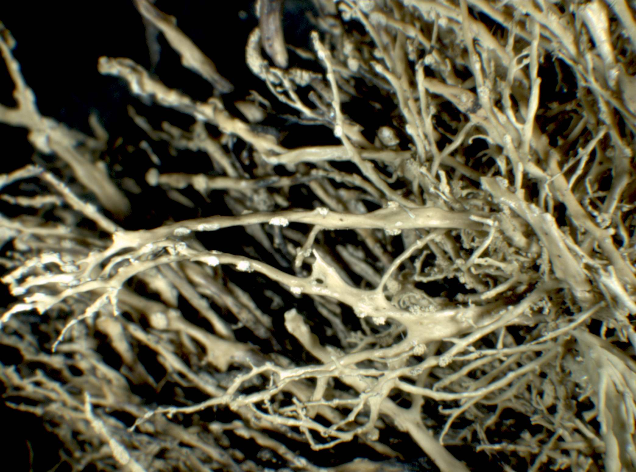
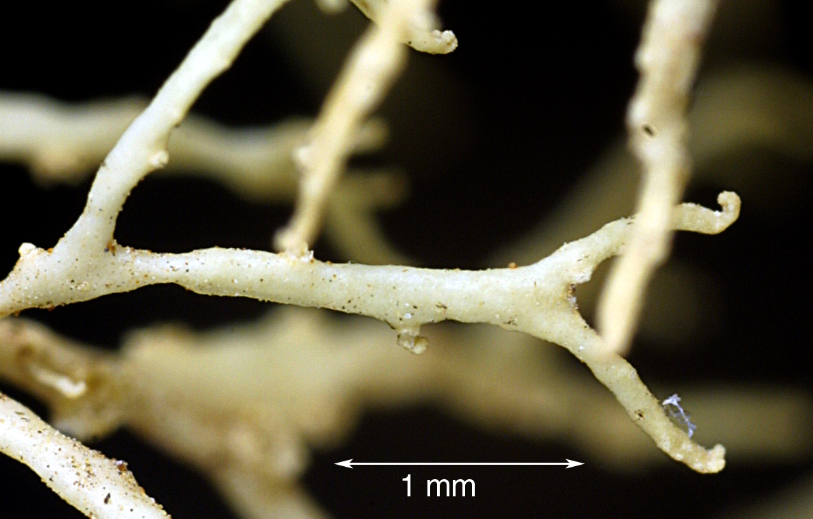
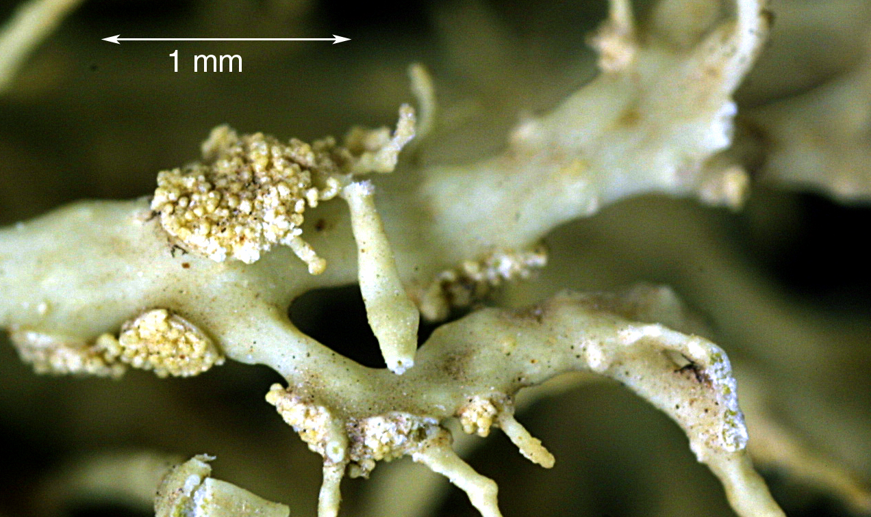
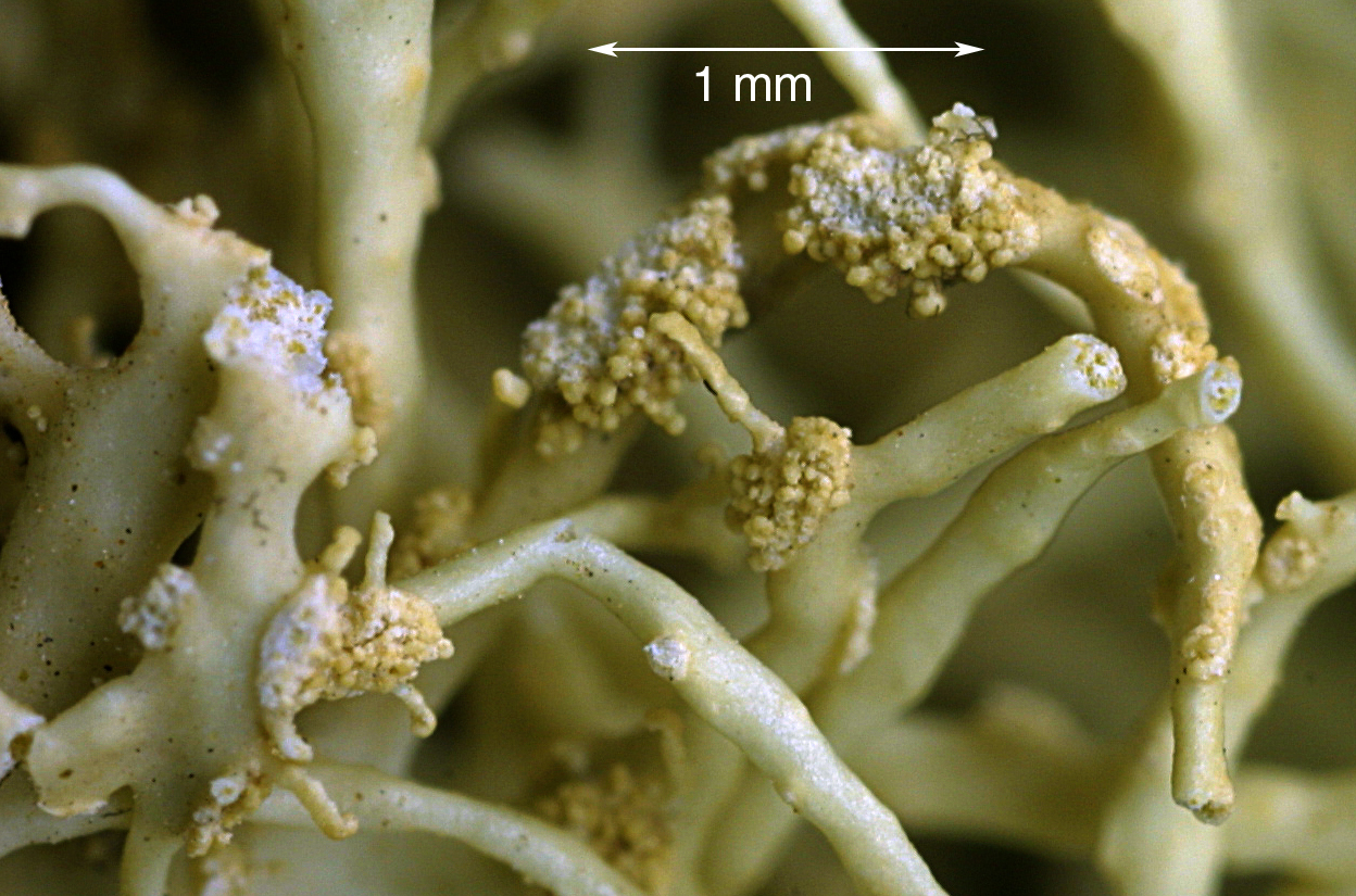
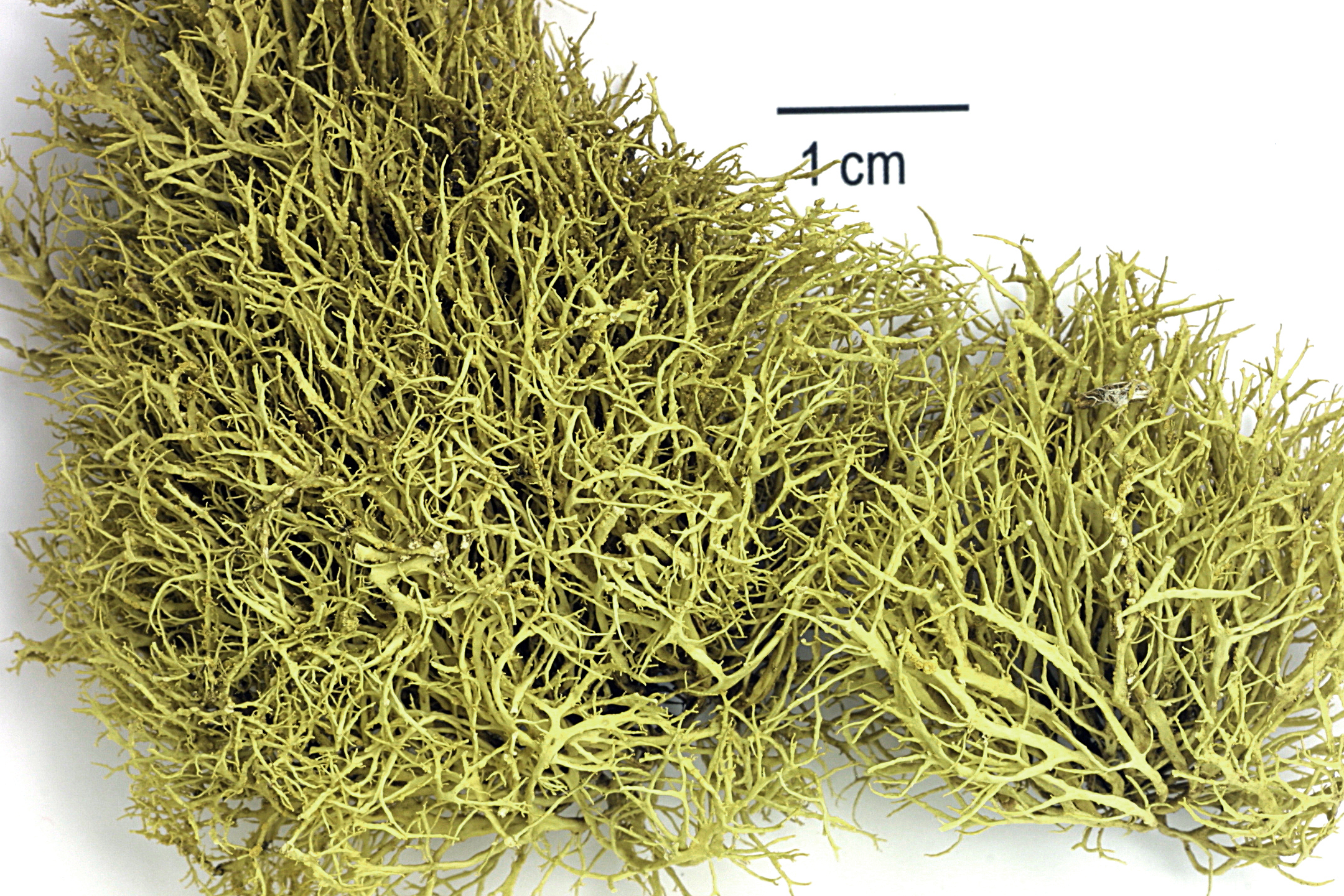
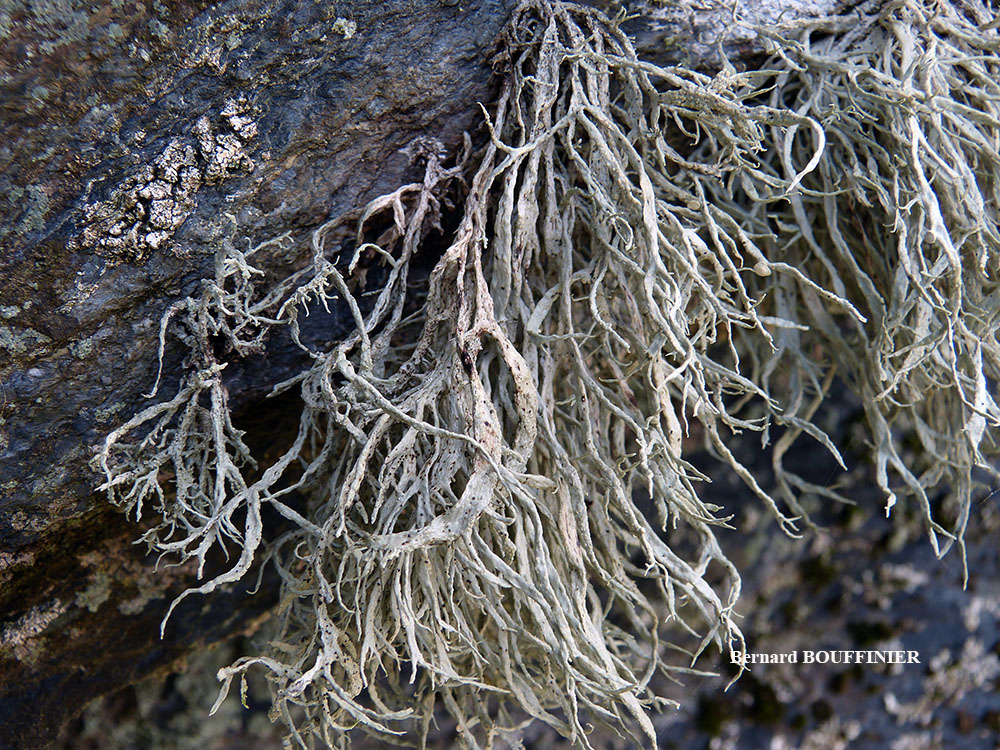
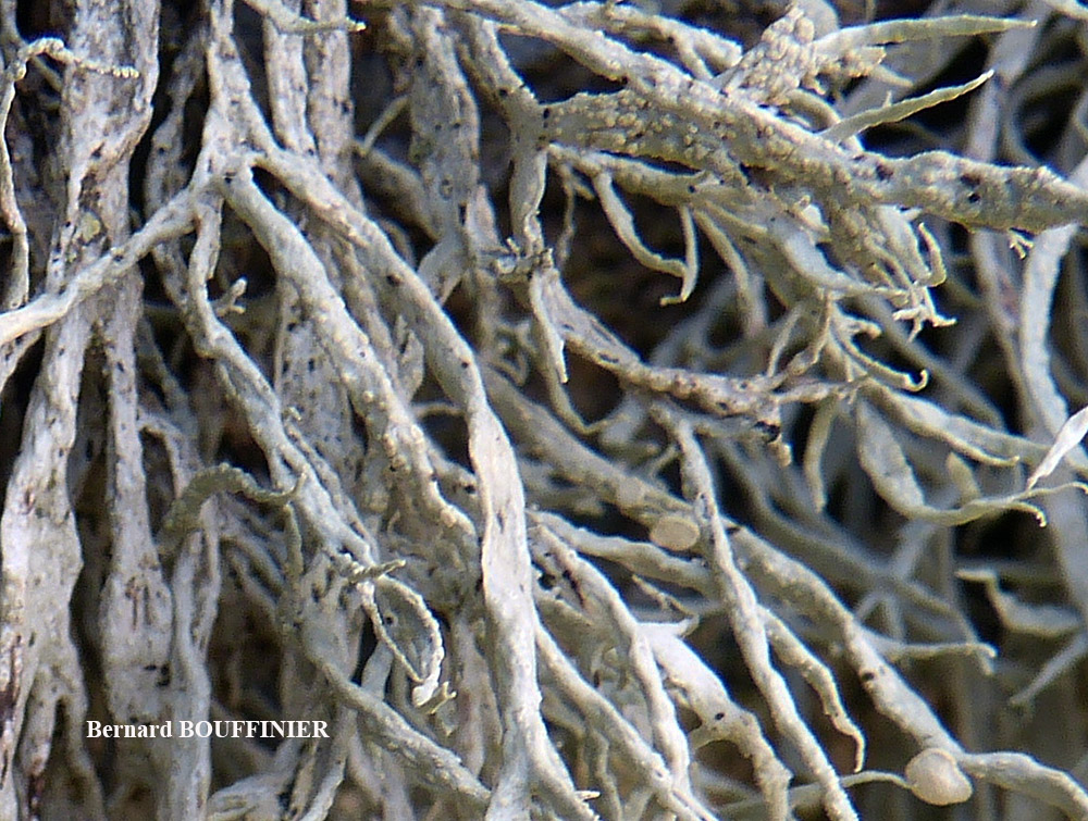
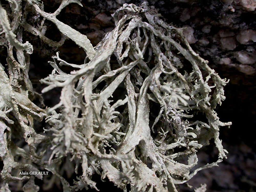
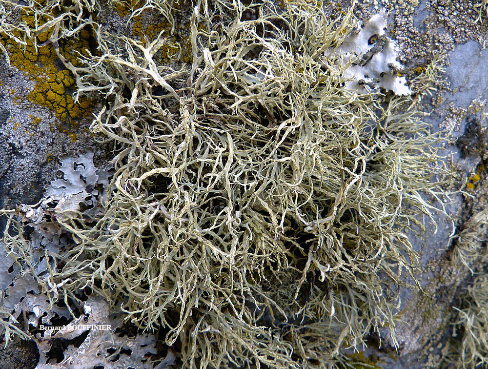
Description: Thallus fruticose, yellowish green, shrubby or tufted, pendulous in very well-developed specimens, to 5(-7) cm long, irregularly or dichotomously branched from a spreading basal holdfast, often forming extensive swards. Branches solid, flattened but not dorsiventral, 0.5-3 mm wide, smooth, with well-delimited, elliptical to round, flat to excavate, marginal soralia bearing granular soredia. Cortex 2-layered, the outer part paraplectenchymatous, the inner part of cartilaginous chondroid strands; medulla white, compact. Apothecia very rare (not observed in Italian material). Photobiont chlorococcoid. Spot tests and chemistry: cortex with usnic acid; medulla and soralia with four chemotypes: 1) K- or orange-brown, P+ orange-red, UV- (protocetraric acid), 2) K+ yellow then red, P+ yellow-orange, UV- (salazinic acid and traces of norstictic acid), 3) K-, P-, UV+ blue-white (hypoprotocetraric acid), and, 4) K-, P-, UV- (no lichen substances).
Growth form: Fruticose
Substrata: rocks
Photobiont: green algae other than Trentepohlia
Reproductive strategy: mainly asexual, by soredia, or soredia-like structures (e.g. blastidia)
Most common in areas with a humid-warm climate (e.g. most of Tyrrenian Italy)
Commonnes-rarity: (info)
Alpine belt: absent
Subalpine belt: absent
Montane belt: absent
Dry submediterranean belt: extremely rare
Humid submediterranean belt: rare
Padanian area: absent
pH of the substrata:
1 2 3 4 5

Solar irradiation:
1 2 3 4 5
Aridity:
1 2 3 4 5
Eutrophication:
1 2 3 4 5
Poleotolerance:
0 1 2 3
Altitudinal distribution:
1 2 3 4 5 6
Rarity
absent
extremely rare
very rare
rare
rather rare
rather common
common
very common
extremely common
Loading data...
Occurrence data
Predictive map
Felix Schumm – CC BY-SA 4.0
Image from: F. Schumm (2008) - Flechten Madeiras, der Kanaren und Azoren. Beck, OHG - ISBN: 978-3-00-023700-3
P.L. Nimis; Owner: Department of Life Sciences, University of Trieste
Herbarium: TSB (13204)
2001/12/07
Caterina Azara; Owner: Caterina Azara
Italy, Sardegna, Oristano, Luogosanto, Gallura
2010

Felix Schumm - CC BY-SA 4.0
[10312], Spanien, Kanarische Inseln, La Gomera, westlich von Arure am Weg zum Mirador del Santo (Eremita del Santo), 28°07.9' N, 17°19.3' W, 820 m; wind-, nebel und lichtoffene, NO-exponierte Basaltfelsen mit viel Roccella und Ramalina. Leg. et det. Schumm 18.04.2003

Felix Schumm - CC BY-SA 4.0
[10312], Spanien, Kanarische Inseln, La Gomera, westlich von Arure am Weg zum Mirador del Santo (Eremita del Santo), 28°07.9' N, 17°19.3' W, 820 m; wind-, nebel und lichtoffene, NO-exponierte Basaltfelsen mit viel Roccella und Ramalina. Leg. et det. Schumm 18.04.2003

Felix Schumm - CC BY-SA 4.0
[10312], Spanien, Kanarische Inseln, La Gomera, westlich von Arure am Weg zum Mirador del Santo (Eremita del Santo), 28°07.9' N, 17°19.3' W, 820 m; wind-, nebel und lichtoffene, NO-exponierte Basaltfelsen mit viel Roccella und Ramalina. Leg. et det. Schumm 18.04.2003

Felix Schumm - CC BY-SA 4.0
[10312], Spanien, Kanarische Inseln, La Gomera, westlich von Arure am Weg zum Mirador del Santo (Eremita del Santo), 28°07.9' N, 17°19.3' W, 820 m; wind-, nebel und lichtoffene, NO-exponierte Basaltfelsen mit viel Roccella und Ramalina. Leg. et det. Schumm 18.04.2003
Felix Schumm - CC BY-SA 4.0
[10312], Spanien, Kanarische Inseln, La Gomera, westlich von Arure am Weg zum Mirador del Santo (Eremita del Santo), 28°07.9' N, 17°19.3' W, 820 m; wind-, nebel und lichtoffene, NO-exponierte Basaltfelsen mit viel Roccella und Ramalina. Leg. et det. Schumm 18.04.2003
Felix Schumm - CC BY-SA 4.0
[10312], Spanien, Kanarische Inseln, La Gomera, westlich von Arure am Weg zum Mirador del Santo (Eremita del Santo), 28°07.9' N, 17°19.3' W, 820 m; wind-, nebel und lichtoffene, NO-exponierte Basaltfelsen mit viel Roccella und Ramalina. Leg. et det. Schumm 18.04.2003

Felix Schumm - CC BY-SA 4.0
[10312], Spanien, Kanarische Inseln, La Gomera, westlich von Arure am Weg zum Mirador del Santo (Eremita del Santo), 28°07.9' N, 17°19.3' W, 820 m; wind-, nebel und lichtoffene, NO-exponierte Basaltfelsen mit viel Roccella und Ramalina. Leg. et det. Schumm 18.04.2003
Alain Gerault - Source:http://www.lichensmaritimes.org/index.php?task=fiche&lichen=50&lang=en
France, Roc'h Tredudon
Alain Gerault - Source:http://www.lichensmaritimes.org/index.php?task=fiche&lichen=50&lang=en
France, Roc'h Tredudon
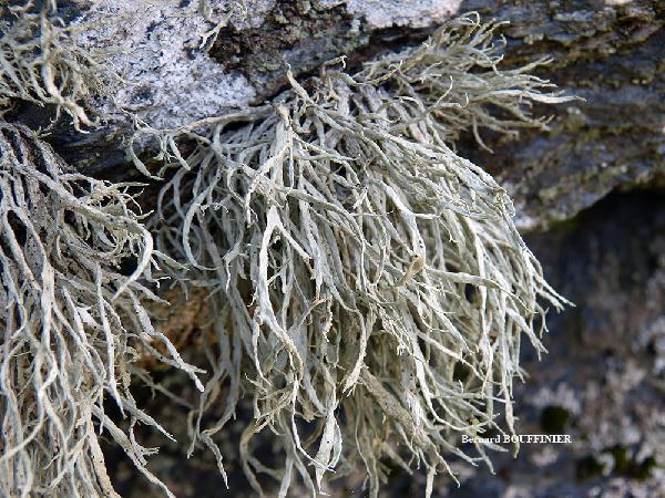
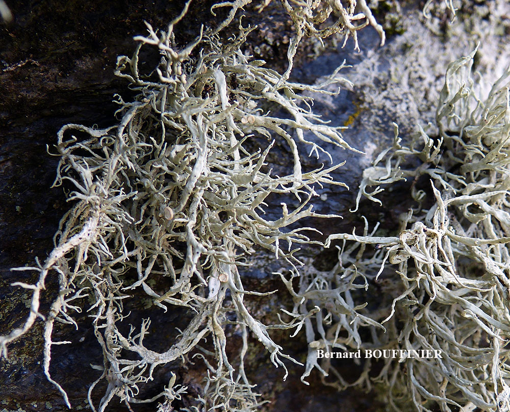
Bernard Bouffinier - Source:http://www.lichensmaritimes.org/index.php?task=fiche&lichen=50&lang=en
France, Argenton

Bernard Bouffinier - Source:http://www.lichensmaritimes.org/index.php?task=fiche&lichen=50&lang=en
France, Argenton

Bernard Bouffinier - Source:http://www.lichensmaritimes.org/index.php?task=fiche&lichen=50&lang=en
France, Roc'h Tredudon
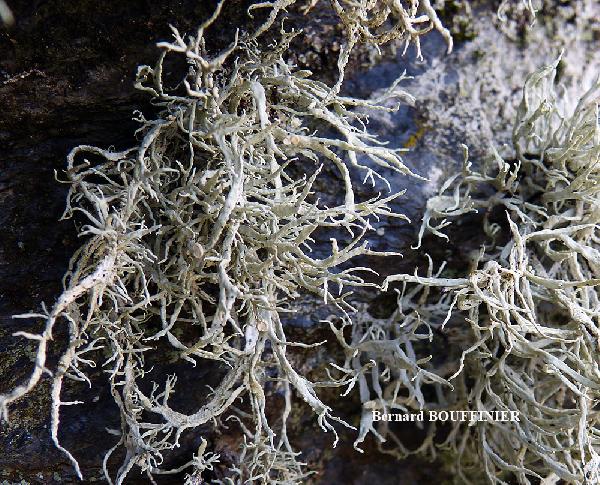
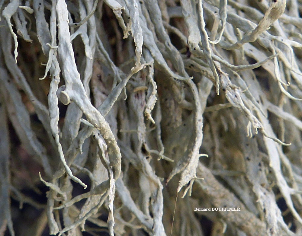
Bernard Bouffinier - Source:http://www.lichensmaritimes.org/index.php?task=fiche&lichen=50&lang=en
France, Roc'h Tredudon
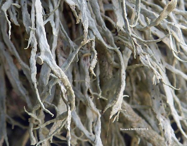
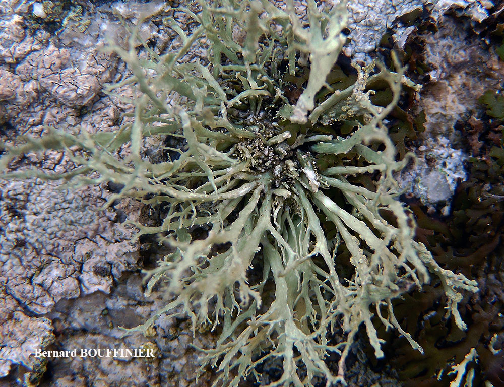
Bernard Bouffinier - Source:http://www.lichensmaritimes.org/index.php?task=fiche&lichen=50&lang=en
France, Roc'h Tredudon
Bernard Bouffinier - Source:http://www.lichensmaritimes.org/index.php?task=fiche&lichen=50&lang=en
France, Roc'h Tredudon

Bernard Bouffinier - Source:http://www.lichensmaritimes.org/index.php?task=fiche&lichen=50&lang=en
France, Pointe du Van
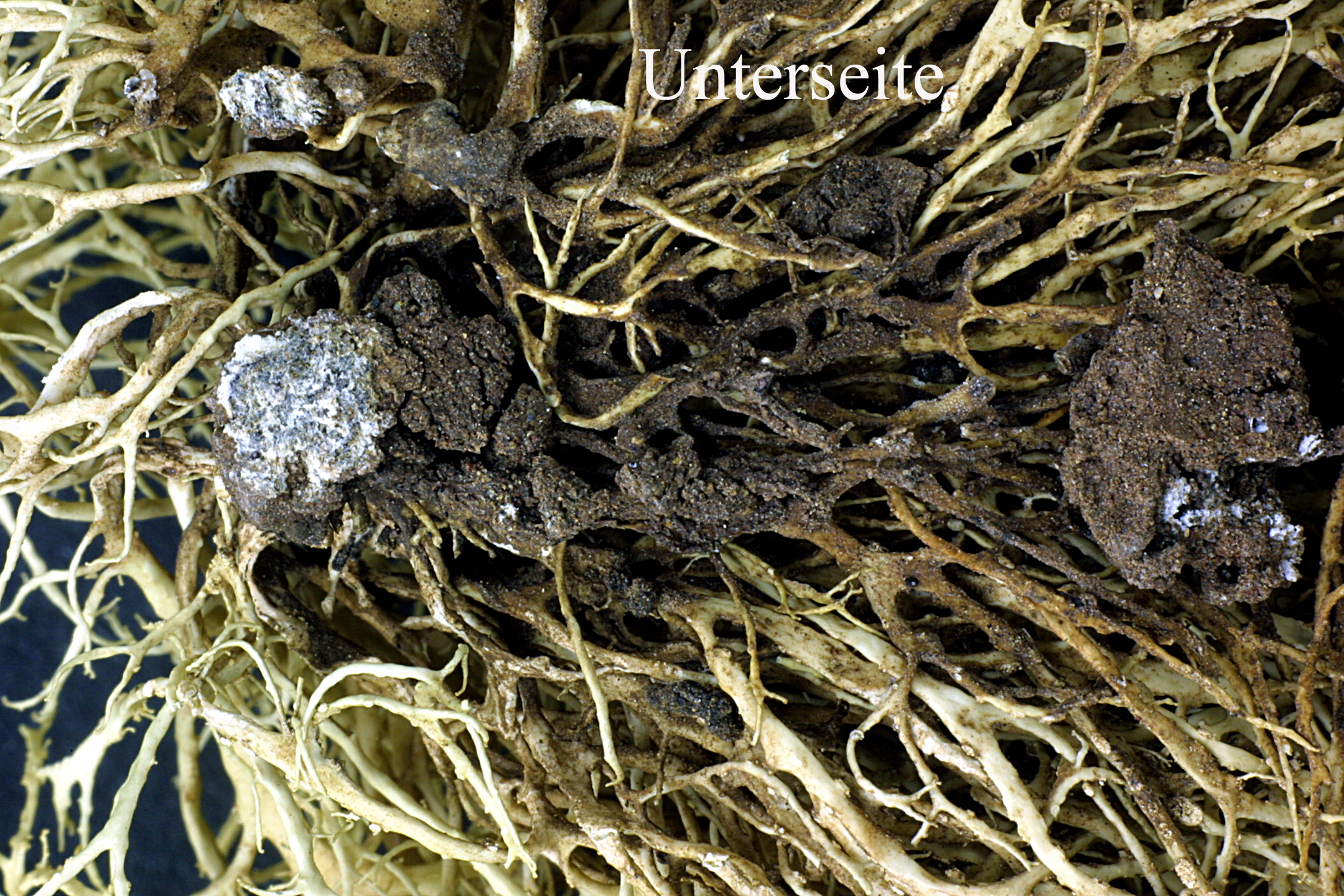
Ulrich Kirschbaum - CC BY-SA 4.0
Spain, Canary Islands, La Gomera und wurde auf vulkanischem Gestein
Ulrich Kirschbaum - CC BY-SA 4.0
Spain, Canary Islands, La Gomera und wurde auf vulkanischem Gestein
Ulrich Kirschbaum - CC BY-SA 4.0
Spain, Canary Islands, La Gomera und wurde auf vulkanischem Gestein
Growth form: Fruticose
Substrata: rocks
Photobiont: green algae other than Trentepohlia
Reproductive strategy: mainly asexual, by soredia, or soredia-like structures (e.g. blastidia)
Most common in areas with a humid-warm climate (e.g. most of Tyrrenian Italy)
Commonnes-rarity: (info)
Alpine belt: absent
Subalpine belt: absent
Montane belt: absent
Dry submediterranean belt: extremely rare
Humid submediterranean belt: rare
Padanian area: absent
pH of the substrata:
| 1 | 2 | 3 | 4 | 5 |
Solar irradiation:
| 1 | 2 | 3 | 4 | 5 |
Aridity:
| 1 | 2 | 3 | 4 | 5 |
Eutrophication:
| 1 | 2 | 3 | 4 | 5 |
Poleotolerance:
| 0 | 1 | 2 | 3 |
Altitudinal distribution:
| 1 | 2 | 3 | 4 | 5 | 6 |
Rarity
absent
extremely rare
very rare
rare
rather rare
rather common
common
very common
extremely common
Loading data...
Occurrence data
Predictive map

Felix Schumm – CC BY-SA 4.0
Image from: F. Schumm (2008) - Flechten Madeiras, der Kanaren und Azoren. Beck, OHG - ISBN: 978-3-00-023700-3
P.L. Nimis; Owner: Department of Life Sciences, University of Trieste
Herbarium: TSB (13204)
2001/12/07

Caterina Azara; Owner: Caterina Azara
Italy, Sardegna, Oristano, Luogosanto, Gallura
2010
Felix Schumm - CC BY-SA 4.0
[10312], Spanien, Kanarische Inseln, La Gomera, westlich von Arure am Weg zum Mirador del Santo (Eremita del Santo), 28°07.9' N, 17°19.3' W, 820 m; wind-, nebel und lichtoffene, NO-exponierte Basaltfelsen mit viel Roccella und Ramalina. Leg. et det. Schumm 18.04.2003
Felix Schumm - CC BY-SA 4.0
[10312], Spanien, Kanarische Inseln, La Gomera, westlich von Arure am Weg zum Mirador del Santo (Eremita del Santo), 28°07.9' N, 17°19.3' W, 820 m; wind-, nebel und lichtoffene, NO-exponierte Basaltfelsen mit viel Roccella und Ramalina. Leg. et det. Schumm 18.04.2003
Felix Schumm - CC BY-SA 4.0
[10312], Spanien, Kanarische Inseln, La Gomera, westlich von Arure am Weg zum Mirador del Santo (Eremita del Santo), 28°07.9' N, 17°19.3' W, 820 m; wind-, nebel und lichtoffene, NO-exponierte Basaltfelsen mit viel Roccella und Ramalina. Leg. et det. Schumm 18.04.2003
Felix Schumm - CC BY-SA 4.0
[10312], Spanien, Kanarische Inseln, La Gomera, westlich von Arure am Weg zum Mirador del Santo (Eremita del Santo), 28°07.9' N, 17°19.3' W, 820 m; wind-, nebel und lichtoffene, NO-exponierte Basaltfelsen mit viel Roccella und Ramalina. Leg. et det. Schumm 18.04.2003

Felix Schumm - CC BY-SA 4.0
[10312], Spanien, Kanarische Inseln, La Gomera, westlich von Arure am Weg zum Mirador del Santo (Eremita del Santo), 28°07.9' N, 17°19.3' W, 820 m; wind-, nebel und lichtoffene, NO-exponierte Basaltfelsen mit viel Roccella und Ramalina. Leg. et det. Schumm 18.04.2003

Felix Schumm - CC BY-SA 4.0
[10312], Spanien, Kanarische Inseln, La Gomera, westlich von Arure am Weg zum Mirador del Santo (Eremita del Santo), 28°07.9' N, 17°19.3' W, 820 m; wind-, nebel und lichtoffene, NO-exponierte Basaltfelsen mit viel Roccella und Ramalina. Leg. et det. Schumm 18.04.2003
Felix Schumm - CC BY-SA 4.0
[10312], Spanien, Kanarische Inseln, La Gomera, westlich von Arure am Weg zum Mirador del Santo (Eremita del Santo), 28°07.9' N, 17°19.3' W, 820 m; wind-, nebel und lichtoffene, NO-exponierte Basaltfelsen mit viel Roccella und Ramalina. Leg. et det. Schumm 18.04.2003
Alain Gerault - Source:http://www.lichensmaritimes.org/index.php?task=fiche&lichen=50&lang=en
France, Roc'h Tredudon
Alain Gerault - Source:http://www.lichensmaritimes.org/index.php?task=fiche&lichen=50&lang=en
France, Roc'h Tredudon

Bernard Bouffinier - Source:http://www.lichensmaritimes.org/index.php?task=fiche&lichen=50&lang=en
France, Argenton
Bernard Bouffinier - Source:http://www.lichensmaritimes.org/index.php?task=fiche&lichen=50&lang=en
France, Argenton
Bernard Bouffinier - Source:http://www.lichensmaritimes.org/index.php?task=fiche&lichen=50&lang=en
France, Roc'h Tredudon

Bernard Bouffinier - Source:http://www.lichensmaritimes.org/index.php?task=fiche&lichen=50&lang=en
France, Roc'h Tredudon
Bernard Bouffinier - Source:http://www.lichensmaritimes.org/index.php?task=fiche&lichen=50&lang=en
France, Roc'h Tredudon
Bernard Bouffinier - Source:http://www.lichensmaritimes.org/index.php?task=fiche&lichen=50&lang=en
France, Roc'h Tredudon
Bernard Bouffinier - Source:http://www.lichensmaritimes.org/index.php?task=fiche&lichen=50&lang=en
France, Pointe du Van

Ulrich Kirschbaum - CC BY-SA 4.0
Spain, Canary Islands, La Gomera und wurde auf vulkanischem Gestein

Ulrich Kirschbaum - CC BY-SA 4.0
Spain, Canary Islands, La Gomera und wurde auf vulkanischem Gestein


