
Stenocybe pullatula (Ach.) Stein
in Cohn, Krypt- Fl. von Schlesien, 2, 2: 298, 1879. Basionym: Calicium pullatulum Ach. - K. Vetensk.-Akad. Nya Handl.: 121, 1816.
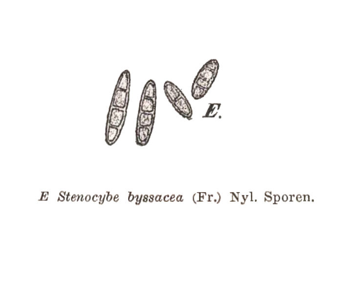
Synonyms: Calicium byssaceum Fr.; Stenocybe byssacea (Fr.) Körb.
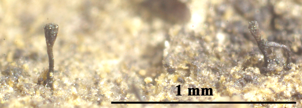
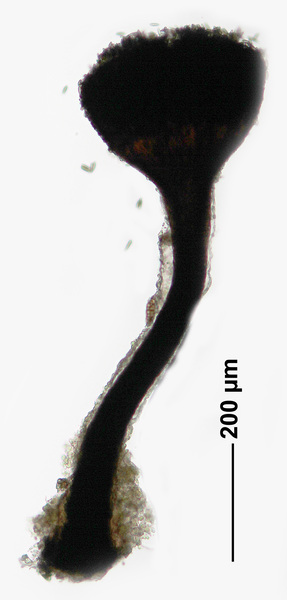
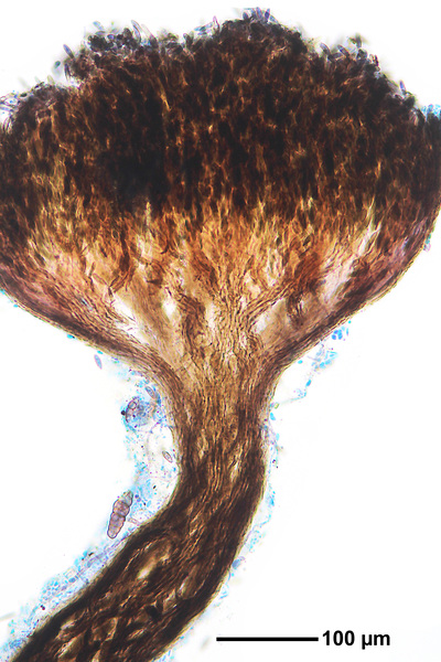
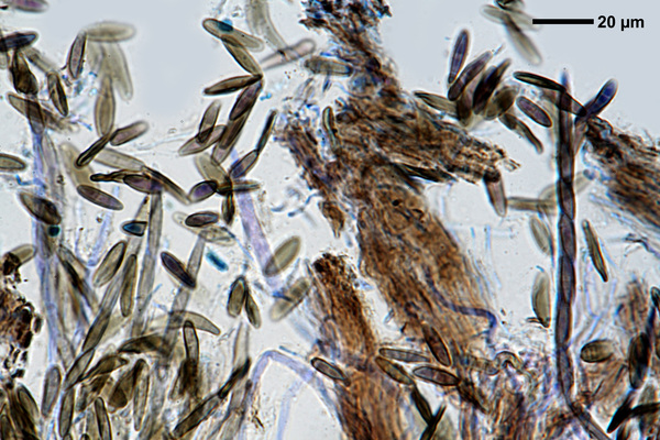
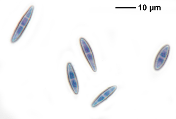
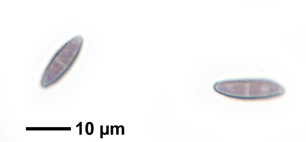
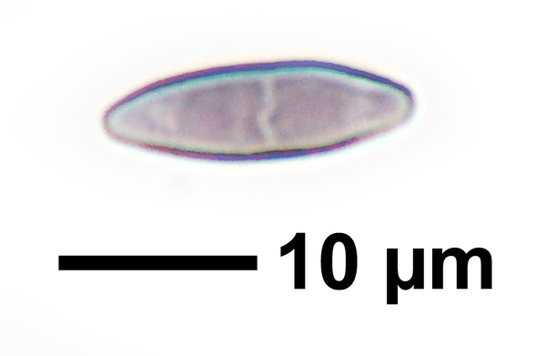
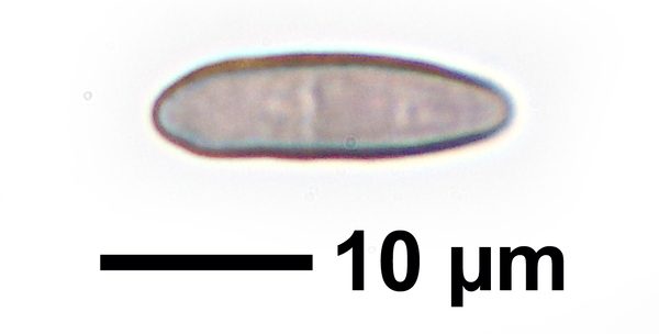
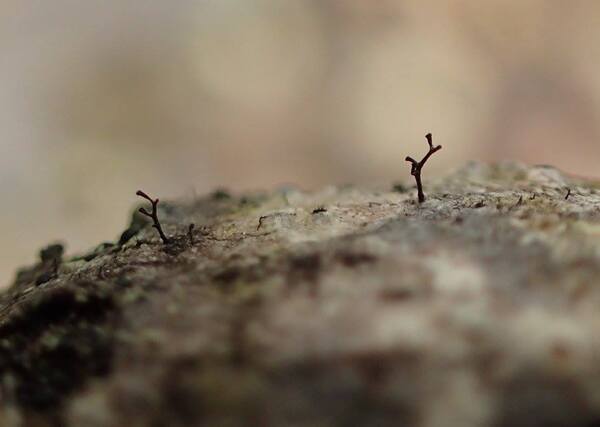
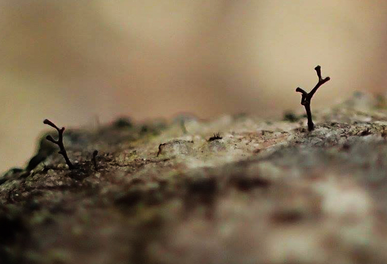
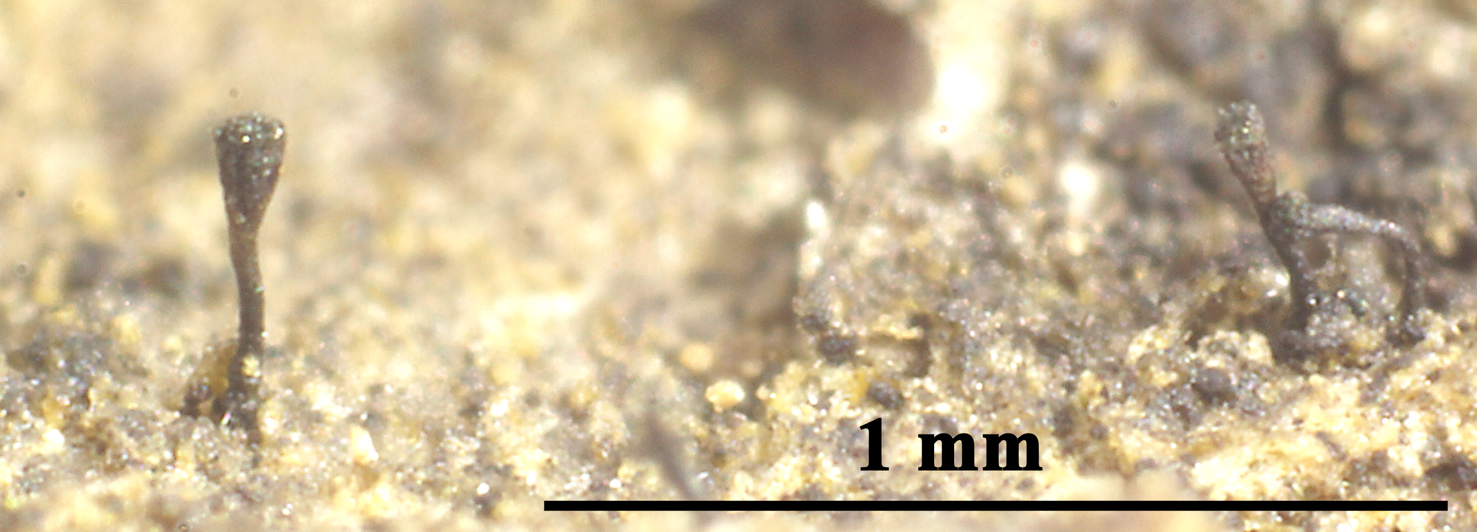
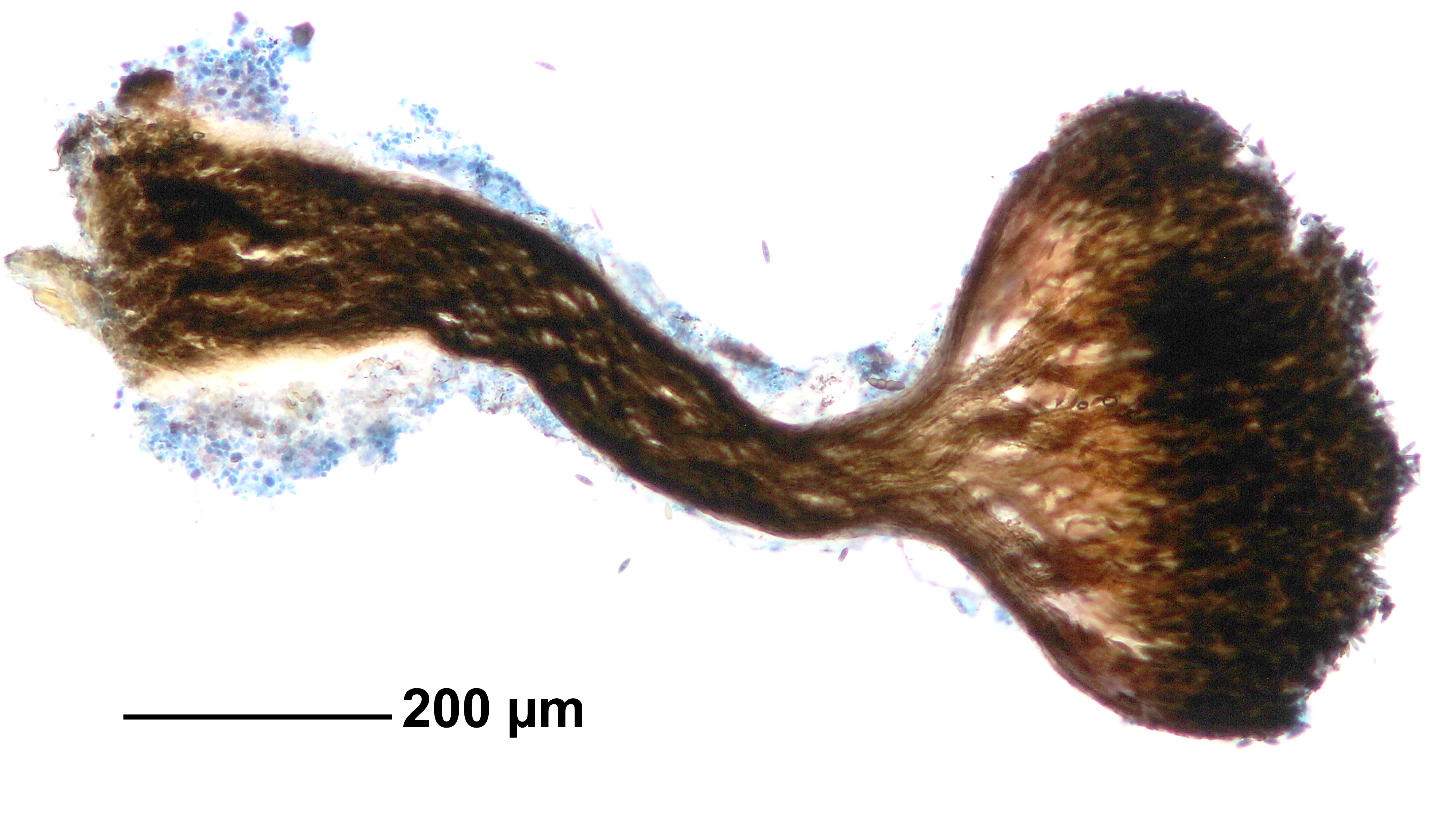
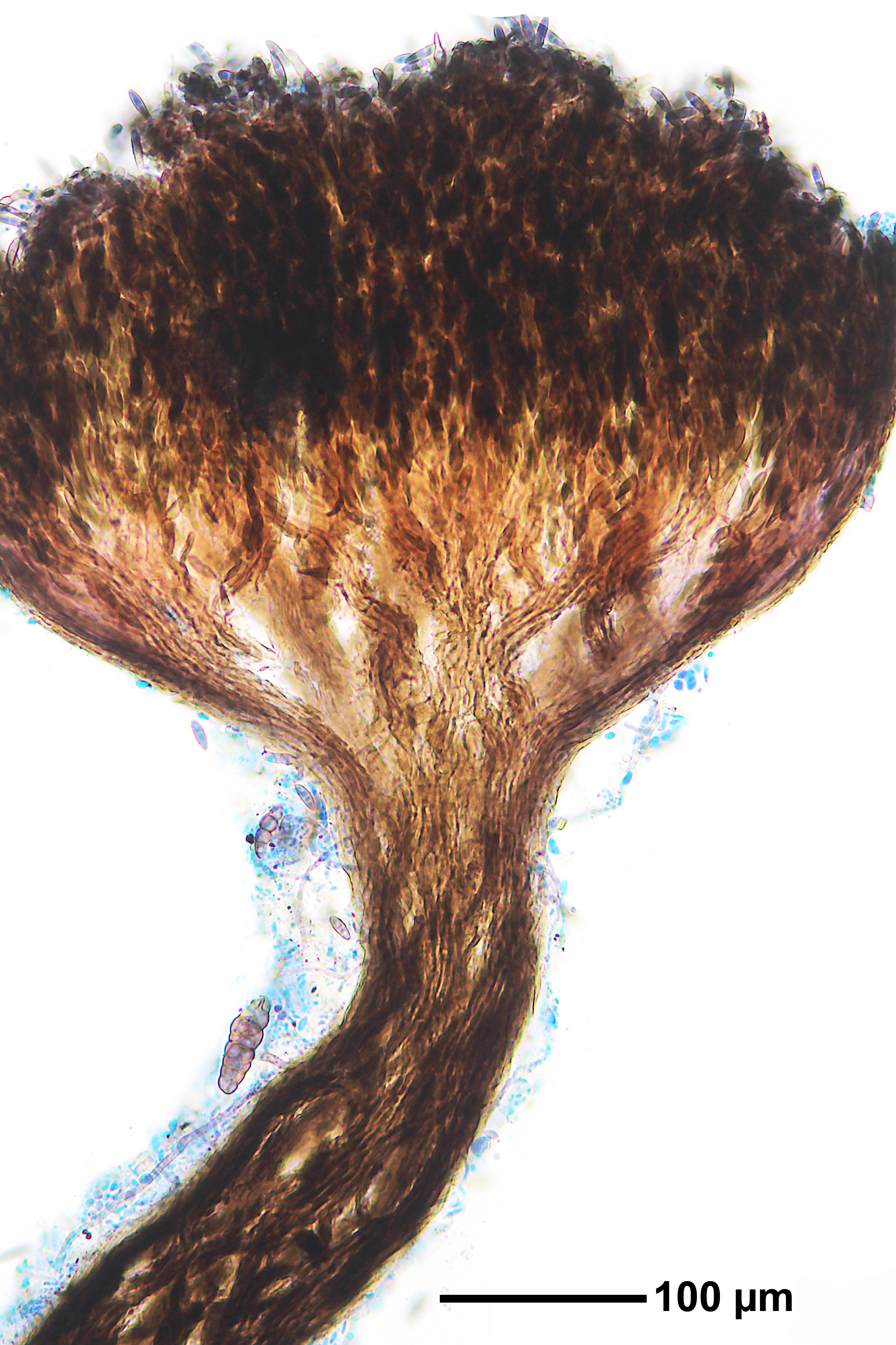
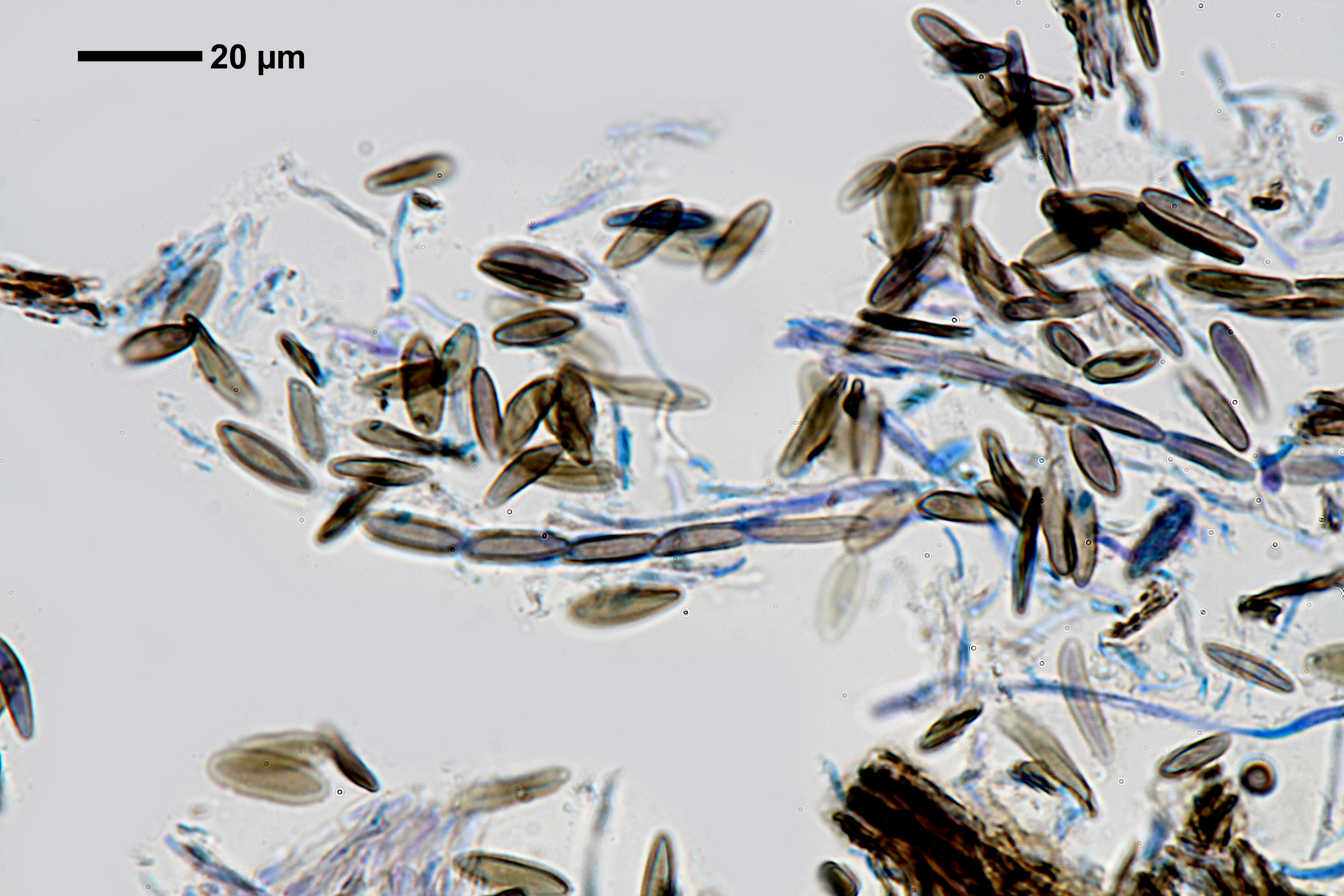
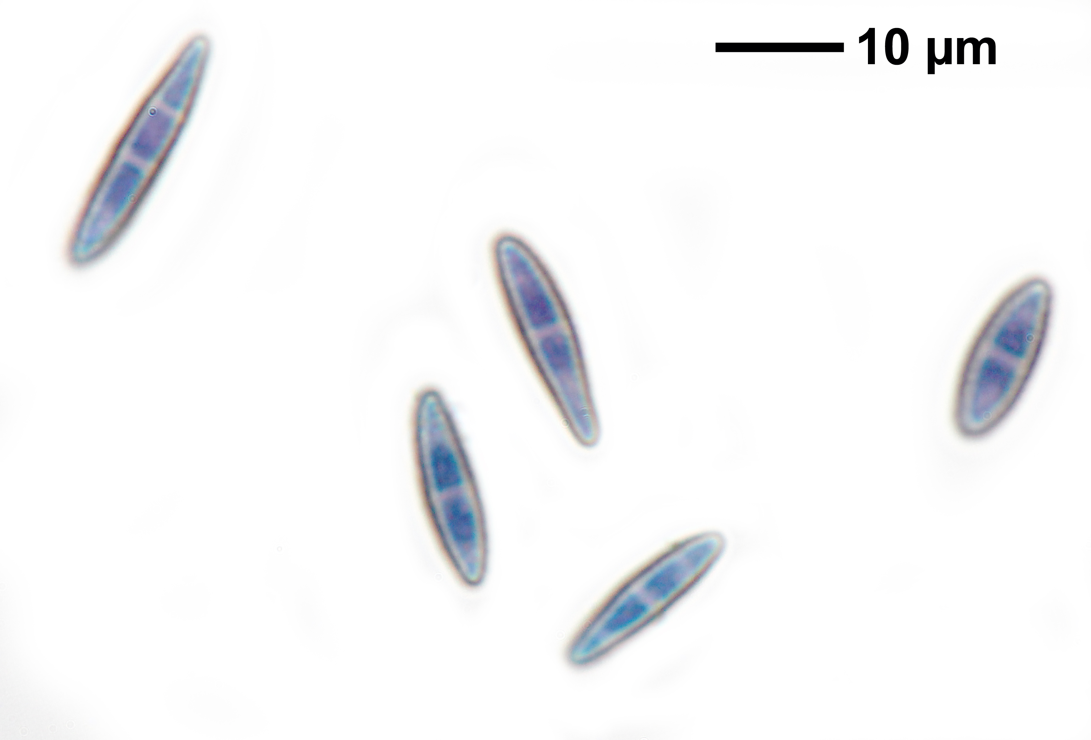
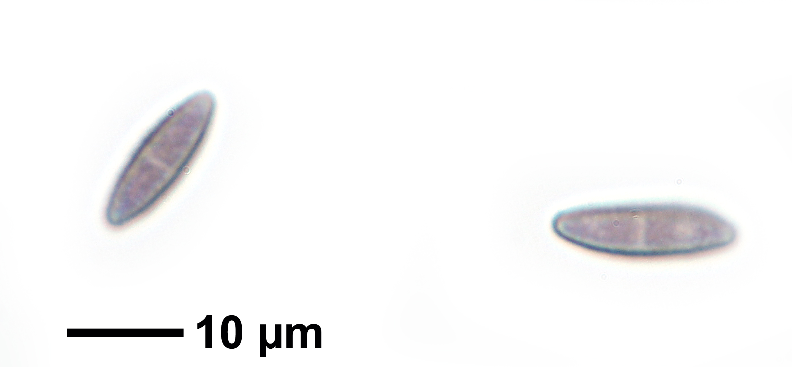
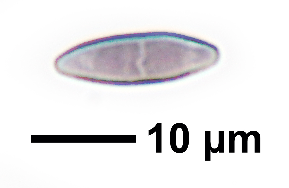
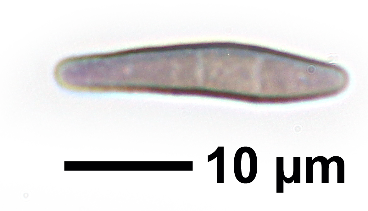
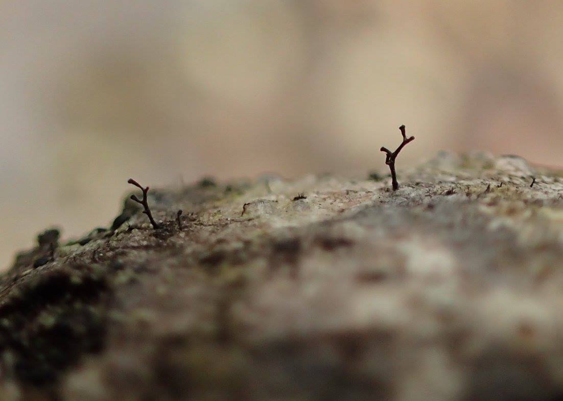
Description: Thallus not evident, not lichenized. Apothecia stalked, pin-like, (0.2-)0.3-0.5(-0.8) mm high, shiny black, the stalk slender, 0.06-0.08 mm thick, simple or quite often branched and bearing 2-5 capitula, of dark brown, periclinally arranged, sclerotized hyphae, surrounded by a 3-5 µm thick gelatinous coat. Capitulum lenticular to elongate or cup-shaped, with a slightly constricted margin, 0.08-0.15 mm across; mazaedium absent. Epithecium dark brown, thin, of interwoven sclerotized hyphae; exciple well-developed, consisting of 4-7 layers of dark brown, periclinally arranged hyphae; paraphyses absent; hypothecium poorly developed, colourless, of periclinally arranged hyphae. Asci 8-spored, narrowly cylindrical, formed singly from ascogenous hyphae with croziers, uniformly thickened at apex, with a single functional wall layer, persisting until the spores are ejected, with uniseriately arranged spores. Ascospores 1-3 septate, the septa poorly pigmented (3 septa well-visible in fully mature ascospores only), narrowly ellipsoid, pale to medium grey-brown, 10-16(-20) x (3-)4-5(-6) µm, with a minutely warted wall. Photobiont absent. Spot tests: K-, C-, KC-, P-. Chemistry: without lichen substances.
Growth form: Fungus
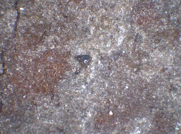
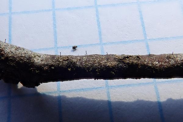
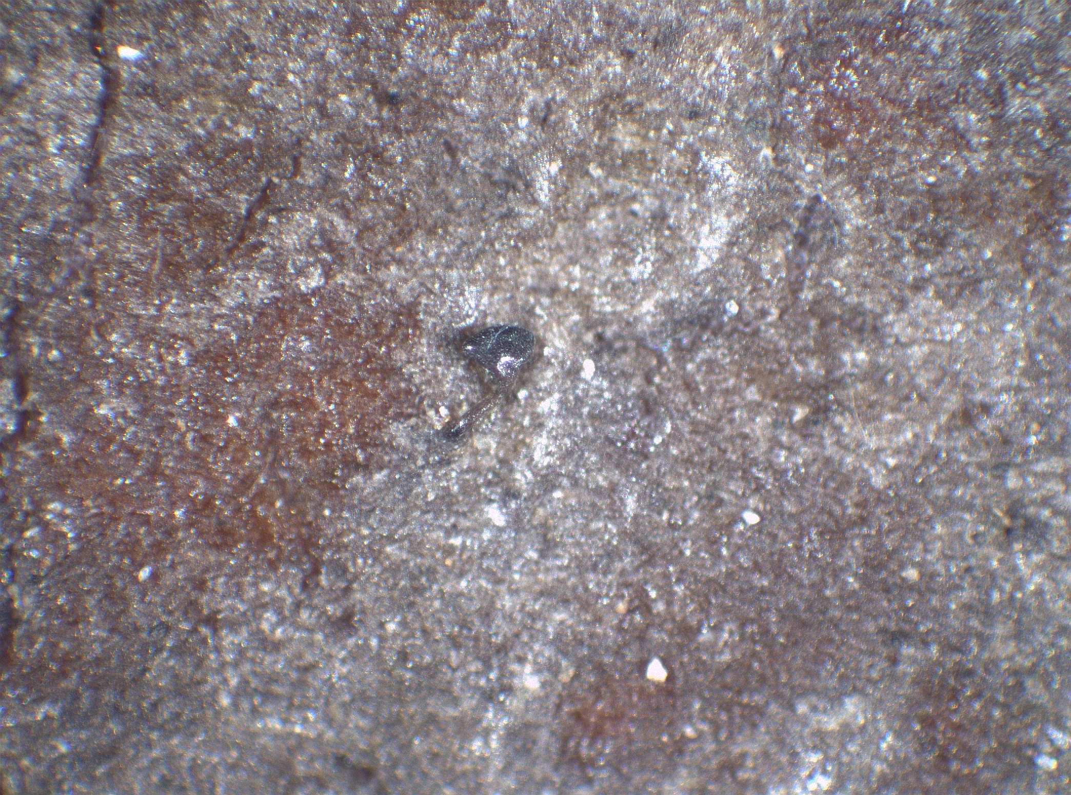
Substrata: bark
Reproductive strategy: mainly sexual
Commonnes-rarity: (info)
Alpine belt: absent
Subalpine belt: absent
Montane belt: very rare
Dry submediterranean belt: extremely rare
Humid submediterranean belt: absent
Padanian area: absent
pH of the substrata:
1 2 3 4 5

Solar irradiation:
1 2 3 4 5
Aridity:
1 2 3 4 5
Eutrophication:
1 2 3 4 5
Poleotolerance:
0 1 2 3
Altitudinal distribution:
1 2 3 4 5 6
Rarity
absent
extremely rare
very rare
rare
rather rare
rather common
common
very common
extremely common
Loading data...
Occurrence data
Predictive map

Curtis Randall Björk CC BY-SA 4.0
Sugarbowl-Grizzly Den Provincial Park, British Columbia, Canada September 2017
P.L. Nimis; Owner: Department of Life Sciences, University of Trieste
Herbarium: TSB (25880)
2003/03/20
Felix Schumm – CC BY-SA 4.0
[14967], Germany, Baden-Württemberg, Kreis Göppingen, südöstlich der Zachersmühle im Herrenbachtal, 48,74408° N, 9,62049° E, 359 m, auf Erle am Bach. TK 7223. Leg. F. Schumm 24.07.2009, det. F. Schumm 2009
Felix Schumm – CC BY-SA 4.0
[14967], Germany, Baden-Württemberg, Kreis Göppingen, südöstlich der Zachersmühle im Herrenbachtal, 48,74408° N, 9,62049° E, 359 m, auf Erle am Bach. TK 7223. Leg. F. Schumm 24.07.2009, det. F. Schumm 2009

Felix Schumm – CC BY-SA 4.0
[14967], Germany, Baden-Württemberg, Kreis Göppingen, südöstlich der Zachersmühle im Herrenbachtal, 48,74408° N, 9,62049° E, 359 m, auf Erle am Bach. TK 7223. Leg. F. Schumm 24.07.2009, det. F. Schumm 2009
Felix Schumm – CC BY-SA 4.0
[14967], Germany, Baden-Württemberg, Kreis Göppingen, südöstlich der Zachersmühle im Herrenbachtal, 48,74408° N, 9,62049° E, 359 m, auf Erle am Bach. TK 7223. Leg. F. Schumm 24.07.2009, det. F. Schumm 2009
Felix Schumm – CC BY-SA 4.0
[14967], Germany, Baden-Württemberg, Kreis Göppingen, südöstlich der Zachersmühle im Herrenbachtal, 48,74408° N, 9,62049° E, 359 m, auf Erle am Bach. TK 7223. Leg. F. Schumm 24.07.2009, det. F. Schumm 2009

Felix Schumm – CC BY-SA 4.0
[14967], Germany, Baden-Württemberg, Kreis Göppingen, südöstlich der Zachersmühle im Herrenbachtal, 48,74408° N, 9,62049° E, 359 m, auf Erle am Bach. TK 7223. Leg. F. Schumm 24.07.2009, det. F. Schumm 2009
Felix Schumm – CC BY-SA 4.0
[14967], Germany, Baden-Württemberg, Kreis Göppingen, südöstlich der Zachersmühle im Herrenbachtal, 48,74408° N, 9,62049° E, 359 m, auf Erle am Bach. TK 7223. Leg. F. Schumm 24.07.2009, det. F. Schumm 2009
Felix Schumm – CC BY-SA 4.0
[14967], Germany, Baden-Württemberg, Kreis Göppingen, südöstlich der Zachersmühle im Herrenbachtal, 48,74408° N, 9,62049° E, 359 m, auf Erle am Bach. TK 7223. Leg. F. Schumm 24.07.2009, det. F. Schumm 2009
Felix Schumm – CC BY-SA 4.0
[14967], Germany, Baden-Württemberg, Kreis Göppingen, südöstlich der Zachersmühle im Herrenbachtal, 48,74408° N, 9,62049° E, 359 m, auf Erle am Bach. TK 7223. Leg. F. Schumm 24.07.2009, det. F. Schumm 2009

Felix Schumm – CC BY-SA 4.0
[14967], Germany, Baden-Württemberg, Kreis Göppingen, südöstlich der Zachersmühle im Herrenbachtal, 48,74408° N, 9,62049° E, 359 m, auf Erle am Bach. TK 7223. Leg. F. Schumm 24.07.2009, det. F. Schumm 2009
Felix Schumm – CC BY-SA 4.0
[14967], Germany, Baden-Württemberg, Kreis Göppingen, südöstlich der Zachersmühle im Herrenbachtal, 48,74408° N, 9,62049° E, 359 m, auf Erle am Bach. TK 7223. Leg. F. Schumm 24.07.2009, det. F. Schumm 2009

Zahlbruckner A. 1926. Lichenes (Flechten). In: Engler A. (ed.): Die natürlichen Pflanzenfamilien. 2nd ed., vol 8, W. Engelmann, Leipzig, 270 pp.
Curtis Randall Björk, - CC BY-SA 4.0
Sugarbowl-Grizzly Den Provincial Park, British Columbia, Canada
September 2017
Wolfgang von Brackel - CC BY-4.0
Germany, Bavaria, Hangmoor Waldberg
Growth form: Fungus
Substrata: bark
Reproductive strategy: mainly sexual
Commonnes-rarity: (info)
Alpine belt: absent
Subalpine belt: absent
Montane belt: very rare
Dry submediterranean belt: extremely rare
Humid submediterranean belt: absent
Padanian area: absent
pH of the substrata:
| 1 | 2 | 3 | 4 | 5 |
Solar irradiation:
| 1 | 2 | 3 | 4 | 5 |
Aridity:
| 1 | 2 | 3 | 4 | 5 |
Eutrophication:
| 1 | 2 | 3 | 4 | 5 |
Poleotolerance:
| 0 | 1 | 2 | 3 |
Altitudinal distribution:
| 1 | 2 | 3 | 4 | 5 | 6 |
Rarity
absent
extremely rare
very rare
rare
rather rare
rather common
common
very common
extremely common
Loading data...
Occurrence data
Predictive map
Curtis Randall Björk CC BY-SA 4.0
Sugarbowl-Grizzly Den Provincial Park, British Columbia, Canada September 2017
P.L. Nimis; Owner: Department of Life Sciences, University of Trieste
Herbarium: TSB (25880)
2003/03/20
Felix Schumm – CC BY-SA 4.0
[14967], Germany, Baden-Württemberg, Kreis Göppingen, südöstlich der Zachersmühle im Herrenbachtal, 48,74408° N, 9,62049° E, 359 m, auf Erle am Bach. TK 7223. Leg. F. Schumm 24.07.2009, det. F. Schumm 2009

Felix Schumm – CC BY-SA 4.0
[14967], Germany, Baden-Württemberg, Kreis Göppingen, südöstlich der Zachersmühle im Herrenbachtal, 48,74408° N, 9,62049° E, 359 m, auf Erle am Bach. TK 7223. Leg. F. Schumm 24.07.2009, det. F. Schumm 2009
Felix Schumm – CC BY-SA 4.0
[14967], Germany, Baden-Württemberg, Kreis Göppingen, südöstlich der Zachersmühle im Herrenbachtal, 48,74408° N, 9,62049° E, 359 m, auf Erle am Bach. TK 7223. Leg. F. Schumm 24.07.2009, det. F. Schumm 2009
Felix Schumm – CC BY-SA 4.0
[14967], Germany, Baden-Württemberg, Kreis Göppingen, südöstlich der Zachersmühle im Herrenbachtal, 48,74408° N, 9,62049° E, 359 m, auf Erle am Bach. TK 7223. Leg. F. Schumm 24.07.2009, det. F. Schumm 2009

Felix Schumm – CC BY-SA 4.0
[14967], Germany, Baden-Württemberg, Kreis Göppingen, südöstlich der Zachersmühle im Herrenbachtal, 48,74408° N, 9,62049° E, 359 m, auf Erle am Bach. TK 7223. Leg. F. Schumm 24.07.2009, det. F. Schumm 2009
Felix Schumm – CC BY-SA 4.0
[14967], Germany, Baden-Württemberg, Kreis Göppingen, südöstlich der Zachersmühle im Herrenbachtal, 48,74408° N, 9,62049° E, 359 m, auf Erle am Bach. TK 7223. Leg. F. Schumm 24.07.2009, det. F. Schumm 2009
Felix Schumm – CC BY-SA 4.0
[14967], Germany, Baden-Württemberg, Kreis Göppingen, südöstlich der Zachersmühle im Herrenbachtal, 48,74408° N, 9,62049° E, 359 m, auf Erle am Bach. TK 7223. Leg. F. Schumm 24.07.2009, det. F. Schumm 2009
Felix Schumm – CC BY-SA 4.0
[14967], Germany, Baden-Württemberg, Kreis Göppingen, südöstlich der Zachersmühle im Herrenbachtal, 48,74408° N, 9,62049° E, 359 m, auf Erle am Bach. TK 7223. Leg. F. Schumm 24.07.2009, det. F. Schumm 2009
Felix Schumm – CC BY-SA 4.0
[14967], Germany, Baden-Württemberg, Kreis Göppingen, südöstlich der Zachersmühle im Herrenbachtal, 48,74408° N, 9,62049° E, 359 m, auf Erle am Bach. TK 7223. Leg. F. Schumm 24.07.2009, det. F. Schumm 2009
Felix Schumm – CC BY-SA 4.0
[14967], Germany, Baden-Württemberg, Kreis Göppingen, südöstlich der Zachersmühle im Herrenbachtal, 48,74408° N, 9,62049° E, 359 m, auf Erle am Bach. TK 7223. Leg. F. Schumm 24.07.2009, det. F. Schumm 2009

Felix Schumm – CC BY-SA 4.0
[14967], Germany, Baden-Württemberg, Kreis Göppingen, südöstlich der Zachersmühle im Herrenbachtal, 48,74408° N, 9,62049° E, 359 m, auf Erle am Bach. TK 7223. Leg. F. Schumm 24.07.2009, det. F. Schumm 2009
Zahlbruckner A. 1926. Lichenes (Flechten). In: Engler A. (ed.): Die natürlichen Pflanzenfamilien. 2nd ed., vol 8, W. Engelmann, Leipzig, 270 pp.
Curtis Randall Björk, - CC BY-SA 4.0
Sugarbowl-Grizzly Den Provincial Park, British Columbia, Canada
September 2017


