
Polyblastia dermatodes A. Massal.
Geneac. Lich.: 24, 1854.
Synonyms: Amphoroblastia dermatodes (A. Massal.) Servít; Amphoroblastia tyrolensis (Arnold) Servít; Polyblastia schraderi (Gray) A.L. Sm.
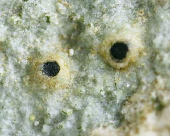
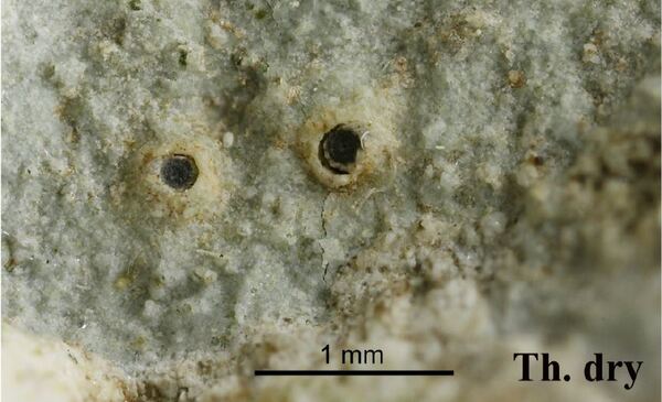
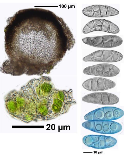
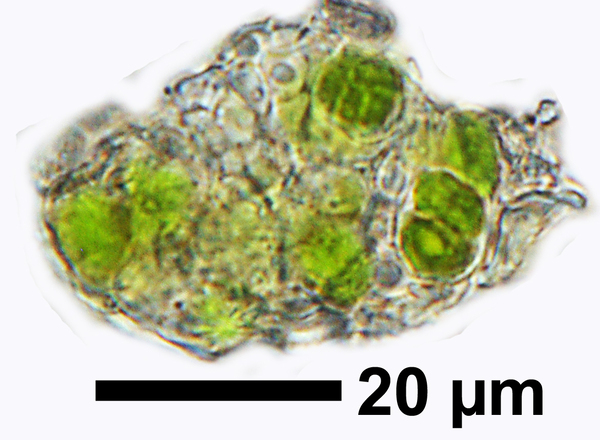
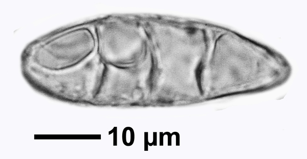
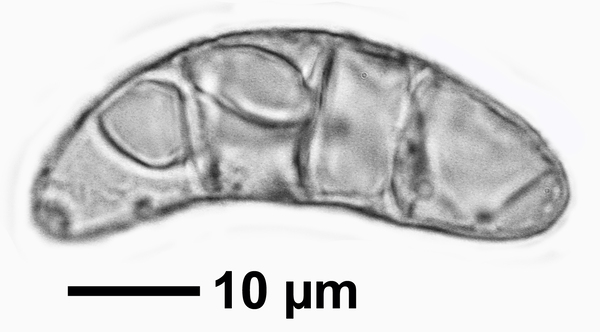
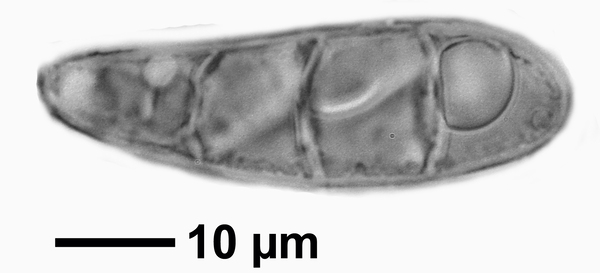
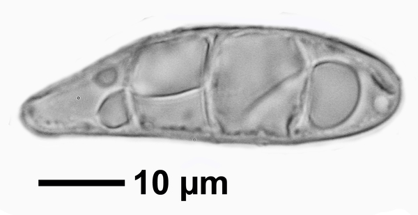
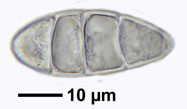
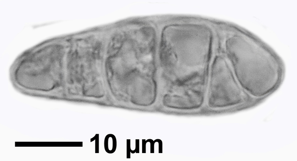
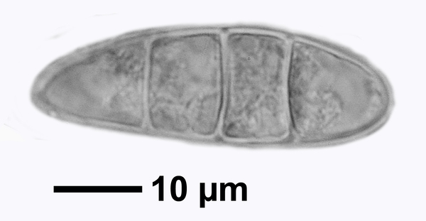
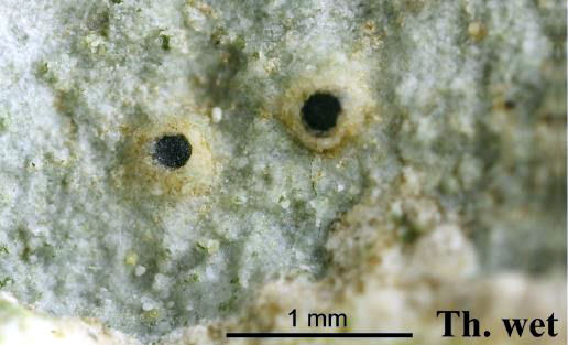
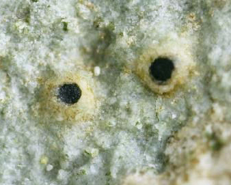
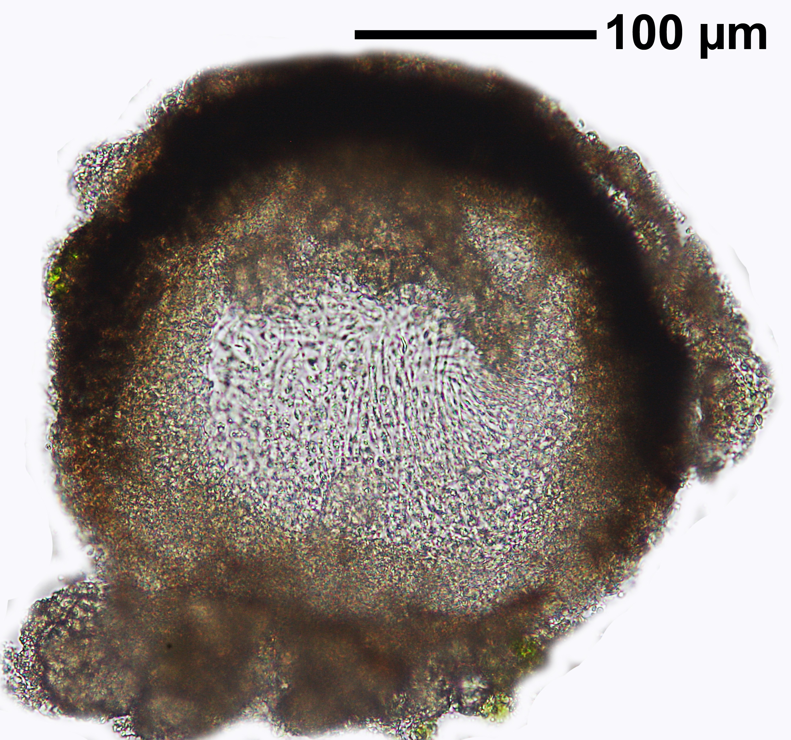
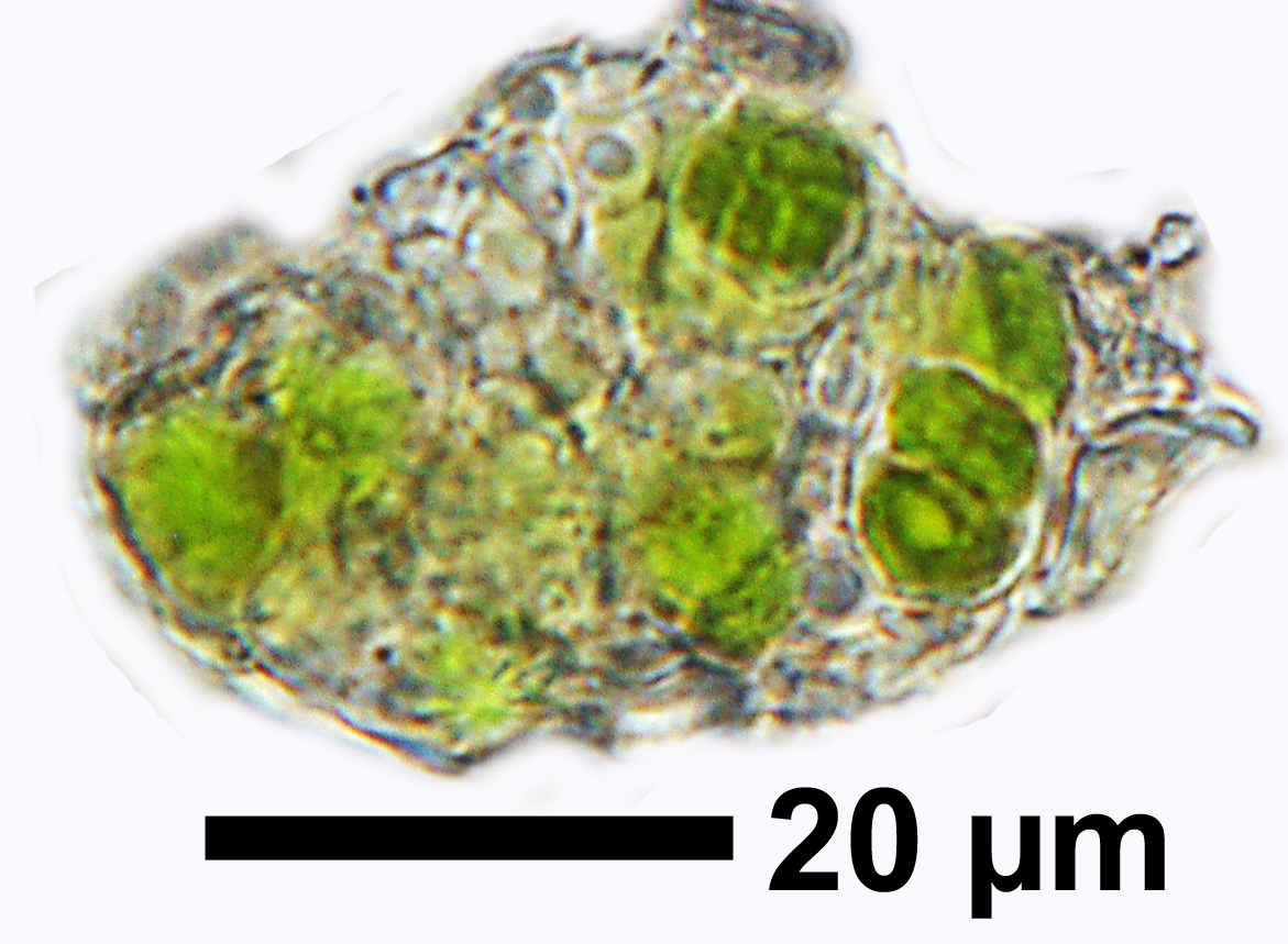
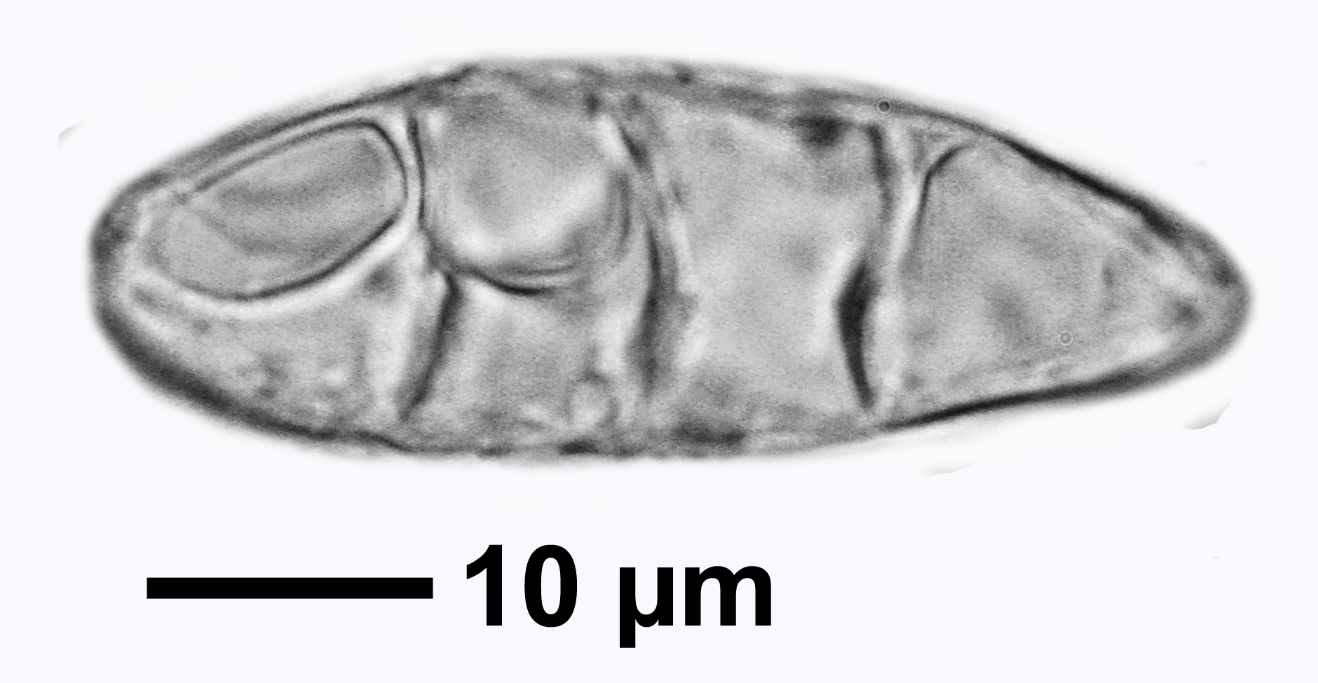
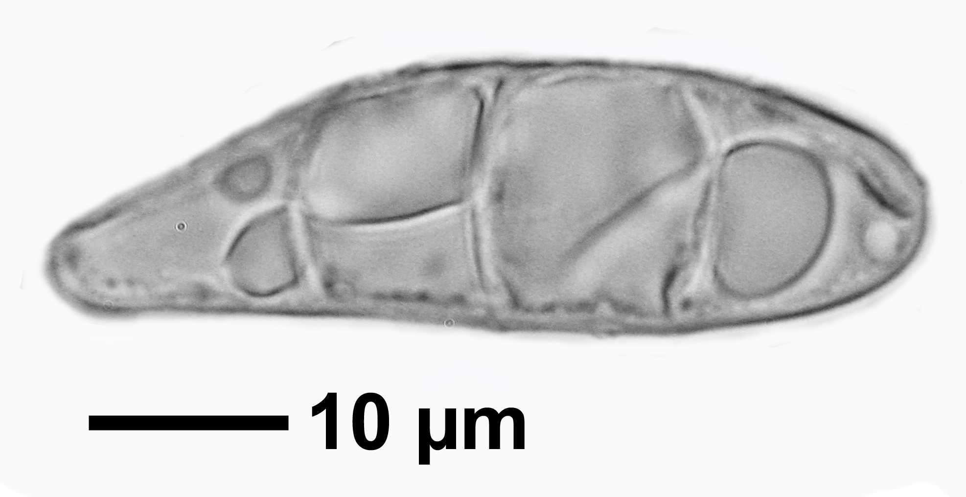
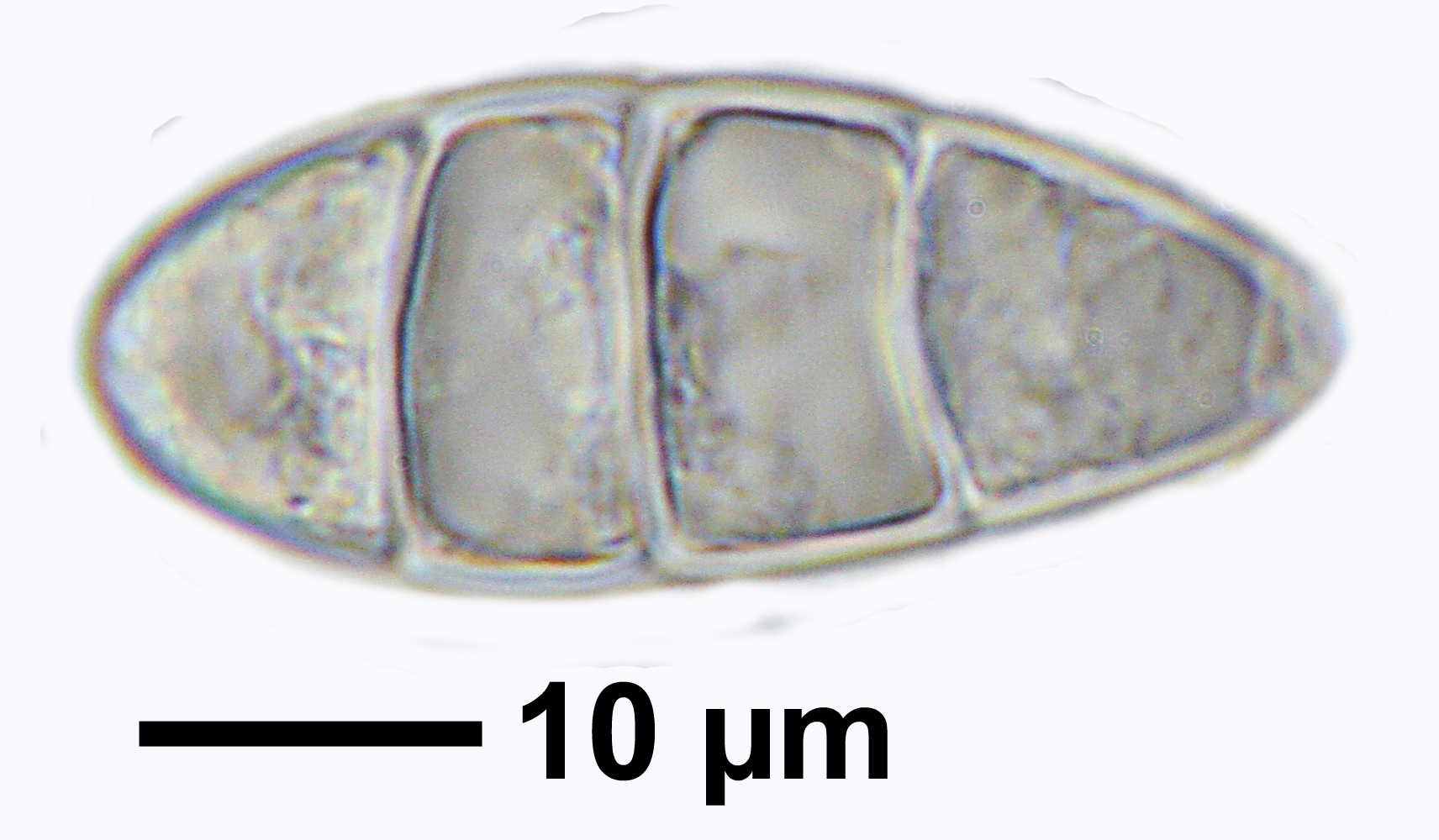
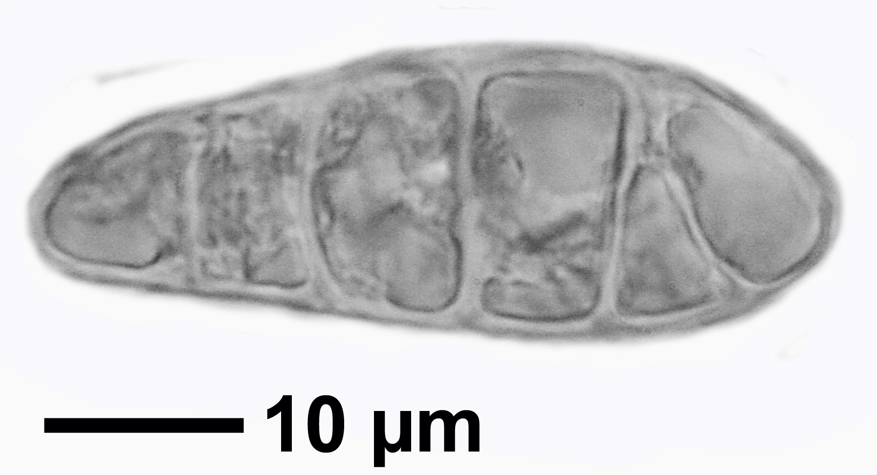
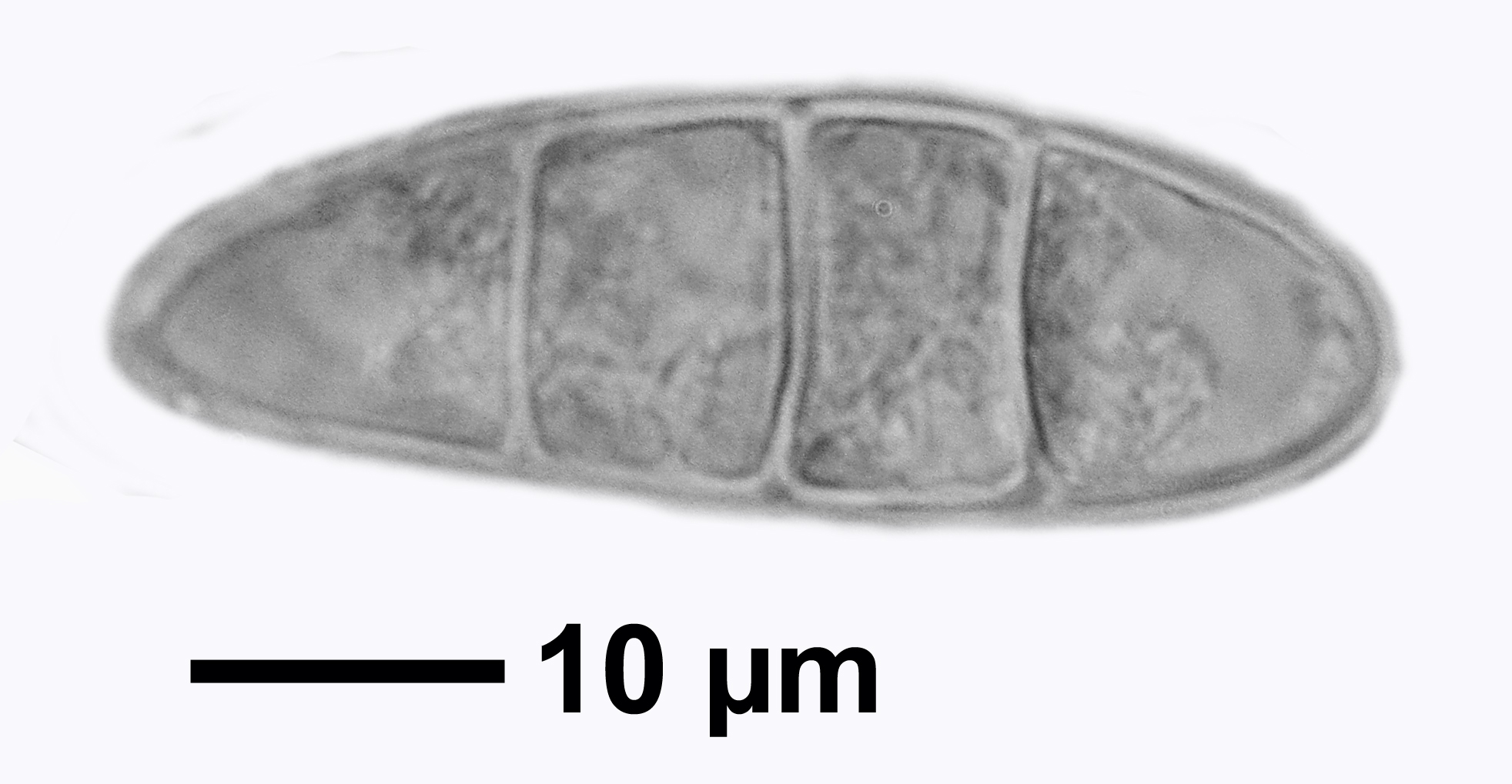
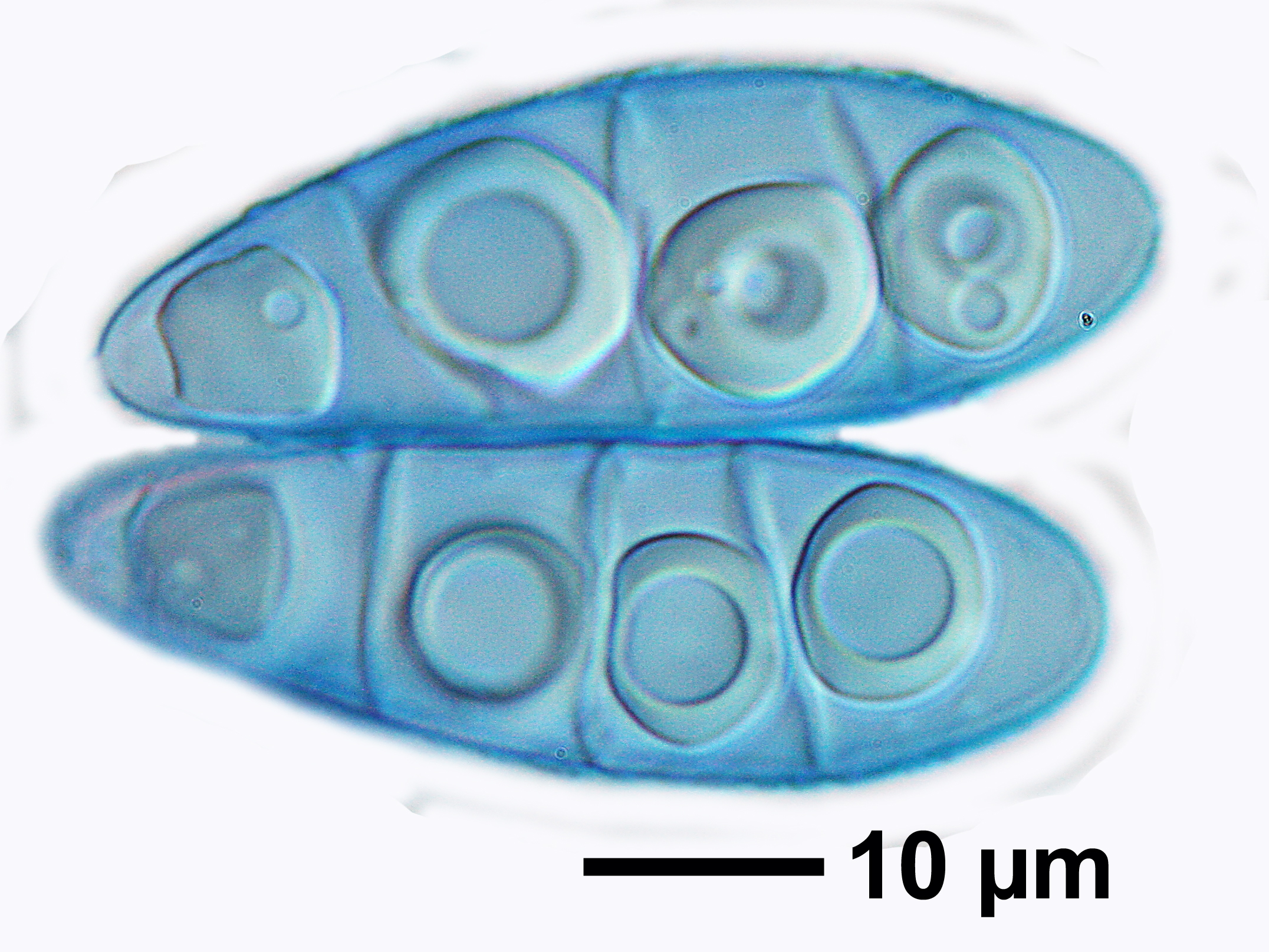
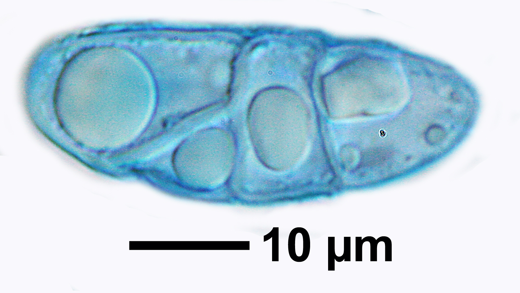
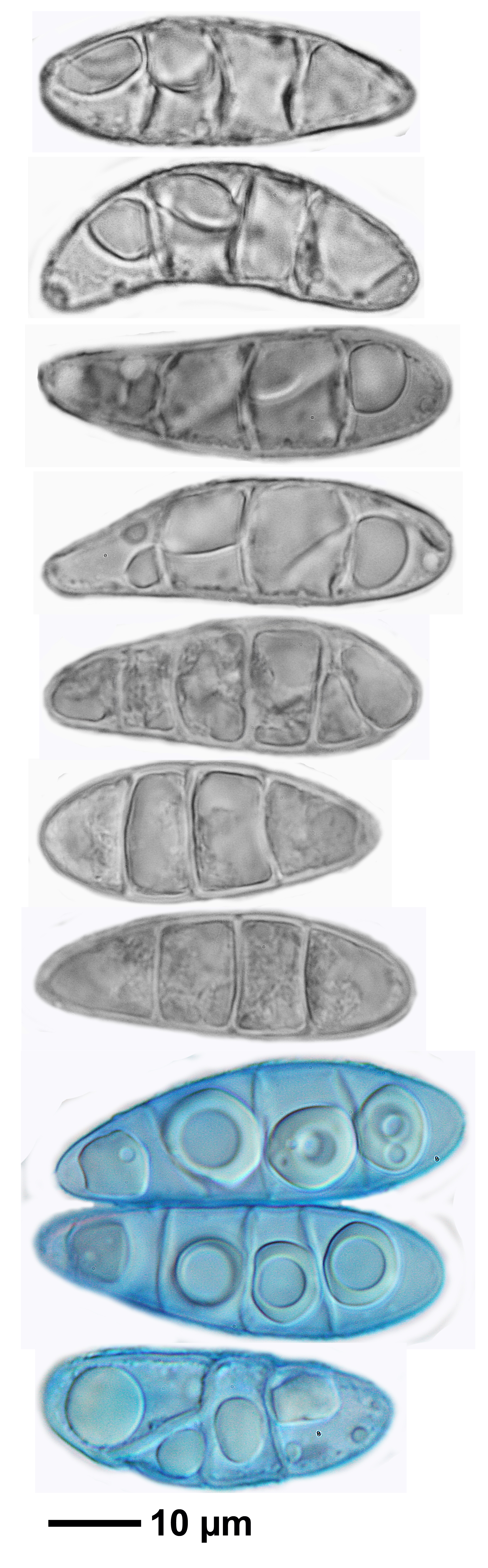
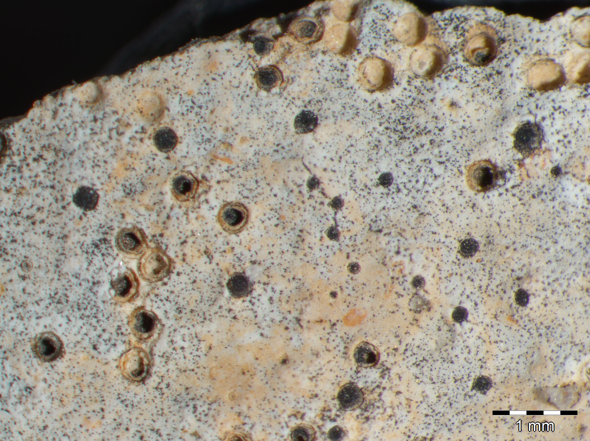
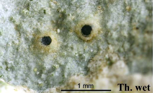
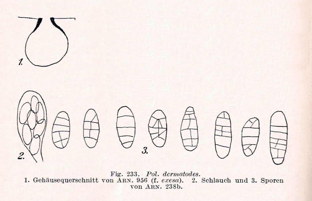
Description: Thallus crustose, endosubstratic, dirty white to pale grey. Perithecia black, immersed in pits in the rock, projecting only with the ostiolar region, 0.4-0.6(-0.7) mm across. Involucrellum absent; exciple dark throughout, thicker around the ostiole; hamathecium of periphyses and periphysoids, interascal filaments absent. Asci 8-spored, clavate, K/I-, fissitunicate, the wall thickened above, with an ocular chamber, dehiscent by extrusion of an endotunica to form a delicate rostrum. Ascospores submuriform to weakly muriform, with 3-7 transverse septa and (0-)1-2(-3) longitudinal septa, hyaline, narrowly ellipsoid, (25-)30-45(-60) x 12-25 μm. Photobiont chlorococcoid. Spot tests: K-, C-, KC-, P-, UV-. Chemistry: without lichen substances.
Growth form: Crustose
Substrata: rocks
Photobiont: green algae other than Trentepohlia
Reproductive strategy: mainly sexual
Commonnes-rarity: (info)
Alpine belt: rather rare
Subalpine belt: very rare
Montane belt: absent
Dry submediterranean belt: absent
Humid submediterranean belt: absent
Padanian area: absent
pH of the substrata:
1 2 3 4 5

Solar irradiation:
1 2 3 4 5
Aridity:
1 2 3 4 5
Eutrophication:
1 2 3 4 5
Poleotolerance:
0 1 2 3
Altitudinal distribution:
1 2 3 4 5 6
Rarity
absent
extremely rare
very rare
rare
rather rare
rather common
common
very common
extremely common
Loading data...
Occurrence data
Predictive map
Felix Schumm CC BY-SA 4.0
Germany, Baden-Württemberg, Kreis Heidenheim, Steinheim a. Albuch, Wental, schattige feuchte Kalkfelsen im Wald nahe dem Gnannenstein, 48,70783° N, 10,03095° E, 580 m. 19.09.2010 Leg. Schumm
Felix Schumm – CC BY-SA 4.0
[16684], Germany, Baden-Württemberg, Kreis Heidenheim, Steinheim a. Albuch, Wental, schattige feuchte Kalkfelsen im Wald nahe dem Gnannenstein, 48,70783° N, 10,03095° E, 580 m. Leg. Schumm 19.09.2010
Felix Schumm – CC BY-SA 4.0
[16684], Germany, Baden-Württemberg, Kreis Heidenheim, Steinheim a. Albuch, Wental, schattige feuchte Kalkfelsen im Wald nahe dem Gnannenstein, 48,70783° N, 10,03095° E, 580 m. Leg. Schumm 19.09.2010

Felix Schumm CC BY-SA 4.0
[16684], Germany, Baden-Württemberg, Kreis Heidenheim, Steinheim a. Albuch, Wental, schattige feuchte Kalkfelsen im Wald nahe dem Gnannenstein, 48,70783° N, 10,03095° E, 580 m. Leg. Schumm 19.09.2010
Felix Schumm CC BY-SA 4.0
[16684], Germany, Baden-Württemberg, Kreis Heidenheim, Steinheim a. Albuch, Wental, schattige feuchte Kalkfelsen im Wald nahe dem Gnannenstein, 48,70783° N, 10,03095° E, 580 m. Leg. Schumm 19.09.2010
Felix Schumm CC BY-SA 4.0
[16684], Germany, Baden-Württemberg, Kreis Heidenheim, Steinheim a. Albuch, Wental, schattige feuchte Kalkfelsen im Wald nahe dem Gnannenstein, 48,70783° N, 10,03095° E, 580 m. Leg. Schumm 19.09.2010
Felix Schumm CC BY-SA 4.0
[16684], Germany, Baden-Württemberg, Kreis Heidenheim, Steinheim a. Albuch, Wental, schattige feuchte Kalkfelsen im Wald nahe dem Gnannenstein, 48,70783° N, 10,03095° E, 580 m. Leg. Schumm 19.09.2010
Felix Schumm CC BY-SA 4.0
[16684], Germany, Baden-Württemberg, Kreis Heidenheim, Steinheim a. Albuch, Wental, schattige feuchte Kalkfelsen im Wald nahe dem Gnannenstein, 48,70783° N, 10,03095° E, 580 m. Leg. Schumm 19.09.2010
Felix Schumm CC BY-SA 4.0
[16684], Germany, Baden-Württemberg, Kreis Heidenheim, Steinheim a. Albuch, Wental, schattige feuchte Kalkfelsen im Wald nahe dem Gnannenstein, 48,70783° N, 10,03095° E, 580 m. Leg. Schumm 19.09.2010
Felix Schumm CC BY-SA 4.0
[16684], Germany, Baden-Württemberg, Kreis Heidenheim, Steinheim a. Albuch, Wental, schattige feuchte Kalkfelsen im Wald nahe dem Gnannenstein, 48,70783° N, 10,03095° E, 580 m. Leg. Schumm 19.09.2010
Felix Schumm CC BY-SA 4.0
[16684], Germany, Baden-Württemberg, Kreis Heidenheim, Steinheim a. Albuch, Wental, schattige feuchte Kalkfelsen im Wald nahe dem Gnannenstein, 48,70783° N, 10,03095° E, 580 m. Leg. Schumm 19.09.2010
Felix Schumm CC BY-SA 4.0
[16684], Germany, Baden-Württemberg, Kreis Heidenheim, Steinheim a. Albuch, Wental, schattige feuchte Kalkfelsen im Wald nahe dem Gnannenstein, 48,70783° N, 10,03095° E, 580 m. Leg. Schumm 19.09.2010

Felix Schumm CC BY-SA 4.0
[16684], Germany, Baden-Württemberg, Kreis Heidenheim, Steinheim a. Albuch, Wental, schattige feuchte Kalkfelsen im Wald nahe dem Gnannenstein, 48,70783° N, 10,03095° E, 580 m. Leg. Schumm 19.09.2010

Felix Schumm CC BY-SA 4.0
[16684], Germany, Baden-Württemberg, Kreis Heidenheim, Steinheim a. Albuch, Wental, schattige feuchte Kalkfelsen im Wald nahe dem Gnannenstein, 48,70783° N, 10,03095° E, 580 m. Leg. Schumm 19.09.2010

Felix Schumm CC BY-SA 4.0
[16684], Germany, Baden-Württemberg, Kreis Heidenheim, Steinheim a. Albuch, Wental, schattige feuchte Kalkfelsen im Wald nahe dem Gnannenstein, 48,70783° N, 10,03095° E, 580 m. Leg. Schumm 19.09.2010

Harrie Sipman – Source http://www.bgbm.fu-berlin.de/sipman/Zschackia/AegeanLichens/CaloplacaAC.htm - As Caloplaca oasis
Felix Schumm – CC BY-SA 4.0
Germany, Baden-Württemberg, Kreis Heidenheim, Steinheim a. Albuch, Wental, schattige feuchte Kalkfelsen im Wald nahe dem Gnannenstein, 48,70783° N, 10,03095° E, 580 m.
19.09.2010
Leg. Schumm
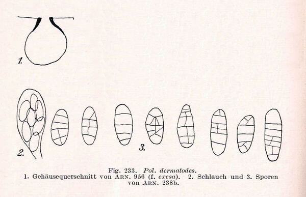
Source: Zschacke, H. (1934) Epigloeaceae, Verrucariaceae und Dermatocarpaceae. In: Dr. L. Rabenhorst‘s Kryptogamen-Flora, Band 9, Abt. 1, Teil 1. Akademische Verlagsgesellschaft, Leipzig, 695 pp. - Public Domain
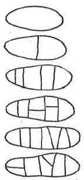
Source: Servít M. 1954a. Lichenes familiae Verrucariacearum. Prag, 249 pp.
Growth form: Crustose
Substrata: rocks
Photobiont: green algae other than Trentepohlia
Reproductive strategy: mainly sexual
Commonnes-rarity: (info)
Alpine belt: rather rare
Subalpine belt: very rare
Montane belt: absent
Dry submediterranean belt: absent
Humid submediterranean belt: absent
Padanian area: absent
pH of the substrata:
| 1 | 2 | 3 | 4 | 5 |
Solar irradiation:
| 1 | 2 | 3 | 4 | 5 |
Aridity:
| 1 | 2 | 3 | 4 | 5 |
Eutrophication:
| 1 | 2 | 3 | 4 | 5 |
Poleotolerance:
| 0 | 1 | 2 | 3 |
Altitudinal distribution:
| 1 | 2 | 3 | 4 | 5 | 6 |
Rarity
absent
extremely rare
very rare
rare
rather rare
rather common
common
very common
extremely common
Loading data...
Occurrence data
Predictive map
Felix Schumm CC BY-SA 4.0
Germany, Baden-Württemberg, Kreis Heidenheim, Steinheim a. Albuch, Wental, schattige feuchte Kalkfelsen im Wald nahe dem Gnannenstein, 48,70783° N, 10,03095° E, 580 m. 19.09.2010 Leg. Schumm

Felix Schumm – CC BY-SA 4.0
[16684], Germany, Baden-Württemberg, Kreis Heidenheim, Steinheim a. Albuch, Wental, schattige feuchte Kalkfelsen im Wald nahe dem Gnannenstein, 48,70783° N, 10,03095° E, 580 m. Leg. Schumm 19.09.2010

Felix Schumm – CC BY-SA 4.0
[16684], Germany, Baden-Württemberg, Kreis Heidenheim, Steinheim a. Albuch, Wental, schattige feuchte Kalkfelsen im Wald nahe dem Gnannenstein, 48,70783° N, 10,03095° E, 580 m. Leg. Schumm 19.09.2010
Felix Schumm CC BY-SA 4.0
[16684], Germany, Baden-Württemberg, Kreis Heidenheim, Steinheim a. Albuch, Wental, schattige feuchte Kalkfelsen im Wald nahe dem Gnannenstein, 48,70783° N, 10,03095° E, 580 m. Leg. Schumm 19.09.2010
Felix Schumm CC BY-SA 4.0
[16684], Germany, Baden-Württemberg, Kreis Heidenheim, Steinheim a. Albuch, Wental, schattige feuchte Kalkfelsen im Wald nahe dem Gnannenstein, 48,70783° N, 10,03095° E, 580 m. Leg. Schumm 19.09.2010
Felix Schumm CC BY-SA 4.0
[16684], Germany, Baden-Württemberg, Kreis Heidenheim, Steinheim a. Albuch, Wental, schattige feuchte Kalkfelsen im Wald nahe dem Gnannenstein, 48,70783° N, 10,03095° E, 580 m. Leg. Schumm 19.09.2010

Felix Schumm CC BY-SA 4.0
[16684], Germany, Baden-Württemberg, Kreis Heidenheim, Steinheim a. Albuch, Wental, schattige feuchte Kalkfelsen im Wald nahe dem Gnannenstein, 48,70783° N, 10,03095° E, 580 m. Leg. Schumm 19.09.2010

Felix Schumm CC BY-SA 4.0
[16684], Germany, Baden-Württemberg, Kreis Heidenheim, Steinheim a. Albuch, Wental, schattige feuchte Kalkfelsen im Wald nahe dem Gnannenstein, 48,70783° N, 10,03095° E, 580 m. Leg. Schumm 19.09.2010
Felix Schumm CC BY-SA 4.0
[16684], Germany, Baden-Württemberg, Kreis Heidenheim, Steinheim a. Albuch, Wental, schattige feuchte Kalkfelsen im Wald nahe dem Gnannenstein, 48,70783° N, 10,03095° E, 580 m. Leg. Schumm 19.09.2010
Felix Schumm CC BY-SA 4.0
[16684], Germany, Baden-Württemberg, Kreis Heidenheim, Steinheim a. Albuch, Wental, schattige feuchte Kalkfelsen im Wald nahe dem Gnannenstein, 48,70783° N, 10,03095° E, 580 m. Leg. Schumm 19.09.2010
Felix Schumm CC BY-SA 4.0
[16684], Germany, Baden-Württemberg, Kreis Heidenheim, Steinheim a. Albuch, Wental, schattige feuchte Kalkfelsen im Wald nahe dem Gnannenstein, 48,70783° N, 10,03095° E, 580 m. Leg. Schumm 19.09.2010
Felix Schumm CC BY-SA 4.0
[16684], Germany, Baden-Württemberg, Kreis Heidenheim, Steinheim a. Albuch, Wental, schattige feuchte Kalkfelsen im Wald nahe dem Gnannenstein, 48,70783° N, 10,03095° E, 580 m. Leg. Schumm 19.09.2010
Felix Schumm CC BY-SA 4.0
[16684], Germany, Baden-Württemberg, Kreis Heidenheim, Steinheim a. Albuch, Wental, schattige feuchte Kalkfelsen im Wald nahe dem Gnannenstein, 48,70783° N, 10,03095° E, 580 m. Leg. Schumm 19.09.2010
Felix Schumm CC BY-SA 4.0
[16684], Germany, Baden-Württemberg, Kreis Heidenheim, Steinheim a. Albuch, Wental, schattige feuchte Kalkfelsen im Wald nahe dem Gnannenstein, 48,70783° N, 10,03095° E, 580 m. Leg. Schumm 19.09.2010
Felix Schumm CC BY-SA 4.0
[16684], Germany, Baden-Württemberg, Kreis Heidenheim, Steinheim a. Albuch, Wental, schattige feuchte Kalkfelsen im Wald nahe dem Gnannenstein, 48,70783° N, 10,03095° E, 580 m. Leg. Schumm 19.09.2010
Harrie Sipman – Source http://www.bgbm.fu-berlin.de/sipman/Zschackia/AegeanLichens/CaloplacaAC.htm - As Caloplaca oasis
Felix Schumm – CC BY-SA 4.0
Germany, Baden-Württemberg, Kreis Heidenheim, Steinheim a. Albuch, Wental, schattige feuchte Kalkfelsen im Wald nahe dem Gnannenstein, 48,70783° N, 10,03095° E, 580 m.
19.09.2010
Leg. Schumm
Source: Zschacke, H. (1934) Epigloeaceae, Verrucariaceae und Dermatocarpaceae. In: Dr. L. Rabenhorst‘s Kryptogamen-Flora, Band 9, Abt. 1, Teil 1. Akademische Verlagsgesellschaft, Leipzig, 695 pp. - Public Domain


