
Ramalina pollinaria (Westr.) Ach.
Lichenogr. Univ.: 608, 1810. Basionym: Lichen pollinarius Westr. - K. Vetensk.-Akad. Nya Handl., 16: 56, 1795.
Synonyms: Ramalina farinacea var. bolcana A. Massal.; Ramalina intermedia auct. non (Delise ex Nyl.) Nyl.; Ramalina pollinaria var. humilis Ach.
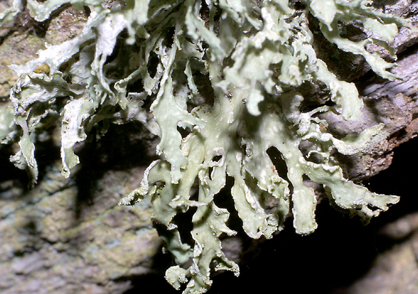
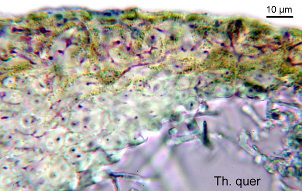
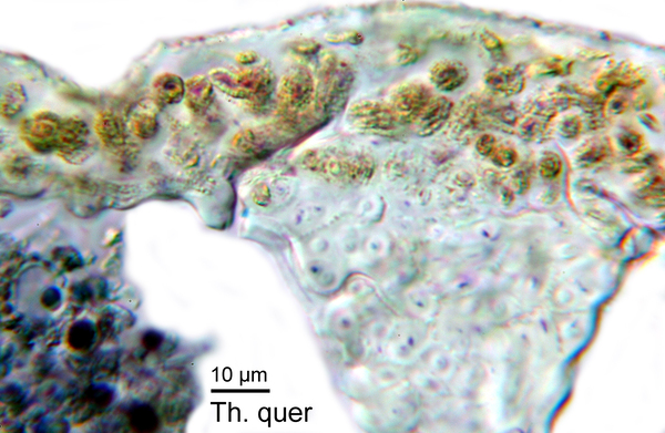
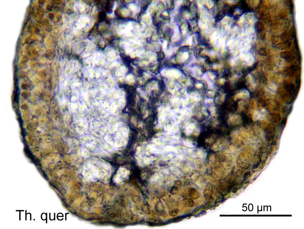
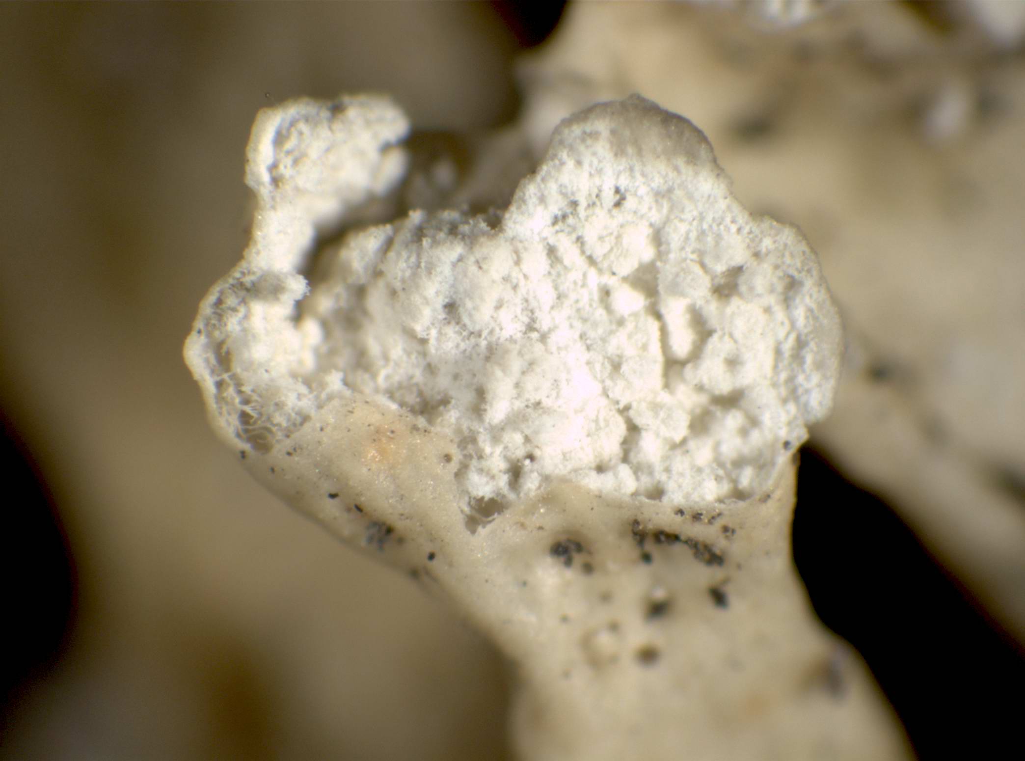
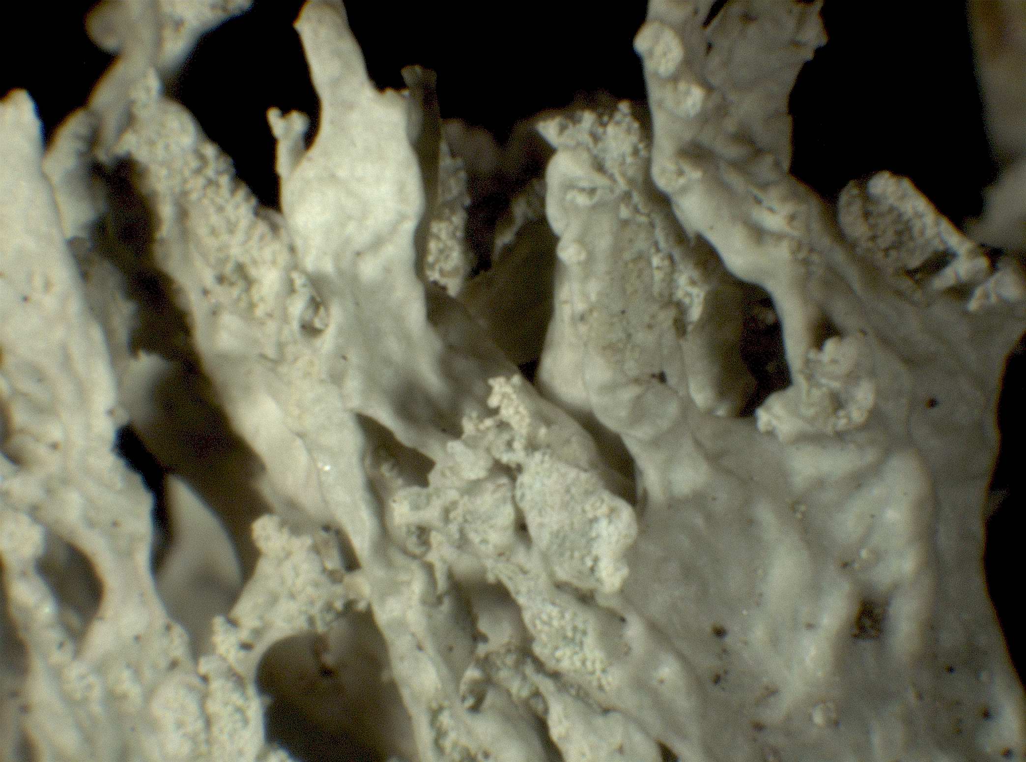
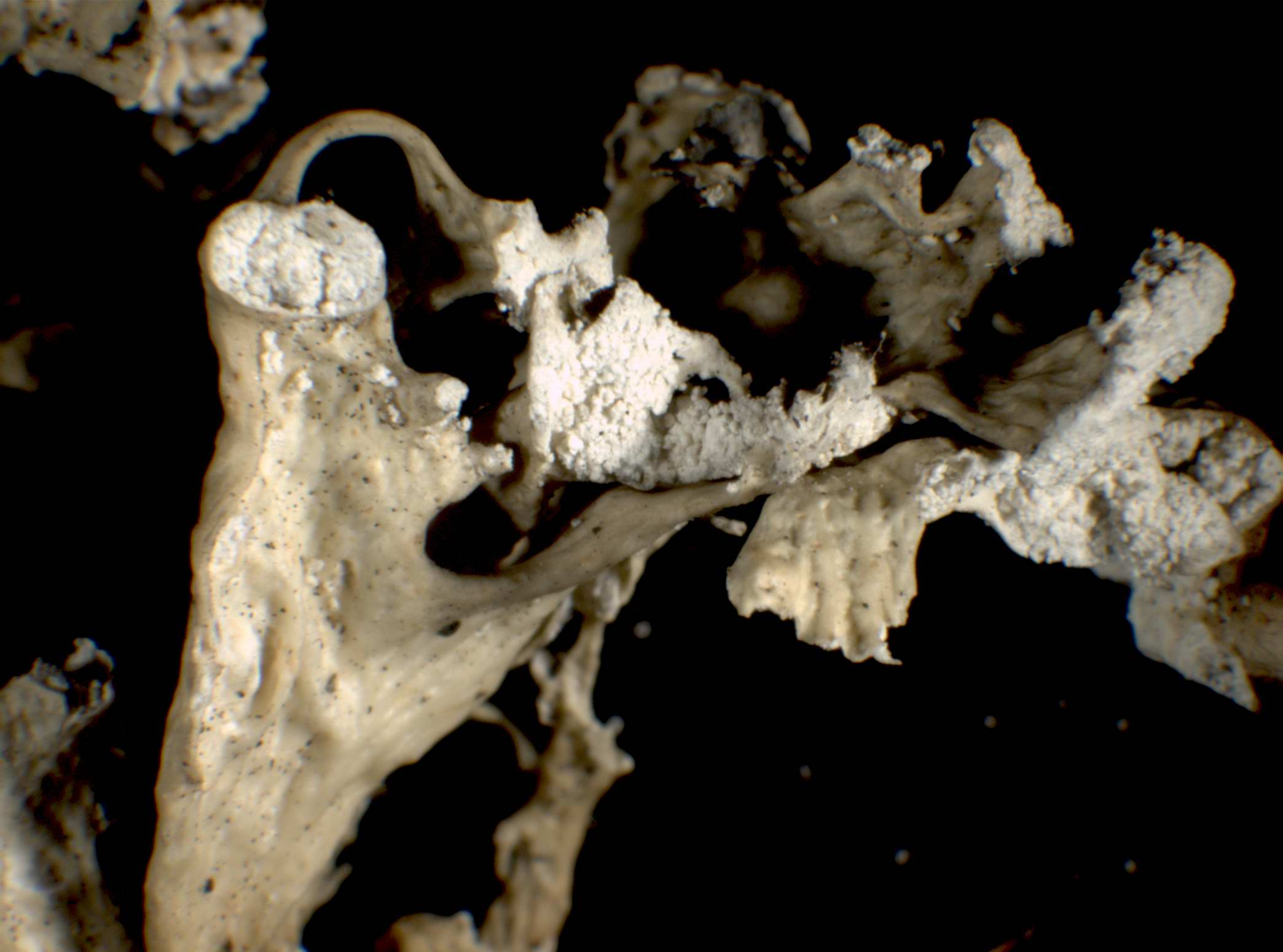
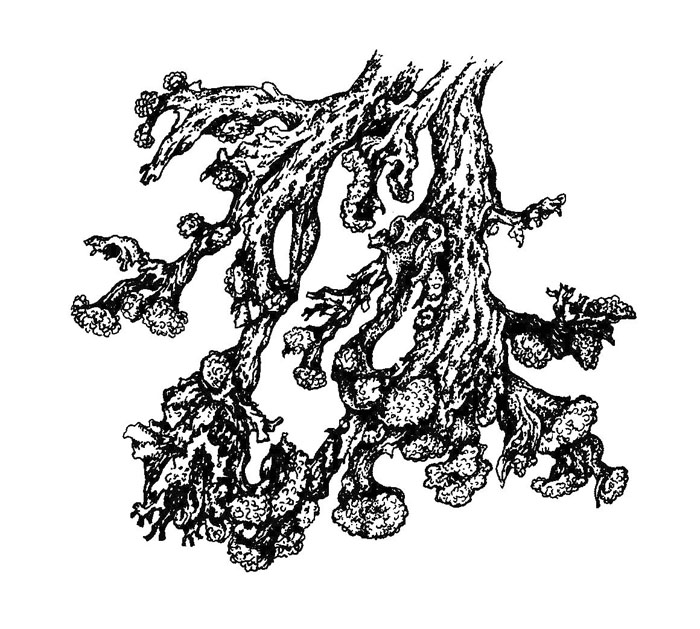
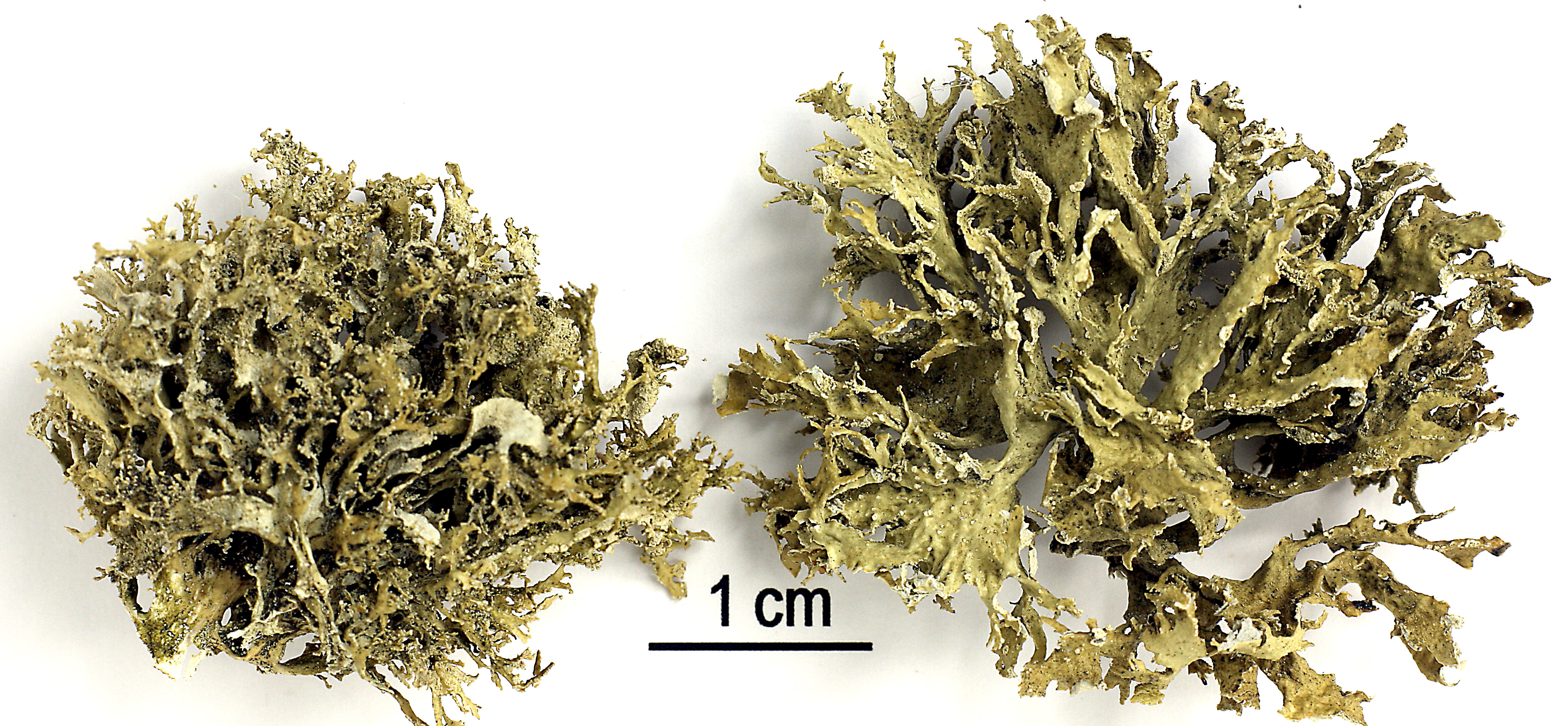
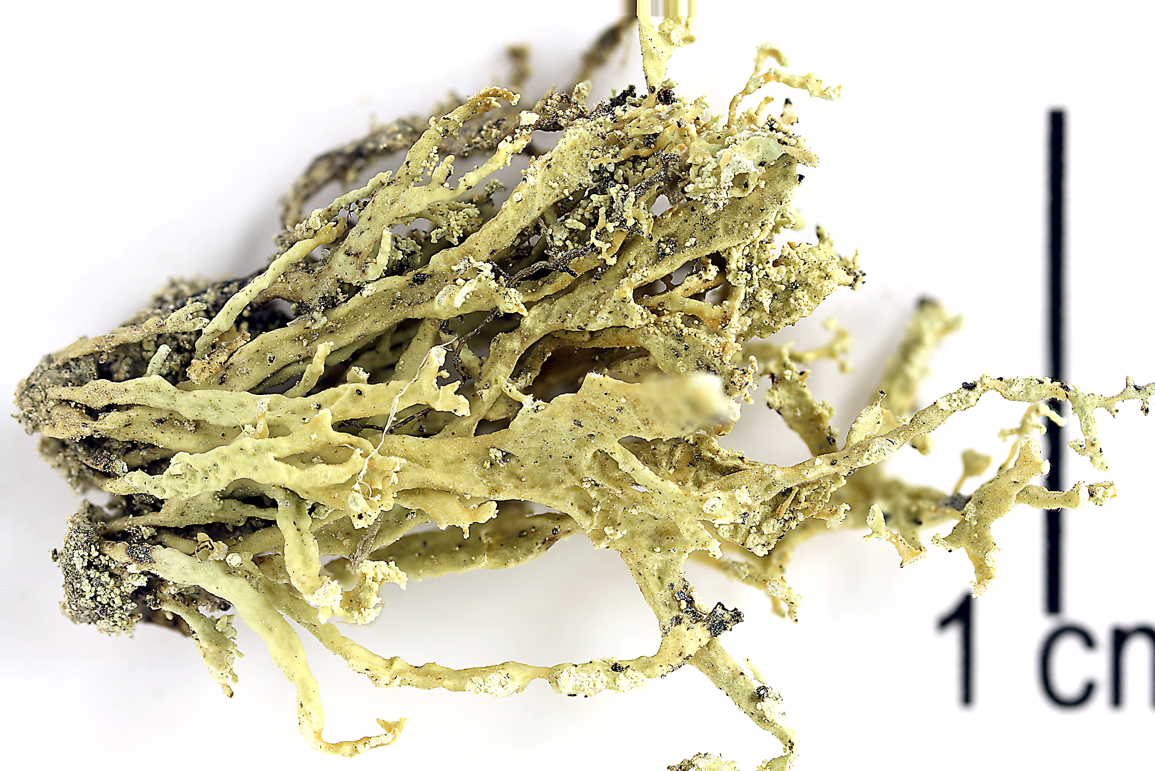
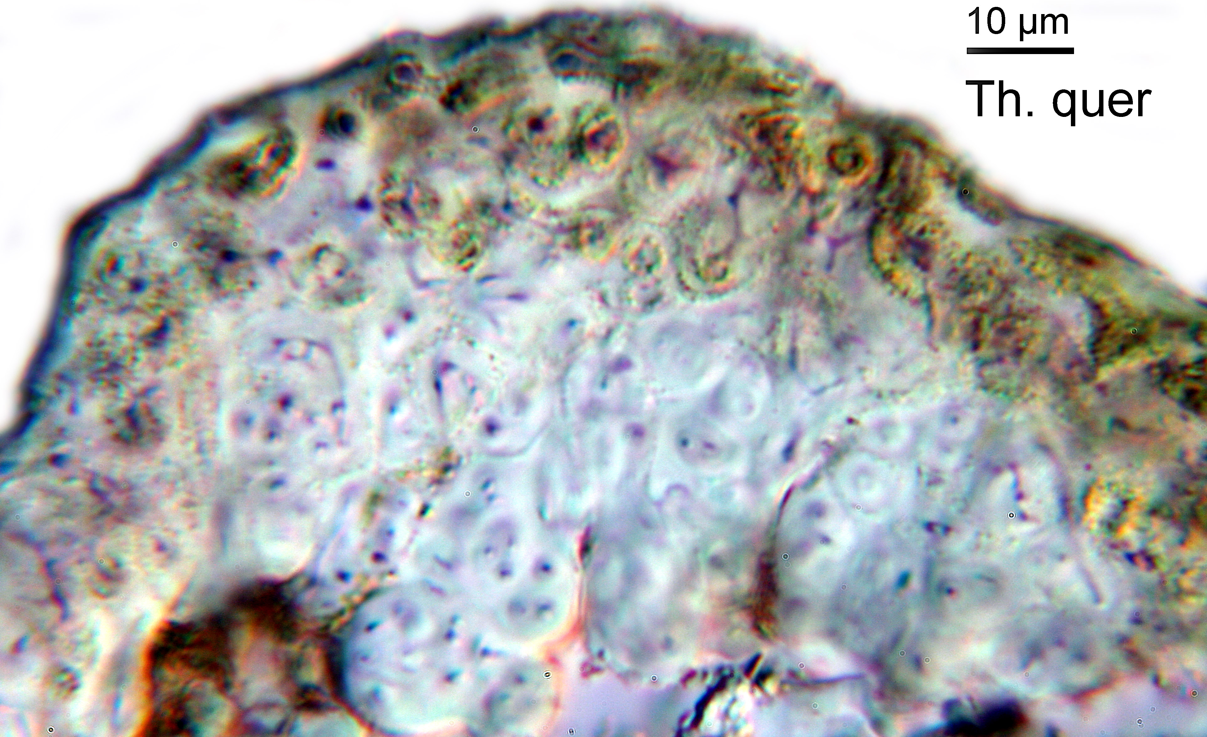
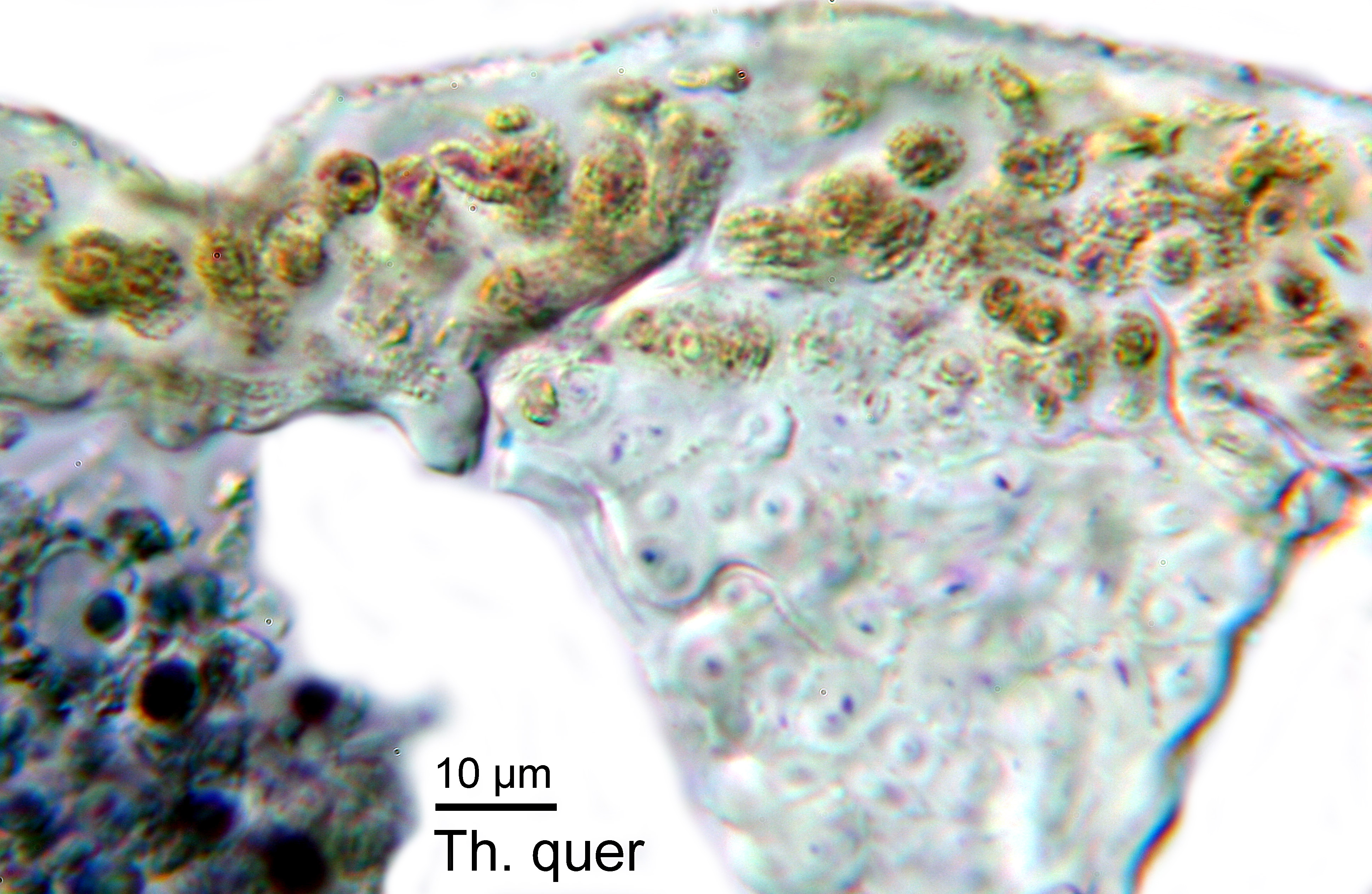
Description: Thallus fruticose, pale yellowish green to greenish white, rather polymorphic, of discrete lobes often coalescing to form extensive swards, to 5(-8) cm long (usually much less), simple or sparingly dichotomously or palmately branched from a narrow or expanded basal holdfast. Laciniae usually flattened, sometimes fan-like in terminal parts and up to 3(-5) mm wide, solid but often secondarily subfistulose at apex, irregular in thickness, somewhat shiny and cartilaginous, the largest ones often with a foveolate surface, occasionally with ellipsoid, laminal pseudocyphellae; soralia elongate, marginal to subterminal, spreading over the underside, becoming more roundish and more crowded terminally, small soralia may develop laminally; soredia farinose to subgranular, 30-50 μm diam. Cortex thin, 2-layered, the outer part paraplectenchymatous, the inner part cartilaginous; medulla white, compact. Apothecia not observed in Italian material. Photobiont chlorococcoid. Spot tests: K-, C-, KC- or KC+ pale yellow (cortex only), P-, UV-. Chemistry: cortex with usnic acid; medulla with evernic acid.
Growth form: Fruticose
Substrata: bark and rocks
Photobiont: green algae other than Trentepohlia
Reproductive strategy: mainly asexual, by soredia, or soredia-like structures (e.g. blastidia)
Subcontinental: restricted to areas with a dry-subcontinental climate (e.g. dry Alpine valleys, parts of Mediterranean Italy)
In underhangs rarely wetted by rain
Commonnes-rarity: (info)
Alpine belt: absent
Subalpine belt: rather rare
Montane belt: rare
Dry submediterranean belt: very rare
Humid submediterranean belt: extremely rare
Padanian area: absent
pH of the substrata:
1 2 3 4 5

Solar irradiation:
1 2 3 4 5
Aridity:
1 2 3 4 5
Eutrophication:
1 2 3 4 5
Poleotolerance:
0 1 2 3
Altitudinal distribution:
1 2 3 4 5 6
Rarity
absent
extremely rare
very rare
rare
rather rare
rather common
common
very common
extremely common
Loading data...
Occurrence data
Predictive map
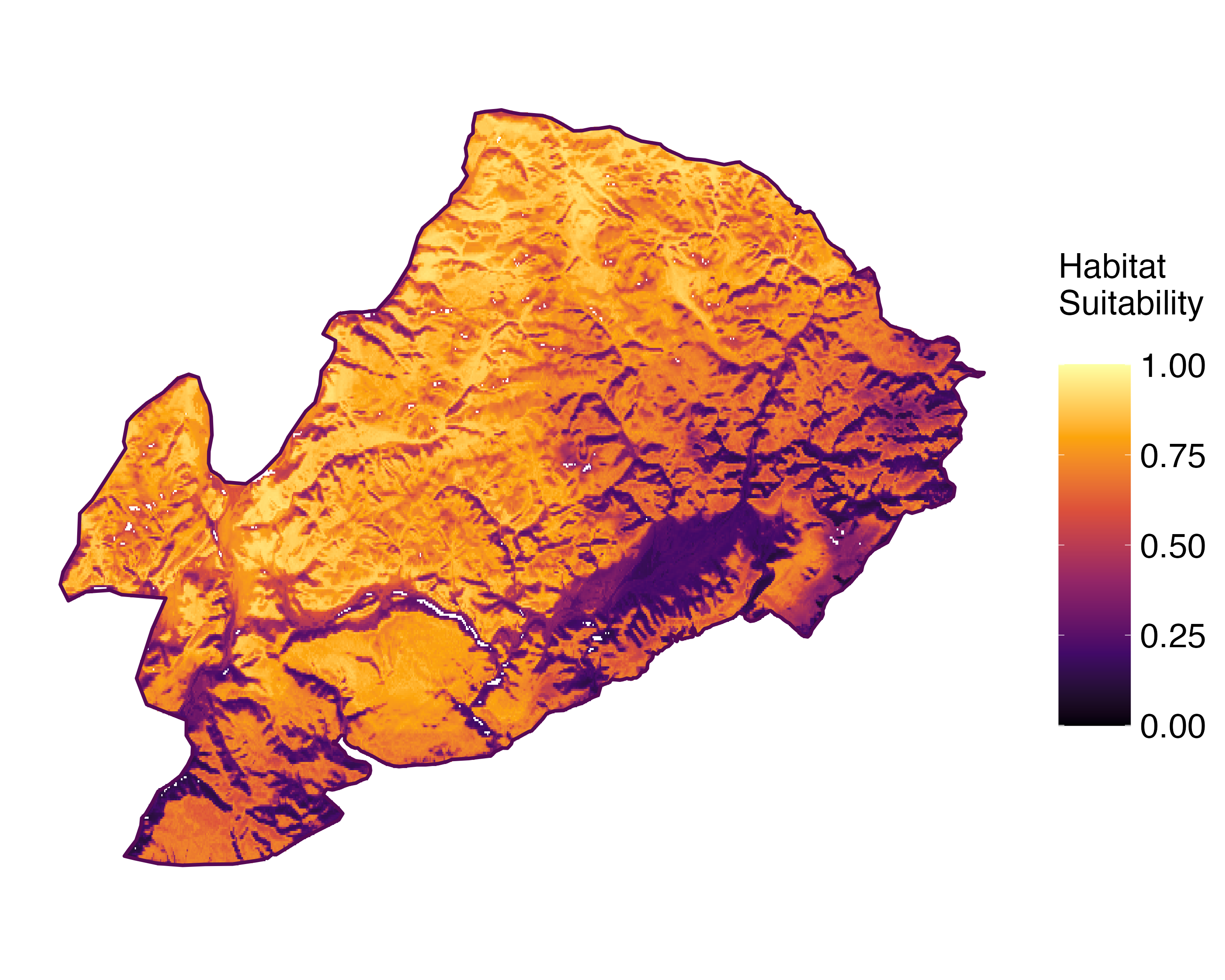 Current prediction (1981-2010)
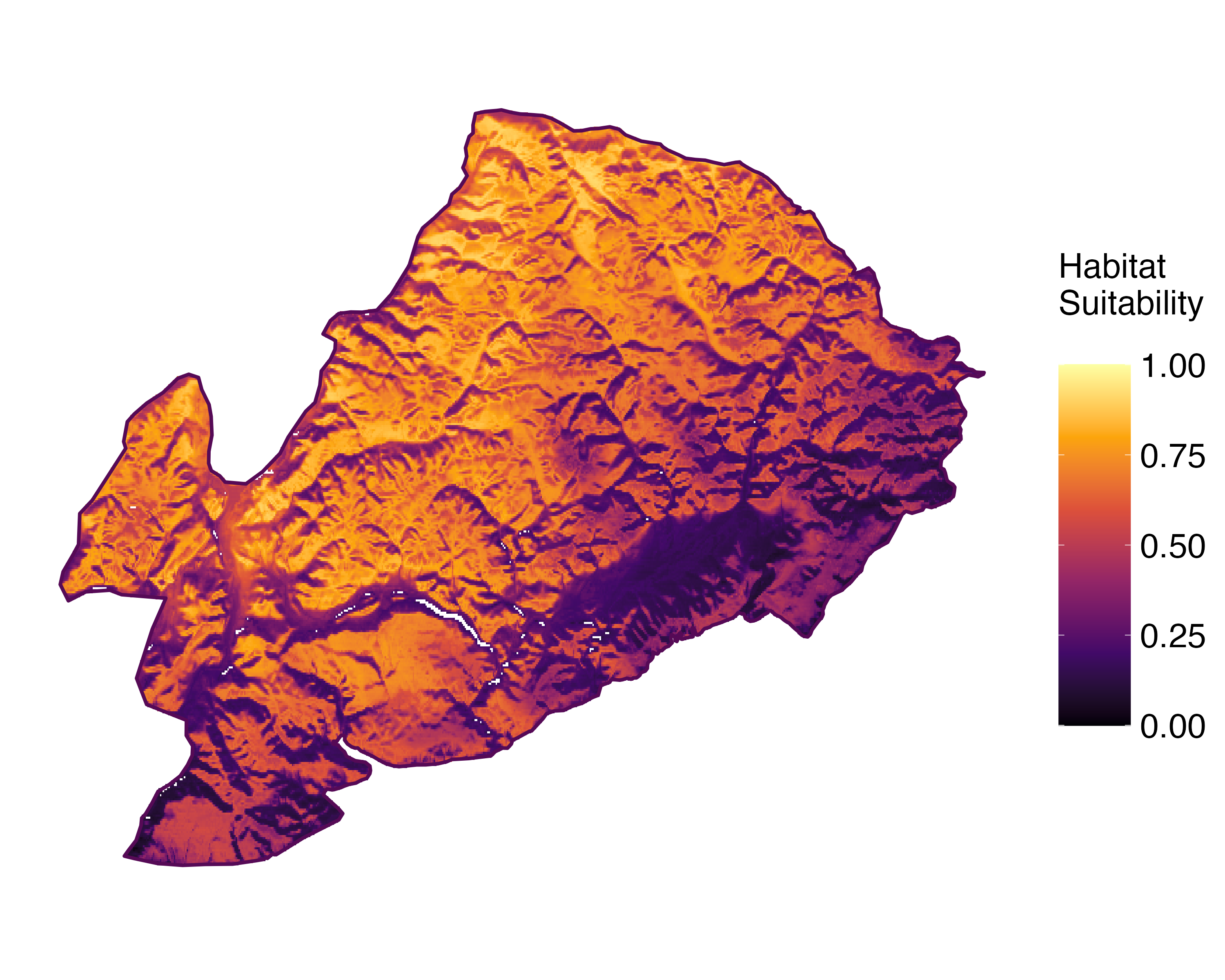 Future prediction (2071-2100) SSP 1-2.6
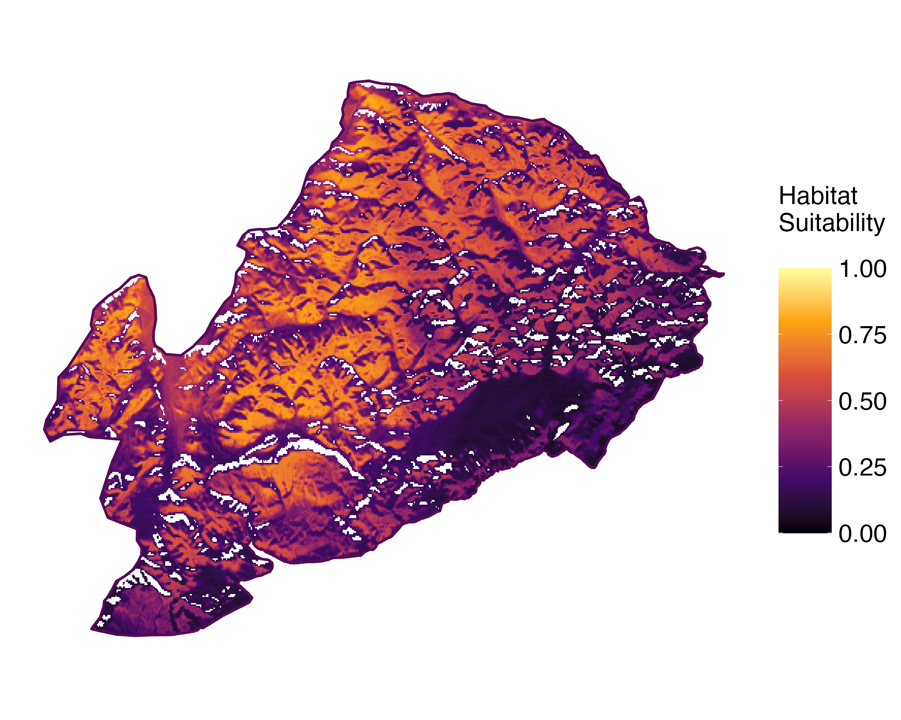 Future prediction (2071-2100) SSP 5-8.5Predictive maps according to Francesconi et al. 2025
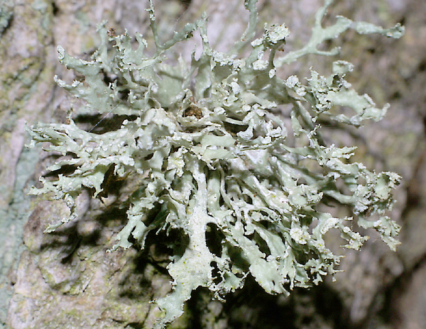
Felix Schumm - CC BY-SA 4.0
[9584], Germany, Baden-Württemberg, Stuttgart, zwischen Stuttgart und Leonberg, an Quercus, an der Schattenalle beim Bärensee, 48°45.368'N, 9°05.505'E, 430 m, TK 7220. Leg. et det. F. Schumm 15.06.2002
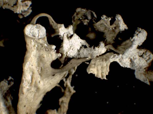
P.L. Nimis; Owner: Department of Life Sciences, University of Trieste
Herbarium: TSB (17887)
2001/12/10
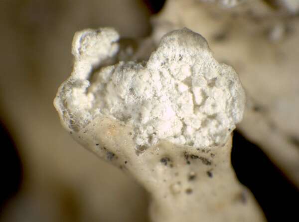
young soralium

P.L. Nimis; Owner: Department of Life Sciences, University of Trieste
Herbarium: TSB (35292)
2002/07/14
P.L. Nimis; Owner: Department of Life Sciences, University of Trieste
Herbarium: TSB (17887)
2001/12/10

Triin Aimla; Owner: University of Tartu
Felix Schumm - CC BY-SA 4.0
[9584], Germany, Baden-Württemberg, Stuttgart, zwischen Stuttgart und Leonberg, an Quercus, an der Schattenalle beim Bärensee, 48°45.368'N, 9°05.505'E, 430 m, TK 7220. Leg. et det. F. Schumm 15.06.2002

Felix Schumm - CC BY-SA 4.0
[11705], Germany, Baden-Württemberg, Kreis Göppingen, ca. 3,2 km nördlich von Ebersbach an der Kreuzung K1412/K1413 an der Königseiche auf der Kaiserstr.; 48°44.784' N, 9°30.978' E, 480 m, TK:7223/3. Leg et det. F. Schumm 06.06.2004, conf. ıA. Aptroot 05.2006.
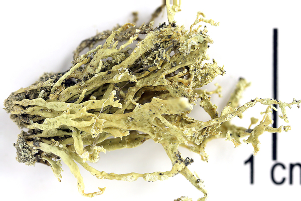
Felix Schumm - CC BY-SA 4.0
[14283], Österreich, Vorarlberg: Verwall-Gruppe, Silbertal ca. 7 km E von Schruns, zwischen dem Teufelsbach Wasserfall und dem Gasthof Fellimännle, 47°05' N, 10°00' E, ca 900-1100 m, GF 8926/1, an Silikatfelsen im koniferenreichen Mischwald in Bachnähe. Leg. F. Schumm & Schönbrodt (BLAM) 30.08.2008, det F. Schumm
Growth form: Fruticose
Substrata: bark and rocks
Photobiont: green algae other than Trentepohlia
Reproductive strategy: mainly asexual, by soredia, or soredia-like structures (e.g. blastidia)
Subcontinental: restricted to areas with a dry-subcontinental climate (e.g. dry Alpine valleys, parts of Mediterranean Italy)
In underhangs rarely wetted by rain
Commonnes-rarity: (info)
Alpine belt: absent
Subalpine belt: rather rare
Montane belt: rare
Dry submediterranean belt: very rare
Humid submediterranean belt: extremely rare
Padanian area: absent
pH of the substrata:
| 1 | 2 | 3 | 4 | 5 |
Solar irradiation:
| 1 | 2 | 3 | 4 | 5 |
Aridity:
| 1 | 2 | 3 | 4 | 5 |
Eutrophication:
| 1 | 2 | 3 | 4 | 5 |
Poleotolerance:
| 0 | 1 | 2 | 3 |
Altitudinal distribution:
| 1 | 2 | 3 | 4 | 5 | 6 |
Rarity
absent
extremely rare
very rare
rare
rather rare
rather common
common
very common
extremely common
Loading data...
Occurrence data
Predictive map
Current prediction (1981-2010)Future prediction (2071-2100) SSP 1-2.6Future prediction (2071-2100) SSP 5-8.5Predictive maps according to Francesconi et al. 2025

Felix Schumm - CC BY-SA 4.0
[9584], Germany, Baden-Württemberg, Stuttgart, zwischen Stuttgart und Leonberg, an Quercus, an der Schattenalle beim Bärensee, 48°45.368'N, 9°05.505'E, 430 m, TK 7220. Leg. et det. F. Schumm 15.06.2002
P.L. Nimis; Owner: Department of Life Sciences, University of Trieste
Herbarium: TSB (17887)
2001/12/10
young soralium
P.L. Nimis; Owner: Department of Life Sciences, University of Trieste
Herbarium: TSB (35292)
2002/07/14
P.L. Nimis; Owner: Department of Life Sciences, University of Trieste
Herbarium: TSB (17887)
2001/12/10
Triin Aimla; Owner: University of Tartu

Felix Schumm - CC BY-SA 4.0
[9584], Germany, Baden-Württemberg, Stuttgart, zwischen Stuttgart und Leonberg, an Quercus, an der Schattenalle beim Bärensee, 48°45.368'N, 9°05.505'E, 430 m, TK 7220. Leg. et det. F. Schumm 15.06.2002
Felix Schumm - CC BY-SA 4.0
[11705], Germany, Baden-Württemberg, Kreis Göppingen, ca. 3,2 km nördlich von Ebersbach an der Kreuzung K1412/K1413 an der Königseiche auf der Kaiserstr.; 48°44.784' N, 9°30.978' E, 480 m, TK:7223/3. Leg et det. F. Schumm 06.06.2004, conf. ıA. Aptroot 05.2006.
Felix Schumm - CC BY-SA 4.0
[14283], Österreich, Vorarlberg: Verwall-Gruppe, Silbertal ca. 7 km E von Schruns, zwischen dem Teufelsbach Wasserfall und dem Gasthof Fellimännle, 47°05' N, 10°00' E, ca 900-1100 m, GF 8926/1, an Silikatfelsen im koniferenreichen Mischwald in Bachnähe. Leg. F. Schumm & Schönbrodt (BLAM) 30.08.2008, det F. Schumm


